Bwlchtocyn

Settlement in Caernarfonshire

Wales

Bwlchtocyn

Porth Ceiriad
Porth Ceiriad Credit: Anthony Parkes

Bwlchtocyn is a small coastal village located in the county of Caernarfonshire, Wales. It is situated on the Llŷn Peninsula, which extends into the Irish Sea. The village sits approximately 5 miles southwest of the town of Abersoch, and about 15 miles from the town of Pwllheli.

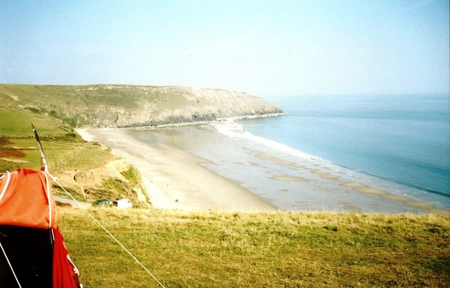
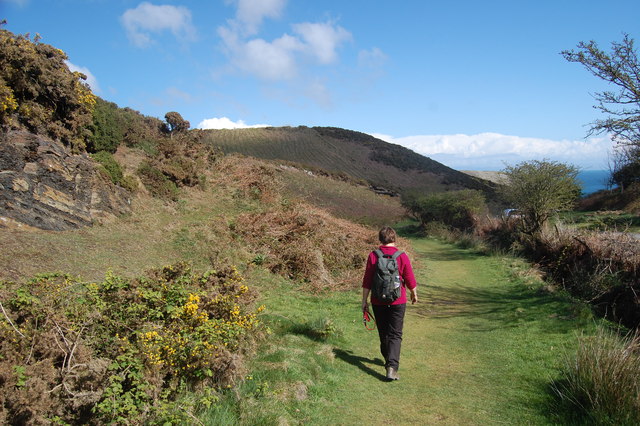
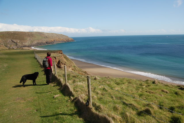
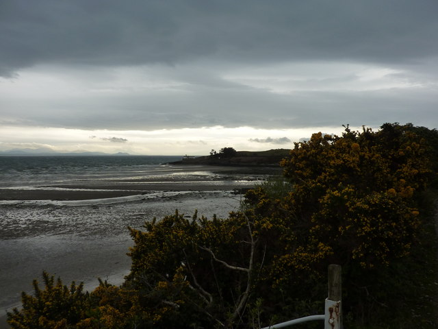
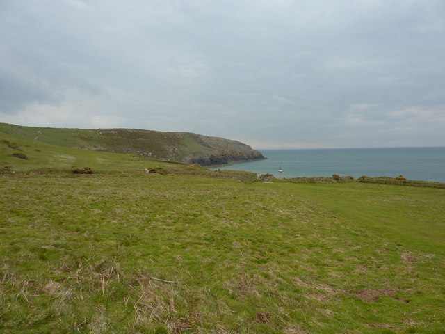
Known for its natural beauty and stunning coastline, Bwlchtocyn attracts many visitors each year. The village offers breathtaking views of Cardigan Bay and the distant Snowdonia mountains. It is an ideal destination for those seeking a peaceful and picturesque retreat.

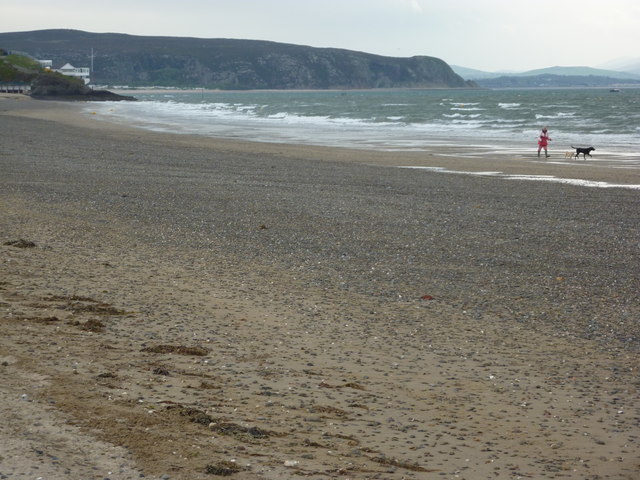
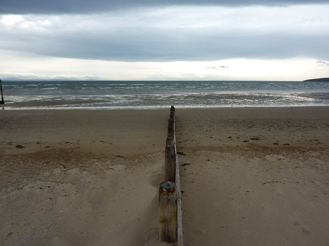
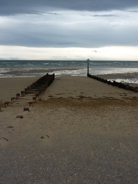
The main attraction of Bwlchtocyn is its sandy beach, which stretches for approximately one mile along the coastline. The beach is popular among families and water sports enthusiasts, offering opportunities for swimming, sailing, and windsurfing. The clear waters and clean sands make it a perfect spot for beachgoers.

In addition to its natural beauty, Bwlchtocyn is also home to some charming holiday cottages, providing accommodation options for tourists. The village has limited amenities, but nearby Abersoch offers a wider range of services including shops, restaurants, and pubs.

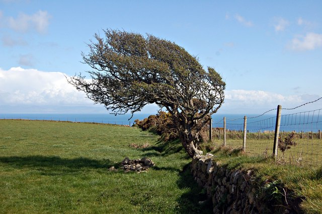
For those interested in exploring the area, Bwlchtocyn is a great starting point. The Llŷn Peninsula is known for its rugged cliffs, hidden coves, and picturesque villages. Visitors can take coastal walks, visit historical sites, or simply relax and enjoy the peaceful surroundings.

In summary, Bwlchtocyn is a small coastal village in Caernarfonshire, Wales, renowned for its stunning beach, natural beauty, and tranquil atmosphere. It is an idyllic destination for those seeking a peaceful retreat and an opportunity to explore the beautiful Llŷn Peninsula.

If you have any feedback on the listing, please let us know in the comments section below.
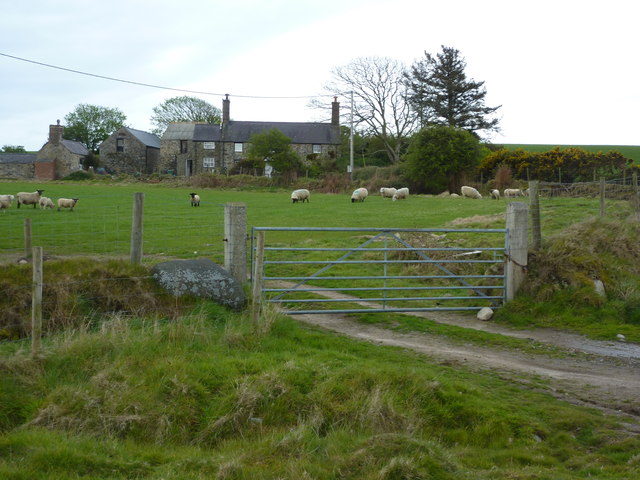
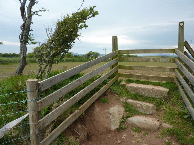
Bwlchtocyn Images

Images are sourced within 2km of 52.807068/-4.507832 or Grid Reference SH3126. Thanks to Geograph Open Source API. All images are credited.

Porth Ceiriad
Porth Ceiriad
Low Water Spring At Spring tides the bay empties. This picture was taken from the top Cae Du using a telephoto lens
Low Water Spring
At Spring tides the bay empties. This picture was taken from the top Cae Du using a telephoto lens
Tree on a wall A wind-blown tree growing on an old wall above Porth Ceiriad.
Tree on a wall
A wind-blown tree growing on an old wall above Porth Ceiriad.
Entering Llanengan
Entering Llanengan
The Sun, Llanengan  With a full washing line.
The Sun, Llanengan
With a full washing line.
Lleyn Coast Path On a slight detour inland heading for Nant-y-big
Lleyn Coast Path
On a slight detour inland heading for Nant-y-big
Path to Porth Ceiriad  On the Llyn coastal path.
Path to Porth Ceiriad
On the Llyn coastal path.
Porth Ceiriad On the coast path above Porth Ceiriad beach.
Porth Ceiriad
On the coast path above Porth Ceiriad beach.
Walking the dogs, at Abersoch On the beach to the south of the town.
Walking the dogs, at Abersoch
On the beach to the south of the town.
Groyne, Borth Fawr On the beach at Abersoch, Lleyn Peninsula, looking East.
Groyne, Borth Fawr
On the beach at Abersoch, Lleyn Peninsula, looking East.
Groynes, Borth Fawr On the beach at Abersoch, Lleyn Peninsula, looking east.
Groynes, Borth Fawr
On the beach at Abersoch, Lleyn Peninsula, looking east.
Beach, yachts and houses At Machroes, south of Abersoch, on the Lleyn Peninsula.
Beach, yachts and houses
At Machroes, south of Abersoch, on the Lleyn Peninsula.
Penrhyn Du Low tide on the beach at Machroes, south of Aberdaron, on the Lleyn Peninsula. Headland with old lifeboat station.
Penrhyn Du
Low tide on the beach at Machroes, south of Aberdaron, on the Lleyn Peninsula. Headland with old lifeboat station.
Penrhyn Du, the old lifeboat station Gorse in full yellow flower, and the sky clearing over the mainland, to the east.
Penrhyn Du, the old lifeboat station
Gorse in full yellow flower, and the sky clearing over the mainland, to the east.
Penrhynmawr, farmhouse South east of Machroes, on the Llyn Coastal Path.
Penrhynmawr, farmhouse
South east of Machroes, on the Llyn Coastal Path.
Cim, farmhouse south of Machroes
Stile over Welsh wall A wall of stone with earth and vegetation.
Stile over Welsh wall
A wall of stone with earth and vegetation.
Porth Ceiriad, Lleyn Peninsula
Show me another place!

Bwlchtocyn is located at Grid Ref: SH3126 (Lat: 52.807068, Lng: -4.507832)

Unitary Authority: Gwynedd

Police Authority: North Wales

What 3 Words

///ready.assembles.shallower. Near Pwllheli, Gwynedd

Nearby Locations

Bwlchtocyn Machroes

Related Wikis

Penrhyn Du Mines

The Penrhyn Du Mines are a collection of mines situated near Llanengan on the Llŷn Peninsula. It encompasses the Penrhyn, Assheton, Western and Tan-y-Bwlch...

Porth Ceiriad

Porth Ceiriad is a south-east facing beach and bay in the parish of Llanengan, near to Abersoch, in the county of Gwynedd, North Wales. It has several...
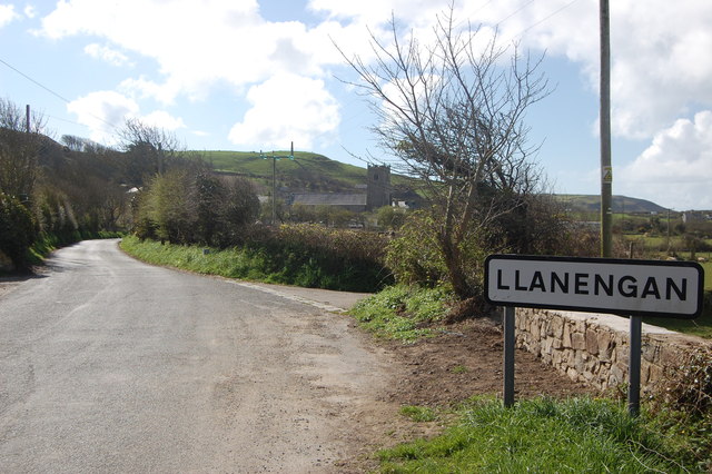
Llanengan

Llanengan is a small village and community 1.2 mi (1.9 km) around Abersoch in Gwynedd in north-west Wales. It had a population of 2,024 at the 2001 census...

Abersoch

Abersoch (Welsh: [abɛrˈsoːχ]) is a village in the community of Llanengan in Gwynedd, Wales. It is a popular coastal seaside resort, with around 2,600 residents...

Nearby Amenities

Located within 500m of 52.807068,-4.507832
Tourism: caravan_site
Lat/Long: 52.8094855/-4.5136202
Place Of Worship
Lat/Long: 52.8055948/-4.506565
Tourism: caravan_site
Lat/Long: 52.810289/-4.5027392
Post Box
Ref: LL53 109
Lat/Long: 52.8070112/-4.5013292
Post Box
Ref: LL53 27
Lat/Long: 52.805467/-4.5067162
Bwlchtocyn
Place: hamlet
Source: OS_OpenData_StreetView
Lat/Long: 52.8057452/-4.5073138
Barrier: hedge
Lat/Long: 52.8031371/-4.50595
Barrier: kissing_gate
Lat/Long: 52.8082302/-4.5064251
Direction: 175
Generator Method: photovoltaic
Generator Output Electricity: yes
Generator Solar Modules: 4
Generator Source: solar
Generator Type: solar_photovoltaic_panel
Location: roof
Power: generator
Lat/Long: 52.8106423/-4.5080444
Direction: 175
Generator Method: photovoltaic
Generator Output Electricity: yes
Generator Solar Modules: 12
Generator Source: solar
Generator Type: solar_photovoltaic_panel
Location: roof
Power: generator
Lat/Long: 52.8106314/-4.5081805
Power: pole
Source: bing
Lat/Long: 52.8058625/-4.5101827
Power: pole
Source: bing
Transformer: yes
Lat/Long: 52.8063676/-4.5097268
Power: pole
Lat/Long: 52.8027379/-4.5070781
Power: pole
Lat/Long: 52.8036387/-4.5068555
Power: pole
Lat/Long: 52.8043286/-4.5067281
Power: pole
Lat/Long: 52.8057519/-4.5081731
Power: pole
Source: bing
Transformer: yes
Lat/Long: 52.8063927/-4.5083763
Power: pole
Source: bing
Lat/Long: 52.8069035/-4.5089395
Power: pole
Source: bing
Lat/Long: 52.8072756/-4.5095189
Power: pole
Source: bing
Lat/Long: 52.8080117/-4.5091099
Power: pole
Source: bing
Lat/Long: 52.8083611/-4.5086311
Power: pole
Source: bing
Lat/Long: 52.8087219/-4.5082516
Line Attachment: pin
Power: pole
Source: bing
Lat/Long: 52.8088921/-4.5021093
Line Attachment: pin
Power: pole
Source: bing
Lat/Long: 52.8089618/-4.5035228
Line Attachment: pin
Power: pole
Source: bing
Lat/Long: 52.8090169/-4.5046279
Line Attachment: pin
Power: pole
Source: bing
Lat/Long: 52.8090607/-4.5055479
Line Attachment: pin
Power: pole
Lat/Long: 52.8093242/-4.5105194
Line Attachment: pin
Power: pole
Source: bing
Lat/Long: 52.8092763/-4.5095001
Line Attachment: pin
Power: pole
Source: bing
Lat/Long: 52.8092245/-4.5085198
Line Management: branch
Power: pole
Source: bing
Lat/Long: 52.8091629/-4.5076199
Line Attachment: pin
Power: pole
Source: bing
Lat/Long: 52.8091288/-4.5067267
Line Attachment: pin
Power: pole
Source: bing
Lat/Long: 52.8098142/-4.5067173
Power: pole
Source: bing
Lat/Long: 52.8105114/-4.506669
Power: pole
Source: bing
Lat/Long: 52.8111262/-4.5061427
The data included in this document is from www.openstreetmap.org. The data is made available under ODbL.

Have you been to Bwlchtocyn?

Leave your review of Bwlchtocyn below (or comments, questions and feedback).