Tyncoed Wood

Wood, Forest in Radnorshire

Wales

Tyncoed Wood

The valley of the Nant y Prophwyd
The valley of the Nant y Prophwyd Credit: David Smith

The requested URL returned error: 429 Too Many Requests

If you have any feedback on the listing, please let us know in the comments section below.
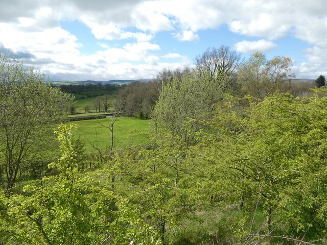
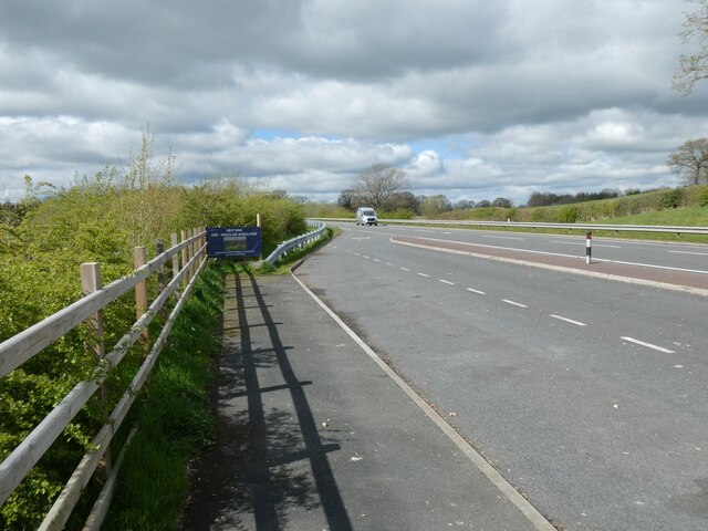
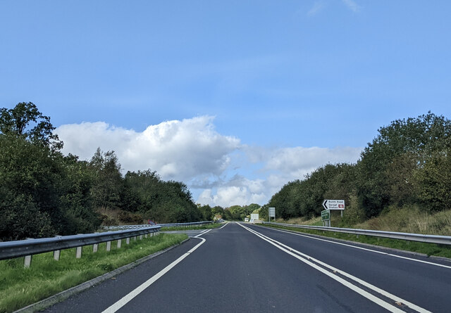
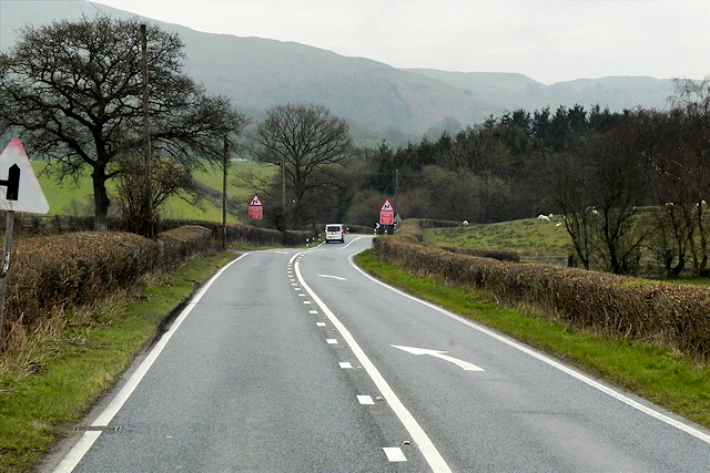
Tyncoed Wood Images

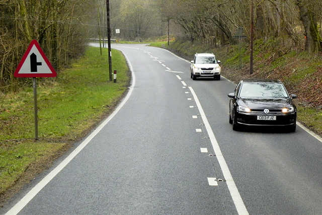
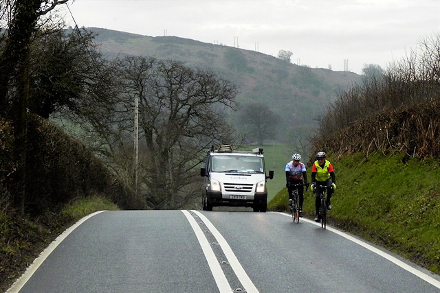
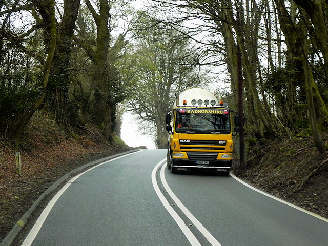
Images are sourced within 2km of 52.18561/-3.4115367 or Grid Reference SO0355. Thanks to Geograph Open Source API. All images are credited.

The valley of the Nant y Prophwyd
Protetcted lay-by by A470
Turning off the A470 to Builth Road station
A Roadside Yew A Rare roadside Yew just outside the tiny hamlet Of Cwmbach Lecryhd
A Roadside Yew
A Rare roadside Yew just outside the tiny hamlet Of Cwmbach Lecryhd
Sharp Bend on the A483 The A483 is a major north-south trunk road in Wales, running for 149 miles between Chester and Junction 42 of the M4 motorway just east of Swansea.
<span class="nowrap"><a title="http://www.sabre-roads.org.uk/wiki/index.php?title=A483" rel="nofollow ugc noopener" href="http://www.sabre-roads.org.uk/wiki/index.php?title=A483">Link</a><img style="margin-left:2px;" alt="External link" title="External link - shift click to open in new window" src="https://s1.geograph.org.uk/img/external.png" width="10" height="10"/></span>  SABRE
<span class="nowrap"><a title="https://en.wikipedia.org/wiki/A483_road" rel="nofollow ugc noopener" href="https://en.wikipedia.org/wiki/A483_road">Link</a><img style="margin-left:2px;" alt="External link" title="External link - shift click to open in new window" src="https://s1.geograph.org.uk/img/external.png" width="10" height="10"/></span>  Wikipedia
Sharp Bend on the A483
The A483 is a major north-south trunk road in Wales, running for 149 miles between Chester and Junction 42 of the M4 motorway just east of Swansea. LinkExternal link SABRE LinkExternal link Wikipedia
Southbound A483 The A483 is a major north-south trunk road in Wales, running for 149 miles between Chester and Junction 42 of the M4 motorway just east of Swansea.
<span class="nowrap"><a title="http://www.sabre-roads.org.uk/wiki/index.php?title=A483" rel="nofollow ugc noopener" href="http://www.sabre-roads.org.uk/wiki/index.php?title=A483">Link</a><img style="margin-left:2px;" alt="External link" title="External link - shift click to open in new window" src="https://s1.geograph.org.uk/img/external.png" width="10" height="10"/></span>  SABRE
<span class="nowrap"><a title="https://en.wikipedia.org/wiki/A483_road" rel="nofollow ugc noopener" href="https://en.wikipedia.org/wiki/A483_road">Link</a><img style="margin-left:2px;" alt="External link" title="External link - shift click to open in new window" src="https://s1.geograph.org.uk/img/external.png" width="10" height="10"/></span>  Wikipedia
Southbound A483
The A483 is a major north-south trunk road in Wales, running for 149 miles between Chester and Junction 42 of the M4 motorway just east of Swansea. LinkExternal link SABRE LinkExternal link Wikipedia
A483 at Brynsadwrn Bridge The A483 is a major north-south trunk road in Wales, running for 149 miles between Chester and Junction 42 of the M4 motorway just east of Swansea.
<span class="nowrap"><a title="http://www.sabre-roads.org.uk/wiki/index.php?title=A483" rel="nofollow ugc noopener" href="http://www.sabre-roads.org.uk/wiki/index.php?title=A483">Link</a><img style="margin-left:2px;" alt="External link" title="External link - shift click to open in new window" src="https://s1.geograph.org.uk/img/external.png" width="10" height="10"/></span>  SABRE
<span class="nowrap"><a title="https://en.wikipedia.org/wiki/A483_road" rel="nofollow ugc noopener" href="https://en.wikipedia.org/wiki/A483_road">Link</a><img style="margin-left:2px;" alt="External link" title="External link - shift click to open in new window" src="https://s1.geograph.org.uk/img/external.png" width="10" height="10"/></span>  Wikipedia
A483 at Brynsadwrn Bridge
The A483 is a major north-south trunk road in Wales, running for 149 miles between Chester and Junction 42 of the M4 motorway just east of Swansea. LinkExternal link SABRE LinkExternal link Wikipedia
A483 Approaching Coedmawr Crossroads The A483 is a major north-south trunk road in Wales, running for 149 miles between Chester and Junction 42 of the M4 motorway just east of Swansea.
<span class="nowrap"><a title="http://www.sabre-roads.org.uk/wiki/index.php?title=A483" rel="nofollow ugc noopener" href="http://www.sabre-roads.org.uk/wiki/index.php?title=A483">Link</a><img style="margin-left:2px;" alt="External link" title="External link - shift click to open in new window" src="https://s1.geograph.org.uk/img/external.png" width="10" height="10"/></span>  SABRE
<span class="nowrap"><a title="https://en.wikipedia.org/wiki/A483_road" rel="nofollow ugc noopener" href="https://en.wikipedia.org/wiki/A483_road">Link</a><img style="margin-left:2px;" alt="External link" title="External link - shift click to open in new window" src="https://s1.geograph.org.uk/img/external.png" width="10" height="10"/></span>  Wikipedia
A483 Approaching Coedmawr Crossroads
The A483 is a major north-south trunk road in Wales, running for 149 miles between Chester and Junction 42 of the M4 motorway just east of Swansea. LinkExternal link SABRE LinkExternal link Wikipedia
Cyclists near Coed Mawr The A483 is a major north-south trunk road in Wales, running for 149 miles between Chester and Junction 42 of the M4 motorway just east of Swansea.
<span class="nowrap"><a title="http://www.sabre-roads.org.uk/wiki/index.php?title=A483" rel="nofollow ugc noopener" href="http://www.sabre-roads.org.uk/wiki/index.php?title=A483">Link</a><img style="margin-left:2px;" alt="External link" title="External link - shift click to open in new window" src="https://s1.geograph.org.uk/img/external.png" width="10" height="10"/></span>  SABRE
<span class="nowrap"><a title="https://en.wikipedia.org/wiki/A483_road" rel="nofollow ugc noopener" href="https://en.wikipedia.org/wiki/A483_road">Link</a><img style="margin-left:2px;" alt="External link" title="External link - shift click to open in new window" src="https://s1.geograph.org.uk/img/external.png" width="10" height="10"/></span>  Wikipedia
Cyclists near Coed Mawr
The A483 is a major north-south trunk road in Wales, running for 149 miles between Chester and Junction 42 of the M4 motorway just east of Swansea. LinkExternal link SABRE LinkExternal link Wikipedia
Bend in A483 South of Coed Mawr The A483 is a major north-south trunk road in Wales, running for 149 miles between Chester and Junction 42 of the M4 motorway just east of Swansea.
<span class="nowrap"><a title="http://www.sabre-roads.org.uk/wiki/index.php?title=A483" rel="nofollow ugc noopener" href="http://www.sabre-roads.org.uk/wiki/index.php?title=A483">Link</a><img style="margin-left:2px;" alt="External link" title="External link - shift click to open in new window" src="https://s1.geograph.org.uk/img/external.png" width="10" height="10"/></span>  SABRE
<span class="nowrap"><a title="https://en.wikipedia.org/wiki/A483_road" rel="nofollow ugc noopener" href="https://en.wikipedia.org/wiki/A483_road">Link</a><img style="margin-left:2px;" alt="External link" title="External link - shift click to open in new window" src="https://s1.geograph.org.uk/img/external.png" width="10" height="10"/></span>  Wikipedia
Bend in A483 South of Coed Mawr
The A483 is a major north-south trunk road in Wales, running for 149 miles between Chester and Junction 42 of the M4 motorway just east of Swansea. LinkExternal link SABRE LinkExternal link Wikipedia
DAF CF Tanker on the A483 near to Llanelwedd The A483 is a major north-south trunk road in Wales, running for 149 miles between Chester and Junction 42 of the M4 motorway just east of Swansea.
<span class="nowrap"><a title="http://www.sabre-roads.org.uk/wiki/index.php?title=A483" rel="nofollow ugc noopener" href="http://www.sabre-roads.org.uk/wiki/index.php?title=A483">Link</a><img style="margin-left:2px;" alt="External link" title="External link - shift click to open in new window" src="https://s1.geograph.org.uk/img/external.png" width="10" height="10"/></span>  SABRE
<span class="nowrap"><a title="https://en.wikipedia.org/wiki/A483_road" rel="nofollow ugc noopener" href="https://en.wikipedia.org/wiki/A483_road">Link</a><img style="margin-left:2px;" alt="External link" title="External link - shift click to open in new window" src="https://s1.geograph.org.uk/img/external.png" width="10" height="10"/></span>  Wikipedia
DAF CF Tanker on the A483 near to Llanelwedd
The A483 is a major north-south trunk road in Wales, running for 149 miles between Chester and Junction 42 of the M4 motorway just east of Swansea. LinkExternal link SABRE LinkExternal link Wikipedia
Ordnance Survey Flush Bracket (S0736) This OS Flush Bracket can be found on the south face of St John's Church. It marks a point 167.831m above mean sea level.
Ordnance Survey Flush Bracket (S0736)
This OS Flush Bracket can be found on the south face of St John's Church. It marks a point 167.831m above mean sea level.
Ordnance Survey Cut Mark This OS cut mark can be found on the SW side of the railway bridge. It marks a point 151.805m above mean sea level.
Ordnance Survey Cut Mark
This OS cut mark can be found on the SW side of the railway bridge. It marks a point 151.805m above mean sea level.
A470 near Builth Road The A470, also known as the Cardiff to Glan Conwy Trunk Road, is the major long-distance road in Wales, from Cardiff on the south coast to Llandudno on the north coast. It is 185 miles long, and has undergone considerable road improvement in the last two decades. While previously one had to navigate the narrow roads of Llanidloes and Dolgellau, both these market towns are now bypassed due to extensive road modernisation.

The road travels through two of Wales's national parks, the Brecon Beacons in the South and Snowdonia National Park, starting just south of Dinas Mawddwy in the North. It is a primary trunk route throughout its length, and the southernmost 26 miles, from Cardiff Bay to Merthyr Tydfil, is mainly direct and good quality dual carriageway, but most of the route from north of Merthyr to Llandudno is single carriageway.
<span class="nowrap"><a title="http://www.sabre-roads.org.uk/wiki/index.php?title=A470" rel="nofollow ugc noopener" href="http://www.sabre-roads.org.uk/wiki/index.php?title=A470">Link</a><img style="margin-left:2px;" alt="External link" title="External link - shift click to open in new window" src="https://s1.geograph.org.uk/img/external.png" width="10" height="10"/></span>  SABRE
A470 near Builth Road
The A470, also known as the Cardiff to Glan Conwy Trunk Road, is the major long-distance road in Wales, from Cardiff on the south coast to Llandudno on the north coast. It is 185 miles long, and has undergone considerable road improvement in the last two decades. While previously one had to navigate the narrow roads of Llanidloes and Dolgellau, both these market towns are now bypassed due to extensive road modernisation. The road travels through two of Wales's national parks, the Brecon Beacons in the South and Snowdonia National Park, starting just south of Dinas Mawddwy in the North. It is a primary trunk route throughout its length, and the southernmost 26 miles, from Cardiff Bay to Merthyr Tydfil, is mainly direct and good quality dual carriageway, but most of the route from north of Merthyr to Llandudno is single carriageway. LinkExternal link SABRE
Cwmbach Llechrhyd The former A470 road into Cwmbach Llechrhyd, just over two miles north of Builth Wells.
Cwmbach Llechrhyd
The former A470 road into Cwmbach Llechrhyd, just over two miles north of Builth Wells.
Under the A470 The former route of the A47o passes under the new road.
Under the A470
The former route of the A47o passes under the new road.
Caerwnon Park, Builth Wells‎
Show me another place!

Tyncoed Wood is located at Grid Ref: SO0355 (Lat: 52.18561, Lng: -3.4115367)

Unitary Authority: Powys

Police Authority: Dyfed Powys

What 3 Words

///grabs.elbowing.stubble. Near Builth Wells, Powys

Related Wikis

Cors y Llyn National Nature Reserve

Cors y Llyn National Nature Reserve can be found about 2.5 kilometres south of Newbridge on Wye, off the A470 road in mid-Wales.The bogs and open water...

Builth Road railway station

Builth Road railway station is a station primarily serving the town of Builth Wells, in mid Wales. It is on the Heart of Wales Line. The station is over...

Builth Wells transmitting station

The Builth Wells television relay station is sited on high ground to the north of the town of Builth Wells in Powys, South Wales. It was originally built...

Disserth and Trecoed

Disserth and Trecoed is an electoral ward and community in central Powys, Wales (the historic county of Radnorshire). It has a population of 1,239 according...

Nearby Amenities

Located within 500m of 52.18561,-3.4115367
Building: yes
Lat/Long: 52.1847322/-3.4084913
Place: farm
Lat/Long: 52.1877054/-3.4131423
The data included in this document is from www.openstreetmap.org. The data is made available under ODbL.

Have you been to Tyncoed Wood?

Leave your review of Tyncoed Wood below (or comments, questions and feedback).