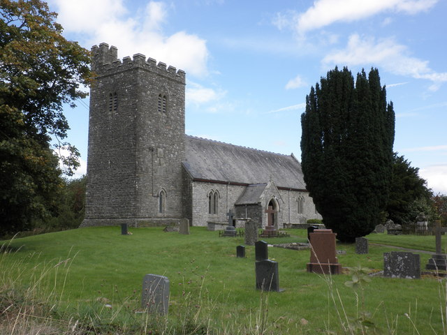
Llethr Plantation
Wood, Forest in Brecknockshire
Wales
Llethr Plantation

Llethr Plantation is a picturesque woodland located in the county of Brecknockshire, Wales. Nestled in the heart of the Brecon Beacons National Park, this charming forest covers an area of approximately 200 acres and is a haven for nature lovers and outdoor enthusiasts.
The plantation boasts a diverse range of tree species, including oak, beech, and pine, which create a stunning tapestry of colors throughout the year. The woodland floor is adorned with a rich variety of flora, including bluebells, wild garlic, and ferns, providing a vibrant and enchanting setting.
Visitors to Llethr Plantation can explore its well-maintained network of walking trails that wind through the forest. These paths offer breathtaking views of the surrounding countryside and provide opportunities for peaceful strolls, invigorating hikes, or even a leisurely picnic amidst the tranquil surroundings.
The woodland is also home to an array of wildlife, making it a popular spot for nature enthusiasts. Birdwatchers can spot a variety of species, including woodpeckers, nuthatches, and buzzards, while lucky visitors may even catch a glimpse of the elusive red squirrel or the occasional deer.
Llethr Plantation is easily accessible, with a car park located nearby, and is open to the public throughout the year. It offers a welcome respite from the hustle and bustle of everyday life, providing a peaceful and serene retreat for those seeking solace in nature's embrace. Whether it's to appreciate the beauty of the changing seasons or to immerse oneself in the wonders of the natural world, Llethr Plantation is a true gem in the heart of Brecknockshire.
If you have any feedback on the listing, please let us know in the comments section below.
Llethr Plantation Images
Images are sourced within 2km of 52.212148/-3.4649524 or Grid Reference SO0058. Thanks to Geograph Open Source API. All images are credited.

Llethr Plantation is located at Grid Ref: SO0058 (Lat: 52.212148, Lng: -3.4649524)
Unitary Authority: Powys
Police Authority: Dyfed Powys
What 3 Words
///encoded.thickens.plants. Near Llandrindod Wells, Powys
Nearby Locations
Related Wikis
Llysdinam
Llysdinam is a hamlet located in Powys, Wales, to the west and near to the town of Llandrindod Wells. == History == The Llysdinam estate and hamlet were...
River Ithon
The River Ithon (Welsh: Afon Ieithon) is a major left-bank tributary of the River Wye in Powys, mid Wales. It rises in the broad saddle between the western...
Newbridge on Wye railway station
Newbridge on Wye railway station stood on the single-tracked Mid Wales Railway between Builth Wells and Rhayader. It was closed on 31 December 1962 and...
Newbridge-on-Wye
Newbridge-on-Wye (Welsh: Y Bontnewydd-ar-Wy) is a small village in Powys, Wales. It lies, as its name suggests, on the River Wye, just downstream from...
Cors y Llyn National Nature Reserve
Cors y Llyn National Nature Reserve can be found about 2.5 kilometres south of Newbridge on Wye, off the A470 road in mid-Wales.The bogs and open water...
Disserth and Trecoed
Disserth and Trecoed is an electoral ward and community in central Powys, Wales (the historic county of Radnorshire). It has a population of 1,239 according...
Llanafan Fawr
Llanafan Fawr is a village and community and ecclesiastical parish in Powys, Wales. Located in the former cantref of Buellt (Builth) and historic county...
Argoed, Powys
Argoed is a small village in the community of Nantmel, Powys, Wales, which is 55 miles (88 km) from Cardiff and 152 miles (244 km) from London.The village...
Nearby Amenities
Located within 500m of 52.212148,-3.4649524Have you been to Llethr Plantation?
Leave your review of Llethr Plantation below (or comments, questions and feedback).


