Coed Esgair-rhiw

Wood, Forest in Radnorshire

Wales

Coed Esgair-rhiw

Valve House Part of the Elan Valley Aqueduct that feeds drinking water from Foel Tower Elan Valley to Franckley Reservoir in Birmingham, for more information visit: <a title="https://www.geograph.org.uk/photo/145151" href="https://www.geograph.org.uk/photo/145151">Link</a>
Valve House Credit: Mr M Evison

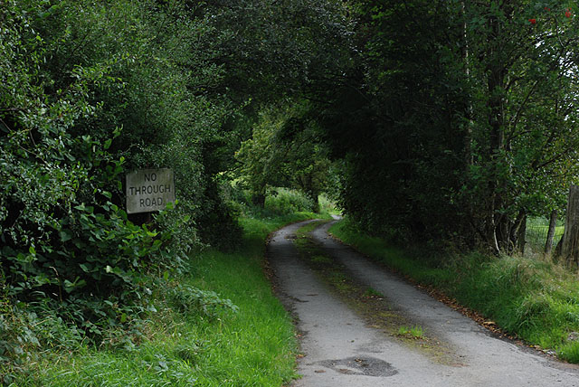
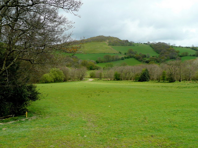
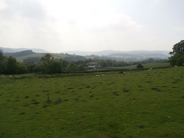
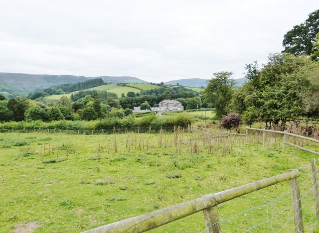
Coed Esgair-rhiw, located in Radnorshire, Wales, is a picturesque woodland area known for its natural beauty and rich biodiversity. Covering an approximate area of [number] hectares, the forest is situated within the Esgair-rhiw Valley, surrounded by rolling hills and stunning landscapes.

The woodland is predominantly composed of mixed deciduous and coniferous trees, including oak, beech, birch, and pine. These trees provide a diverse and vibrant habitat for a wide range of flora and fauna. Within the forest, visitors can find a myriad of plant species, including bluebells, wild garlic, and ferns, adding to the enchanting atmosphere of the woodland.

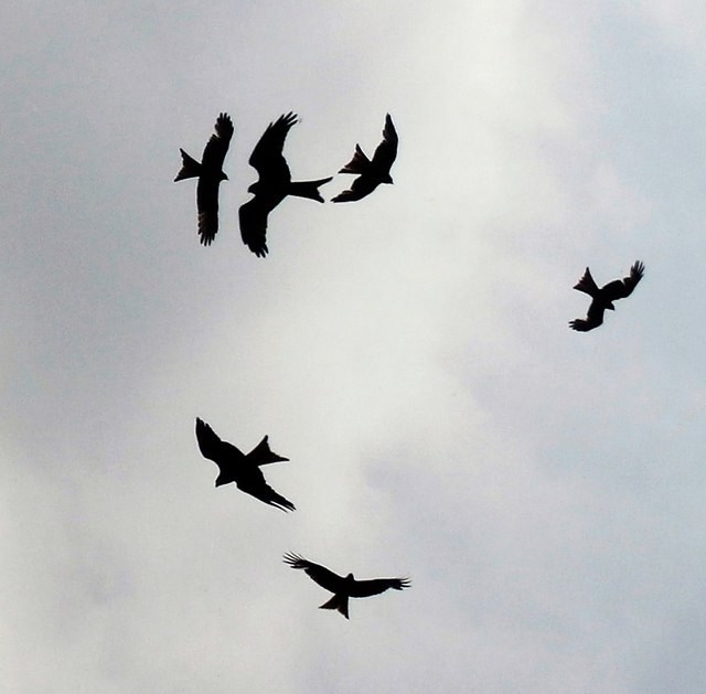
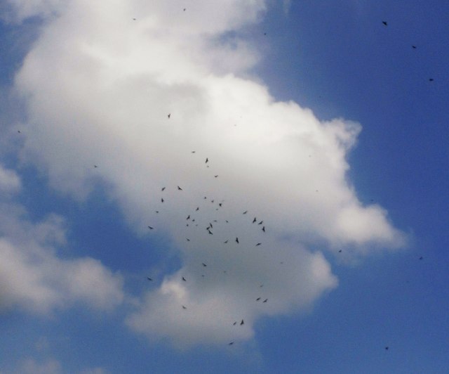
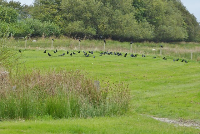
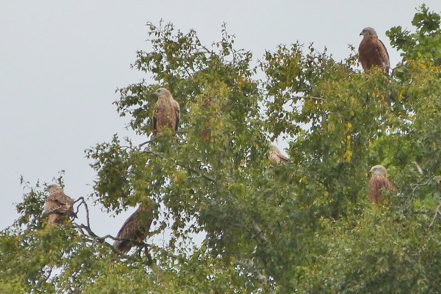
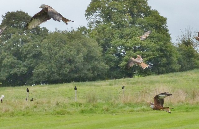
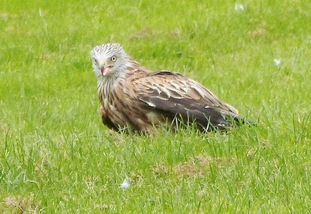
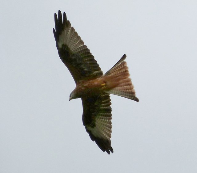
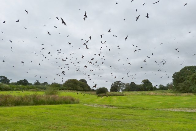
Coed Esgair-rhiw offers several walking trails, allowing visitors to explore its natural wonders at their own pace. These trails wind through the forest, revealing stunning vistas, babbling brooks, and hidden waterfalls along the way. The forest is also home to various wildlife species, such as deer, foxes, badgers, and a plethora of bird species, making it a paradise for nature enthusiasts and birdwatchers.

The woodland is managed by the local authorities, who ensure the preservation and conservation of this natural treasure. Coed Esgair-rhiw serves as an important ecological corridor, connecting different habitats and allowing for the movement of wildlife across the region.

Whether it's a peaceful walk, a nature photography expedition, or simply a desire to immerse oneself in nature's tranquility, Coed Esgair-rhiw provides an idyllic setting for anyone seeking solace in the beauty of the natural world.

If you have any feedback on the listing, please let us know in the comments section below.

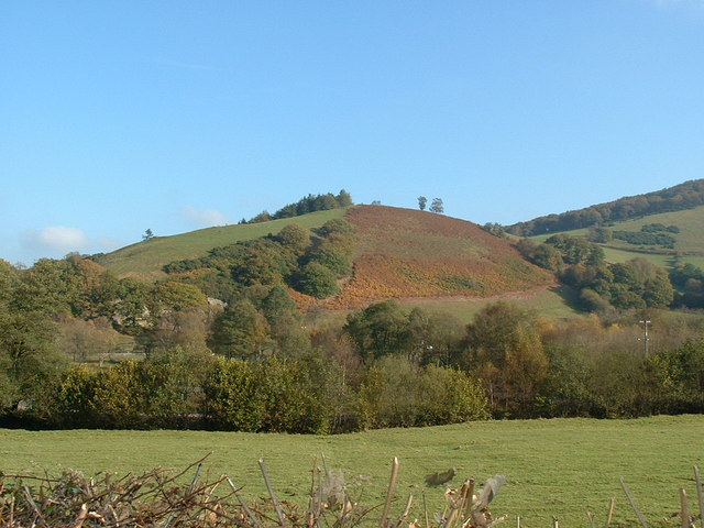
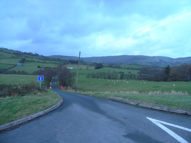
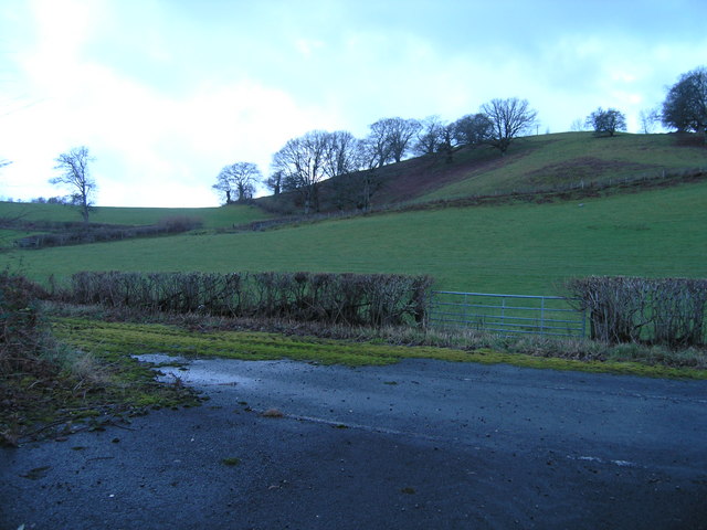
Coed Esgair-rhiw Images

Images are sourced within 2km of 52.298255/-3.4678224 or Grid Reference SO0067. Thanks to Geograph Open Source API. All images are credited.

Valve House Part of the Elan Valley Aqueduct that feeds drinking water from Foel Tower Elan Valley to Franckley Reservoir in Birmingham, for more information visit: <a title="https://www.geograph.org.uk/photo/145151" href="https://www.geograph.org.uk/photo/145151">Link</a>
Valve House
Part of the Elan Valley Aqueduct that feeds drinking water from Foel Tower Elan Valley to Franckley Reservoir in Birmingham, for more information visit: Link
Castle Hill from Gaufron
Road to Great Castle and Little Castle
Layby and hill beside A44
Dead end road Mainly an access to Betting and Tan-y-cefn farms. However, it is also the continuation of a route from Rhayader which by track, bridleway and path ends up at Llandrindod Wells; see also <a href="https://www.geograph.org.uk/photo/947415">SN9968 : Minor road from Rhayader</a>.
Dead end road
Mainly an access to Betting and Tan-y-cefn farms. However, it is also the continuation of a route from Rhayader which by track, bridleway and path ends up at Llandrindod Wells; see also SN9968 : Minor road from Rhayader.
Over the fields to Castle Hill Looking north-east from the A44 at Gaufron.
Over the fields to Castle Hill
Looking north-east from the A44 at Gaufron.
Ford Consul Classic at Gigrin Farm
Morris Minor at Gigrin Farm
Sheep Pasture at Gigrin Farm
Red Kites at Gigrin Farm
Flock of Red Kites at Gigrin Farm
Gigrin Farm from the track to the feeding site
Red Kite feeding station, Gigrin Farm, Rhayader The Red Kites have had their fill and the crows come down to scavenge what's left
Red Kite feeding station, Gigrin Farm, Rhayader
The Red Kites have had their fill and the crows come down to scavenge what's left
Red Kite feeding station, Gigrin Farm, Rhayader The Red Kites are resting in the trees at the far end of the field after their feeding frenzy
Red Kite feeding station, Gigrin Farm, Rhayader
The Red Kites are resting in the trees at the far end of the field after their feeding frenzy
Red Kite feeding station, Gigrin Farm, Rhayader The crows keep well out of the way during the feeding frenzy, no doubt in case they get taken instead
Red Kite feeding station, Gigrin Farm, Rhayader
The crows keep well out of the way during the feeding frenzy, no doubt in case they get taken instead
Red Kite feeding station, Gigrin Farm, Rhayader This poor bird took a bit of a battering in the skirmish over a food item, but managed to keep his prize and flew off with it.
Red Kite feeding station, Gigrin Farm, Rhayader
This poor bird took a bit of a battering in the skirmish over a food item, but managed to keep his prize and flew off with it.
Red Kite feeding station, Gigrin Farm, Rhayader
Red Kite feeding station, Gigrin Farm, Rhayader Hundreds of birds fill the sky at 3 o'clock every day when the farmer's tractor appears towing a food laden trailer. Yet less than an hour before the sky was virtually empty. Where do they all come from and how do they know?
Red Kite feeding station, Gigrin Farm, Rhayader
Hundreds of birds fill the sky at 3 o'clock every day when the farmer's tractor appears towing a food laden trailer. Yet less than an hour before the sky was virtually empty. Where do they all come from and how do they know?
Show me another place!

Coed Esgair-rhiw is located at Grid Ref: SO0067 (Lat: 52.298255, Lng: -3.4678224)

Unitary Authority: Powys

Police Authority: Dyfed Powys

What 3 Words

///joystick.clef.washroom. Near Rhayader, Powys

Nearby Locations

Coed Esgair-rhiw Gaufron

Related Wikis

Nantmel Landfill Site

Nantmel Landfill Site is a closed waste-disposal site situated in the community of Nantmel, Llandrindod Wells, Powys, Wales. It operated from 1960 to 1990...

Nant Glas

Nant Glas (or Nant-glas) is a village in the Elan Valley near Rhayader and Llandrindod Wells in Powys, Wales. It is on a side road between the A44 to the...
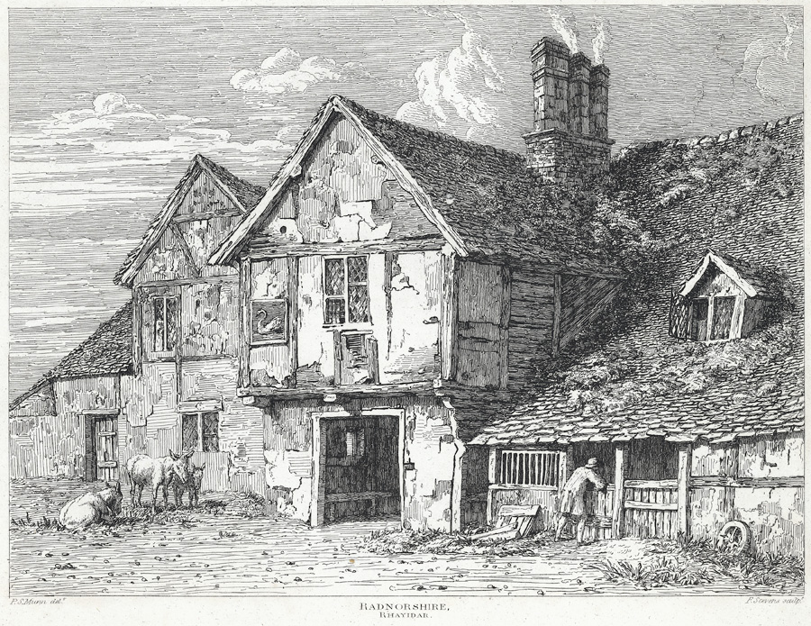
Old Swan, Rhayader

The Old Swan is a former historic public house at the centre of Rhayader, Powys, Wales. The buildings are timber framed and while there is a datestone...

Rhayader Town F.C.

Rhayader Town Football Club (Welsh: Clwb Pêl-droed Tref Rhaeadr Gwy) are a Welsh football team. The club dates from around 1884 and their ground is called...

Rhayader

Rhayader (; Welsh: Rhaeadr Gwy; pronounced [ˈr̥əɪadar ˈɡʊi̯]) is a market town and community in Powys, Wales, within the historic county of Radnorshire...

Rhayader Rural District

Rhayader was, from 1894 to 1974, a rural district in the administrative county of Radnorshire, Wales. The district was formed by the Local Government Act...

Cwmdauddwr

Cwmdauddwr (rarely referred to by its correct full name of Llansanffraid Cwmteuddwr) is a village in Powys, Wales. It is contiguous with the town of Rhayader...

Rhayader railway station

Rhayader railway station was a station serving the town of Rhayader, Powys, on the Mid Wales Railway line. It was opened in 1864 in Cwmdauddwr, a village...

Nearby Amenities

Located within 500m of 52.298255,-3.4678224
Power: pole
Lat/Long: 52.3009688/-3.468681
Power: pole
Lat/Long: 52.2980737/-3.4699792
Power: pole
Lat/Long: 52.2998157/-3.4722966
Power: pole
Lat/Long: 52.2992285/-3.4709582
Power: pole
Lat/Long: 52.2955967/-3.466208
Power: pole
Lat/Long: 52.2961594/-3.4688017
Power: pole
Lat/Long: 52.2983689/-3.4748662
Power: pole
Lat/Long: 52.2979851/-3.473804
Power: pole
Lat/Long: 52.2976636/-3.4729323
Power: pole
Lat/Long: 52.2973815/-3.4722027
Power: pole
Lat/Long: 52.2970124/-3.4712613
Power: pole
Lat/Long: 52.2966318/-3.470073
Power: pole
Lat/Long: 52.2958904/-3.4680292
Power: pole
Lat/Long: 52.2955246/-3.4669778
Power: pole
Lat/Long: 52.2950669/-3.4650815
Gaufron
Place: hamlet
Source: OS-OpenData_StreetView_2016_04
Lat/Long: 52.301167/-3.468413
The data included in this document is from www.openstreetmap.org. The data is made available under ODbL.

Have you been to Coed Esgair-rhiw?

Leave your review of Coed Esgair-rhiw below (or comments, questions and feedback).