Coed Isaf

Wood, Forest in Merionethshire

Wales

Coed Isaf

Old Railway Bridge Across the Dee The bridge carried the former railway from Ruabon - Barmouth Junction.
Old Railway Bridge Across the Dee Credit: David Robinson

Coed Isaf is a picturesque and enchanting woodland located in the county of Merionethshire, Wales. Stretching over an area of approximately 100 hectares, this ancient forest is nestled within the Snowdonia National Park, known for its breathtaking natural beauty.

The woodland is characterized by a diverse range of trees, including oak, beech, birch, and pine, creating a rich and vibrant tapestry of colors throughout the year. Walking through Coed Isaf, visitors are greeted by a serene and tranquil atmosphere, with the gentle rustling of leaves and the chirping of birds providing a melodic soundtrack.

This woodland is not only a haven for nature enthusiasts but also a habitat for a wide variety of wildlife. It is home to numerous bird species, such as woodpeckers, owls, and buzzards, which can be spotted perched on branches or soaring above the treetops. Additionally, Coed Isaf provides a safe haven for mammals like badgers, foxes, and deer, allowing them to thrive in their natural habitat.

For those seeking outdoor activities, the forest offers a network of well-maintained walking trails, suitable for all levels of fitness. These paths wind through the woodland, unveiling hidden treasures such as a cascading waterfall and a tranquil lake. Along the way, informative signage provides visitors with valuable insights into the flora, fauna, and history of the area.

Coed Isaf is not only a place of natural beauty but also holds historical significance. The forest has remnants of ancient settlements, including stone circles and burial mounds, dating back to the Bronze Age. These archaeological sites provide a glimpse into the lives of the people who once inhabited this land.

Whether it is to immerse oneself in the beauty of nature, observe wildlife, or explore the rich history of the area, Coed Isaf offers a captivating and memorable experience for all who venture into its leafy embrace.

If you have any feedback on the listing, please let us know in the comments section below.
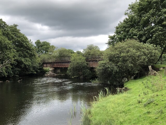
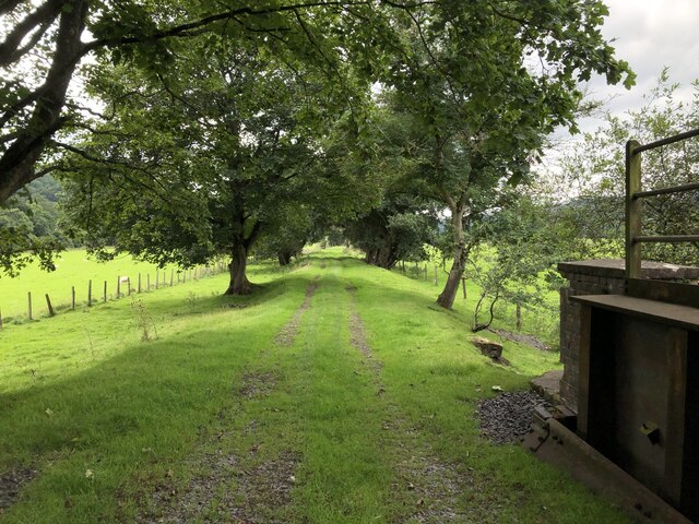
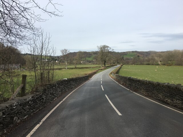
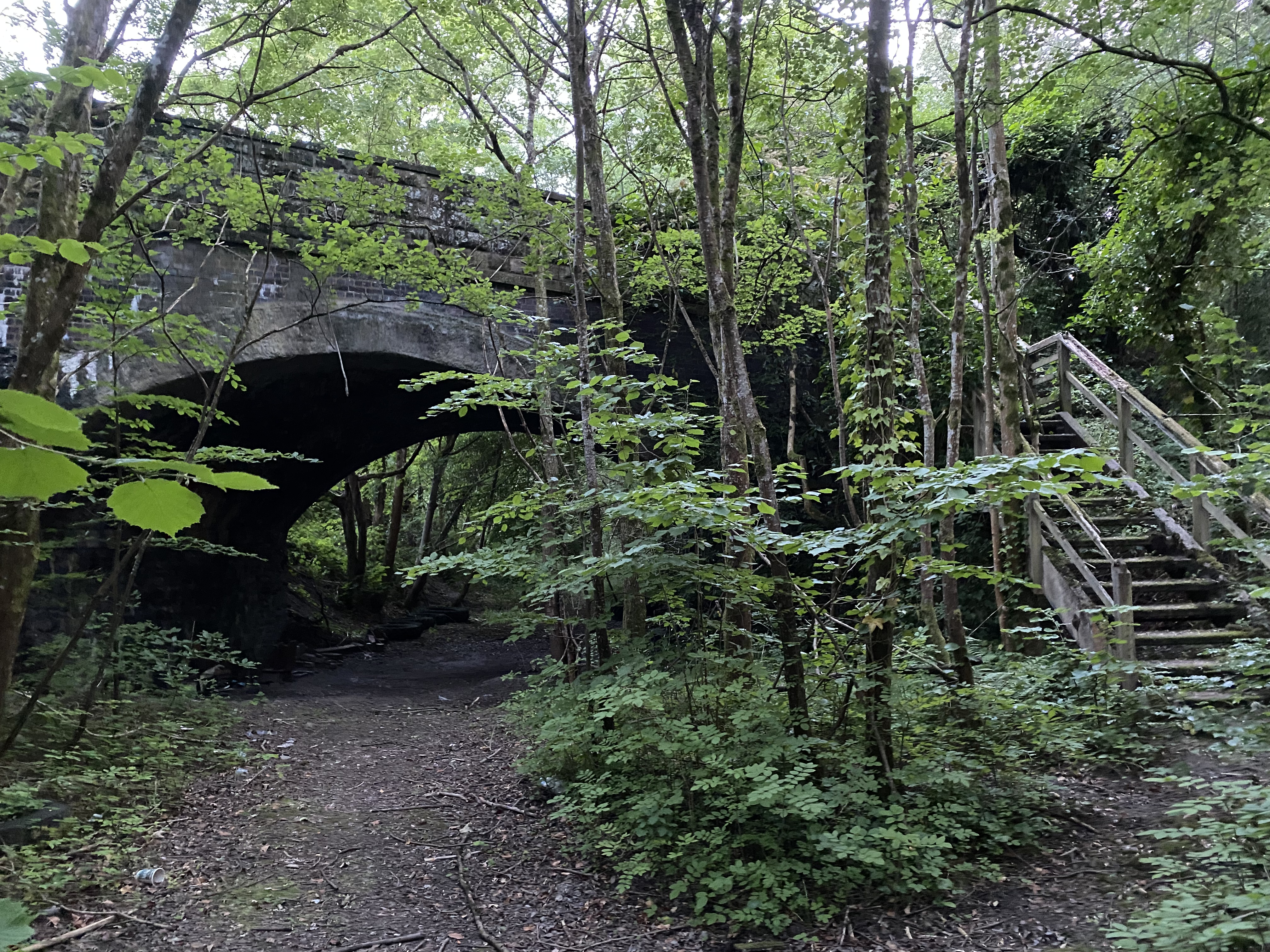
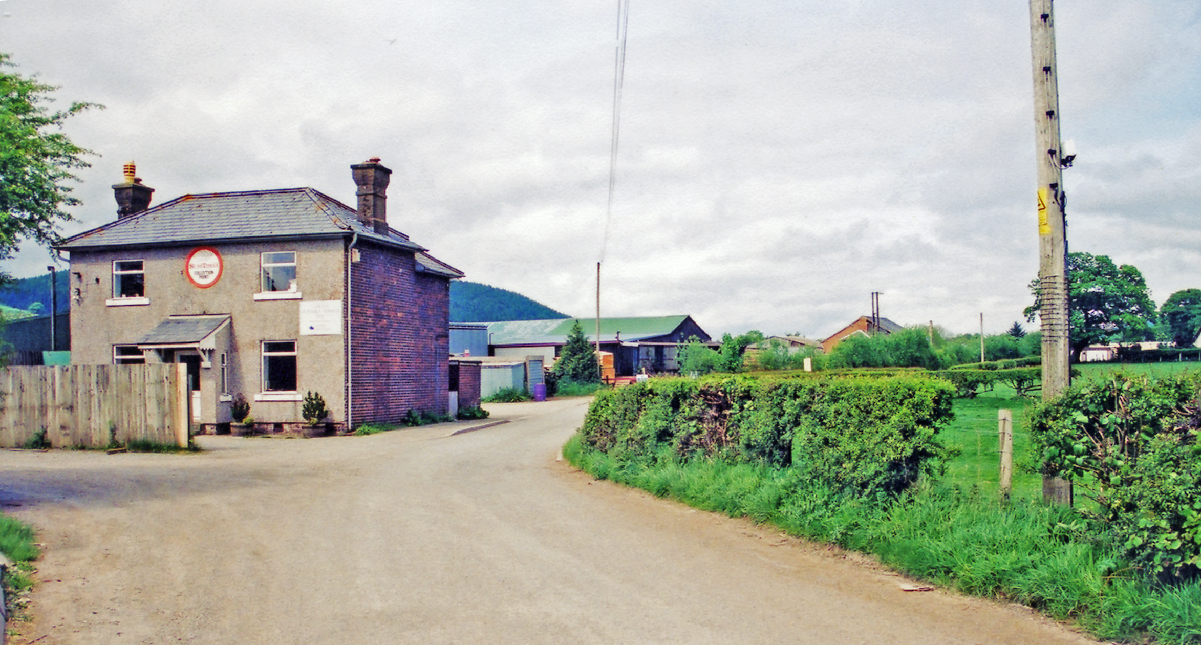
Coed Isaf Images

Images are sourced within 2km of 52.91566/-3.497572 or Grid Reference SH9936. Thanks to Geograph Open Source API. All images are credited.

Old Railway Bridge Across the Dee The bridge carried the former railway from Ruabon - Barmouth Junction.
Old Railway Bridge Across the Dee
The bridge carried the former railway from Ruabon - Barmouth Junction.
Disused Railway Bridge Across the Dee The former Ruabon - Barmouth line crossing the Dee. Despite over 50 years of closure the bridge remains in good condition and sees some use by farm vehicles.
Disused Railway Bridge Across the Dee
The former Ruabon - Barmouth line crossing the Dee. Despite over 50 years of closure the bridge remains in good condition and sees some use by farm vehicles.
River Dee at Pont Dol-y-gadfa
Green lane (Tegid Way) south of Syrior
Lane dropping down towards Branas Lodge, Dee Valley
View from Bryn-melyn The grounds of Bryn-melyn, a former farm now providing holiday accommodation in converted farm buildings.
View from Bryn-melyn
The grounds of Bryn-melyn, a former farm now providing holiday accommodation in converted farm buildings.
Trackbed of Former Ruabon - Barmouth Railway The railway was closed as part of the Beeching cuts in the mid 1960s.
Trackbed of Former Ruabon - Barmouth Railway
The railway was closed as part of the Beeching cuts in the mid 1960s.
B4401 near Llandderfel
Church Street, Llandderfel
Cattle grid on the B 4391
The Dee valley The Dee valley downstream from viewed here from a hairpin bend on the B4391 beside Coed Ty'n-y-gwrych.
The Dee valley
The Dee valley downstream from viewed here from a hairpin bend on the B4391 beside Coed Ty'n-y-gwrych.
Replanted forestry Replanted Norwegian spruce beside the B4391.
Replanted forestry
Replanted Norwegian spruce beside the B4391.
Site of former Llanderfel station View NE down the Upper Dee valley, towards Corwen, Llangollen and Ruabon on the trackbed of the ex-GWR Ruabon - Llangollen - Bala Junction - Dolgellau - Morfa Mawddach line, blocked by flood 14/12/64, officially closed 18/1/65.
Site of former Llanderfel station
View NE down the Upper Dee valley, towards Corwen, Llangollen and Ruabon on the trackbed of the ex-GWR Ruabon - Llangollen - Bala Junction - Dolgellau - Morfa Mawddach line, blocked by flood 14/12/64, officially closed 18/1/65.
Junction ahead on B4391
Entrance to Ty-cerrig from B4391
Hair pin bend at Coed Ty'n-y-gwrch
The Bryntirion Inn What a lovely looking place. Must return.
The Bryntirion Inn
What a lovely looking place. Must return.
Palé Hall Hotel Exquisite hotel and restaurant in an exquisite location, far from the madding crowds! The building is Grade II* listed, Mid-Victorian country house on the site of an earlier house, the seat of the Lloyds of Pale. The present building, in eclectic Jacobean style, was designed by Samuel Pountney Smith, architect of Shrewsbury, and built 1869-1871 for Henry Robertson, the eminent railway engineer and Liberal MP for Meirionethshire under Gladstone. In 1889 Queen Victoria stayed here as Robertson's guest during her tour of North Wales.
Palé Hall Hotel
Exquisite hotel and restaurant in an exquisite location, far from the madding crowds! The building is Grade II* listed, Mid-Victorian country house on the site of an earlier house, the seat of the Lloyds of Pale. The present building, in eclectic Jacobean style, was designed by Samuel Pountney Smith, architect of Shrewsbury, and built 1869-1871 for Henry Robertson, the eminent railway engineer and Liberal MP for Meirionethshire under Gladstone. In 1889 Queen Victoria stayed here as Robertson's guest during her tour of North Wales.
Show me another place!

Coed Isaf is located at Grid Ref: SH9936 (Lat: 52.91566, Lng: -3.497572)

Unitary Authority: Gwynedd

Police Authority: North Wales

What 3 Words

///revisits.garden.escapades. Near Llandrillo, Denbighshire

Nearby Locations

Coed Isaf Coed Uchaf

Related Wikis

Llandderfel railway station

Llandderfel railway station in Gwynedd, Wales, was a station on the Ruabon to Barmouth line. It closed to passengers ahead of the scheduled closure date...

Llandderfel

Llandderfel is a village and a sparsely populated community in Gwynedd, Wales, near Bala, formerly served by the Llandderfel railway station. The community...

Cefnddwysarn

Cefnddwysarn () is a small village in Gwynedd, Wales. It is located on the A494 road approximately 3 miles east of the town of Bala and 8 miles west of...

Llandrillo railway station

Llandrillo railway station (ɬandriːɬɔ) in Denbighshire, Wales, was a station on the Ruabon to Barmouth line. It was to have closed to passengers on Monday...

Nearby Amenities

Located within 500m of 52.91566,-3.497572
Place: farm
Lat/Long: 52.9158747/-3.5018196
Ford: yes
Lat/Long: 52.9116926/-3.5007614
The data included in this document is from www.openstreetmap.org. The data is made available under ODbL.

Have you been to Coed Isaf?

Leave your review of Coed Isaf below (or comments, questions and feedback).