Allonby

Settlement in Cumberland Allerdale

England

Allonby

B5300 near Mealo House
B5300 near Mealo House Credit: Colin Pyle

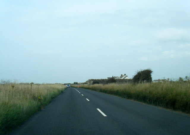
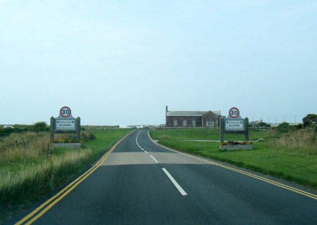
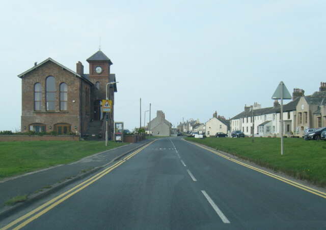
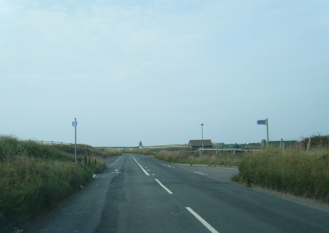
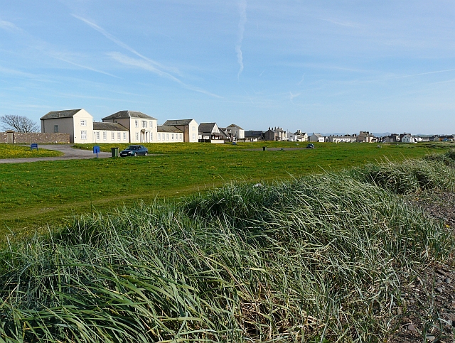
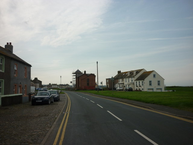
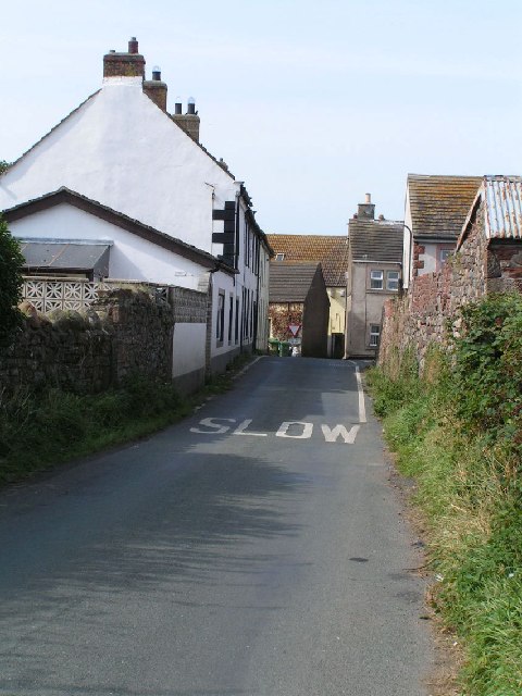
Allonby is a small coastal village located in the county of Cumberland, in the northwest of England. Situated on the Solway Firth, it is part of the Allerdale district and lies about 8 miles northwest of the town of Maryport. The village offers stunning views across the sea to the Scottish coast, making it a popular tourist destination for nature lovers and outdoor enthusiasts.

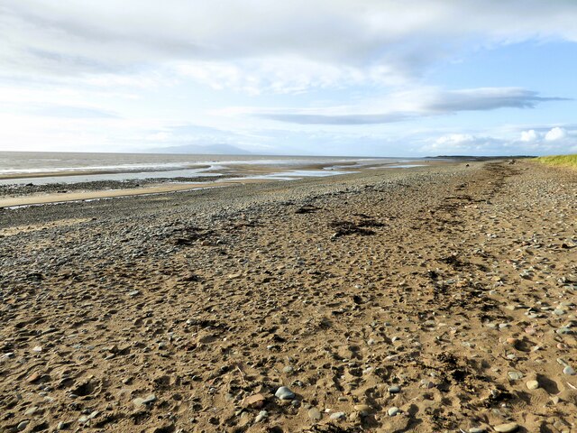
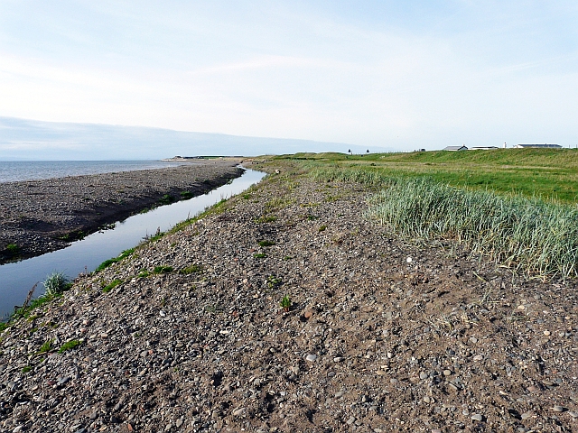
One of the main attractions of Allonby is its long sandy beach, which stretches for approximately three miles. The beach is a designated Area of Outstanding Natural Beauty and is ideal for long walks, picnics, and sunbathing during the summer months. The village is also known for its excellent watersports opportunities, including windsurfing and kiteboarding, due to the strong winds that blow across the Solway Firth.

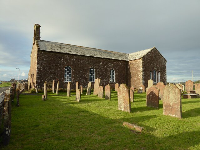
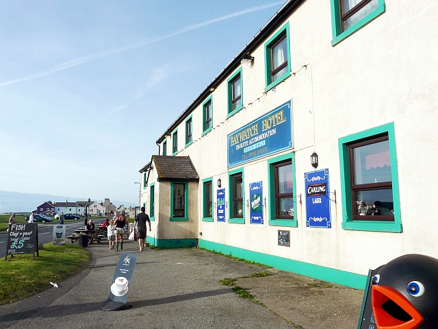
Allonby has a rich history, with evidence of human habitation dating back to the Roman period. The village was an important center for fishing and shipbuilding in the 19th century, and remnants of its maritime heritage can still be seen today. The Allonby Bay Hotel, a prominent landmark, was built in the 18th century and has served as a popular meeting point for locals and visitors alike.

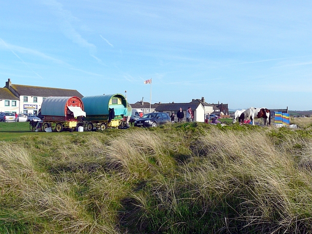
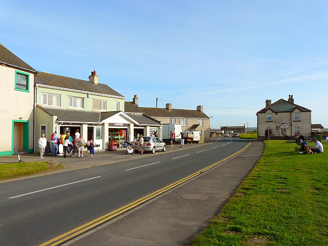
In terms of amenities, Allonby offers a range of accommodation options, including guesthouses and self-catering cottages, as well as a few local shops and cafes. The village has a friendly and welcoming community, with regular events and activities organized for residents and tourists throughout the year.

If you have any feedback on the listing, please let us know in the comments section below.
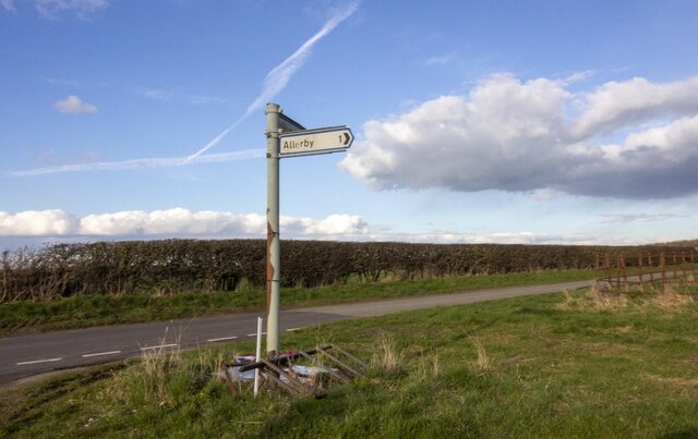
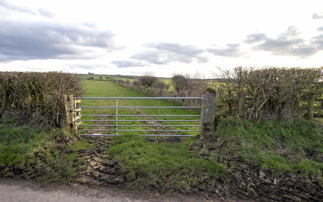
Allonby Images

Images are sourced within 2km of 54.770965/-3.430542 or Grid Reference NY0842. Thanks to Geograph Open Source API. All images are credited.

B5300 near Mealo House
B5300 at Allonby village boundary
B5300 in Allonby village
B5300 north of Allonby
Grapes Hotel, Allonby Long since closed and now a private house.
Grapes Hotel, Allonby
Long since closed and now a private house.
Road Junction at Mealo Road Junction at Mealo with sign post
Road Junction at Mealo
Road Junction at Mealo with sign post
Mealo House Farm Modern and vernacular farm buildings at Mealo House Farm
Mealo House Farm
Modern and vernacular farm buildings at Mealo House Farm
Gateway to field Gateway to field near Bowscale Farm
Gateway to field
Gateway to field near Bowscale Farm
Beach at Allonby Near the car park at Toll Gate House
Beach at Allonby
Near the car park at Toll Gate House
Christ Church An historic sea front Church and Sunday School
Christ Church
An historic sea front Church and Sunday School
North Lodge Built as Quaker's almshouses with an adjoining walled burial plot (to the left in this view)
North Lodge
Built as Quaker's almshouses with an adjoining walled burial plot (to the left in this view)
The Baywatch Hotel, Allonby On Main Street, overlooking the sea - hotel website : <span class="nowrap"><a title="http://www.baywatchhotelallonby.co.uk/index.html" rel="nofollow ugc noopener" href="http://www.baywatchhotelallonby.co.uk/index.html">Link</a><img style="margin-left:2px;" alt="External link" title="External link - shift click to open in new window" src="https://s1.geograph.org.uk/img/external.png" width="10" height="10"/></span> .
The Baywatch Hotel, Allonby
On Main Street, overlooking the sea - hotel website : LinkExternal link .
Gypsy caravans on the green, Allonby Easter weekend, ideal weather for a trip to the seaside.
Gypsy caravans on the green, Allonby
Easter weekend, ideal weather for a trip to the seaside.
West End, Allonby On the coast road between Silloth and Maryport, with Twentyman's famous ice cream shop on the left, Toll Gate House on the right.
West End is at the south of the village, so we're wondering how it got that name.
West End, Allonby
On the coast road between Silloth and Maryport, with Twentyman's famous ice cream shop on the left, Toll Gate House on the right. West End is at the south of the village, so we're wondering how it got that name.
Allonby Beck You can't see this stream from the nearby car park, so it was a surprise to find that a quick walk to the sea would require an extra paddle (there are several bridges near the centre of Allonby village).
Allonby Beck
You can't see this stream from the nearby car park, so it was a surprise to find that a quick walk to the sea would require an extra paddle (there are several bridges near the centre of Allonby village).
Green to the north of Allonby village View from beside <a href="https://www.geograph.org.uk/photo/2410604">NY0843 : Allonby Beck</a> . The large building on the left is <a href="https://www.geograph.org.uk/photo/598270">NY0843 : North Lodge, Allonby</a>.
Green to the north of Allonby village
View from beside NY0843 : Allonby Beck . The large building on the left is NY0843 : North Lodge, Allonby.
A water installation on the B5300
The village of Allonby
Show me another place!

Allonby is located at Grid Ref: NY0842 (Lat: 54.770965, Lng: -3.430542)

Administrative County: Cumbria

District: Allerdale

Police Authority: Cumbria

What 3 Words

///ruling.badge.beaks. Near Aspatria, Cumbria

Nearby Locations

Allonby

Related Wikis

Allonby

Allonby is a village on the coast of Cumberland in Cumbria, England. The village is on the B5300 road 5 miles (8.0 km) north of Maryport and 8 miles...

Allonby Bay

Allonby Bay is a crescent-shaped bay of the Solway Firth on the north-western shore of Cumbria, England. The bay is 5.5 miles (8.9 km) across. Its northern...

Milefortlet 20

Milefortlet 20 (Low Mire) was a Milefortlet of the Roman Cumbrian Coast defences. These milefortlets and intervening stone watchtowers extended from the...

Salta Moss

Salta Moss is a raised blanket mire which is a Site of Special Scientific Interest ('SSSI') located in the hamlet of Salta, in Cumbria, United Kingdom...

Salta, Cumbria

Salta is a hamlet in the parish of Holme St Cuthbert in northwestern Cumbria, United Kingdom. It is 1.1 miles (1.8 km) southwest of the village of Mawbray...

Hayton, Allerdale

Hayton is a village in the Cumberland unitary authority area of Cumbria, England. It is the only settlement in the civil parish of Hayton and Mealo. Historically...

Hayton and Mealo

Hayton and Mealo is a civil parish in Allerdale district, Cumbria. The only settlement is Hayton, a village in the centre of the parish, which had a population...

Dubmill

Dubmill is a settlement in the civil parish of Holme St. Cuthbert in Cumbria, United Kingdom. It is located approximately one mile south-west of the village...

Nearby Amenities

Located within 500m of 54.770965,-3.430542
Bus Stop
Village Green (N bound)
Local Ref: AT
Naptan AtcoCode: 090002031404
Naptan Bearing: N
Naptan BusStopType: CUS
Naptan CommonName: Village Green (N bound)
Naptan Indicator: at
Naptan Landmark: Allonby village green
Naptan NaptanCode: cumdmtmj
Naptan Street: B5300 Main Street
Naptan Verified: no
Source: naptan_import
Lat/Long: 54.7710555/-3.4305887
Bus Stop
Village Green (S bound)
Local Ref: ON
Naptan AtcoCode: 090002031836
Naptan Bearing: S
Naptan CommonName: Village Green (S bound)
Naptan Indicator: on
Naptan Landmark: village green
Naptan NaptanCode: cumdmtmt
Naptan Street: B5300 Main Street
Naptan Verified: no
Source: naptan_import
Lat/Long: 54.7708915/-3.4304753
Fast Food
The Codfather Fish and Chips
Lat/Long: 54.7724095/-3.43018
Public Bookcase
Defibrillator
Booth: KX100
Covered: booth
Defibrillator Location: inside old phone box (that is now a book exchange) Main Street, Allonby
Disused Amenity: telephone
Emergency: defibrillator
Man Made: telephone_box
Public Bookcase Type: phone_box
Source: survey
Lat/Long: 54.7746814/-3.4299348
Post Box
Ref: CA15 63
Lat/Long: 54.7724323/-3.4301305
Allonby
Place: village
Wikidata: Q2849195
Wikipedia: en:Allonby
Lat/Long: 54.7729585/-3.4285665
West End
Place: locality
Lat/Long: 54.7696842/-3.4298753
Telephone
Booth: KX100
Covered: booth
Lat/Long: 54.7704308/-3.4305772
Pub
Jack's Surf Bar
Lat/Long: 54.770265/-3.4305476
Cafe
West Winds Coffee Shop
Lat/Long: 54.7687178/-3.4305876
Captain Tom Moore
Artwork Type: mural_painting
Tourism: artwork
Lat/Long: 54.770311/-3.4305234
Clock
Lat/Long: 54.7748673/-3.4294199
Defibrillator
Defibrillator Location: outside Twentymans
Emergency: defibrillator
Indoor: no
Lat/Long: 54.7700133/-3.4306401
Power: pole
Lat/Long: 54.7684665/-3.4248454
Power: pole
Lat/Long: 54.7690081/-3.4256431
Power: pole
Lat/Long: 54.7696984/-3.4266277
Power: pole
Lat/Long: 54.7703647/-3.4275501
Power: pole
Lat/Long: 54.7709974/-3.4284703
The data included in this document is from www.openstreetmap.org. The data is made available under ODbL.

Have you been to Allonby?

Leave your review of Allonby below (or comments, questions and feedback).