Coed y Brynau

Wood, Forest in Glamorgan

Wales

Coed y Brynau

Cemetery near Llanharry
Cemetery near Llanharry Credit: John Lord

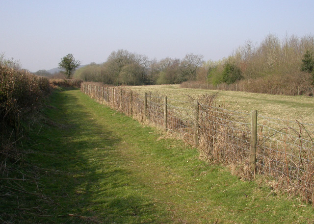
Coed y Brynau, located in Glamorgan, Wales, is a picturesque wood or forest that spans over a vast area. It is known for its diverse range of flora and fauna, making it a popular destination for nature enthusiasts and hikers alike.

The wood is situated on a hillside, providing visitors with breathtaking panoramic views of the surrounding landscape. The terrain is predominantly hilly, with some areas featuring steep slopes and rocky outcrops. This creates a challenging yet rewarding experience for those who enjoy outdoor activities such as hiking and mountain biking.

The woodland itself is primarily composed of native tree species, including oak, beech, and ash. These trees provide a dense canopy, creating a cool and shaded environment. Beneath the canopy, a rich undergrowth of ferns, mosses, and wildflowers thrives, adding to the area's natural beauty.

Coed y Brynau is home to a variety of wildlife, including red squirrels, badgers, and a wide range of bird species. Nature enthusiasts can observe and appreciate these creatures in their natural habitat, making it an ideal location for birdwatching and wildlife photography.

The wood is also a designated Site of Special Scientific Interest (SSSI), recognizing its ecological importance and unique features. As such, visitors are encouraged to respect and preserve the natural environment, adhering to designated walking paths and avoiding any damage to the flora and fauna.

Overall, Coed y Brynau in Glamorgan offers a serene and captivating experience for those seeking a connection with nature. Its stunning landscapes, diverse wildlife, and ecological significance make it a true gem for outdoor enthusiasts and nature lovers alike.

If you have any feedback on the listing, please let us know in the comments section below.

Coed y Brynau Images

Images are sourced within 2km of 51.513891/-3.4646886 or Grid Reference SS9880. Thanks to Geograph Open Source API. All images are credited.

Cemetery near Llanharry
Degar Farm, Llanharry
Addison Avenue Bridge, M4 The M4 is 190 miles long and runs from London to South Wales. Major centres close to the motorway include Reading, Swindon, Bristol, Newport, Cardiff and Swansea. The motorway was constructed between 1961 and 1996. The M4 originally crossed the first Severn Road Bridge. It has now been diverted to use the Second Severn Crossing and the motorway over the older bridge has been renumbered as M48.
Wikipedia: <span class="nowrap"><a title="http://en.wikipedia.org/wiki/M4_motorway" rel="nofollow ugc noopener" href="http://en.wikipedia.org/wiki/M4_motorway">Link</a><img style="margin-left:2px;" alt="External link" title="External link - shift click to open in new window" src="https://s1.geograph.org.uk/img/external.png" width="10" height="10"/></span>
Addison Avenue Bridge, M4
The M4 is 190 miles long and runs from London to South Wales. Major centres close to the motorway include Reading, Swindon, Bristol, Newport, Cardiff and Swansea. The motorway was constructed between 1961 and 1996. The M4 originally crossed the first Severn Road Bridge. It has now been diverted to use the Second Severn Crossing and the motorway over the older bridge has been renumbered as M48. Wikipedia: LinkExternal link
Rhondda Cynon Taf : M4 Motorway The M4 Motorway heading through Rhondda Cynon Taf.
Rhondda Cynon Taf : M4 Motorway
The M4 Motorway heading through Rhondda Cynon Taf.
Llanharry Cemetery Llanharry Cemetery.
Llanharry Cemetery
Llanharry Cemetery.
Road junction near M4, Llanharry
Ordnance Survey Cut Mark This OS cut mark can be found on the wall of the cemetery. It marks a point 103.672m above mean sea level.
Ordnance Survey Cut Mark
This OS cut mark can be found on the wall of the cemetery. It marks a point 103.672m above mean sea level.
End of the 30 zone, Degar South of Llanharry and the bridge over the M4 motorway, the 30mph speed limit increases to the National Speed Limit. This road is at the southern edge of Rhondda Cynon Taff County Borough. Ahead for the northern edge of the Vale of Glamorgan and Cowbridge.
End of the 30 zone, Degar
South of Llanharry and the bridge over the M4 motorway, the 30mph speed limit increases to the National Speed Limit. This road is at the southern edge of Rhondda Cynon Taff County Borough. Ahead for the northern edge of the Vale of Glamorgan and Cowbridge.
Field gate in Degar near Llanharry South of Llanharry at the southern edge of Rhondda Cynon Taff County Borough.
Field gate in Degar near Llanharry
South of Llanharry at the southern edge of Rhondda Cynon Taff County Borough.
Line spur pole in Degar south of Llanharry A rural part of the Western Power Distribution electricity supply infrastructure.
Line spur pole in Degar south of Llanharry
A rural part of the Western Power Distribution electricity supply infrastructure.
Road towards Degar Farm south of Llanharry At the southern edge of Rhondda Cynon Taff County Borough.
Road towards Degar Farm south of Llanharry
At the southern edge of Rhondda Cynon Taff County Borough.
Start of the 30 zone on the southern approach to Llanharry The National Speed Limit on the minor road through Degar drops to 30mph at the edge of the bridge over the M4 motorway.
Start of the 30 zone on the southern approach to Llanharry
The National Speed Limit on the minor road through Degar drops to 30mph at the edge of the bridge over the M4 motorway.
Llanilid Former Opencast A small lagoon that has formed adjacent to the till mound known as Mynydd Hywel Deio at the former opencast mine. The site is currently being redeveloped.
Llanilid Former Opencast
A small lagoon that has formed adjacent to the till mound known as Mynydd Hywel Deio at the former opencast mine. The site is currently being redeveloped.
M4 Bridge
M4 Bridge
Harvester Pub & Restaurant
Llanilid Former Opencast Part of the restored opencast site, now under redevelopment. The foundations for a new bypass can be seen at the extreme right.
Llanilid Former Opencast
Part of the restored opencast site, now under redevelopment. The foundations for a new bypass can be seen at the extreme right.
Llanilid Former Opencast Part of the restored former opencast. The muddy area was previously a pool, but has been drained to facilitate the site's redevelopment.
Llanilid Former Opencast
Part of the restored former opencast. The muddy area was previously a pool, but has been drained to facilitate the site's redevelopment.
Tir-eithin Woodland west of Tir-eithin Farm.
Tir-eithin
Woodland west of Tir-eithin Farm.
Show me another place!

Coed y Brynau is located at Grid Ref: SS9880 (Lat: 51.513891, Lng: -3.4646886)

Unitary Authority: The Vale of Glamorgan

Police Authority: South Wales

What 3 Words

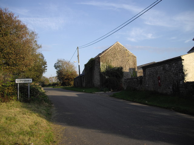
///section.essay.covers. Near Llanharry, Rhondda Cynon Taf

Nearby Locations

Coed y Brynau

Related Wikis

Llanilid

Llanilid is a small settlement of in the county borough of Rhondda Cynon Taf, Wales. It is in the historic county of Glamorgan. Llanilid is part of the...

Ysgol Llanhari

Ysgol Llanhari is a Welsh-medium school for 3-19 year olds situated in the village of Llanharry, Rhondda Cynon Taf, Wales. == History == Llanhari is one...

City, Vale of Glamorgan

City is a small village in the Vale of Glamorgan, Wales, United Kingdom. == Location == It is quite near to the town of Cowbridge. == Origin of the... ==

Pencoed College

Pencoed College was founded in 1925 to serve sons and daughters of farmers. Its main building is the old Tregroes House and was originally known as Pencoed...

Nearby Amenities

Located within 500m of 51.513891,-3.4646886
Power: tower
Lat/Long: 51.5172238/-3.4600068
Power: tower
Lat/Long: 51.5176082/-3.4616732
The data included in this document is from www.openstreetmap.org. The data is made available under ODbL.

Have you been to Coed y Brynau?

Leave your review of Coed y Brynau below (or comments, questions and feedback).