Coed y Gilfach

Wood, Forest in Brecknockshire

Wales

Coed y Gilfach

Llwybr i'r mynydd / Path to the hill Llwybr ceffyl yn agosau at Fynydd Aberysgir.

A bridleway approaches Mynydd Aberysgir (trans. mountain of the river Yscir confluence).
Llwybr i'r mynydd / Path to the hill Credit: Alan Richards

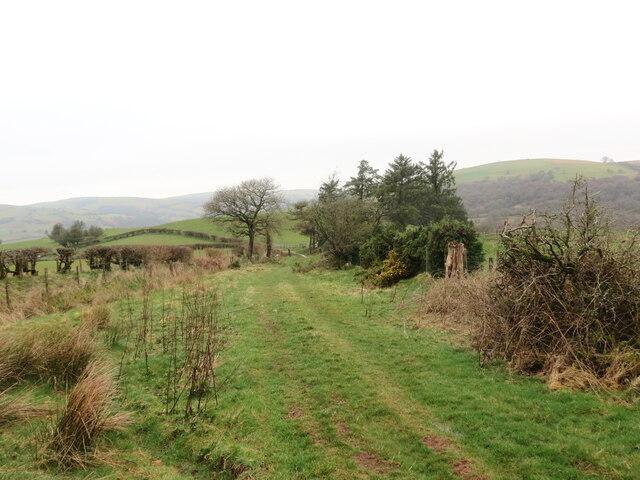
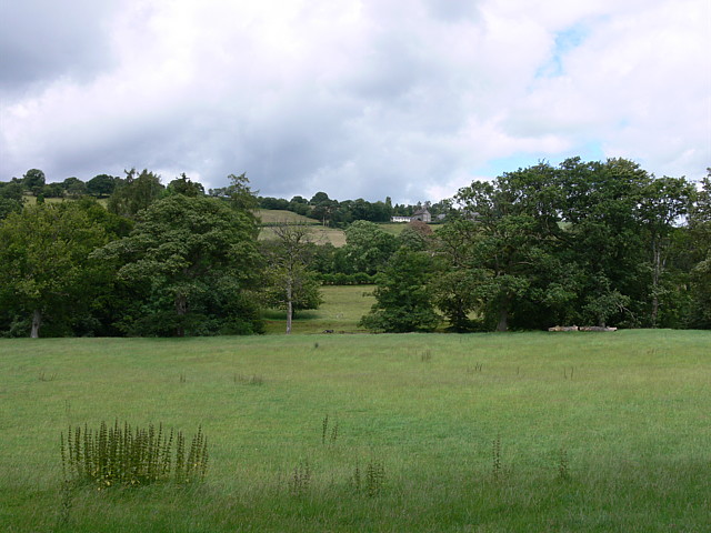
Coed y Gilfach is a stunning woodland located in the county of Brecknockshire, Wales. Spanning an area of approximately 200 acres, this enchanting forest is nestled amidst the picturesque landscape of the Brecon Beacons National Park.

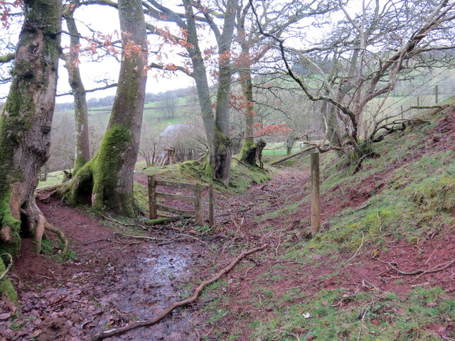
The woodland is characterized by its diverse array of tree species, including oak, beech, birch, and ash, which create a rich and vibrant canopy. The forest floor is adorned with a carpet of bluebells in the spring, creating a breathtaking sight that attracts nature enthusiasts from far and wide.

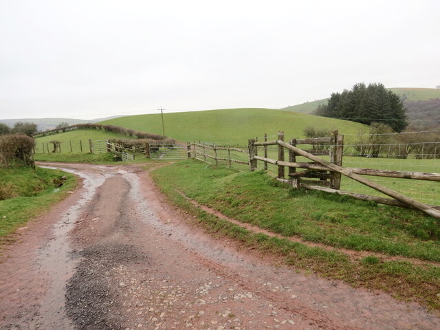
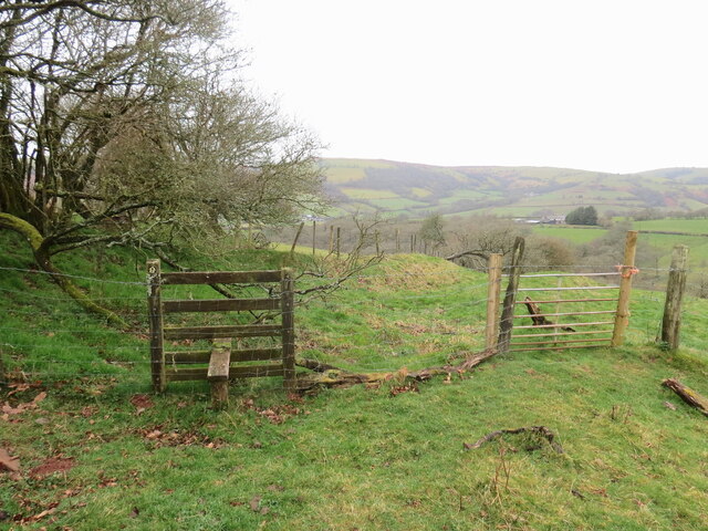
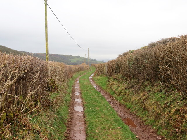
Coed y Gilfach boasts a network of well-maintained trails, allowing visitors to explore the woodland at their own pace. These paths meander through the forest, offering opportunities for leisurely walks, invigorating hikes, or peaceful picnics in the heart of nature.

The woodland is also home to an abundance of wildlife, making it a haven for nature lovers. Red kites, buzzards, and woodpeckers can often be spotted soaring through the sky, while foxes, badgers, and squirrels roam the forest floor.

In addition to its natural beauty, Coed y Gilfach holds historical significance as well. The woodland is home to remnants of an ancient hillfort, dating back to the Iron Age, which adds an element of intrigue and mystery to the site.

Overall, Coed y Gilfach is a captivating destination that offers a peaceful retreat from the hustle and bustle of daily life, where visitors can immerse themselves in the beauty of nature and explore the rich history of the area.

If you have any feedback on the listing, please let us know in the comments section below.

Coed y Gilfach Images

Images are sourced within 2km of 51.971568/-3.4971404 or Grid Reference SN9731. Thanks to Geograph Open Source API. All images are credited.

Llwybr i'r mynydd / Path to the hill Llwybr ceffyl yn agosau at Fynydd Aberysgir.

A bridleway approaches Mynydd Aberysgir (trans. mountain of the river Yscir confluence).
Llwybr i'r mynydd / Path to the hill
Llwybr ceffyl yn agosau at Fynydd Aberysgir. A bridleway approaches Mynydd Aberysgir (trans. mountain of the river Yscir confluence).
Mynydd Aberysgir Gât yn rhoi mynediad i gomin Fynydd Aberysgir.

A gate gives access to a common known as Mynydd Aberysgir (trans. mountain of the river Yscir confluence).
Mynydd Aberysgir
Gât yn rhoi mynediad i gomin Fynydd Aberysgir. A gate gives access to a common known as Mynydd Aberysgir (trans. mountain of the river Yscir confluence).
Mynydd Aberysgir Llwybr ceffyl ar dir comin a elwir Mynydd Aberysgir.

A bridleway on common land known as Mynydd Aberysgir (trans. mountain of the river Yscir confluence).
Mynydd Aberysgir
Llwybr ceffyl ar dir comin a elwir Mynydd Aberysgir. A bridleway on common land known as Mynydd Aberysgir (trans. mountain of the river Yscir confluence).
Mynydd Aberysgir Llwybr yn croesi comin a elwir Mynydd Aberysgir.

A path crosses a common known as Mynydd Aberysgir (trans. mountain of the river Yscir confluence).
Mynydd Aberysgir
Llwybr yn croesi comin a elwir Mynydd Aberysgir. A path crosses a common known as Mynydd Aberysgir (trans. mountain of the river Yscir confluence).
Cerrig Mynydd Aberysgir /  Mynydd Aberysgir Stone Dau faenhir ar Fynydd Aberysgir. Mae'r llythyren 'D' ar un a 'T' ar y llall. Dywedir eu bod nhw'n hen gerrig terfyn.

Two standing stones on Mynydd Aberysgir. The letter 'D' is on one and 'T' on the other. They are said to be old boundary stones.
Cerrig Mynydd Aberysgir / Mynydd Aberysgir Stone
Dau faenhir ar Fynydd Aberysgir. Mae'r llythyren 'D' ar un a 'T' ar y llall. Dywedir eu bod nhw'n hen gerrig terfyn. Two standing stones on Mynydd Aberysgir. The letter 'D' is on one and 'T' on the other. They are said to be old boundary stones.
Mynydd Aberysgir Piler triongli ar Fynydd Aberysgir.

A trig point on Mynydd Aberysgir (trans. mountain of the river Yscir confluence).
Mynydd Aberysgir
Piler triongli ar Fynydd Aberysgir. A trig point on Mynydd Aberysgir (trans. mountain of the river Yscir confluence).
Mynydd Aberysgir Tir comin a elwir Mynydd Aberysgir.

Common land known as Mynydd Aberysgir (trans. mountain of the river Yscir confluence).
Mynydd Aberysgir
Tir comin a elwir Mynydd Aberysgir. Common land known as Mynydd Aberysgir (trans. mountain of the river Yscir confluence).
Llwybr ger Rhiwgoch / Path near Rhiwgoch Llwybr cyhoeddus ger Ffarm Rhiwgoch.

A public footpath near Rhiwgoch Farm (trans. red slope / hill).
Llwybr ger Rhiwgoch / Path near Rhiwgoch
Llwybr cyhoeddus ger Ffarm Rhiwgoch. A public footpath near Rhiwgoch Farm (trans. red slope / hill).
Cyffordd o lwybrau / A junction of paths Cyffordd o lwybrau cyhoeddus ger Ffarm Rhiwgoch.

A junction of public footpaths near Rhiwgoch Farm (trans. red slope / hill).
Cyffordd o lwybrau / A junction of paths
Cyffordd o lwybrau cyhoeddus ger Ffarm Rhiwgoch. A junction of public footpaths near Rhiwgoch Farm (trans. red slope / hill).
Llwybr i Dynycwm / Path to Tynycwm Llwybr cyhoeddus yn mynd i lawr y waered i gyfeiriad Tynycwm a'r heol.

A public footpath descending the hill towards Tynycwm (trans. valley homestead) and the road.
Llwybr i Dynycwm / Path to Tynycwm
Llwybr cyhoeddus yn mynd i lawr y waered i gyfeiriad Tynycwm a'r heol. A public footpath descending the hill towards Tynycwm (trans. valley homestead) and the road.
Llwybr i Dynycwm / Path to Tynycwm Llwybr cyhoeddus yn agosau at yr heol ac anhedd-dy o'r enw Tynycwm.

A public footpath approaching the road and a property known as Tynycwm (trans. valley homestead).
Llwybr i Dynycwm / Path to Tynycwm
Llwybr cyhoeddus yn agosau at yr heol ac anhedd-dy o'r enw Tynycwm. A public footpath approaching the road and a property known as Tynycwm (trans. valley homestead).
Heol las i Soar / Green lane to Soar Hen heol las yn arwain at bentre Soar.

An old green road heading towards Soar village.
Heol las i Soar / Green lane to Soar
Hen heol las yn arwain at bentre Soar. An old green road heading towards Soar village.
Heol las i Soar / Green lane to Soar Hen heol las yn mynd i lawr y waered tuag at bentre Soar.

An old green road descending towards Soar village.
Heol las i Soar / Green lane to Soar
Hen heol las yn mynd i lawr y waered tuag at bentre Soar. An old green road descending towards Soar village.
Capel Soar / Soar Chapel Capel Soar, addoldy'r Bedyddwyr. Codwyd y ty cwrdd cyntaf yn 1827 ac mae'r adeilad presennol yn dyddio o 1874. 

Capel Soar Baptist Chapel. The first meeting house was built in 1827 and the present building dates from 1874.
Capel Soar / Soar Chapel
Capel Soar, addoldy'r Bedyddwyr. Codwyd y ty cwrdd cyntaf yn 1827 ac mae'r adeilad presennol yn dyddio o 1874. Capel Soar Baptist Chapel. The first meeting house was built in 1827 and the present building dates from 1874.
Pombren yn Soar / Footbridge at Soar Pombren y croesi Nant Bran ym mhentre Soar. Yn anffodus, ar adeg ysgrifennu hyn mae'r llwybr wedi ei rwystro.

A footbridge spans Nant Brân (trans. crow stream) in the village of Soar. Unfortunately, at the time of writing the path is obstructed.
Pombren yn Soar / Footbridge at Soar
Pombren y croesi Nant Bran ym mhentre Soar. Yn anffodus, ar adeg ysgrifennu hyn mae'r llwybr wedi ei rwystro. A footbridge spans Nant Brân (trans. crow stream) in the village of Soar. Unfortunately, at the time of writing the path is obstructed.
Llwybr i Soar / Path to Soar Llwybr cyhoeddus yn gadael yr heol ac yn  mynd i gyfeiriad pentre Soar. Yn anffodus, ar adeg ysgrifennu hwn mae'r llwybr wedi ei rwystro.

A public footpath exits the road and heads in the direction of Soar village. Unfortunately at the time of writing the path is obstructed.
Llwybr i Soar / Path to Soar
Llwybr cyhoeddus yn gadael yr heol ac yn mynd i gyfeiriad pentre Soar. Yn anffodus, ar adeg ysgrifennu hwn mae'r llwybr wedi ei rwystro. A public footpath exits the road and heads in the direction of Soar village. Unfortunately at the time of writing the path is obstructed.
Llwybr yn gadael yr heol / Path exiting the road Ar y chwith mae hen ffordd- sy'n bellach yn llwybr cyhoeddus - yn gadael yr heol ac yn mynd dros y banc i gyfeiriad pentre Trallwng. 

On the left a former road, downgraded to a path, exits the road and heads over the hill towards Trallong village (trans. muddy area).
Llwybr yn gadael yr heol / Path exiting the road
Ar y chwith mae hen ffordd- sy'n bellach yn llwybr cyhoeddus - yn gadael yr heol ac yn mynd dros y banc i gyfeiriad pentre Trallwng. On the left a former road, downgraded to a path, exits the road and heads over the hill towards Trallong village (trans. muddy area).
Show me another place!

Coed y Gilfach is located at Grid Ref: SN9731 (Lat: 51.971568, Lng: -3.4971404)

Unitary Authority: Powys

Police Authority: Dyfed Powys

What 3 Words

///demanding.revolts.detergent. Near Brecon, Powys

Nearby Locations

Coed y Gilfach

Related Wikis

Soar, Powys

Soar is a small village in Powys, Wales, 37 miles North West of Cardiff. It sits at the foot of Mynydd Epynt, and is near Brecon in the historic county...

Trallong

Trallong (Welsh: Y Trallwng) is a village and community in Powys, Wales, in the historic county of Brecknockshire. == Description == The community of Trallong...

Aberbrân

Aberbrân is a small settlement in Powys, Wales. It lies on the Afon Brân immediately above its confluence (Welsh 'aber') with the River Usk and is 7 kilometres...

Aberbran railway station

Aberbran railway station served the village of Aberbran in the traditional county of Brecknockshire, Wales. == History == Opened by the Neath and Brecon...

Have you been to Coed y Gilfach?

Leave your review of Coed y Gilfach below (or comments, questions and feedback).