Allithwaite

Settlement in Lancashire South Lakeland

England

Allithwaite

Kents Bank, Cumbria Kents Bank and Hampsfield Fell across Morecambe Bay
Kents Bank, Cumbria Credit: Ralph Rawlinson

Allithwaite is a small village located in the county of Lancashire, England. Situated on the southern edge of the Lake District National Park, it lies approximately 7 miles southwest of the town of Grange-over-Sands and 15 miles west of the city of Lancaster. With a population of around 1,000 residents, Allithwaite offers a serene and peaceful setting amidst the picturesque countryside.

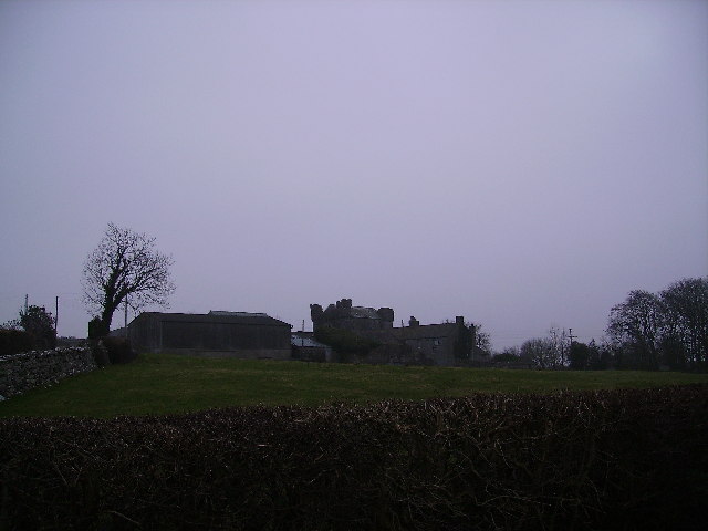
The village is known for its rich history, dating back to Roman times. It was mentioned in the Domesday Book of 1086 as "Aluuet," and evidence of its ancient past can still be seen in the form of archaeological sites and structures scattered throughout the area.

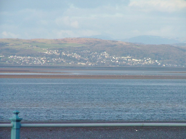
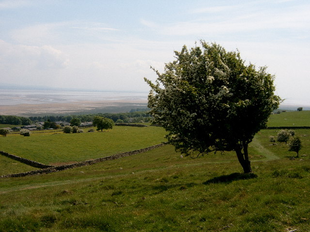
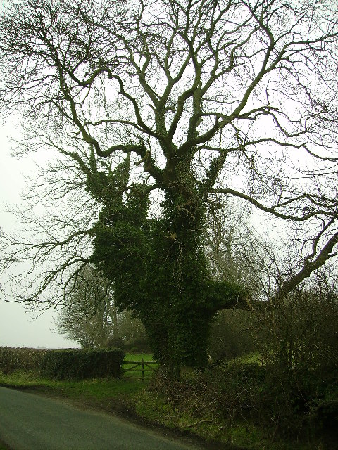
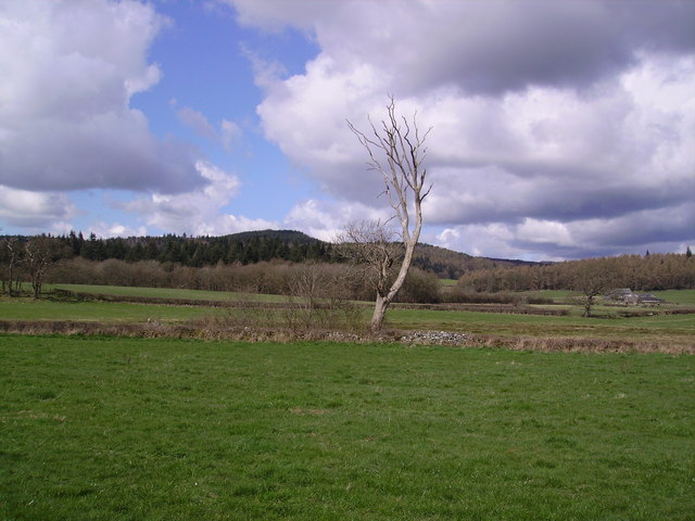
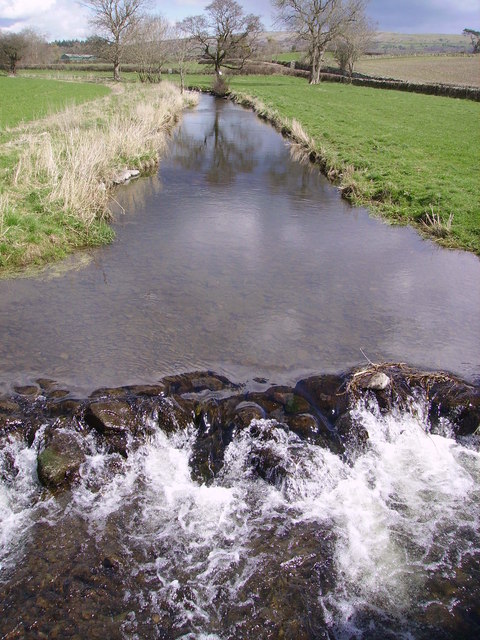
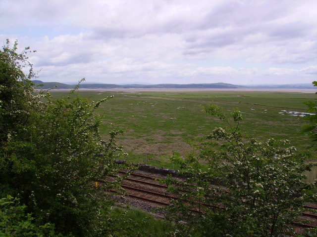
Allithwaite is surrounded by stunning natural beauty, offering residents and visitors alike the opportunity to explore the nearby fells and woodlands. The village is also in close proximity to the picturesque Morecambe Bay, providing breathtaking views and a variety of outdoor activities.

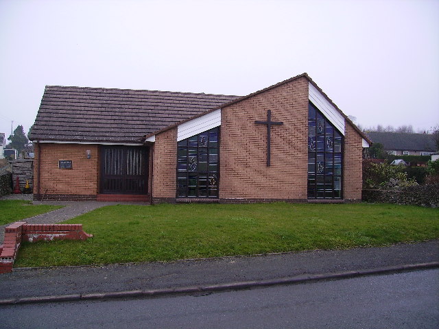
Despite its small size, Allithwaite boasts a strong sense of community, with a local primary school, a village hall, a post office, and a church serving as focal points. The village also benefits from excellent transport links, with regular bus services connecting it to neighboring towns and villages.

In conclusion, Allithwaite is a charming village in Lancashire, offering a tranquil escape for nature lovers and history enthusiasts. With its idyllic location and strong community spirit, it provides a welcoming environment for residents and visitors to enjoy the beauty of the surrounding countryside.

If you have any feedback on the listing, please let us know in the comments section below.
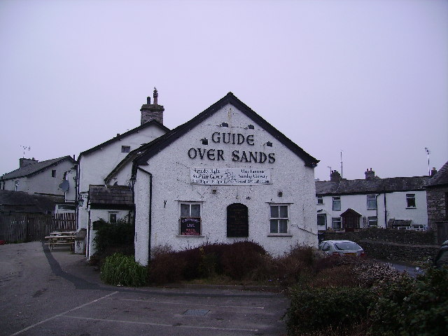
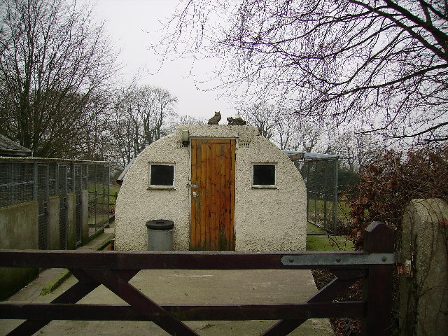
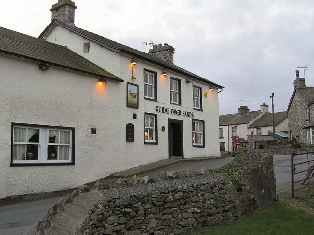
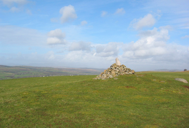
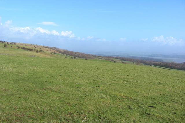
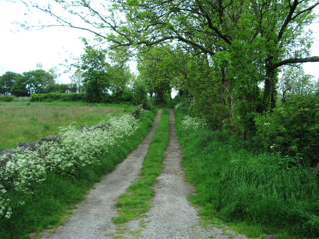
Allithwaite Images

Images are sourced within 2km of 54.182115/-2.9411 or Grid Reference SD3876. Thanks to Geograph Open Source API. All images are credited.

Kents Bank, Cumbria Kents Bank and Hampsfield Fell across Morecambe Bay
Kents Bank, Cumbria
Kents Bank and Hampsfield Fell across Morecambe Bay
Footpath Under Fell End Taken close to Fell End looking back over Morecambe Bay.
Footpath Under Fell End
Taken close to Fell End looking back over Morecambe Bay.
Guide Over Sands Allithwaite Perhaps not a good idea for a guide to visit the pub before crossing Morecambe Bay's notorious sands.
Guide Over Sands Allithwaite
Perhaps not a good idea for a guide to visit the pub before crossing Morecambe Bay's notorious sands.
Cattery Near Templand
Cattery
Near Templand
Tree Middle Fell Gate One good thing about winter is the shapes of old roadside trees like this one.
Tree Middle Fell Gate
One good thing about winter is the shapes of old roadside trees like this one.
Wrysholme Tower A farm near Kents Bank
Wrysholme Tower
A farm near Kents Bank
St. Cuthbert's Church, Flookburgh A relatively modern church.
St. Cuthbert's Church, Flookburgh
A relatively modern church.
Farm On the road between Allithwaite and Flookborough
Farm
On the road between Allithwaite and Flookborough
Tree near Cartmel From the road leaving Cartmel for Holker
Tree near Cartmel
From the road leaving Cartmel for Holker
River Eea Eea that's nice
River Eea
Eea that's nice
Morecambe Bay from Kents Bank Rail Line and foreshore with some tasty 'salt marsh lamb' just visible.
Morecambe Bay from Kents Bank
Rail Line and foreshore with some tasty 'salt marsh lamb' just visible.
Miners' Convalescent Home Now serving as a nursing home. Still retaining its splendid form, gardens and colourful facade which can be seen from miles away across Morecambe Bay with binoculars. Its striking presence is noticed as you approach round the corner and up the hill on the B5277 Grange to Flookburgh road.
Miners' Convalescent Home
Now serving as a nursing home. Still retaining its splendid form, gardens and colourful facade which can be seen from miles away across Morecambe Bay with binoculars. Its striking presence is noticed as you approach round the corner and up the hill on the B5277 Grange to Flookburgh road.
Guide Over Sands
Guide Over Sands
Cairn on Fell End View WNW from the grassy rounded 187m summit of Fell End on Hampsfell, with the Cartmel valley in the distance
Cairn on Fell End
View WNW from the grassy rounded 187m summit of Fell End on Hampsfell, with the Cartmel valley in the distance
View eastwards from Fell End View ENE from the grassy rounded 187m summit of Fell End on Hampsfell, with Morecambe Bay in the distance (right)
View eastwards from Fell End
View ENE from the grassy rounded 187m summit of Fell End on Hampsfell, with Morecambe Bay in the distance (right)
Footpath to Applebury Hill Farm
Lancaster to Barrow Railway Looking south east towards Grange-over-Sands
Lancaster to Barrow Railway
Looking south east towards Grange-over-Sands
Priest Bridge Carries the Cark to Cartmell road over the River Eea
Priest Bridge
Carries the Cark to Cartmell road over the River Eea
Show me another place!

Allithwaite is located at Grid Ref: SD3876 (Lat: 54.182115, Lng: -2.9411)

Administrative County: Cumbria

District: South Lakeland

Police Authority: Cumbria

What 3 Words

///rail.scariest.bars. Near Grange-over-Sands, Cumbria

Nearby Locations

Allithwaite

Related Wikis

Lindale and Newton-in-Cartmel

Lindale and Newton-in-Cartmel, formerly Upper Allithwaite (sometimes Allithwaite Upper) is a civil parish in the Westmorland and Furness district, in the...

Lower Allithwaite

Lower Allithwaite is a civil parish in the South Lakeland district of the English county of Cumbria. It includes the villages of Allithwaite and Cartmel...

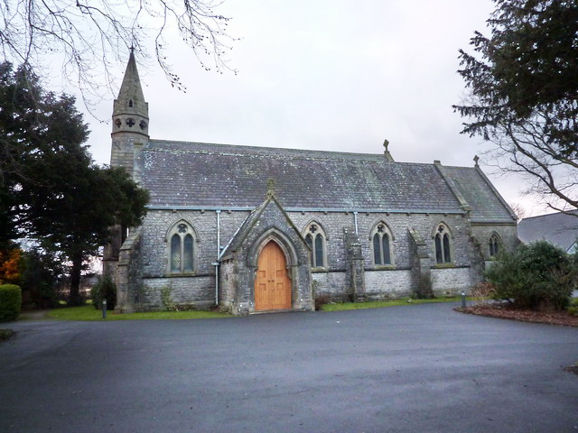
St Mary's Church, Allithwaite

St Mary's Church is in the village of Allithwaite, Cumbria, England. It is an active Anglican parish church in the deanery of Windermere, the archdeacon...

Allithwaite

Allithwaite is a village in Cumbria, England, located roughly 1.2 miles (1.9 km) west of Grange-over-Sands. Within the boundaries of the historic county...

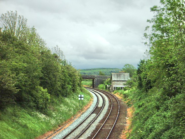
Wraysholme Halt railway station

Wraysholme Halt was a railway station on the Furness Railway in the Furness exclave of Lancashire. Situated between Cark and Cartmel and Kents Bank the...

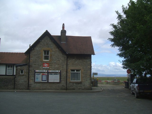
Kents Bank railway station

Kents Bank is a railway station on the Furness Line, which runs between Barrow-in-Furness and Lancaster. The station, situated 17+1⁄4 miles (28 km) north...

Kents Bank

Kents Bank is a small village in Cumbria, England, so named for its proximity to the River Kent estuary. Part of the historic County Palatine of Lancashire...

Grange Fell Church, Grange-Over-Sands

Grange Fell Church commonly referred to by locals as the Fell Church is a Church of England church in the Grange Fell area of Grange-over-Sands, Cumbria...

Nearby Amenities

Located within 500m of 54.182115,-2.9411
Bus Stop
Guide over Sands (E bound)
Local Ref: AT
Naptan AtcoCode: 090079021119
Naptan Bearing: E
Naptan CommonName: Guide over Sands (E bound)
Naptan Indicator: at
Naptan Landmark: Pub
Naptan NaptanCode: cumdgmpg
Naptan Street: Holme Rd
Naptan Verified: no
Source: naptan_import
Lat/Long: 54.179749/-2.9406395
Lane Ends
Local Ref: AT
Naptan AtcoCode: 090079021506
Naptan Bearing: S
Naptan BusStopType: CUS
Naptan CommonName: Lane Ends
Naptan Indicator: at
Naptan Landmark: junction with Wart Barrow Lane
Naptan NaptanCode: cumdgmpt
Naptan Street: Cartmel Road
Naptan Verified: no
Source: naptan_import
Lat/Long: 54.1845103/-2.9427585
Bus Stop
Church Road Hazelgarth junction
Local Ref: AT
Naptan AtcoCode: 090079023161
Naptan Bearing: N
Naptan CommonName: Church Road Hazelgarth junction
Naptan Indicator: at
Naptan Landmark: junction with Hazelgarth
Naptan NaptanCode: cumdgmtm
Naptan Street: Church Road
Naptan Verified: no
Source: naptan_import
Lat/Long: 54.1811529/-2.9410886
Bus Stop
Church Road / Kirkhead View
Naptan AtcoCode: 090079023162
Naptan Bearing: S
Naptan CommonName: Church Road / Kirkhead View
Naptan Indicator: near
Naptan Landmark: junction with Kirkhead View
Naptan NaptanCode: cumdgmtp
Naptan Street: Church Road
Naptan Verified: no
Source: naptan_import
Lat/Long: 54.1811545/-2.9408741
Guide over Sands (W bound)
Local Ref: AT
Naptan AtcoCode: 090079023789
Naptan Bearing: W
Naptan BusStopType: CUS
Naptan CommonName: Guide over Sands (W bound)
Naptan Indicator: at
Naptan Landmark: pub
Naptan NaptanCode: cumdgmtw
Naptan Street: Maychells Orchard
Naptan Verified: no
Source: naptan_import
Lat/Long: 54.1797152/-2.9405517
Barrier: stile
Lat/Long: 54.1855322/-2.9452326
Barrier: stile
Lat/Long: 54.1857303/-2.9440765
Allithwaite
Place: village
Wikidata: Q4732878
Lat/Long: 54.1821794/-2.9410796
Post Box
Lat/Long: 54.1776592/-2.9418833
Post Box
Collection Times: Mo-Fr 16:30; Sa 11:15
Post Box Type: lamp
Ref: LA11 120
Royal Cypher: EIIR
Royal Cypher Wikidata: Q33102113
Lat/Long: 54.1816221/-2.9409163
Waste Basket
Lat/Long: 54.1816191/-2.9409226
Cafe
The Lantern Community Space
Addr City: Allithwaite
Addr Postcode: LA11 7QH
Addr Street: Church Road
Check Date: 2019-09-28
Contact Facebook: https://www.facebook.com/TheLanterncharityshopAllithwaite/
Description: Community-run charity shop and cafe
Shop: charity
Lat/Long: 54.1818835/-2.9408356
Man Made: flagpole
Lat/Long: 54.1828112/-2.9429146
Grit Bin
Lat/Long: 54.183295/-2.945501
Waste Basket
Lat/Long: 54.1832956/-2.9455279
Bench
Backrest: yes
Lat/Long: 54.1833072/-2.9455594
Post Box
Collection Times: Mo-Fr 09:00; Sa 07:00
Post Box Type: wall
Ref: LA11 152D
Royal Cypher: GR
Royal Cypher Wikidata: Q33102273
Lat/Long: 54.1833435/-2.9461926
Leisure: picnic_table
Lat/Long: 54.1827265/-2.9421297
Leisure: picnic_table
Lat/Long: 54.1828181/-2.9420946
Bench
Backrest: yes
Lat/Long: 54.1829616/-2.9419849
Bench
Backrest: yes
Lat/Long: 54.1828782/-2.9419358
Bench
Backrest: yes
Lat/Long: 54.182937/-2.9416113
Waste Basket
Lat/Long: 54.1829192/-2.9415996
Waste Basket
Lat/Long: 54.1826514/-2.9419755
Bench
Backrest: yes
Lat/Long: 54.1826289/-2.9419593
Leisure: picnic_table
Lat/Long: 54.1826258/-2.9420443
Leisure: picnic_table
Lat/Long: 54.1827559/-2.9420461
Bicycle Parking
Bicycle Parking: wall_loops
Capacity: 5
Covered: no
Lat/Long: 54.183086/-2.9416401
Clock
Display: sundial
Lat/Long: 54.1827099/-2.9412172
Bench
Backrest: yes
Lat/Long: 54.1827268/-2.9412712
Board Type: notice
Information: board
Tourism: information
Lat/Long: 54.1825146/-2.9413482
Grit Bin
Lat/Long: 54.1824276/-2.9412642
Generator Method: photovoltaic
Generator Output Electricity: yes
Generator Source: solar
Generator Type: solar_photovoltaic_panel
Location: roof
Power: generator
Lat/Long: 54.1783424/-2.9451241
Generator Method: photovoltaic
Generator Output Electricity: yes
Generator Source: solar
Generator Type: solar_photovoltaic_panel
Location: roof
Power: generator
Lat/Long: 54.179942/-2.9398114
Generator Method: photovoltaic
Generator Output Electricity: yes
Generator Source: solar
Generator Type: solar_photovoltaic_panel
Location: roof
Power: generator
Lat/Long: 54.1799373/-2.9398651
Generator Method: photovoltaic
Generator Output Electricity: yes
Generator Source: solar
Generator Type: solar_photovoltaic_panel
Location: roof
Power: generator
Lat/Long: 54.1799891/-2.9401601
Generator Method: photovoltaic
Generator Output Electricity: yes
Generator Source: solar
Generator Type: solar_photovoltaic_panel
Location: roof
Power: generator
Lat/Long: 54.1799326/-2.9410077
Generator Method: photovoltaic
Generator Output Electricity: yes
Generator Source: solar
Generator Type: solar_photovoltaic_panel
Location: roof
Power: generator
Lat/Long: 54.1810738/-2.9412303
Generator Method: photovoltaic
Generator Output Electricity: yes
Generator Source: solar
Generator Type: solar_photovoltaic_panel
Location: roof
Power: generator
Lat/Long: 54.1825948/-2.9383858
Generator Method: photovoltaic
Generator Output Electricity: yes
Generator Source: solar
Generator Type: solar_photovoltaic_panel
Location: roof
Power: generator
Lat/Long: 54.1826089/-2.9382973
Generator Method: photovoltaic
Generator Output Electricity: yes
Generator Source: solar
Generator Type: solar_photovoltaic_panel
Location: roof
Power: generator
Lat/Long: 54.1825885/-2.938013
Generator Method: photovoltaic
Generator Output Electricity: yes
Generator Source: solar
Generator Type: solar_photovoltaic_panel
Location: roof
Power: generator
Lat/Long: 54.1829574/-2.9402687
Generator Method: photovoltaic
Generator Output Electricity: yes
Generator Source: solar
Generator Type: solar_photovoltaic_panel
Location: roof
Power: generator
Lat/Long: 54.1829134/-2.9402231
Generator Method: photovoltaic
Generator Output Electricity: yes
Generator Source: solar
Generator Type: solar_photovoltaic_panel
Location: roof
Power: generator
Lat/Long: 54.1837387/-2.940781
Generator Method: photovoltaic
Generator Output Electricity: yes
Generator Source: solar
Generator Type: solar_photovoltaic_panel
Location: roof
Power: generator
Lat/Long: 54.1833785/-2.9404833
Generator Method: photovoltaic
Generator Output Electricity: yes
Generator Source: solar
Generator Type: solar_photovoltaic_panel
Location: roof
Power: generator
Lat/Long: 54.1843143/-2.9457069
Generator Method: photovoltaic
Generator Output Electricity: yes
Generator Source: solar
Generator Type: solar_photovoltaic_panel
Location: roof
Power: generator
Lat/Long: 54.184297/-2.9444221
Generator Method: photovoltaic
Generator Output Electricity: yes
Generator Source: solar
Generator Type: solar_photovoltaic_panel
Location: roof
Power: generator
Lat/Long: 54.1848526/-2.9418821
Barrier: stile
Lat/Long: 54.1861513/-2.9416189
Noexit: yes
Lat/Long: 54.1838659/-2.9440085
Noexit: yes
Lat/Long: 54.1836214/-2.944724
Give Way
Direction: backward
Lat/Long: 54.1833934/-2.9455869
Noexit: yes
Lat/Long: 54.1833956/-2.9450291
Noexit: yes
Lat/Long: 54.182936/-2.9442885
Power: pole
Lat/Long: 54.1823861/-2.9485083
Power: pole
Lat/Long: 54.1816852/-2.9400238
Power: pole
Lat/Long: 54.1810693/-2.9384152
Power: pole
Lat/Long: 54.1798844/-2.9377511
Power: pole
Lat/Long: 54.1789942/-2.9371899
Power: pole
Lat/Long: 54.1787948/-2.9370846
Power: pole
Lat/Long: 54.1793271/-2.9359771
Power: pole
Lat/Long: 54.1799401/-2.9347417
The data included in this document is from www.openstreetmap.org. The data is made available under ODbL.

Have you been to Allithwaite?

Leave your review of Allithwaite below (or comments, questions and feedback).