Coed Bwlch-glas

Wood, Forest in Brecknockshire

Wales

Coed Bwlch-glas

Elan River Dam One of the huge dams in the Elan Valley that serves the people of Birmingham with its water supply
Elan River Dam Credit: paul wood

Coed Bwlch-glas is a captivating woodland located in the historic county of Brecknockshire, Wales. Situated in the breathtaking Brecon Beacons National Park, this forested area is a haven for nature enthusiasts and those seeking solace in the tranquility of the outdoors.

Covering an expansive area of approximately 500 acres, Coed Bwlch-glas boasts a diverse range of flora and fauna, making it an important habitat for wildlife conservation. The woodland is primarily composed of deciduous trees, such as oak, beech, and ash, which create a magnificent canopy overhead, providing shade and shelter for the myriad of creatures that call this forest home.

The forest is crisscrossed by a network of well-maintained walking trails, allowing visitors to explore its beauty at their own pace. These trails wind through enchanting groves, alongside babbling brooks, and up gentle slopes, providing breathtaking views of the surrounding countryside. It is a perfect destination for hikers, joggers, and dog walkers who are looking to immerse themselves in nature.

Coed Bwlch-glas also holds historical significance, as it is believed to have been part of the hunting grounds of medieval nobility. The remnants of ancient stone walls and earthworks can still be found within the forest, serving as a reminder of its rich heritage.

Overall, Coed Bwlch-glas is a captivating and diverse woodland, offering visitors a chance to escape the bustle of modern life and reconnect with nature. Its natural beauty, rich biodiversity, and historical importance make it a must-visit destination for anyone exploring the Brecon Beacons National Park.

If you have any feedback on the listing, please let us know in the comments section below.

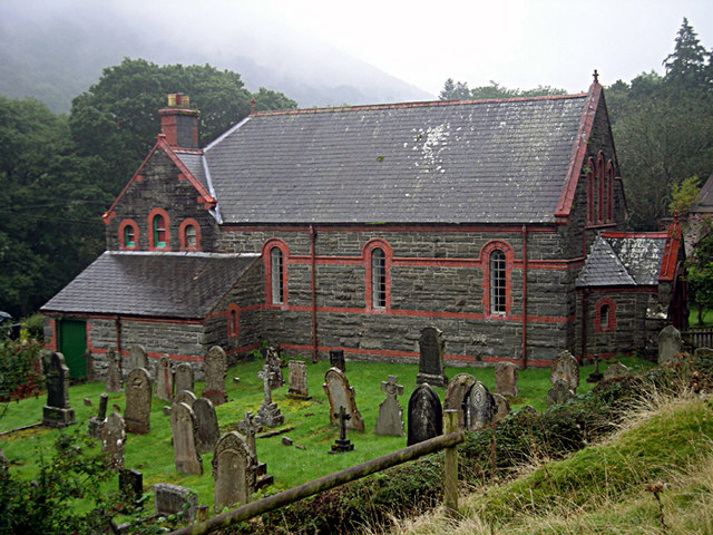
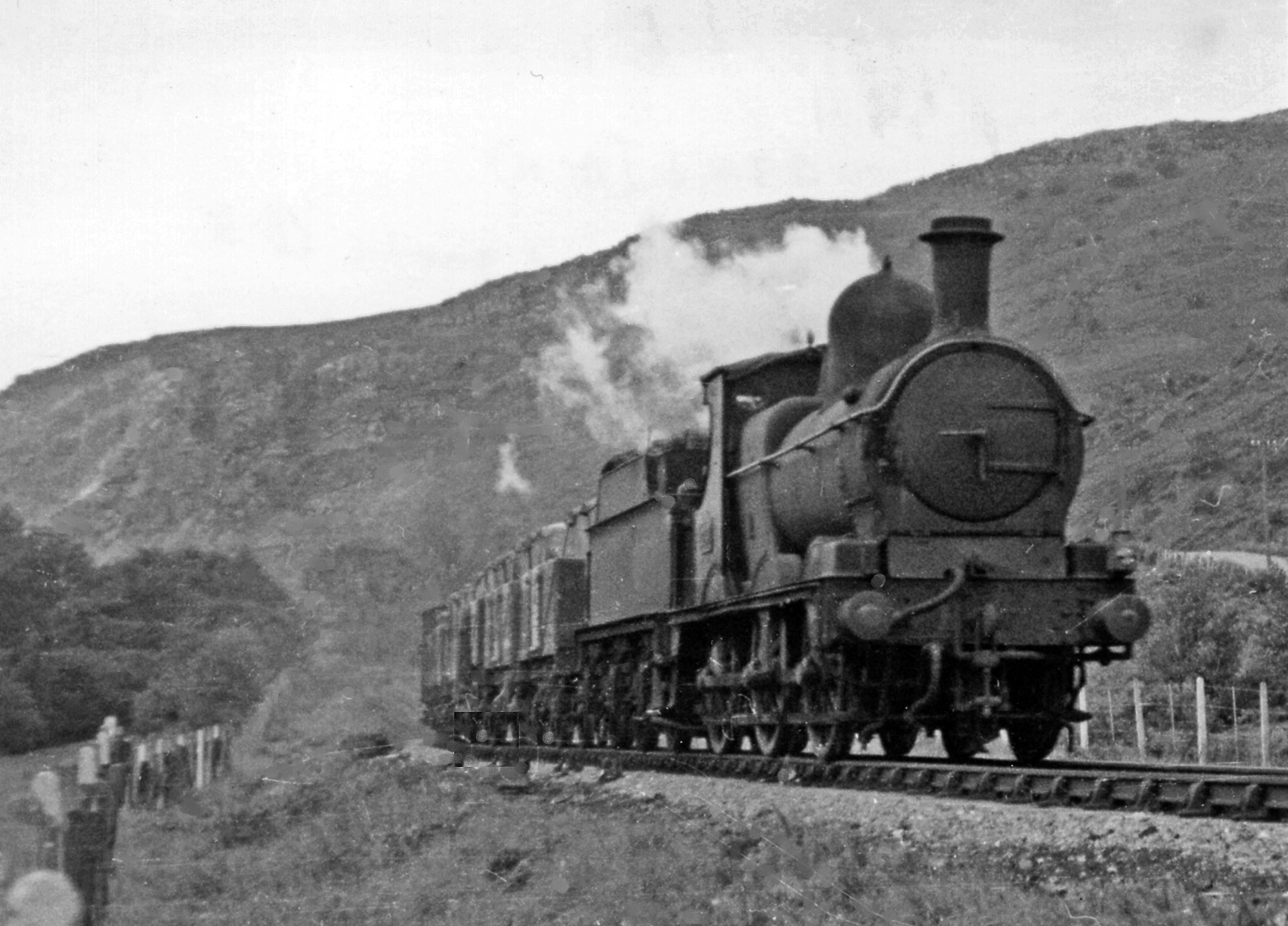
Coed Bwlch-glas Images

Images are sourced within 2km of 52.267014/-3.5533701 or Grid Reference SN9464. Thanks to Geograph Open Source API. All images are credited.

Elan River Dam One of the huge dams in the Elan Valley that serves the people of Birmingham with its water supply
Elan River Dam
One of the huge dams in the Elan Valley that serves the people of Birmingham with its water supply
Caban Coch Dam
Caban Coch Dam
Water Treatment Works, Elan
River Elan (Afon Elan) at Elan Valley Visitor Centre Looking upstream from the visitor centre towards the Caban Coch Dam.

The Elan Valley (Welsh: Cwm Elan) is a river valley situated to the west of Rhayader, famous for its picturesque scenery and sometimes known as the "Welsh Lake District". It covers 70 square miles (180 km2) of lake and countryside. Over 80% of the valley is designated as Sites of Special Scientific Interest, and a popular cycle trail, the Elan Valley Trail, makes a loop from Rhayader around the reservoirs. Part of the trail overlaps with a spur of National Cycle Route 81 (Lon Cambria). A visitor centre is located below Caban Coch dam.
River Elan (Afon Elan) at Elan Valley Visitor Centre
Looking upstream from the visitor centre towards the Caban Coch Dam. The Elan Valley (Welsh: Cwm Elan) is a river valley situated to the west of Rhayader, famous for its picturesque scenery and sometimes known as the "Welsh Lake District". It covers 70 square miles (180 km2) of lake and countryside. Over 80% of the valley is designated as Sites of Special Scientific Interest, and a popular cycle trail, the Elan Valley Trail, makes a loop from Rhayader around the reservoirs. Part of the trail overlaps with a spur of National Cycle Route 81 (Lon Cambria). A visitor centre is located below Caban Coch dam.
River Elan (Afon Elan) Bridge and Caban Coch Dam Caban Coch dam is the lowest of a sequence of four the dams in built in the valley of the Elan River built by the Birmingham Corporation Water Department in the late 1890s to provide clean drinking water for the population of Birmingham. It is the simplest and most functional in appearance of all the dams, resembling a natural waterfall when the reservoir is full and the dam is in full spate with water pouring over the dam wall.

The footbridge just below the dam wall connects two identical stone buildings on either side of the river which house electricity generating turbines and valves and sluices to adjust the amount of compensation water released downstream (<span class="nowrap"><a title="http://www.elanvalley.org.uk/discover/reservoirs-dams/6-dams" rel="nofollow ugc noopener" href="http://www.elanvalley.org.uk/discover/reservoirs-dams/6-dams">Link</a><img style="margin-left:2px;" alt="External link" title="External link - shift click to open in new window" src="https://s1.geograph.org.uk/img/external.png" width="10" height="10"/></span>  Visit Elan Valley).
River Elan (Afon Elan) Bridge and Caban Coch Dam
Caban Coch dam is the lowest of a sequence of four the dams in built in the valley of the Elan River built by the Birmingham Corporation Water Department in the late 1890s to provide clean drinking water for the population of Birmingham. It is the simplest and most functional in appearance of all the dams, resembling a natural waterfall when the reservoir is full and the dam is in full spate with water pouring over the dam wall. The footbridge just below the dam wall connects two identical stone buildings on either side of the river which house electricity generating turbines and valves and sluices to adjust the amount of compensation water released downstream (LinkExternal link Visit Elan Valley).
Afon Elan (River Elan) The Afon Elan (River Elan) is a tributary of the River Wye which runs through the wide expanse of upland moors, traditionally known as Elenydd, in central Wales. Its valley is the Elan Valley (<span class="nowrap"><a title="http://www.elanvalley.org.uk/visit" rel="nofollow ugc noopener" href="http://www.elanvalley.org.uk/visit">Link</a><img style="margin-left:2px;" alt="External link" title="External link - shift click to open in new window" src="https://s1.geograph.org.uk/img/external.png" width="10" height="10"/></span>  Visit Elan Valley). It rises  in the wet moorland on the eastern flank of Pen y Deunant and enters the top of the Elan Valley Reservoirs at Craig Goch Reservoir which in turn discharges to Garreg-ddu Reservoir and then Caban-coch Reservoir. It emerges from this chain of reservoirs in a north-easterly direction and passes through Elan Village before turning south-east and making its confluence with the River Wye.
Afon Elan (River Elan)
The Afon Elan (River Elan) is a tributary of the River Wye which runs through the wide expanse of upland moors, traditionally known as Elenydd, in central Wales. Its valley is the Elan Valley (LinkExternal link Visit Elan Valley). It rises in the wet moorland on the eastern flank of Pen y Deunant and enters the top of the Elan Valley Reservoirs at Craig Goch Reservoir which in turn discharges to Garreg-ddu Reservoir and then Caban-coch Reservoir. It emerges from this chain of reservoirs in a north-easterly direction and passes through Elan Village before turning south-east and making its confluence with the River Wye.
River Elan The Afon Elan (River Elan) is a tributary of the River Wye which runs through the wide expanse of upland moors, traditionally known as Elenydd, in central Wales. Its valley is the Elan Valley (<span class="nowrap"><a title="http://www.elanvalley.org.uk/visit" rel="nofollow ugc noopener" href="http://www.elanvalley.org.uk/visit">Link</a><img style="margin-left:2px;" alt="External link" title="External link - shift click to open in new window" src="https://s1.geograph.org.uk/img/external.png" width="10" height="10"/></span>  Visit Elan Valley). It rises  in the wet moorland on the eastern flank of Pen y Deunant and enters the top of the Elan Valley Reservoirs at Craig Goch Reservoir which in turn discharges to Garreg-ddu Reservoir and then Caban-coch Reservoir. It emerges from this chain of reservoirs in a north-easterly direction and passes through Elan Village before turning south-east and making its confluence with the River Wye.
River Elan
The Afon Elan (River Elan) is a tributary of the River Wye which runs through the wide expanse of upland moors, traditionally known as Elenydd, in central Wales. Its valley is the Elan Valley (LinkExternal link Visit Elan Valley). It rises in the wet moorland on the eastern flank of Pen y Deunant and enters the top of the Elan Valley Reservoirs at Craig Goch Reservoir which in turn discharges to Garreg-ddu Reservoir and then Caban-coch Reservoir. It emerges from this chain of reservoirs in a north-easterly direction and passes through Elan Village before turning south-east and making its confluence with the River Wye.
Elan Valley, Caban Coch Dam and Visitor Centre The Elan Valley (Welsh: Cwm Elan) is a river valley situated to the west of Rhayader, famous for its picturesque scenery and sometimes known as the "Welsh Lake District". It covers 70 square miles (180 km2) of lake and countryside. Over 80% of the valley is designated as Sites of Special Scientific Interest, and a popular cycle trail, the Elan Valley Trail, makes a loop from Rhayader around the reservoirs. Part of the trail overlaps with a spur of National Cycle Route 81 (Lon Cambria). The visitor centre is located below Caban Coch dam and can be seen in this photograph.
Elan Valley, Caban Coch Dam and Visitor Centre
The Elan Valley (Welsh: Cwm Elan) is a river valley situated to the west of Rhayader, famous for its picturesque scenery and sometimes known as the "Welsh Lake District". It covers 70 square miles (180 km2) of lake and countryside. Over 80% of the valley is designated as Sites of Special Scientific Interest, and a popular cycle trail, the Elan Valley Trail, makes a loop from Rhayader around the reservoirs. Part of the trail overlaps with a spur of National Cycle Route 81 (Lon Cambria). The visitor centre is located below Caban Coch dam and can be seen in this photograph.
Craig-Y-Foel Distinctively shaped hill overlooking the Elan Valley (see small watercolour by Joseph Mallord William Turner, now in the Ashmolean Museum at Oxford <span class="nowrap"><a title="http://www.tate.org.uk/art/artworks/turner-craig-y-foel-radnorshire-tw0687" rel="nofollow ugc noopener" href="http://www.tate.org.uk/art/artworks/turner-craig-y-foel-radnorshire-tw0687">Link</a><img style="margin-left:2px;" alt="External link" title="External link - shift click to open in new window" src="https://s1.geograph.org.uk/img/external.png" width="10" height="10"/></span>  - Tate Galleries).
Craig-Y-Foel
Distinctively shaped hill overlooking the Elan Valley (see small watercolour by Joseph Mallord William Turner, now in the Ashmolean Museum at Oxford LinkExternal link - Tate Galleries).
Shelley Sculpture at Elan Valley Visitor Centre This sculpture dedicated to the poet Percy Bysshe Shelley <span class="nowrap"><a title="https://en.wikipedia.org/wiki/Percy_Bysshe_Shelley" rel="nofollow ugc noopener" href="https://en.wikipedia.org/wiki/Percy_Bysshe_Shelley">Link</a><img style="margin-left:2px;" alt="External link" title="External link - shift click to open in new window" src="https://s1.geograph.org.uk/img/external.png" width="10" height="10"/></span>  was created by sculptor Christopher Kelly in 1988. An information board records that Shelley, one of the major English Romantic poets, stayed in the Elan Valley for several weeks in 1811 and 1812. It also suggests that the sculpture is inspired by “Prometheus Unbound” with the central figure of Shelley in deep, creative thought. Nymph-like female figures dance on either side representing the poet’s muse.

The statue stands in the grounds of the Elan Valley visitor centre, beside the River Elan.
Shelley Sculpture at Elan Valley Visitor Centre
This sculpture dedicated to the poet Percy Bysshe Shelley LinkExternal link was created by sculptor Christopher Kelly in 1988. An information board records that Shelley, one of the major English Romantic poets, stayed in the Elan Valley for several weeks in 1811 and 1812. It also suggests that the sculpture is inspired by “Prometheus Unbound” with the central figure of Shelley in deep, creative thought. Nymph-like female figures dance on either side representing the poet’s muse. The statue stands in the grounds of the Elan Valley visitor centre, beside the River Elan.
Navvy Statue at Entrance to the Elan Valley Visitor Centre This statue was installed in 2004 to commemorate the centenary of the official opening of the Elan Valley reservoirs by King Edward VII and Queen Alexandra on 21 July 1904 <span class="nowrap"><a title="https://en.wikipedia.org/wiki/Elan_Valley_Reservoirs" rel="nofollow ugc noopener" href="https://en.wikipedia.org/wiki/Elan_Valley_Reservoirs">Link</a><img style="margin-left:2px;" alt="External link" title="External link - shift click to open in new window" src="https://s1.geograph.org.uk/img/external.png" width="10" height="10"/></span>  . It depicts one of the thousands of navvies and labourers who lived with their families in the purpose-built Elan Village during the construction of the first four dams and without whom the project couldn't have been achieved.
Navvy Statue at Entrance to the Elan Valley Visitor Centre
This statue was installed in 2004 to commemorate the centenary of the official opening of the Elan Valley reservoirs by King Edward VII and Queen Alexandra on 21 July 1904 LinkExternal link . It depicts one of the thousands of navvies and labourers who lived with their families in the purpose-built Elan Village during the construction of the first four dams and without whom the project couldn't have been achieved.
Stones Behind the Elan Valley Visitor Centre I couldn't see anything to explain the purpose or meaning of these stone but a nearby plaque (<a href="https://www.geograph.org.uk/photo/886736">SN9264 : Plaque that tells all</a>) carries the title "Maesyfed 2000 Radnor" and each of these stones carries a plaque with a place name. Perhaps they represent places or districts in Radnorshire (Maesyfed is the Welsh version of "Radnor") and the whole collection is a commemoration of the millennium?
Stones Behind the Elan Valley Visitor Centre
I couldn't see anything to explain the purpose or meaning of these stone but a nearby plaque (SN9264 : Plaque that tells all) carries the title "Maesyfed 2000 Radnor" and each of these stones carries a plaque with a place name. Perhaps they represent places or districts in Radnorshire (Maesyfed is the Welsh version of "Radnor") and the whole collection is a commemoration of the millennium?
Generator Housing Beneath Caban Coch Reservoir One of two identical stone buildings on either side of the river which house electricity generating turbines and valves and sluices to adjust the amount of compensation water released downstream (<span class="nowrap"><a title="http://www.elanvalley.org.uk/discover/reservoirs-dams/6-dams" rel="nofollow ugc noopener" href="http://www.elanvalley.org.uk/discover/reservoirs-dams/6-dams">Link</a><img style="margin-left:2px;" alt="External link" title="External link - shift click to open in new window" src="https://s1.geograph.org.uk/img/external.png" width="10" height="10"/></span>  Visit Elan Valley).
Generator Housing Beneath Caban Coch Reservoir
One of two identical stone buildings on either side of the river which house electricity generating turbines and valves and sluices to adjust the amount of compensation water released downstream (LinkExternal link Visit Elan Valley).
Bridge and Generator Buildings Below Caban Coch Reservoir Caban Coch dam is the lowest of a sequence of four the dams in built in the valley of the Elan River built by the Birmingham Corporation Water Department in the late 1890s to provide clean drinking water for the population of Birmingham. It is the simplest and most functional in appearance of all the dams, resembling a natural waterfall when the reservoir is full and the dam is in full spate with water pouring over the dam wall (see <a href="https://www.geograph.org.uk/photo/3026014">SN9264 : Caban Coch dam overflowing</a>).

The footbridge just below the dam wall connects two identical stone buildings on either side of the river which house electricity generating turbines and valves and sluices to adjust the amount of compensation water released downstream (<span class="nowrap"><a title="http://www.elanvalley.org.uk/discover/reservoirs-dams/6-dams" rel="nofollow ugc noopener" href="http://www.elanvalley.org.uk/discover/reservoirs-dams/6-dams">Link</a><img style="margin-left:2px;" alt="External link" title="External link - shift click to open in new window" src="https://s1.geograph.org.uk/img/external.png" width="10" height="10"/></span>  Visit Elan Valley).
Bridge and Generator Buildings Below Caban Coch Reservoir
Caban Coch dam is the lowest of a sequence of four the dams in built in the valley of the Elan River built by the Birmingham Corporation Water Department in the late 1890s to provide clean drinking water for the population of Birmingham. It is the simplest and most functional in appearance of all the dams, resembling a natural waterfall when the reservoir is full and the dam is in full spate with water pouring over the dam wall (see SN9264 : Caban Coch dam overflowing). The footbridge just below the dam wall connects two identical stone buildings on either side of the river which house electricity generating turbines and valves and sluices to adjust the amount of compensation water released downstream (LinkExternal link Visit Elan Valley).
Turbine Housing, River Elan One of the two identical stone buildings on either side of the river which house electricity generating turbines and valves and sluices to adjust the amount of compensation water released downstream (<span class="nowrap"><a title="http://www.elanvalley.org.uk/discover/reservoirs-dams/6-dams" rel="nofollow ugc noopener" href="http://www.elanvalley.org.uk/discover/reservoirs-dams/6-dams">Link</a><img style="margin-left:2px;" alt="External link" title="External link - shift click to open in new window" src="https://s1.geograph.org.uk/img/external.png" width="10" height="10"/></span>  Visit Elan Valley).They are connected by a footbridge just below the Caban Coch dam wall.
Turbine Housing, River Elan
One of the two identical stone buildings on either side of the river which house electricity generating turbines and valves and sluices to adjust the amount of compensation water released downstream (LinkExternal link Visit Elan Valley).They are connected by a footbridge just below the Caban Coch dam wall.
Caban Coch Dam Caban Coch dam is the lowest of a sequence of four the dams in built in the Elan Valley by the Birmingham Corporation Water Department in the late 1890s to provide clean drinking water for the population of Birmingham. It is the simplest and most functional in appearance of all the dams, resembling a natural waterfall when the reservoir is full and the dam is in full spate with water pouring over the dam wall (see <a href="https://www.geograph.org.uk/photo/3026014">SN9264 : Caban Coch dam overflowing</a>).

The footbridge just below the dam wall connects two identical stone buildings on either side of the river which house electricity generating turbines and valves and sluices to adjust the amount of compensation water released downstream (<span class="nowrap"><a title="http://www.elanvalley.org.uk/discover/reservoirs-dams/6-dams" rel="nofollow ugc noopener" href="http://www.elanvalley.org.uk/discover/reservoirs-dams/6-dams">Link</a><img style="margin-left:2px;" alt="External link" title="External link - shift click to open in new window" src="https://s1.geograph.org.uk/img/external.png" width="10" height="10"/></span>  Visit Elan Valley).
Caban Coch Dam
Caban Coch dam is the lowest of a sequence of four the dams in built in the Elan Valley by the Birmingham Corporation Water Department in the late 1890s to provide clean drinking water for the population of Birmingham. It is the simplest and most functional in appearance of all the dams, resembling a natural waterfall when the reservoir is full and the dam is in full spate with water pouring over the dam wall (see SN9264 : Caban Coch dam overflowing). The footbridge just below the dam wall connects two identical stone buildings on either side of the river which house electricity generating turbines and valves and sluices to adjust the amount of compensation water released downstream (LinkExternal link Visit Elan Valley).
Caban Coch Reservoir, View Towards the Dam Looking towards the dam, the mirror-like surface of Caban Coch Reservoir reflects the surrounding hills.

Caban Coch is the most southerly, and lowest, of the Elan Valley Reservoirs which are a chain of man-made lakes and reservoirs built to supply water to the City of Birmingham.  The six lakes/reservoirs and their picturesque stone dams are amongst the most scenic areas of mid-Wales set within an Area of Outstanding Natural Beauty. The area is sometimes referred to as the "Welsh Lake District".
Caban Coch Reservoir, View Towards the Dam
Looking towards the dam, the mirror-like surface of Caban Coch Reservoir reflects the surrounding hills. Caban Coch is the most southerly, and lowest, of the Elan Valley Reservoirs which are a chain of man-made lakes and reservoirs built to supply water to the City of Birmingham. The six lakes/reservoirs and their picturesque stone dams are amongst the most scenic areas of mid-Wales set within an Area of Outstanding Natural Beauty. The area is sometimes referred to as the "Welsh Lake District".
Footpath and Road Round Caban Coch Reservoir Caban Coch is the most southerly, and lowest, of the Elan Valley Reservoirs which are a chain of man-made lakes and reservoirs built to supply water to the City of Birmingham.  The six lakes/reservoirs and their picturesque stone dams are amongst the most scenic areas of mid-Wales set within an Area of Outstanding Natural Beauty. The area is sometimes referred to as the "Welsh Lake District".
Footpath and Road Round Caban Coch Reservoir
Caban Coch is the most southerly, and lowest, of the Elan Valley Reservoirs which are a chain of man-made lakes and reservoirs built to supply water to the City of Birmingham. The six lakes/reservoirs and their picturesque stone dams are amongst the most scenic areas of mid-Wales set within an Area of Outstanding Natural Beauty. The area is sometimes referred to as the "Welsh Lake District".
Show me another place!

Coed Bwlch-glas is located at Grid Ref: SN9464 (Lat: 52.267014, Lng: -3.5533701)

Unitary Authority: Powys

Police Authority: Dyfed Powys

What 3 Words

///flip.remaking.flush. Near Rhayader, Powys

Related Wikis

Carn Gafallt

Carn Gafallt is a Site of Special Scientific Interest in Breconshire, Powys, Wales, and a hill of 466 metres (1529 feet) which is a Marilyn. == See... ==

Caeau Cnwch a Ty'n-y-graig

Caeau Cnwch a Ty'n-y-graig is a Site of Special Scientific Interest in Brecknock, Powys, Wales. It occupies sloping ground on the south west side of Pen...

Elan Village

Elan Village (Welsh: Pentre Elan) is a small purpose-built community in Powys, Wales. It was designed by architect Herbert Tudor Buckland as part of Birmingham...

Elan Valley

The Elan Valley (Welsh: Cwm Elan) is a river valley situated to the west of Rhayader, in Powys, Wales, sometimes known as the "Welsh Lake District". It...

Afon Elan

The Afon Elan (English: River Elan) is a tributary of the River Wye which runs through the wide expanse of upland moors, traditionally known as Elenydd...

Llanwrthwl

Llanwrthwl is a village and community in Powys, mid Wales, and the historic county of Brecknockshire. Llanwrthwl lies off the A470 road, north by road...

Doldowlod railway station

Doldowlod railway station stood on the Mid Wales Railway between Builth Wells and Rhayader. It was closed on 31 December 1962 and the track removed....

Cwmdauddwr

Cwmdauddwr (rarely referred to by its correct full name of Llansanffraid Cwmteuddwr) is a village in Powys, Wales. It is contiguous with the town of Rhayader...

Nearby Amenities

Located within 500m of 52.267014,-3.5533701
Carn Gafallt
Ele: 466
Man Made: survey_point
Natural: peak
Source: npe
Type: triangulation
Wikidata: Q5043756
Wikipedia: en:Carn Gafallt
Lat/Long: 52.2701438/-3.5546285
The data included in this document is from www.openstreetmap.org. The data is made available under ODbL.

Have you been to Coed Bwlch-glas?

Leave your review of Coed Bwlch-glas below (or comments, questions and feedback).