Bush

Settlement in Pembrokeshire

Wales

Bush

Pembroke Pembroke is a busy little town and this image is of the traffic thronged main street. The main shopping area can be seen to the left of the tree and the castle where Harri Tudur (later to become King Henry VII) was born is just visible in the distance.
Pembroke Credit: Garth Newton

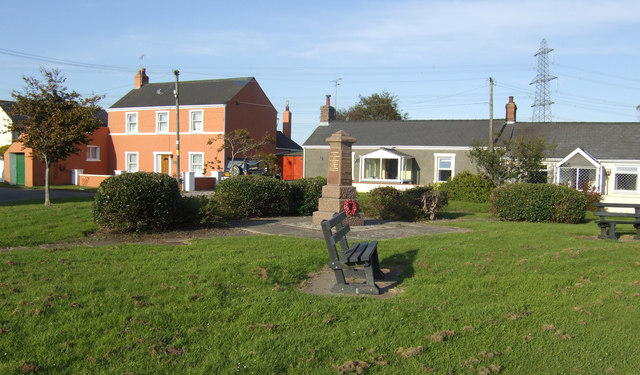
Bush is a small village located in the county of Pembrokeshire, Wales. Situated in the southwestern part of the country, it falls within the community of Roch. With a population of less than 200 residents, Bush is a tight-knit and close community.

The village is surrounded by picturesque countryside, offering stunning views of rolling hills and farmland. It is known for its tranquil and peaceful atmosphere, making it an ideal place for those seeking a rural and idyllic lifestyle. The nearby coastline, including the popular beach of Newgale, is within easy reach, providing residents with opportunities for outdoor activities such as swimming, surfing, and coastal walks.

Despite its small size, Bush has a rich history. The village features a number of traditional Welsh stone houses, some of which date back to the 18th century. St. David's Church, a beautiful medieval building, is a notable landmark in the area. The village also has a community hall, serving as a venue for various events and activities, including local meetings and gatherings.

Although Bush is primarily a residential area, it benefits from its proximity to larger towns, such as Haverfordwest and St. David's, which provide a range of amenities, including shops, schools, and healthcare facilities. Public transportation options are limited in the village, making private vehicles the main mode of transportation for residents.

Overall, Bush offers a peaceful and scenic setting, making it an attractive place for those seeking a quiet countryside lifestyle while still having access to nearby amenities and natural wonders.

If you have any feedback on the listing, please let us know in the comments section below.

Bush Images

Images are sourced within 2km of 51.679979/-4.9377235 or Grid Reference SM9702. Thanks to Geograph Open Source API. All images are credited.

Pembroke Pembroke is a busy little town and this image is of the traffic thronged main street. The main shopping area can be seen to the left of the tree and the castle where Harri Tudur (later to become King Henry VII) was born is just visible in the distance.
Pembroke
Pembroke is a busy little town and this image is of the traffic thronged main street. The main shopping area can be seen to the left of the tree and the castle where Harri Tudur (later to become King Henry VII) was born is just visible in the distance.
Pembroke Castle This was the birthplace of Henry VII and the castle is one of the best preserved Norman castles in Britain.
Pembroke Castle
This was the birthplace of Henry VII and the castle is one of the best preserved Norman castles in Britain.
Martello Tower, Pembroke Dock Pembroke Dock grew up around the Royal Dockyard established by the Admiralty about 200 years ago.
Martello Tower, Pembroke Dock
Pembroke Dock grew up around the Royal Dockyard established by the Admiralty about 200 years ago.
Monkton Church We were staying in the Landmark Trust property "Monkton Old Hall" but this was in the same square as Pembroke Castle. The church wasn't though.
Monkton Church
We were staying in the Landmark Trust property "Monkton Old Hall" but this was in the same square as Pembroke Castle. The church wasn't though.
Military Cemetery There is a GeoCache here for travel bugs.
Military Cemetery
There is a GeoCache here for travel bugs.
Saint Daniel's Hill On the way to find the GeoCache "Grumpy's Grotto"
Saint Daniel's Hill
On the way to find the GeoCache "Grumpy's Grotto"
Pembroke Castle from the North. One of the castles built by the English around the rim of Wales.
Pembroke Castle from the North.
One of the castles built by the English around the rim of Wales.
Pembroke High Street. Castle in the distance, clock tower and bus going to Waterloo.
Pembroke High Street.
Castle in the distance, clock tower and bus going to Waterloo.
Pembroke Castle Gatehouse Norman Castle founded in 1093, which was the birthplace of Henry Tudor, who later became Henry VII.
Pembroke Castle Gatehouse
Norman Castle founded in 1093, which was the birthplace of Henry Tudor, who later became Henry VII.
Pembroke Dockyard Custom House (right) and Sunderland House (left).
See also <a href="https://www.geograph.org.uk/photo/533195">SM9603 : Dockyard buildings  at Pembroke Dock</a>.
Pembroke Dockyard
Custom House (right) and Sunderland House (left). See also SM9603 : Dockyard buildings at Pembroke Dock.
Crossroads on A4139 Looking across to Buttermilk Lane from B4322.
Crossroads on A4139
Looking across to Buttermilk Lane from B4322.
Tank & Propeller memorial Memorial in car park opposite Asda superstore.
Tank & Propeller memorial
Memorial in car park opposite Asda superstore.
Pembroke Castle Keep The tower is 75' high, and has walls 19' thick at the base to support its weight.
Pembroke Castle Keep
The tower is 75' high, and has walls 19' thick at the base to support its weight.
River Pembroke in the castle's shadow.
Pembroke's famous swans. I lost count at about sixty, obviously they don't all appear in this shot!
Pembroke's famous swans.
I lost count at about sixty, obviously they don't all appear in this shot!
Pembroke Castle
Pembroke Castle
Pembroke Castle The gatehouse and part of Pembroke Main Street
Pembroke Castle
The gatehouse and part of Pembroke Main Street
Pembroke Main Street from the castle
Show me another place!

Bush is located at Grid Ref: SM9702 (Lat: 51.679979, Lng: -4.9377235)

Unitary Authority: Pembrokeshire

Police Authority: Dyfed Powys

What 3 Words

///guests.manual.lobby. Near Pembroke Dock, Pembrokeshire

Related Wikis

Monkton, Pembroke

Monkton is a village and parish adjoining Pembroke, Pembrokeshire, Wales. According to the 2001 census, the population was 1,688. == History == Monkton...

Henry Tudor School

Henry Tudor School (Welsh: Ysgol Harri Tudur), formerly the Pembroke School, is a co-educational school of 1500 students in Pembroke, Wales. == History... ==

Bentlass

Bentlass is a small rural riverside settlement in the community of Hundleton and parish of Monkton in south Pembrokeshire, Wales. There was for many years...

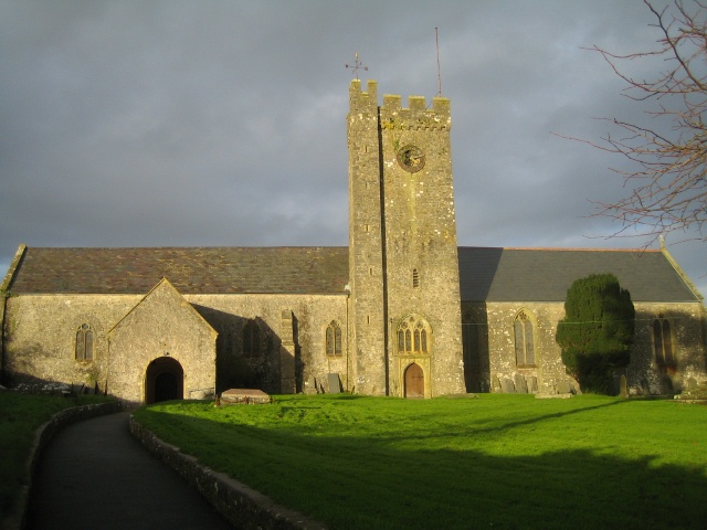
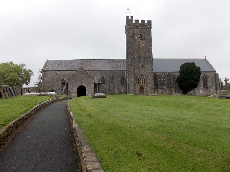
St Nicholas & St John, Monkton

The Church of St Nicholas & St John, formerly the Priory Church of St Nicholas, is the parish church of Monkton, a village on the south bank of the Milford...

Pembroke Castle

Pembroke Castle (Welsh: Castell Penfro) is a medieval castle in the centre of Pembroke, Pembrokeshire in Wales. The castle was the original family seat...

Siege of Pembroke

The siege of Pembroke took place in 1648 during the Second English Civil War. In the engagement, Parliamentarian troops led by Oliver Cromwell sieged Pembroke...

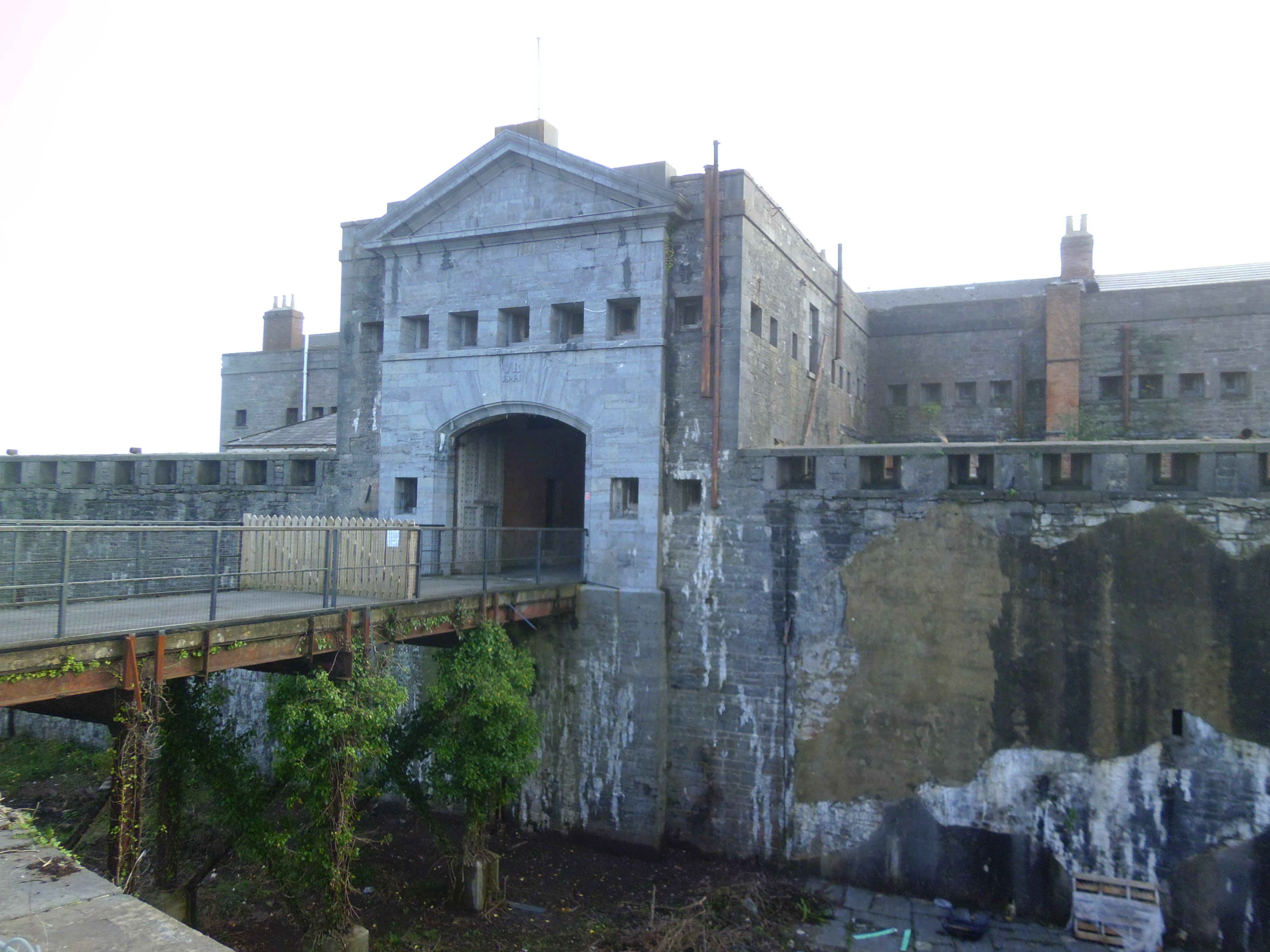
Defensible Barracks, Pembroke Dock

The Defensible Barracks at Pembroke Dock, is a Grade II* listed, Victorian-era fortification and barracks in Pembrokeshire, South Wales. It is a 20-sided...

Hundleton

Hundleton is a village and a community in Pembrokeshire, Wales, in the parish of Monkton. The community covers the adjacent settlements of West Orielton...

Nearby Amenities

Located within 500m of 51.679979,-4.9377235
Source: PGS
Lat/Long: 51.680461/-4.944251
Source: PGS
Lat/Long: 51.680974/-4.944273
Source: PGS
Lat/Long: 51.680987/-4.943449
Source: PGS
Lat/Long: 51.680479/-4.943222
Source: PGS
Lat/Long: 51.680354/-4.94301
Source: PGS
Lat/Long: 51.680374/-4.941774
Source: PGS
Lat/Long: 51.680381/-4.941362
Source: PGS
Lat/Long: 51.680131/-4.940939
Source: PGS
Lat/Long: 51.679889/-4.940104
Source: PGS
Lat/Long: 51.679896/-4.939692
Source: PGS
Lat/Long: 51.680172/-4.938467
Source: PGS
Lat/Long: 51.680435/-4.938066
Source: PGS
Lat/Long: 51.680698/-4.937665
Source: PGS
Lat/Long: 51.68084/-4.936847
Source: PGS
Lat/Long: 51.6811539/-4.9366712
Source: PGS
Lat/Long: 51.6818157/-4.936761
Source: PGS
Lat/Long: 51.681611/-4.9362915
Source: PGS
Lat/Long: 51.6811739/-4.9359683
Source: PGS
Lat/Long: 51.680988/-4.935616
Source: PGS
Lat/Long: 51.680874/-4.934786
Source: PGS
Lat/Long: 51.68114/-4.93418
Source: PGS
Lat/Long: 51.681015/-4.933968
Source: PGS
Lat/Long: 51.681022/-4.933556
Source: PGS
Lat/Long: 51.681154/-4.933356
Source: PGS
Lat/Long: 51.68167/-4.933171
Source: PGS
Lat/Long: 51.681548/-4.932754
Source: PGS
Lat/Long: 51.6814914/-4.931944
Source: PGS
Lat/Long: 51.6815158/-4.931504
Source: PGS
Lat/Long: 51.681575/-4.931106
Source: PGS
Lat/Long: 51.679314/-4.936164
Source: PGS
Lat/Long: 51.6790398/-4.935921
Source: PGS
Lat/Long: 51.6787266/-4.9351516
Source: PGS
Lat/Long: 51.6785993/-4.9349942
Source: PGS
Lat/Long: 51.6785225/-4.9350692
Source: PGS
Lat/Long: 51.6782485/-4.9349526
Source: PGS
Lat/Long: 51.6778807/-4.9349454
Source: PGS
Lat/Long: 51.677644/-4.9362173
Source: PGS
Lat/Long: 51.6772956/-4.9375995
Source: PGS
Lat/Long: 51.6771975/-4.9370193
Source: PGS
Lat/Long: 51.6771283/-4.9365043
Source: PGS
Lat/Long: 51.6768922/-4.9361285
Source: PGS
Lat/Long: 51.6770445/-4.9365832
Source: PGS
Lat/Long: 51.6762572/-4.937463
Source: PGS
Lat/Long: 51.6762024/-4.9375976
Source: PGS
Lat/Long: 51.6757893/-4.9375955
Source: PGS
Lat/Long: 51.6761028/-4.9408671
Source: PGS
Lat/Long: 51.6764289/-4.9403955
Source: PGS
Lat/Long: 51.676688/-4.939967
Source: PGS
Lat/Long: 51.6771874/-4.9400989
Source: PGS
Lat/Long: 51.6774627/-4.9405112
Source: PGS
Lat/Long: 51.677552/-4.9407748
Source: PGS
Lat/Long: 51.6775474/-4.9410471
Source: PGS
Lat/Long: 51.6768678/-4.9415074
Location Transition: yes
Power: pole
Lat/Long: 51.6767251/-4.9414685
The data included in this document is from www.openstreetmap.org. The data is made available under ODbL.

Have you been to Bush?

Leave your review of Bush below (or comments, questions and feedback).