Coed Glan-yr-afon

Wood, Forest in Merionethshire

Wales

Coed Glan-yr-afon

Sheep grazing in Cwmtirmynach Sheep grazing in a field in Cwmtirmynach, viewed here from the B4501.
Sheep grazing in Cwmtirmynach Credit: Philip Halling

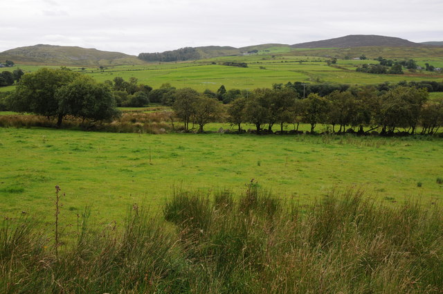
Coed Glan-yr-afon, located in Merionethshire, is a captivating wood and forest area that offers a serene and enchanting experience to visitors. Spread across a generous expanse, this woodland is nestled within the stunning Welsh countryside, providing a picturesque setting for nature enthusiasts and those seeking tranquility.

The wood boasts a rich biodiversity, with a diverse range of flora and fauna. Ancient oak trees, towering pines, and vibrant wildflowers create a vibrant tapestry of colors throughout the seasons. The forest floor is adorned with mossy carpets and ferns, adding to the magical atmosphere.

The area is crisscrossed by numerous walking trails, allowing visitors to explore the wood at their own pace. These well-maintained paths wind through the forest, leading to hidden clearings, babbling brooks, and peaceful picnic spots. The sound of birdsong fills the air, providing a melodic soundtrack to one's wanderings.

Coed Glan-yr-afon is also home to a variety of wildlife, including deer, foxes, and a multitude of bird species. Nature enthusiasts can spot buzzards soaring overhead, woodpeckers tapping away at trees, and perhaps even catch a glimpse of an elusive red squirrel.

For those seeking a more immersive experience, camping facilities are available within the woodland. This allows visitors to fully immerse themselves in the sights and sounds of nature, falling asleep to the gentle rustling of leaves and waking up to the melodies of birds.

Overall, Coed Glan-yr-afon in Merionethshire is a haven for nature lovers, offering a captivating and tranquil retreat amidst the beauty of the Welsh countryside.

If you have any feedback on the listing, please let us know in the comments section below.

Coed Glan-yr-afon Images

Images are sourced within 2km of 52.952007/-3.6248325 or Grid Reference SH9040. Thanks to Geograph Open Source API. All images are credited.

Sheep grazing in Cwmtirmynach Sheep grazing in a field in Cwmtirmynach, viewed here from the B4501.
Sheep grazing in Cwmtirmynach
Sheep grazing in a field in Cwmtirmynach, viewed here from the B4501.
Upland to the east of the B4501 Grazing and upland to the east of the B4501 near Glan-yr-Afon.
Upland to the east of the B4501
Grazing and upland to the east of the B4501 near Glan-yr-Afon.
Meadow and Maes-y-gadfa Covert Meadow in the Afon Mynach valley and Maes-y-gadfa Covert viewed from the B4501.
Meadow and Maes-y-gadfa Covert
Meadow in the Afon Mynach valley and Maes-y-gadfa Covert viewed from the B4501.
View across Cwmtirmynach View across Cwmtirmynach with the Arenigs in the distance.
View across Cwmtirmynach
View across Cwmtirmynach with the Arenigs in the distance.
Entrance to Glan-yr-Afon
The lane from Ciltalgarth to Tyn-y-bont
House at Tyn-y-bont
House at Tyn-y-bont
The old chapel by the A4212 It is now a house.
The old chapel by the A4212
It is now a house.
From north of Bala across Coed Penmaen-mawr, and up Mynach River: aerial 2015 See also <a href="https://www.geograph.org.uk/photo/4699373">SH9140 : Up the Tryweryn River valley from Bala: aerial 2015</a>.
From north of Bala across Coed Penmaen-mawr, and up Mynach River: aerial 2015
Up the Tryweryn River valley from Bala: aerial 2015 See also <a href="https://www.geograph.org.uk/photo/4699345">SH9041 : From north of Bala across Coed Penmaen-mawr, and up Mynach River: aerial 2015</a>.
Up the Tryweryn River valley from Bala: aerial 2015
The B4501 at Pont Mynachddwr
Farmland near Frongoch
Cwmtirmynach Chapel
Cwmtirmynach Chapel
Neuadd Mynach, Cwmtirmynach A local community hall.
Neuadd Mynach, Cwmtirmynach
A local community hall.
Old railway bridge at Frongoch This old bridge crosses the Afon Tryweryn just south of the site of the old Frongoch Station.  These days it carries a track to Rhyd-y-defaid Farm, but originally carried the Bala to Blaneau Ffestiniog branch of the Great Western Railway.  The line closed in 1965.
Old railway bridge at Frongoch
This old bridge crosses the Afon Tryweryn just south of the site of the old Frongoch Station. These days it carries a track to Rhyd-y-defaid Farm, but originally carried the Bala to Blaneau Ffestiniog branch of the Great Western Railway. The line closed in 1965.
Y Foel Hill near Frongoch
Y Foel
Hill near Frongoch
Rhyd-y-Defaid Farmhouse Rhyd-y-Defaid Farmhouse offers excellent bed & breakfast facilities for those touring in North Wales.
Rhyd-y-Defaid Farmhouse
Rhyd-y-Defaid Farmhouse offers excellent bed & breakfast facilities for those touring in North Wales.
The old railway near Frongoch
Show me another place!

Coed Glan-yr-afon is located at Grid Ref: SH9040 (Lat: 52.952007, Lng: -3.6248325)

Unitary Authority: Gwynedd

Police Authority: North Wales

What 3 Words

///megawatt.lyricism.blindfold. Near Bala, Gwynedd

Related Wikis

Frongoch

Frongoch is a village located in Gwynedd, Wales. It lies close to the market town of Bala, on the A4212 road. It was the home of the Frongoch internment...

Frongoch internment camp

Frongoch internment camp at Frongoch in Merionethshire, Wales was a makeshift place of imprisonment during the First World War and the 1916 Easter Rising...

Frongoch railway station

Frongoch railway station served the village of Frongoch on the Great Western Railway's Bala Ffestiniog Line in Gwynedd, Wales.The station closed to passengers...
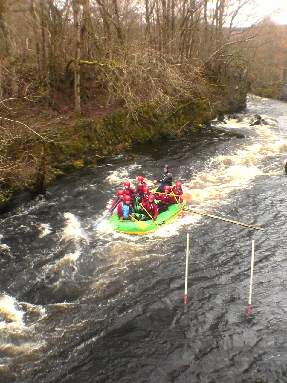
Canolfan Tryweryn

Canolfan Tryweryn is the National White Water Centre for Wales, and is based near Bala in north Wales. In 1986, it developed the first commercial white...

Nearby Amenities

Located within 500m of 52.952007,-3.6248325
Place: farm
Lat/Long: 52.9525665/-3.6190944
Power: pole
Lat/Long: 52.9486101/-3.6213886
Power: pole
Lat/Long: 52.9494179/-3.6211812
Power: pole
Lat/Long: 52.9501691/-3.6209766
Power: pole
Lat/Long: 52.9520607/-3.6206387
Power: pole
Lat/Long: 52.9510569/-3.6207586
Power: pole
Lat/Long: 52.9526658/-3.6205664
Power: pole
Lat/Long: 52.9534178/-3.620481
Power: pole
Lat/Long: 52.9542775/-3.6203793
Power: pole
Lat/Long: 52.9550147/-3.6205582
The data included in this document is from www.openstreetmap.org. The data is made available under ODbL.

Have you been to Coed Glan-yr-afon?

Leave your review of Coed Glan-yr-afon below (or comments, questions and feedback).