Coed-y-nawerw
Wood, Forest in Glamorgan
Wales
Coed-y-nawerw

Coed-y-nawerw, located in Glamorgan, Wales, is a stunning woodland area that offers visitors a unique experience amidst nature. Covering an area of approximately 300 acres, this forest is a haven for outdoor enthusiasts, nature lovers, and those seeking tranquility away from the hustle and bustle of city life.
The woodland is characterized by its diverse range of tree species, including oak, beech, and ash, which create a vibrant and lush environment throughout the year. The forest floor is adorned with a variety of wildflowers, ferns, and mosses, adding to the enchanting atmosphere.
Coed-y-nawerw is crisscrossed by a network of well-maintained walking trails, allowing visitors to explore the area at their own pace. These trails cater to all levels of fitness, from leisurely strolls to more challenging hikes, and offer breathtaking views of the surrounding countryside.
The forest is also home to a rich array of wildlife, making it a perfect spot for birdwatching and animal-spotting. Visitors may be fortunate enough to catch a glimpse of red kites soaring above the treetops or spot elusive woodland creatures such as deer, badgers, and foxes.
For those interested in history, Coed-y-nawerw has its own tales to tell. Remnants of an ancient settlement can still be found within the woodland, adding an extra layer of intrigue to the area.
Overall, Coed-y-nawerw is a natural gem in Glamorgan that offers a peaceful retreat for individuals and families alike. Whether it's a leisurely walk, a picnic among the trees, or simply a moment of quiet contemplation, this woodland is sure to captivate and rejuvenate all who visit.
If you have any feedback on the listing, please let us know in the comments section below.
Coed-y-nawerw Images
Images are sourced within 2km of 51.492309/-3.6061729 or Grid Reference SS8878. Thanks to Geograph Open Source API. All images are credited.


Coed-y-nawerw is located at Grid Ref: SS8878 (Lat: 51.492309, Lng: -3.6061729)
Unitary Authority: Bridgend
Police Authority: South Wales
What 3 Words
///soup.paper.vibes. Near Merthyr Mawr, Bridgend
Nearby Locations
Related Wikis
Merthyr Mawr
Merthyr Mawr is a village and community in Bridgend, Wales. The village is about 2+1⁄2 miles from the centre of Bridgend town. The population of the community...

Ewenny River
The Ewenny River (Welsh: Afon Ewenni) is a river in South Wales. For most of its 10 miles (16 km) length, it forms the border between the Vale of Glamorgan...
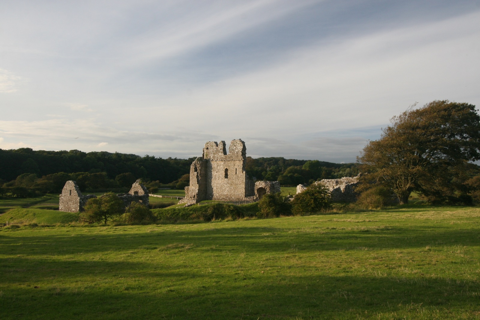
Ogmore Castle
Ogmore Castle (Welsh: Castell Ogwr) is a Grade I listed castle ruin located near the village of Ogmore-by-Sea, south of the town of Bridgend in Glamorgan...
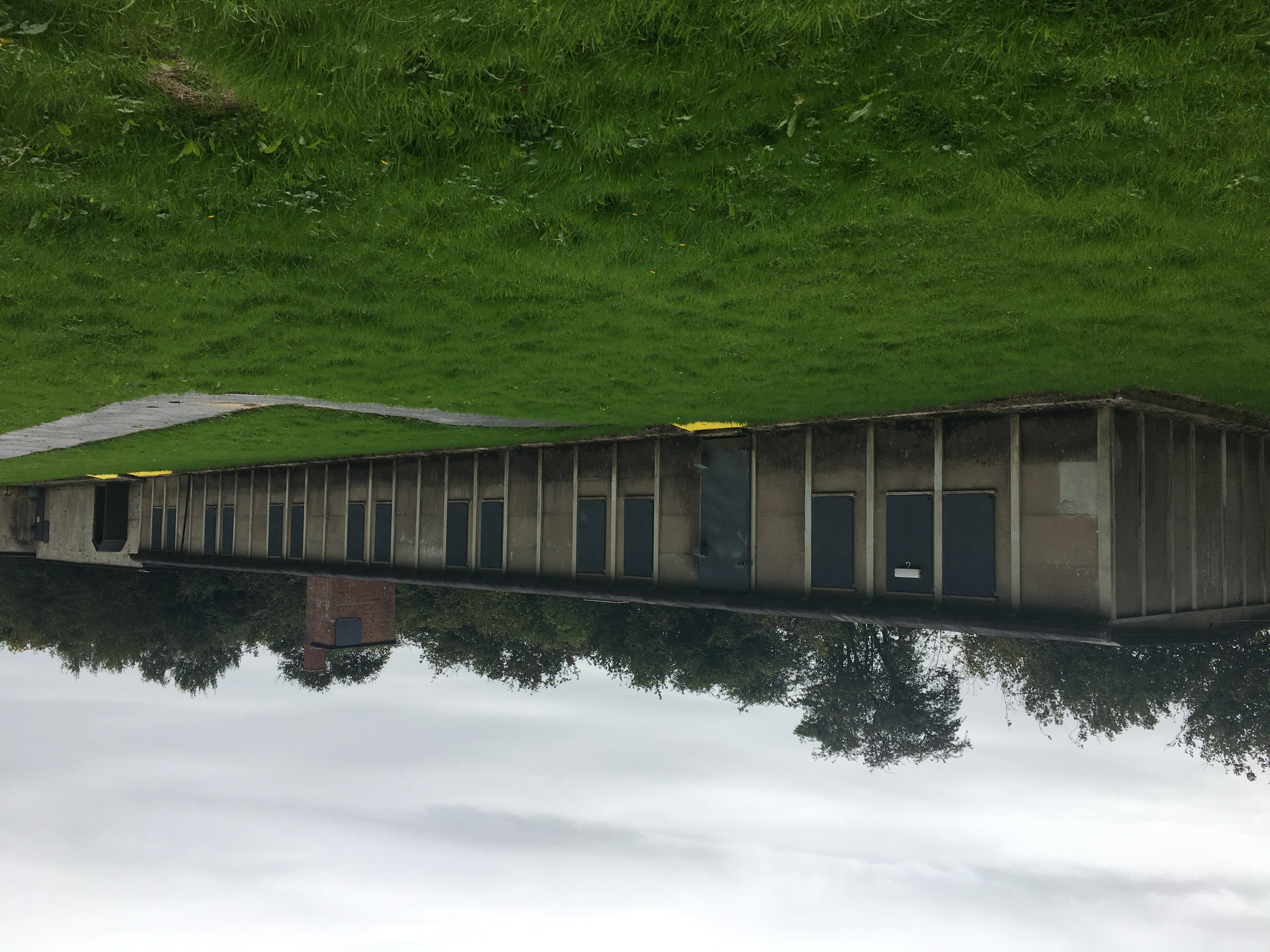
Island Farm
Island Farm, also called Camp 198, was a prisoner of war camp on the outskirts of the town of Bridgend, South Wales. It hosted a number of Axis prisoners...
Nearby Amenities
Located within 500m of 51.492309,-3.6061729Have you been to Coed-y-nawerw?
Leave your review of Coed-y-nawerw below (or comments, questions and feedback).