Coed Derw

Wood, Forest in Denbighshire

Wales

Coed Derw

Track up Moelfre Uchaf The farm is Ysgubor Newydd
Track up Moelfre Uchaf Credit: Eirian Evans

The requested URL returned error: 429 Too Many Requests

If you have any feedback on the listing, please let us know in the comments section below.
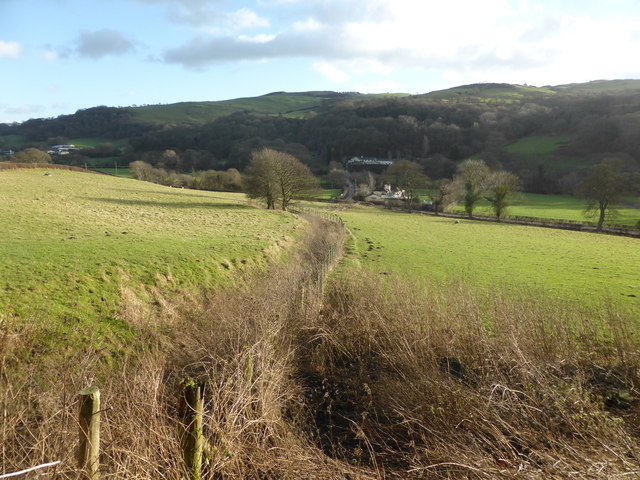
Coed Derw Images

Images are sourced within 2km of 53.208963/-3.6720218 or Grid Reference SH8869. Thanks to Geograph Open Source API. All images are credited.

Track up Moelfre Uchaf The farm is Ysgubor Newydd
Track up Moelfre Uchaf
The farm is Ysgubor Newydd
Farmland in the Elwy Valley West of Llanfair Talhaearn
Farmland in the Elwy Valley
West of Llanfair Talhaearn
Tre-pys-llygod Summit View Good parking to south east on new tarmac.  Pleasant ascent in wet and windy weather. Top is grass in sheep pasture near rocky outcrops and 2 hawthorn bushes.

Name: Tre-pys-llygod
Hill number: 5163
Height: 320m / 1050ft
Area: 30C: Llandudno to Wrexham
Class: Hu
Grid ref: SH894687 (est)
Drop: 119m
Col: 201m  SH890670
Tre-pys-llygod Summit View
Good parking to south east on new tarmac. Pleasant ascent in wet and windy weather. Top is grass in sheep pasture near rocky outcrops and 2 hawthorn bushes. Name: Tre-pys-llygod Hill number: 5163 Height: 320m / 1050ft Area: 30C: Llandudno to Wrexham Class: Hu Grid ref: SH894687 (est) Drop: 119m Col: 201m SH890670
The A548 at Llangernyw The A548 as it heads south through Llangernyw.
The A548 at Llangernyw
The A548 as it heads south through Llangernyw.
Fields next to Afon Elwy There appears to have been significant dredging on the nearside bank of the river - or perhaps preparation for flood defences? The fence shown on the map, crossing the field in front of the camera, is no longer there. It appears that the road is built on top of the ancient river bank and the fields are the alluvial plain.
Fields next to Afon Elwy
There appears to have been significant dredging on the nearside bank of the river - or perhaps preparation for flood defences? The fence shown on the map, crossing the field in front of the camera, is no longer there. It appears that the road is built on top of the ancient river bank and the fields are the alluvial plain.
Fields and ancient river bank near Llangernyw Afon Elwy lies across the field.
Fields and ancient river bank near Llangernyw
Afon Elwy lies across the field.
Fields near the A548
Empty feeding trough
Feed store at Bodgynwch
Afon Elwy
Afon Elwy
Overflow The River Elwy is in spate, and the floodwaters are finding and filling every drainage ditch and hollow around the fields between the river and the A548. The view is to the south from the roadside.
Overflow
The River Elwy is in spate, and the floodwaters are finding and filling every drainage ditch and hollow around the fields between the river and the A548. The view is to the south from the roadside.
Old Milestone by the A548, south of Pentre Isaf, Llangernyw parish Stone post by the A548, in parish of Llangernyw (Conwy County Borough District), South of Pentre Isaf, 100m North of minor road junction to Cefn-coch. Badly damaged.

Inscription once read:-
(ABERGELE 8¾)
(LLANRWST 8)

To be surveyed

Milestone Society National ID: DEN_LRAG08
Old Milestone by the A548, south of Pentre Isaf, Llangernyw parish
Stone post by the A548, in parish of Llangernyw (Conwy County Borough District), South of Pentre Isaf, 100m North of minor road junction to Cefn-coch. Badly damaged. Inscription once read:- (ABERGELE 8¾) (LLANRWST 8) To be surveyed Milestone Society National ID: DEN_LRAG08
The River Elwy at Nant Fawr farm The River Elwy is a tributary of the River Clwyd. The source of the river is sometimes said to be on the northern flank of Moel Seisiog, south-east of Llanrwst. However the river is only actually called the Elwy at the village of Llangernyw, where three rivers, Afon Cledwen, Afon Collen and Afon Gallen, meet to form the Elwy. After flowing eastwards through Llanfair Talhaearn and then Bontnewydd, the river turns northwards again and flows through St. Asaph. It joins the River Clwyd about half way between St. Asaph and Rhuddlan.
The River Elwy at Nant Fawr farm
The River Elwy is a tributary of the River Clwyd. The source of the river is sometimes said to be on the northern flank of Moel Seisiog, south-east of Llanrwst. However the river is only actually called the Elwy at the village of Llangernyw, where three rivers, Afon Cledwen, Afon Collen and Afon Gallen, meet to form the Elwy. After flowing eastwards through Llanfair Talhaearn and then Bontnewydd, the river turns northwards again and flows through St. Asaph. It joins the River Clwyd about half way between St. Asaph and Rhuddlan.
The River Elwy near Pentre Isaf
The River Elwy The River Elwy is a tributary of the River Clwyd. The source of the river is sometimes said to be on the northern flank of Moel Seisiog, south-east of Llanrwst. However the river is only actually called the Elwy at the village of Llangernyw, where three rivers, Afon Cledwen, Afon Collen and Afon Gallen, meet to form the Elwy. After flowing eastwards through Llanfair Talhaearn and then Bontnewydd, the river turns northwards again and flows through St. Asaph. It joins the River Clwyd about half way between St. Asaph and Rhuddlan.
The River Elwy
The River Elwy is a tributary of the River Clwyd. The source of the river is sometimes said to be on the northern flank of Moel Seisiog, south-east of Llanrwst. However the river is only actually called the Elwy at the village of Llangernyw, where three rivers, Afon Cledwen, Afon Collen and Afon Gallen, meet to form the Elwy. After flowing eastwards through Llanfair Talhaearn and then Bontnewydd, the river turns northwards again and flows through St. Asaph. It joins the River Clwyd about half way between St. Asaph and Rhuddlan.
Bus shelter at Pentre Isaf
River Elwy north of Llangernyw
Show me another place!

Coed Derw is located at Grid Ref: SH8869 (Lat: 53.208963, Lng: -3.6720218)

Unitary Authority: Conwy

Police Authority: North Wales

What 3 Words

///strange.really.jots. Near Llysfaen, Conwy

Related Wikis

Llangernyw

Llangernyw ([ɬanˈgɛrnɨ̞u] ) is a rural, mostly Welsh-speaking, village and community in Conwy County Borough, North Wales. == Overview == At the 2011 census...
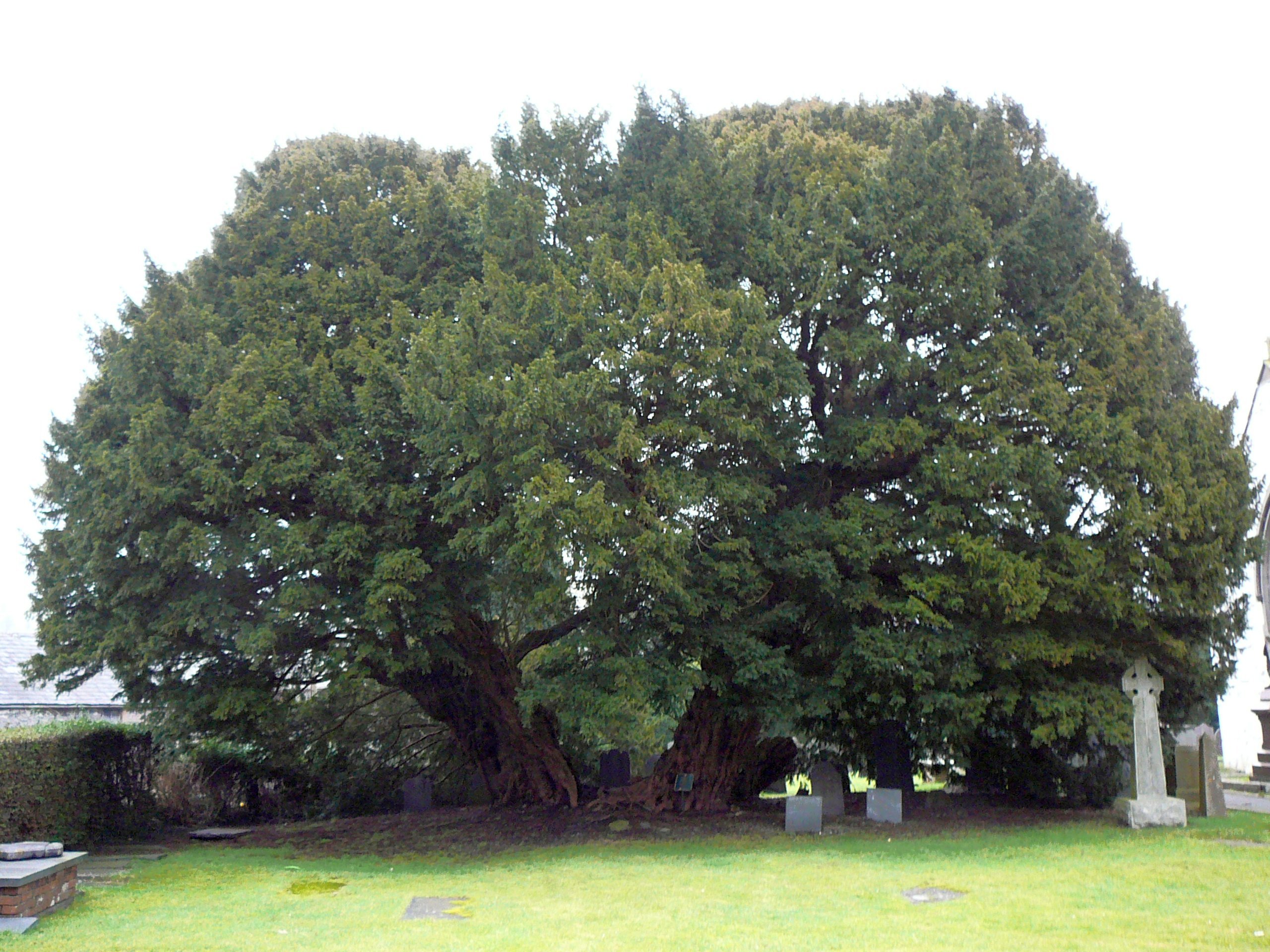
Llangernyw Yew

The Llangernyw Yew ([ɬanˈɡɛrnɨu] ) is an ancient yew (Taxus baccata) in the village of Llangernyw, Conwy, Wales. The tree is fragmented and its core part...

Conwy (UK Parliament constituency)

Conwy (Conway prior to 1983) was an electoral constituency represented in the House of Commons of the Parliament of the United Kingdom. It returned one...

Conwy (Assembly constituency)

Conwy was a constituency of the National Assembly for Wales from 1999 to 2007. It elected one Assembly Member by the first past the post method of election...

Nearby Amenities

Located within 500m of 53.208963,-3.6720218
The data included in this document is from www.openstreetmap.org. The data is made available under ODbL.

Have you been to Coed Derw?

Leave your review of Coed Derw below (or comments, questions and feedback).