Coed yr Ysgol
Wood, Forest in Denbighshire
Wales
Coed yr Ysgol

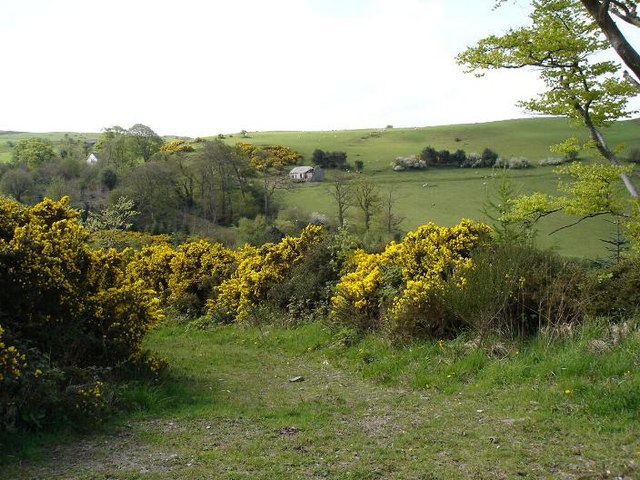
Coed yr Ysgol, located in Denbighshire, Wales, is a picturesque wood and forest area spanning over a significant expanse. Encompassing approximately 200 acres, this enchanting woodland is a haven for nature lovers, hikers, and outdoor enthusiasts.
The diverse ecosystem of Coed yr Ysgol boasts a rich variety of flora and fauna, making it a thriving habitat for numerous species. The woodland is predominantly composed of native broadleaf trees, including oak, beech, and birch, which provide a lush and verdant canopy. Beneath this canopy, a diverse understory flourishes, with woodland flowers such as bluebells, primroses, and wild garlic adding splashes of color to the forest floor.
The woodland is crisscrossed with a network of well-maintained trails, allowing visitors to explore its beauty while immersing themselves in nature. These paths cater to all levels of fitness and are suitable for both leisurely walks and more strenuous hikes. Along the way, visitors may encounter various wildlife, including deer, foxes, badgers, and an array of bird species.
Coed yr Ysgol is not only a place of natural beauty but also a valuable educational resource. It offers educational programs and guided tours, providing visitors with an opportunity to learn about the woodlands' ecology, conservation efforts, and sustainable practices.
Whether one seeks tranquility, adventure, or knowledge, Coed yr Ysgol in Denbighshire is a captivating woodland destination that promises to enchant all who venture within its boundaries.
If you have any feedback on the listing, please let us know in the comments section below.
Coed yr Ysgol Images
Images are sourced within 2km of 53.226167/-3.7158962 or Grid Reference SH8571. Thanks to Geograph Open Source API. All images are credited.


Coed yr Ysgol is located at Grid Ref: SH8571 (Lat: 53.226167, Lng: -3.7158962)
Unitary Authority: Conwy
Police Authority: North Wales
What 3 Words
///slipping.rock.frightens. Near Mochdre, Conwy
Nearby Locations
Related Wikis

St John's Church, Trofarth
St John's Church, Trofarth, is a redundant church standing in an isolated position in Conwy County Borough, Wales (grid reference SH857718). It was designated...

Llyn Ty'n y Llyn
Llyn Ty'n y Llyn is a Site of Special Scientific Interest in the preserved county of Clwyd, north Wales. == See also == List of Sites of Special Scientific...

Coed Coch
Coed Coch, in Dolwen, Conwy, Wales, is a large 19th-century mansion in the neoclassical style, designed by the architect Henry Hakewill. The building...

Llangernyw
Llangernyw ([ɬanˈgɛrnɨ̞u] ) is a rural, mostly Welsh-speaking, village and community in Conwy County Borough, North Wales. == Overview == At the 2011 census...

Moelfre Uchaf
Moelfre Uchaf is a hill in the borough of Conwy, North Wales, 5 miles (8.0 km) south-east of Colwyn Bay and 1.5 mi (2.4 km) south-west of Betws-yn-Rhos...
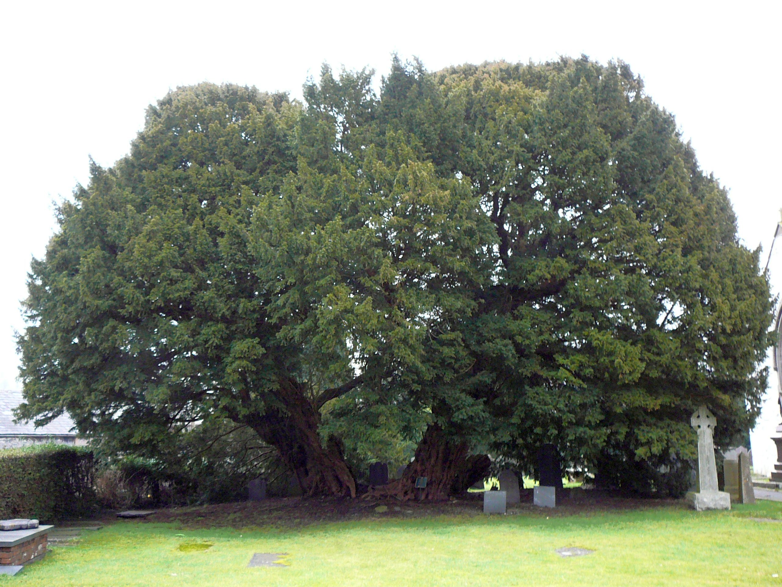
Llangernyw Yew
The Llangernyw Yew ([ɬanˈɡɛrnɨu] ) is an ancient yew (Taxus baccata) in the village of Llangernyw, Conwy, North Wales. The tree is fragmented and its core...

Conwy (UK Parliament constituency)
Conwy (Conway prior to 1983) was an electoral constituency represented in the House of Commons of the Parliament of the United Kingdom. It returned one...
Conwy (Assembly constituency)
Conwy was a constituency of the National Assembly for Wales from 1999 to 2007. It elected one Assembly Member by the first past the post method of election...
Nearby Amenities
Located within 500m of 53.226167,-3.7158962Have you been to Coed yr Ysgol?
Leave your review of Coed yr Ysgol below (or comments, questions and feedback).