Allt Cwmtywyll
Wood, Forest in Brecknockshire
Wales
Allt Cwmtywyll

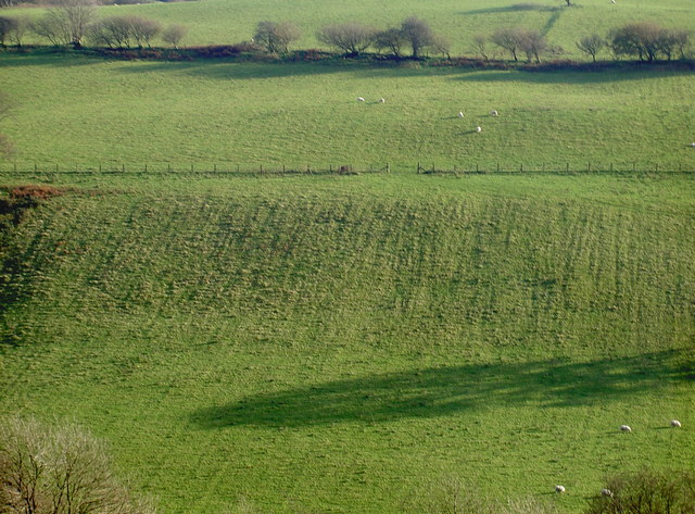
Allt Cwmtywyll is a picturesque woodland located in the county of Brecknockshire, Wales. The name translates to "Wood of the Hollow of the Ghost" in English, adding to its mystique and charm.
Covering an area of approximately 100 hectares, Allt Cwmtywyll is a diverse forest that boasts a rich variety of flora and fauna. The woodland consists mainly of broadleaf trees, such as oak, beech, and ash, which create a dense canopy, providing shade and shelter for a wide range of woodland creatures.
The forest is crisscrossed by a network of well-maintained footpaths, allowing visitors to explore its beauty at their leisure. These paths wind through the woodland, passing by tranquil streams and small waterfalls, enhancing the overall allure of the area.
Allt Cwmtywyll is home to an abundance of wildlife, making it a haven for nature enthusiasts. Visitors may spot various bird species, including woodpeckers, nuthatches, and thrushes, as well as small mammals like squirrels and foxes. The forest also supports a diverse range of insects, contributing to its ecological significance.
The woodland has been carefully managed over the years to maintain its natural beauty while also providing sustainable resources. Local communities often utilize the forest for recreational activities, such as hiking, picnicking, and birdwatching.
Allt Cwmtywyll is a true gem in Brecknockshire, offering visitors a chance to immerse themselves in nature's tranquility and appreciate the wonders of the Welsh countryside.
If you have any feedback on the listing, please let us know in the comments section below.
Allt Cwmtywyll Images
Images are sourced within 2km of 52.010033/-3.6791593 or Grid Reference SN8435. Thanks to Geograph Open Source API. All images are credited.


Allt Cwmtywyll is located at Grid Ref: SN8435 (Lat: 52.010033, Lng: -3.6791593)
Unitary Authority: Carmarthenshire
Police Authority: Dyfed Powys
What 3 Words
///dimes.satin.spill. Near Llandovery, Carmarthenshire
Nearby Locations
Related Wikis

Babel, Carmarthenshire
Babel is a village in Carmarthenshire, Wales.

Crychan Forest Tracks
Crychan Forest Tracks is a Site of Special Scientific Interest in Carmarthen & Dinefwr, Wales. It was chosen as a special stage in the British Rally from...
Trefawr Track
Trefawr Track, a forestry road north of Cwm-coed-Aeron Farm, Llandovery, Wales, is the location of the Global Boundary Stratotype Section and Point (GSSP...
Llandovery transmitting station
The Llandovery transmitting station is a telecommunications facility located to the north of Llandovery and east of Cynghordy, in Carmarthenshire, Wales...
Llandeilo'r-Fan
Llandeilo'r-Fan is a small village located in Powys, Wales. It is located between Llandovery and Brecon. It is very rural and is located in a hilly area...

Mynydd Bach Trecastell
Mynydd Bach Trecastell is a hill on the border between the counties of Carmarthenshire and Powys in southwest Wales. It lies within the Black Mountain...
Llanfair-ar-y-bryn
Llanfair-y-bryn is a community and Church in Wales parish in Carmarthenshire, Wales. Covering an area of some 95 km², it lies along and to the northwest...

Cynghordy
Cynghordy () is a village in the rural community of Llanfair-ar-y-bryn in Carmarthenshire, Wales. It lies on the A483 road northeast of the town of Llandovery...
Nearby Amenities
Located within 500m of 52.010033,-3.6791593Have you been to Allt Cwmtywyll?
Leave your review of Allt Cwmtywyll below (or comments, questions and feedback).