Allt Tyn-y-cwm
Wood, Forest in Brecknockshire
Wales
Allt Tyn-y-cwm

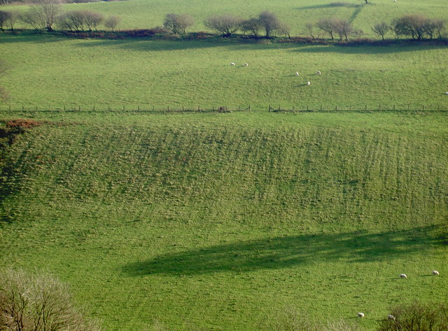
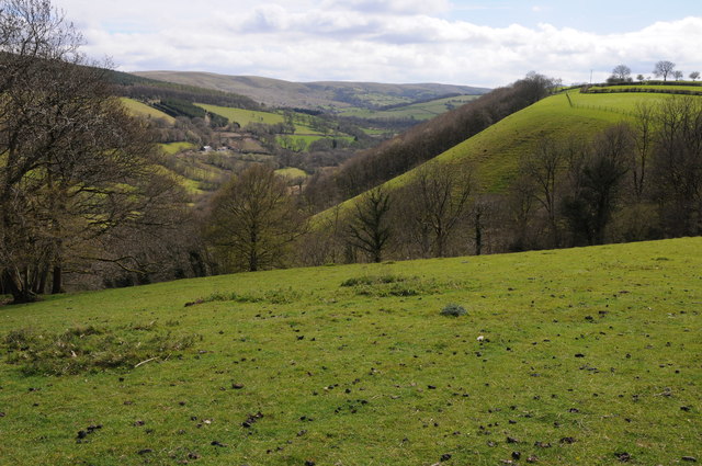
Allt Tyn-y-cwm is a wood located in Brecknockshire, Wales. Situated in the heart of the country, it is surrounded by breathtaking natural beauty and is a popular destination for nature enthusiasts and hikers.
Covering an area of approximately 100 acres, Allt Tyn-y-cwm is predominantly composed of native broadleaf trees, including oak, beech, and ash. The dense canopy provides a habitat for a diverse range of wildlife, including birds, squirrels, and various species of insects. The wood is also home to a number of rare and protected plant species, making it an important conservation site.
The wood offers a network of well-maintained walking trails that wind through its undulating terrain. These trails cater to all levels of fitness and offer stunning views of the surrounding countryside. Visitors can expect to see vibrant displays of wildflowers during the spring and summer months, while the autumn foliage creates a picturesque landscape during the fall.
Allt Tyn-y-cwm is managed by the local forestry commission, who ensure the wood remains accessible and well-preserved for future generations to enjoy. The commission periodically conducts tree thinning and planting activities to maintain a healthy and sustainable woodland ecosystem.
The wood is easily accessible by road, with ample parking facilities available nearby. There are also picnic areas and benches scattered throughout the wood, providing visitors with the opportunity to relax and take in the peaceful atmosphere.
Allt Tyn-y-cwm is a hidden gem in the heart of Brecknockshire, offering a tranquil escape from the hustle and bustle of everyday life. Whether you are a nature lover, a keen walker, or simply seeking solace in nature, this wood is a must-visit destination.
If you have any feedback on the listing, please let us know in the comments section below.
Allt Tyn-y-cwm Images
Images are sourced within 2km of 52.006961/-3.6815211 or Grid Reference SN8435. Thanks to Geograph Open Source API. All images are credited.


Allt Tyn-y-cwm is located at Grid Ref: SN8435 (Lat: 52.006961, Lng: -3.6815211)
Unitary Authority: Carmarthenshire
Police Authority: Dyfed Powys
What 3 Words
///year.ahead.vies. Near Llandovery, Carmarthenshire
Nearby Locations
Related Wikis

Babel, Carmarthenshire
Babel is a village in Carmarthenshire, Wales.

Crychan Forest Tracks
Crychan Forest Tracks is a Site of Special Scientific Interest in Carmarthen & Dinefwr, Wales. It was chosen as a special stage in the British Rally from...
Trefawr Track
Trefawr Track, a forestry road north of Cwm-coed-Aeron Farm, Llandovery, Wales, is the location of the Global Boundary Stratotype Section and Point (GSSP...

Mynydd Bach Trecastell
Mynydd Bach Trecastell is a hill on the border between the counties of Carmarthenshire and Powys in southwest Wales. It lies within the Black Mountain...
Llandeilo'r-Fan
Llandeilo'r-Fan is a small village located in Powys, Wales. It is located between Llandovery and Brecon. It is very rural and is located in a hilly area...
Llandovery transmitting station
The Llandovery transmitting station is a telecommunications facility located to the north of Llandovery and east of Cynghordy, in Carmarthenshire, Wales...
Llanfair-ar-y-bryn
Llanfair-y-bryn is a community and Church in Wales parish in Carmarthenshire, Wales. Covering an area of some 95 km², it lies along and to the northwest...
Waun-Ddu
Waun-Ddu is a part of the Mynydd Bach that is a Site of Special Scientific Interest in Carmarthen & Dinefwr, Wales. == See also == List of Sites of Special...
Have you been to Allt Tyn-y-cwm?
Leave your review of Allt Tyn-y-cwm below (or comments, questions and feedback).