Burton on the Wolds

Settlement in Leicestershire Charnwood

England

Burton on the Wolds

Footpath to Six Hills Road
Footpath to Six Hills Road Credit: Jonathan Thacker

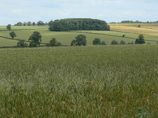
Burton on the Wolds is a picturesque village located in the county of Leicestershire, England. Situated in the East Midlands region, it lies approximately 12 miles north of the city of Leicester. The village is set in a rural landscape, surrounded by rolling hills and scenic countryside.

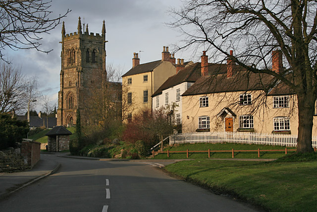
With a population of around 400 residents, Burton on the Wolds maintains a close-knit community atmosphere. The village is characterized by its charming cottages, many of which date back several centuries, showcasing traditional English architecture. The streets are lined with well-tended gardens and flower displays, adding to the village's overall aesthetic appeal.

The heart of Burton on the Wolds is the St. Philip and St. James Parish Church, a historic landmark that has stood for over 800 years. The church serves as a focal point for the community and continues to hold regular services and events throughout the year.

The village is also home to a primary school, providing education for local children. Additionally, there are several community facilities, including a village hall, sports grounds, and a local pub, where residents can come together and socialize.

Despite its small size, Burton on the Wolds benefits from its proximity to nearby towns and cities. Leicester offers a range of amenities, including shopping centers, entertainment venues, and cultural attractions. The village is also well-connected by road, making it accessible for both residents and visitors.

Overall, Burton on the Wolds exudes a tranquil and idyllic ambiance, making it an attractive place to live or visit for those seeking a peaceful rural retreat.

If you have any feedback on the listing, please let us know in the comments section below.

Burton on the Wolds Images

Images are sourced within 2km of 52.784605/-1.127759 or Grid Reference SK5821. Thanks to Geograph Open Source API. All images are credited.

Footpath to Six Hills Road
Footpath to Melton Road Follows the field edge.
Footpath to Melton Road
Follows the field edge.
Footpath to Burton Lane
Farm track off Burton Lane
The beginning of a footpath to Wymeswold
Melton Road Looking towards Burton on the Wolds. The wide verge suggests that this was once a drovers' road.
Melton Road
Looking towards Burton on the Wolds. The wide verge suggests that this was once a drovers' road.
Melton Road The wide verge suggests that this was once a drovers' road.
Melton Road
The wide verge suggests that this was once a drovers' road.
Part of Wymeswold Solar Farm
Footpath east of Walton on the Wolds The path goes towards Walton Thorns. I imagine it is little used, because the same destination is much more easily gained by using the quiet, tarred lane (Six Hills Road) which runs parallel to the path.
Footpath east of Walton on the Wolds
The path goes towards Walton Thorns. I imagine it is little used, because the same destination is much more easily gained by using the quiet, tarred lane (Six Hills Road) which runs parallel to the path.
Six Hills Road No doubt once ran to Six Hills but now truncated.
Six Hills Road
No doubt once ran to Six Hills but now truncated.
Grass field near Walton on the Wolds
Six Hills Road running east from Walton on the Wolds The road runs along a ridge between the valleys of Walton Brook and Fishpool Brook for 2 miles before ending in a byway and a dead end
Six Hills Road running east from Walton on the Wolds
The road runs along a ridge between the valleys of Walton Brook and Fishpool Brook for 2 miles before ending in a byway and a dead end
Six Hills Road passing Middle Farm
B676 leading to Burton on the Wolds Looking west from the footpath crossing showing the very wide verge, cut for hay during the summer.
B676 leading to Burton on the Wolds
Looking west from the footpath crossing showing the very wide verge, cut for hay during the summer.
Farmland near Walton-in-the-Wolds Leicestershire Wolds countryside; Three Oaks Wood far left and Four Acre Wood in the Centre. The house just visible between the two woods is right on the boundary between <a href="https://www.geograph.org.uk/gridref/SK5921">SK5921</a> and <a href="https://www.geograph.org.uk/gridref/SK6021">SK6021</a> while on the horizon to the far right is Horse Leys Farm, in <a href="https://www.geograph.org.uk/gridref/SK6021">SK6021</a>.
Farmland near Walton-in-the-Wolds
Leicestershire Wolds countryside; Three Oaks Wood far left and Four Acre Wood in the Centre. The house just visible between the two woods is right on the boundary between SK5921 and SK6021 while on the horizon to the far right is Horse Leys Farm, in SK6021.
Gateway on Six Hills Road near Walton-on-the-Wolds Decorative use of redundant farm machinery, this spiked rusty metal wheel is part of the gate post at Three Oaks.
Gateway on Six Hills Road near Walton-on-the-Wolds
Decorative use of redundant farm machinery, this spiked rusty metal wheel is part of the gate post at Three Oaks.
Rancliff Wood near Burton on the Wolds
Burton Wolds in Leicestershire Close to the villages of Burton on the Wolds and Walton on the Wolds.
Burton Wolds in Leicestershire
Close to the villages of Burton on the Wolds and Walton on the Wolds.
Show me another place!

Burton on the Wolds is located at Grid Ref: SK5821 (Lat: 52.784605, Lng: -1.127759)

Administrative County: Leicestershire

District: Charnwood

Police Authority: Leicestershire

What 3 Words

///snores.whiplash.sounding. Near Burton on the Wolds, Leicestershire

Related Wikis

Burton on the Wolds

Burton on the Wolds is a village in Leicestershire, England situated on the B676 road 3 miles (4.8 km) west of the A46 and about the same distance to the...

RAF Wymeswold

Royal Air Force Wymeswold, or more simply RAF Wymeswold, is a former Royal Air Force satellite station located 3.5 miles (5.6 km) north-east of Loughborough...

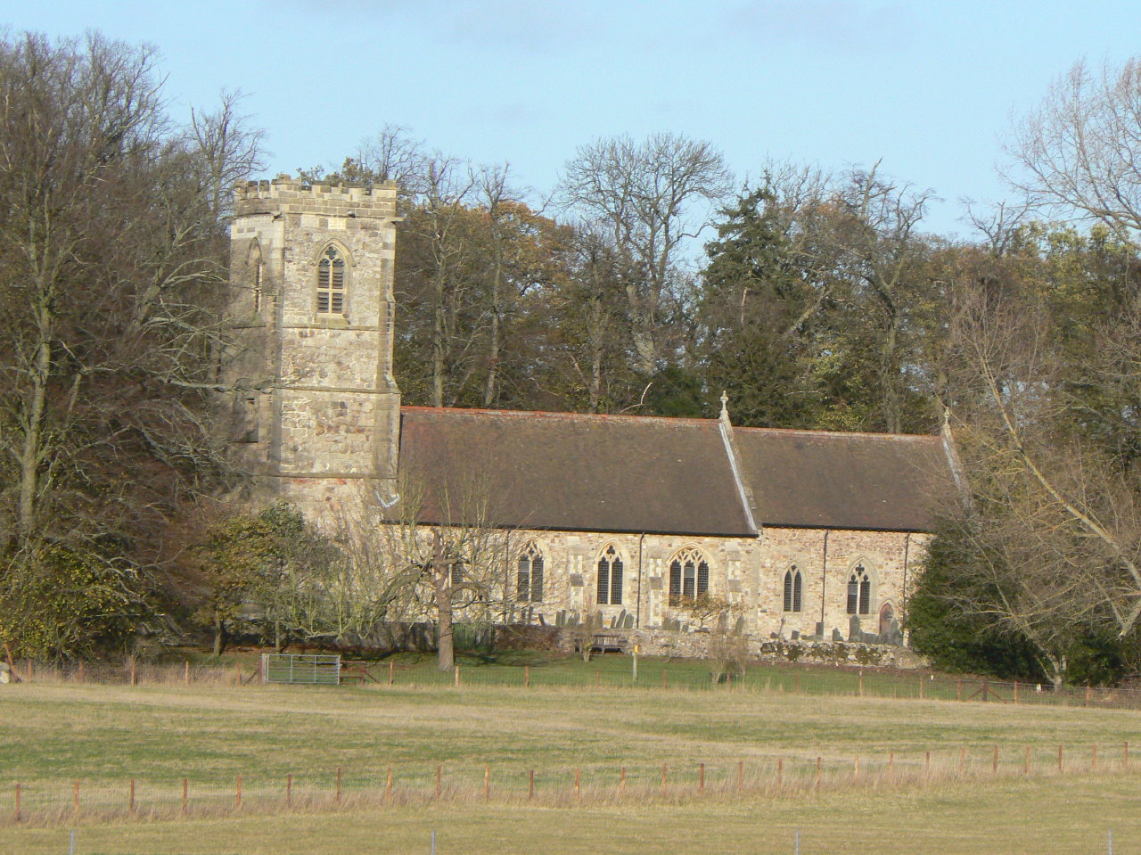
St Andrew's Church, Prestwold

St. Andrew's is a Grade II* medieval parish church situated near Prestwold Hall. The church serves the villages of Prestwold, Burton-on-the-Wolds, Cotes...

Walton on the Wolds

Walton on the Wolds is a village and civil parish in the Charnwood district of Leicestershire, England. In the United Kingdom Census 2011 the parish had...

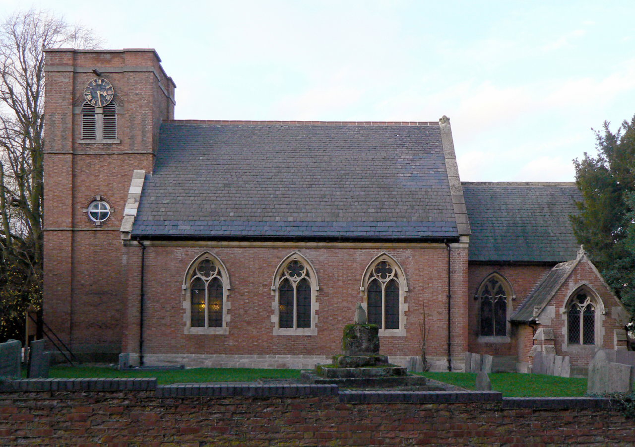
St Mary's Church, Walton on the Wolds

St. Mary's is a Grade II parish church situated in the village of Walton on the Wolds in Leicestershire. == Description == === Current benefice === St Mary...

Prestwold

Prestwold is a hamlet and civil parish in the Charnwood district of Leicestershire, England. The parish has a population of around 60. The population...

Hoton

Hoton is a village and civil parish in the Charnwood district of Leicestershire, England, on the A60 north-east of Loughborough, just south of the border...

Wymeswold

Wymeswold () is a village and civil parish in the Charnwood district of Leicestershire, England. It is in the north of Leicestershire, and north-east of...

Nearby Amenities

Located within 500m of 52.784605,-1.127759
Mini Roundabout
Source: survey
Lat/Long: 52.7847153/-1.1279776
Burton on the Wolds
Is In Country: UK
Is In County: Leicestershire
Place: village
Wikidata: Q737656
Wikipedia: en:Burton on the Wolds
Lat/Long: 52.7852728/-1.1271078
Bus Stop
Melton Road
Alt Name: Burton-on-the-Wolds - Hall Drive
Bus: yes
Naptan AltCommonName: Burton-on-the-Wolds - Hall Drive
Naptan AtcoCode: 260006601
Naptan Bearing: W
Naptan CommonName: Melton Road
Naptan Indicator: outside
Naptan Landmark: Hall Drive
Naptan NaptanCode: leidtwjd
Naptan Notes: Hourly - County
Naptan Street: Melton Road
Naptan Verified: no
Public Transport: platform
Source: naptan_import
Lat/Long: 52.7846019/-1.127196
Bus Stop
Sowters Lane
Bus: yes
Naptan AtcoCode: 260006602
Naptan Bearing: E
Naptan CommonName: Sowters Lane
Naptan Indicator: opposite
Naptan Landmark: Sowters Lane
Naptan NaptanCode: leidtwjg
Naptan Notes: Hourly - County
Naptan Street: Melton Road
Naptan Verified: no
Public Transport: platform
Source: naptan_import
Lat/Long: 52.7859082/-1.1232541
Bus Stop
Sowters Lane
Bus: yes
Naptan AtcoCode: 260006603
Naptan Bearing: W
Naptan CommonName: Sowters Lane
Naptan Indicator: adjacent
Naptan Landmark: Sowters Lane
Naptan NaptanCode: leidtwjm
Naptan Notes: Hourly - County
Naptan Street: Melton Road
Naptan Verified: no
Public Transport: platform
Source: naptan_import
Lat/Long: 52.7858609/-1.1229264
Bus Stop
Loughborough Road
Bus: yes
Naptan AtcoCode: 260006604
Naptan Bearing: W
Naptan CommonName: Loughborough Road
Naptan Indicator: opposite
Naptan Landmark: Brickwood Place
Naptan NaptanCode: leidtwjp
Naptan Notes: Hourly - County
Naptan Street: Loughborough Road
Naptan Verified: no
Public Transport: platform
Source: naptan_import
Lat/Long: 52.7847258/-1.129933
Bus Stop
Melton Road
Bus: yes
Naptan AtcoCode: 260006605
Naptan Bearing: E
Naptan CommonName: Melton Road
Naptan Indicator: opposite
Naptan Landmark: Barrow Road & o/s Post Box
Naptan NaptanCode: leidtwjt
Naptan Notes: Hourly - County
Naptan Street: Melton Road
Naptan Verified: no
Public Transport: platform
Source: naptan_import
Lat/Long: 52.7847467/-1.127863
Bus Stop
Greyhound Inn PH
Bus: yes
Naptan AtcoCode: 260006606
Naptan Bearing: W
Naptan CommonName: Greyhound Inn PH
Naptan Indicator: outside
Naptan Landmark: Greyhound Inn Public House
Naptan NaptanCode: leidtwjw
Naptan Notes: Hourly - County
Naptan Street: Melton Road B676
Naptan Verified: no
Public Transport: platform
Source: naptan_import
Lat/Long: 52.7851603/-1.1254464
Place Of Worship
Lat/Long: 52.7844316/-1.1280558
Wolds Garage
Shop: car_repair
Source: OS OpenData StreetView
Lat/Long: 52.7854529/-1.1255838
Post Box
Brand: Royal Mail
Brand Wikidata: Q638098
Brand Wikipedia: en:Royal Mail
Operator: Royal Mail
Operator Wikidata: Q638098
Post Box Design: type_k
Post Box Type: pillar
Ref: LE12 84
Royal Cypher: EIIR
Royal Cypher Wikidata: Q33102113
Source: survey
Lat/Long: 52.7847478/-1.1277153
Public Bookcase
Booth: K6
Colour: red
Disused Amenity: telephone
Listed Status: Grade II
Man Made: telephone_box
Public Bookcase Type: phone_box
Source: survey
Lat/Long: 52.7847674/-1.1277246
Power: pole
Lat/Long: 52.7850509/-1.1218846
Power: pole
Lat/Long: 52.7849399/-1.1206087
Bicycle Parking
Bicycle Parking: stands
Capacity: 6
Covered: no
Lat/Long: 52.7815347/-1.1321918
Bench
Backrest: yes
Inscription: presented by Martin Betts 1987
Lat/Long: 52.7815693/-1.1322309
Leisure: picnic_table
Material: wood
Lat/Long: 52.7815373/-1.1322523
Bench
Inscription: in memory of George Norton Harvey
Lat/Long: 52.7815053/-1.1326551
Bench
Backrest: yes
Inscription: in memory of John E Saunders
Material: wood
Lat/Long: 52.7817285/-1.1327896
Waste Basket
Lat/Long: 52.7816961/-1.1324432
Leisure: fitness_station
Sport: fitness
Lat/Long: 52.7812808/-1.1314576
Artwork Type: sculpture
Material: metal
Tourism: artwork
Lat/Long: 52.7859612/-1.1260486
Bench
Backrest: yes
Lat/Long: 52.7848985/-1.1280919
Post Box
Lat/Long: 52.7840176/-1.1218701
Barrier: cycle_barrier
Lat/Long: 52.785846/-1.1263074
Waste Basket
Lat/Long: 52.7815886/-1.1323578
Waste Basket
Lat/Long: 52.7813727/-1.1316487
Bench
Lat/Long: 52.7847432/-1.1278348
Defibrillator
Defibrillator Location: outside Burton on the Wolds Village Hall - to left of entrance behind notice boards
Emergency: defibrillator
Indoor: no
Lat/Long: 52.7848892/-1.1282943
Information: board
Tourism: information
Lat/Long: 52.7848542/-1.1283028
The data included in this document is from www.openstreetmap.org. The data is made available under ODbL.

Have you been to Burton on the Wolds?

Leave your review of Burton on the Wolds below (or comments, questions and feedback).