Coed Blaen-y-cwm
Wood, Forest in Merionethshire
Wales
Coed Blaen-y-cwm

Coed Blaen-y-cwm, located in Merionethshire, Wales, is a picturesque woodland area known for its natural beauty and rich biodiversity. The name "Blaen-y-cwm" translates to "wood or forest at the head of the valley," which aptly describes its location nestled at the top of a scenic valley.
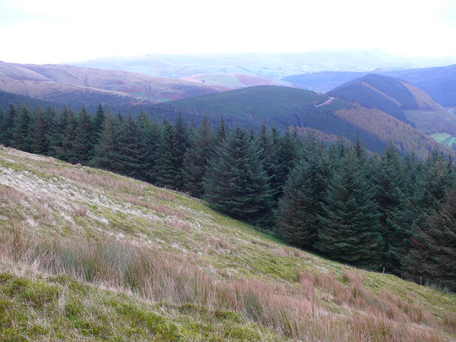
The woodland covers an area of approximately 200 acres and is predominantly composed of native trees such as oak, birch, and beech. These trees provide a dense canopy that creates a tranquil and shaded environment, perfect for those seeking respite from the hustle and bustle of everyday life. The forest floor is adorned with a carpet of wildflowers, adding bursts of color and attracting various insect species.
Coed Blaen-y-cwm is home to a diverse range of wildlife, including birds, mammals, and insects. Birdwatchers can spot species such as the redstart, pied flycatcher, and wood warbler, as well as larger birds of prey like the buzzard and sparrowhawk. The woodland also supports a healthy population of mammals, including badgers, foxes, and several species of bats.
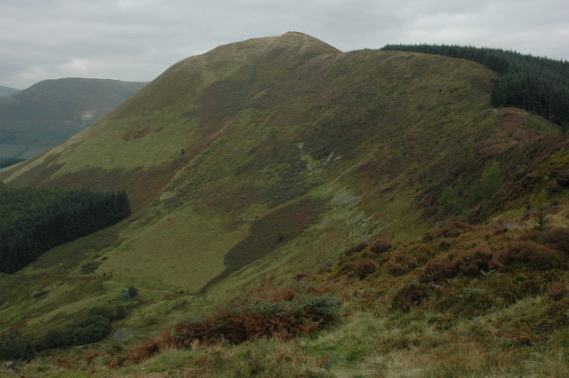
The forest is crisscrossed with a network of footpaths and trails, offering visitors the opportunity to explore its natural wonders. These paths lead to vantage points that provide stunning views of the surrounding countryside, including nearby mountains and the meandering river below.
Coed Blaen-y-cwm is not only a haven for nature enthusiasts but also a valuable ecological resource. It plays a crucial role in preserving the local ecosystem and providing a habitat for numerous species. As such, it is protected and managed by conservation organizations to ensure its longevity for future generations to enjoy.
If you have any feedback on the listing, please let us know in the comments section below.
Coed Blaen-y-cwm Images
Images are sourced within 2km of 52.70325/-3.7223476 or Grid Reference SH8313. Thanks to Geograph Open Source API. All images are credited.


Coed Blaen-y-cwm is located at Grid Ref: SH8313 (Lat: 52.70325, Lng: -3.7223476)
Unitary Authority: Gwynedd
Police Authority: North Wales
What 3 Words
///cleanest.seated.ejects. Near Cwm-Llinau, Powys
Nearby Locations
Related Wikis
Foel Dinas
Foel Dinas is a mountain in Wales. It is the north-westernmost peak of the Dyfi Hills and sits above the town of Dinas Mawddwy. In the 1870s its eastern...

Moel y Ffridd
Moel y Ffridd (also known as Foel y Ffridd) is a mountain in Wales. It lies north-west of the village of Aberangell and west of Mallwyd and is one of the...
Meirion Mill Railway
The Meirion Mill Railway was a narrow gauge railway that operated at Meirion Mill in Dinas Mawddwy, Wales. It only operated for three years from 1975 to...
Gartheiniog quarry
Gartheiniog quarry was a slate quarry served by the Hendre Ddu Tramway. It is located about a mile west of Aberangell in Merioneth (now Gwynedd), North...
Minllyn quarry
Minllyn quarry was a slate quarry near Dinas Mawddwy in Wales that opened before 1793 and continued working intermittently until 1925. The quarry is located...

Pont Minllyn
Pont Minllyn (also known as Pont-y-Ffinant or Pontrusk Bridge) is a bridge spanning the Afon Dyfi, north of the village of Mallwyd, in Gwynedd, Wales....
Mynydd Gartheiniog
Mynydd Gartheiniog is a mountain in southern Snowdonia, Wales. It is a long ridge running south from the cliff of Craig Portas above Dinas Mawddwy and...
Mawddwy
Mawddwy is a community in the county of Gwynedd, Wales, and is 88.3 miles (142.2 km) from Cardiff and 172.8 miles (278.0 km) from London. In 2011 the population...
Nearby Amenities
Located within 500m of 52.70325,-3.7223476Have you been to Coed Blaen-y-cwm?
Leave your review of Coed Blaen-y-cwm below (or comments, questions and feedback).