Allt Ddu

Wood, Forest in Montgomeryshire

Wales

Allt Ddu

Uplands above Cemmaes Road With Moelfre (469m) being the most prominent.
Uplands above Cemmaes Road Credit: John Lucas

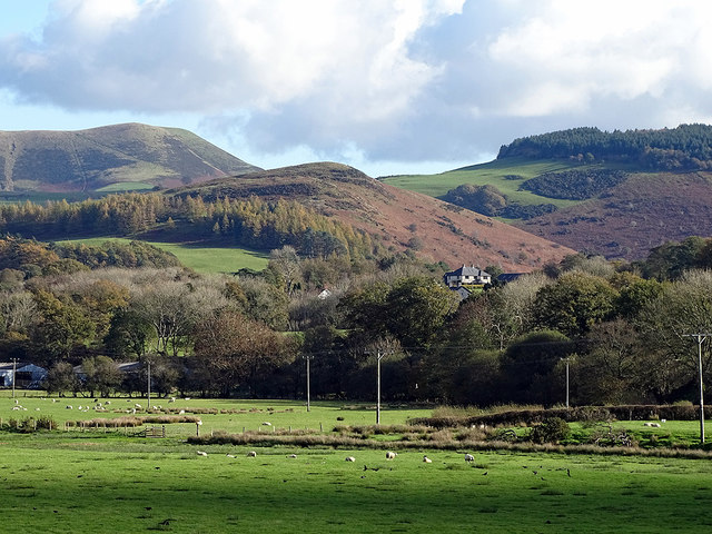
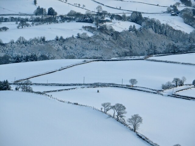
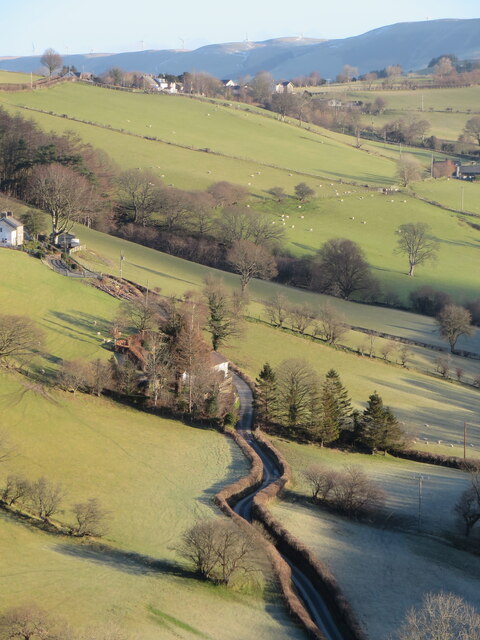
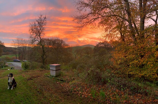
Allt Ddu is a small wood located in Montgomeryshire, a historic county in Wales. Situated in the western part of the county, Allt Ddu is known for its stunning natural beauty and diverse flora and fauna.

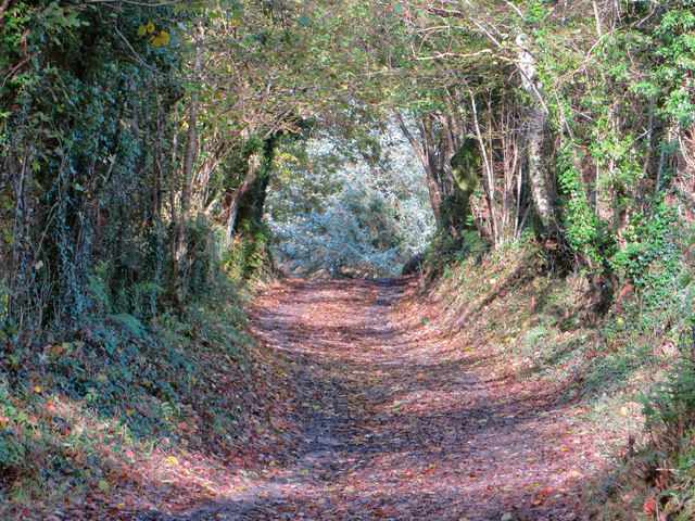
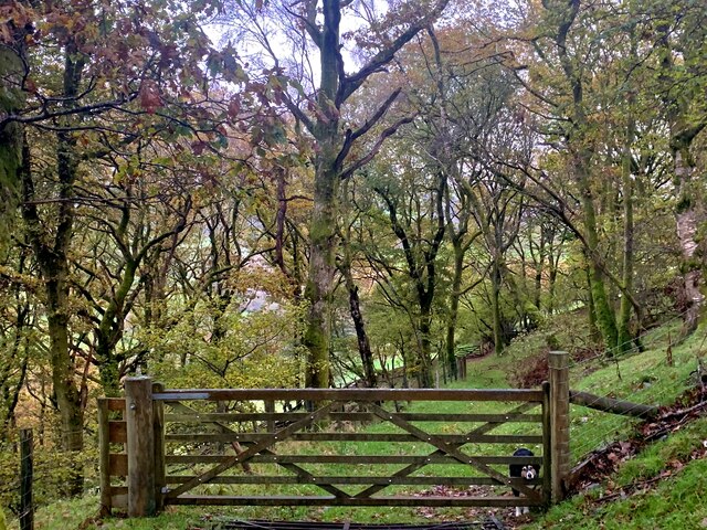
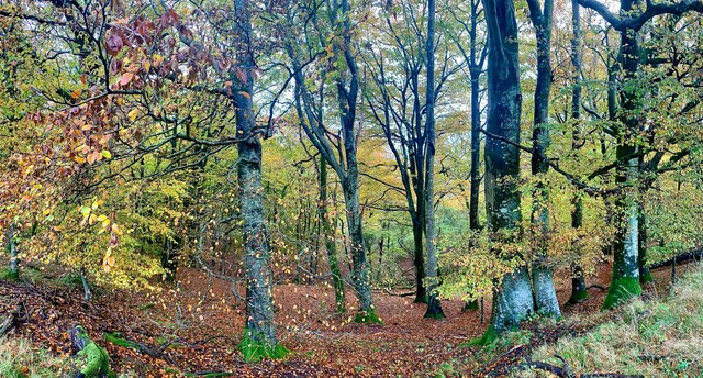
Covering an area of approximately 50 acres, the wood is primarily comprised of native broadleaf trees such as oak, beech, and ash. The dense canopy created by these trees provides a shady and peaceful environment for visitors to explore and enjoy.

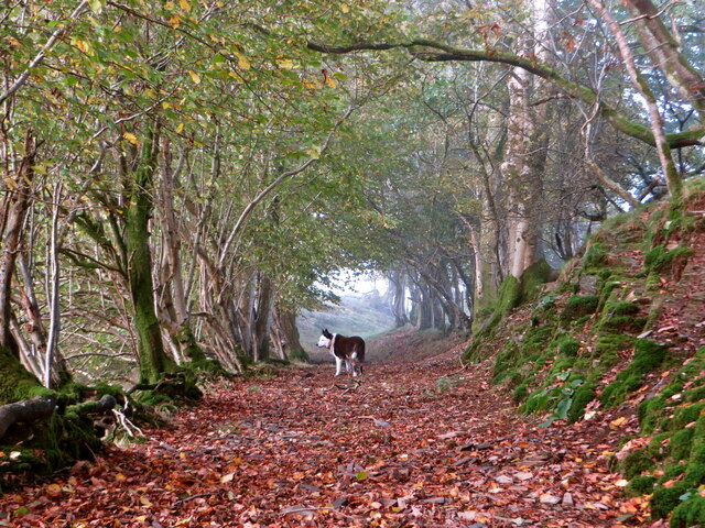
The forest floor is carpeted with a variety of plant species, including bluebells, primroses, and wild garlic, which create a vibrant and colorful display in the spring. Additionally, the wood is home to a wide range of wildlife, including birds such as woodpeckers, owls, and various species of songbirds.

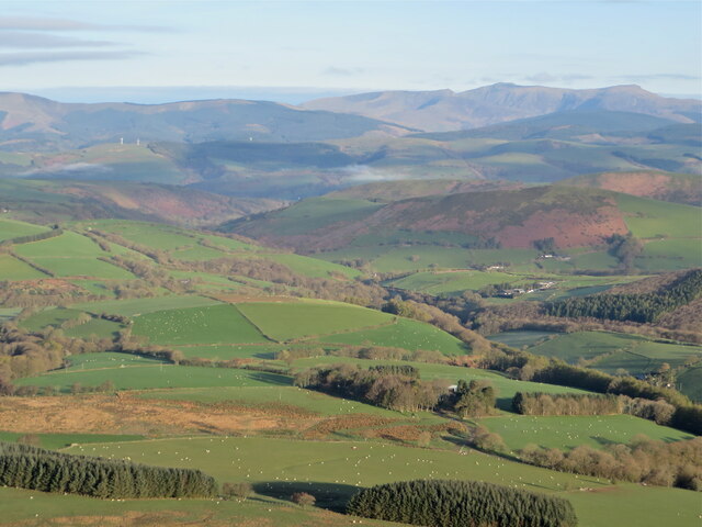
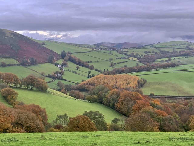
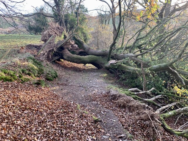
Allt Ddu offers several walking trails that allow visitors to fully immerse themselves in the beauty of the wood. These trails meander through the trees, offering glimpses of small streams and breathtaking views of the surrounding countryside.

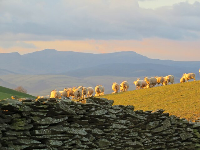
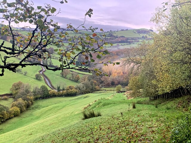
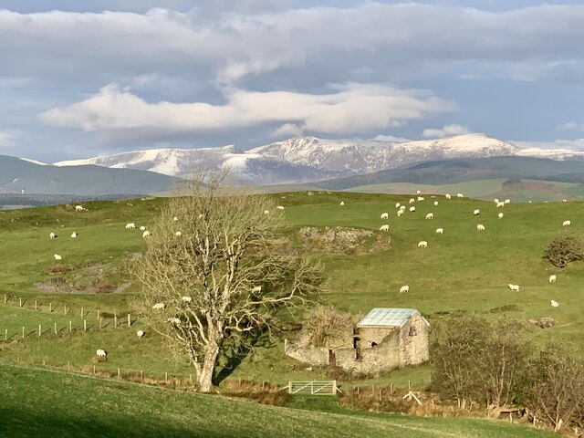
The wood is a popular destination for nature enthusiasts, hikers, and photographers, who are drawn to its tranquil atmosphere and picturesque scenery. Visitors can also find picnic areas and benches scattered throughout the wood, providing the perfect spot to relax and enjoy a packed lunch amidst nature.

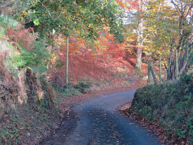
Allt Ddu is a true gem in Montgomeryshire, offering visitors a chance to escape the hustle and bustle of daily life and connect with the natural world.

If you have any feedback on the listing, please let us know in the comments section below.
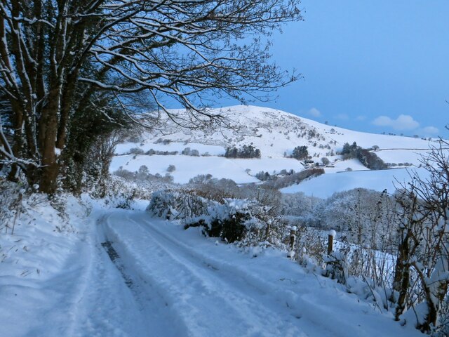
Allt Ddu Images

Images are sourced within 2km of 52.582113/-3.7176527 or Grid Reference SN8399. Thanks to Geograph Open Source API. All images are credited.

Uplands above Cemmaes Road With Moelfre (469m) being the most prominent.
Uplands above Cemmaes Road
With Moelfre (469m) being the most prominent.
Maen Llwyd / Carreg y Noddfa 'Sanctuary stone', standing on farmland at Rhôs Dyrnog [n.b. not 'Drynog' as per Ordnance Survey]
Maen Llwyd / Carreg y Noddfa
'Sanctuary stone', standing on farmland at Rhôs Dyrnog [n.b. not 'Drynog' as per Ordnance Survey]
Hen wtra / Old lane Lôn hynafol rhwng Tal-y-Wern a Darowen / Ancient lane between Tal-y-Wern and Darowen.
Hen wtra / Old lane
Lôn hynafol rhwng Tal-y-Wern a Darowen / Ancient lane between Tal-y-Wern and Darowen.
Across Nant Gwydol September sunrise over the cattle at Rhos Dyrnog
Across Nant Gwydol
September sunrise over the cattle at Rhos Dyrnog
Golygfa tuag at Cadair Idris From the bridleway on Bryn-y-Brain, a view across the old stone wall and a flock of sheep towards Cadair Idris.
Golygfa tuag at Cadair Idris
From the bridleway on Bryn-y-Brain, a view across the old stone wall and a flock of sheep towards Cadair Idris.
Lôn o dan Rhiw Goch Looking down the steep lane to Tal-y-Wern, with Fron Goch rising behind.
Lôn o dan Rhiw Goch
Looking down the steep lane to Tal-y-Wern, with Fron Goch rising behind.
Carreg y Noddfa yn y gaeaf From across the valley, the Bronze Age megalith, Carreg y Noddfa ('stone of sanctuary'), appearing through a fresh snowfall.
Carreg y Noddfa yn y gaeaf
From across the valley, the Bronze Age megalith, Carreg y Noddfa ('stone of sanctuary'), appearing through a fresh snowfall.
Golygfa o gopa Moelfre View from the top of Moelfre, looking NW towards Fron Goch and Cadair Idris.
Golygfa o gopa Moelfre
View from the top of Moelfre, looking NW towards Fron Goch and Cadair Idris.
Ffordd ceffyl uwchben Rhiw Goch The bridleway above Rhiw Goch; an old drovers' road.
Ffordd ceffyl uwchben Rhiw Goch
The bridleway above Rhiw Goch; an old drovers' road.
Lôn agos i Rhiw Goch The lane coming from Melinbyrhedyn, as it dips down and rounds the corner to Rhiw Goch.
Lôn agos i Rhiw Goch
The lane coming from Melinbyrhedyn, as it dips down and rounds the corner to Rhiw Goch.
Dros Nant Gwydol Across Nant Gwydol, looking up the lane towards Darowen.
Dros Nant Gwydol
Across Nant Gwydol, looking up the lane towards Darowen.
Llwybr ceffyl / Bridleway Hen lwybr yn y coed / old bridleway through the wood
Llwybr ceffyl / Bridleway
Hen lwybr yn y coed / old bridleway through the wood
Llwybr ceffyl / Bridleway Llwybr lawr i Esgair Gadwyth / bridleway heading downhill towards Esgair Gadwyth
Llwybr ceffyl / Bridleway
Llwybr lawr i Esgair Gadwyth / bridleway heading downhill towards Esgair Gadwyth
Golygfa tua phentref Darowen / view towards the village of Darowen The hillfort of Fron Goch on left, a fine larch wood in the middle, and between them the lane climbing up to the elevated village of Darowen.
Golygfa tua phentref Darowen / view towards the village of Darowen
The hillfort of Fron Goch on left, a fine larch wood in the middle, and between them the lane climbing up to the elevated village of Darowen.
Y wawr Sunrise over Moelfre, from the bridleway by Rhiw Goch.
Y wawr
Sunrise over Moelfre, from the bridleway by Rhiw Goch.
Coedwig ffawydd / Beech wood At its best on a damp November morning.
Coedwig ffawydd / Beech wood
At its best on a damp November morning.
Atgofion o Arwen! Storm Arwen saw off this double-trunked old oak on the bridleway above Rhiw Goch.
Atgofion o Arwen!
Storm Arwen saw off this double-trunked old oak on the bridleway above Rhiw Goch.
Eira cyntaf ar Gadair Idris / First snow on Cadair In the distance, the first snowfall of the winter has dusted the shapely mountain of Cadair Idris. In the foreground, a disused barn has been roofed to provide nesting shelter for owls.
Eira cyntaf ar Gadair Idris / First snow on Cadair
In the distance, the first snowfall of the winter has dusted the shapely mountain of Cadair Idris. In the foreground, a disused barn has been roofed to provide nesting shelter for owls.
Show me another place!

Allt Ddu is located at Grid Ref: SN8399 (Lat: 52.582113, Lng: -3.7176527)

Unitary Authority: Powys

Police Authority: Dyfed Powys

What 3 Words

///butlers.extension.most. Near Cwm-Llinau, Powys

Nearby Locations

Allt Ddu

Related Wikis

Aberhosan

Aberhosan () is a village in the Welsh principal area of Powys, located between the town of Machynlleth and village of Dylife. It is in the historic county...

Commins Coch

Commins Coch is a small village on the A470 in the county of Powys in Wales. It is part of the Glantwymyn community. Commins Coch is notable for the narrow...

Abercegir

Abercegir () is a small rural village in Powys, Wales. It lies approximately 4 miles east of the town of Machynlleth and is 81 miles (131 km) from Cardiff...

Commins Coch Halt railway station

Commins Coch Halt railway station was a station in Commins Coch, Powys, Wales. The station opened on 19 October 1931 and closed on 14 June 1965. The halt...

Nearby Amenities

Located within 500m of 52.582113,-3.7176527
Place: farm
Lat/Long: 52.5787291/-3.7149727
The data included in this document is from www.openstreetmap.org. The data is made available under ODbL.

Have you been to Allt Ddu?

Leave your review of Allt Ddu below (or comments, questions and feedback).