Coed Cefn-Dylasau

Wood, Forest in Caernarfonshire

Wales

Coed Cefn-Dylasau

A5 in the Conwy Valley The A5 is a major trunk road that runs 260 miles from London to Holyhead. It follows the course of an old Roman Road (Watling Street).
Wikipedia: <span class="nowrap"><a title="http://en.wikipedia.org/wiki/A5_road_(Great_Britain)" rel="nofollow ugc noopener" href="http://en.wikipedia.org/wiki/A5_road_(Great_Britain)">Link</a><img style="margin-left:2px;" alt="External link" title="External link - shift click to open in new window" src="https://s1.geograph.org.uk/img/external.png" width="10" height="10"/></span>
A5 in the Conwy Valley Credit: N Chadwick

Coed Cefn-Dylasau is a stunning woodland area located in the county of Caernarfonshire, Wales. Covering an expansive area, this ancient forest is a captivating natural gem that offers visitors a unique experience in the heart of the Welsh countryside.

Nestled within the Snowdonia National Park, Coed Cefn-Dylasau boasts an impressive diversity of flora and fauna. The forest is home to a wide range of tree species, including oak, beech, and birch, creating a rich and vibrant canopy. The forest floor is adorned with a tapestry of wildflowers, adding to the enchanting ambiance.

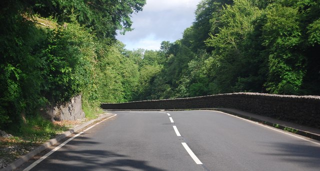
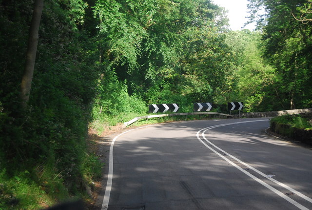
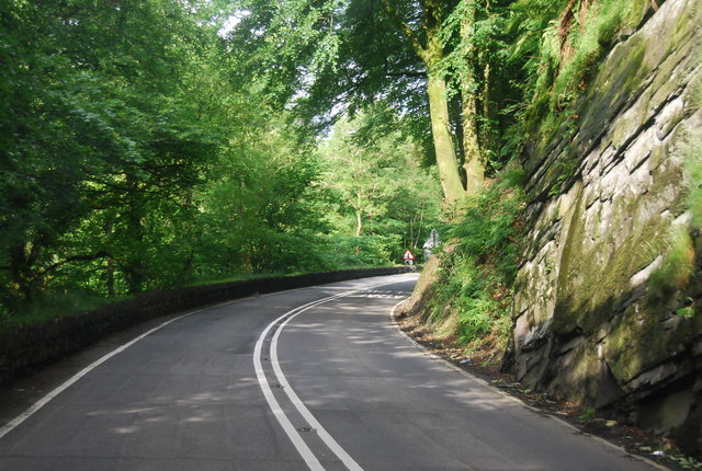
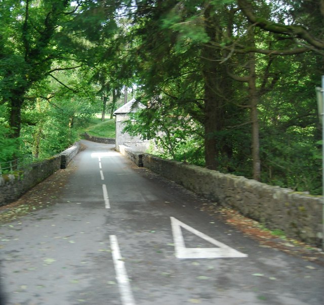
The woodland is crisscrossed with a network of footpaths and trails, offering visitors the opportunity to explore the forest's beauty on foot. As one meanders through the forest, they will encounter babbling brooks, cascading waterfalls, and charming little bridges that add to the magical atmosphere.

Coed Cefn-Dylasau is a haven for wildlife enthusiasts, as it is home to a variety of animals. Deer, badgers, and foxes can often be spotted among the trees, while a symphony of bird songs fills the air, including the melodious calls of thrushes and warblers.

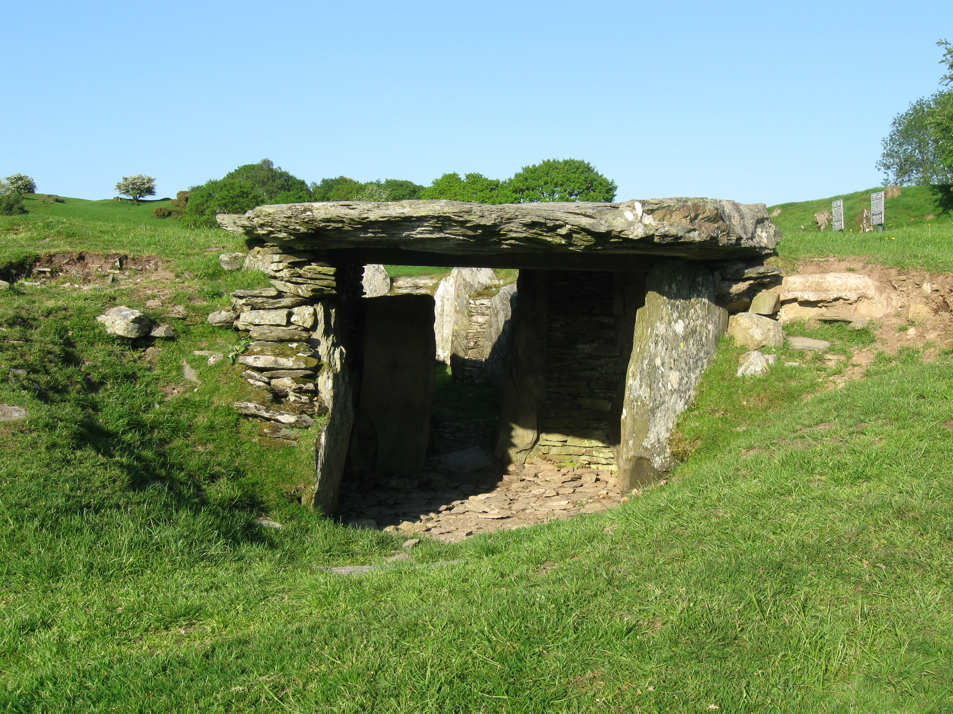
The forest also holds historical significance. It is believed that Coed Cefn-Dylasau was once part of the ancient Celtic landscape, and remnants of Bronze Age settlements have been discovered within its boundaries.

Overall, Coed Cefn-Dylasau is a captivating woodland that offers visitors a peaceful escape into nature. Whether it's hiking, birdwatching, or simply seeking solace in the serene surroundings, this forest has something to offer everyone.

If you have any feedback on the listing, please let us know in the comments section below.

Coed Cefn-Dylasau Images

Images are sourced within 2km of 53.052585/-3.7462017 or Grid Reference SH8352. Thanks to Geograph Open Source API. All images are credited.

A5 in the Conwy Valley The A5 is a major trunk road that runs 260 miles from London to Holyhead. It follows the course of an old Roman Road (Watling Street).
Wikipedia: <span class="nowrap"><a title="http://en.wikipedia.org/wiki/A5_road_(Great_Britain)" rel="nofollow ugc noopener" href="http://en.wikipedia.org/wiki/A5_road_(Great_Britain)">Link</a><img style="margin-left:2px;" alt="External link" title="External link - shift click to open in new window" src="https://s1.geograph.org.uk/img/external.png" width="10" height="10"/></span>
A5 in the Conwy Valley
The A5 is a major trunk road that runs 260 miles from London to Holyhead. It follows the course of an old Roman Road (Watling Street). Wikipedia: LinkExternal link
Bron Ruffydd by the A5 The A5 is a major trunk road that runs 260 miles from London to Holyhead. It follows the course of an old Roman Road (Watling Street).
Wikipedia: <span class="nowrap"><a title="http://en.wikipedia.org/wiki/A5_road_(Great_Britain)" rel="nofollow ugc noopener" href="http://en.wikipedia.org/wiki/A5_road_(Great_Britain)">Link</a><img style="margin-left:2px;" alt="External link" title="External link - shift click to open in new window" src="https://s1.geograph.org.uk/img/external.png" width="10" height="10"/></span>
Bron Ruffydd by the A5
The A5 is a major trunk road that runs 260 miles from London to Holyhead. It follows the course of an old Roman Road (Watling Street). Wikipedia: LinkExternal link
A5, eastbound The A5 is a major trunk road that runs 260 miles from London to Holyhead. It follows the course of an old Roman Road (Watling Street).
Wikipedia: <span class="nowrap"><a title="http://en.wikipedia.org/wiki/A5_road_(Great_Britain)" rel="nofollow ugc noopener" href="http://en.wikipedia.org/wiki/A5_road_(Great_Britain)">Link</a><img style="margin-left:2px;" alt="External link" title="External link - shift click to open in new window" src="https://s1.geograph.org.uk/img/external.png" width="10" height="10"/></span>
A5, eastbound
The A5 is a major trunk road that runs 260 miles from London to Holyhead. It follows the course of an old Roman Road (Watling Street). Wikipedia: LinkExternal link
Tea Bar in a layby, by the A5 The A5 is a major trunk road that runs 260 miles from London to Holyhead. It follows the course of an old Roman Road (Watling Street).
Wikipedia: <span class="nowrap"><a title="http://en.wikipedia.org/wiki/A5_road_(Great_Britain)" rel="nofollow ugc noopener" href="http://en.wikipedia.org/wiki/A5_road_(Great_Britain)">Link</a><img style="margin-left:2px;" alt="External link" title="External link - shift click to open in new window" src="https://s1.geograph.org.uk/img/external.png" width="10" height="10"/></span>
Tea Bar in a layby, by the A5
The A5 is a major trunk road that runs 260 miles from London to Holyhead. It follows the course of an old Roman Road (Watling Street). Wikipedia: LinkExternal link
A5, Nebo turning The A5 is a major trunk road that runs 260 miles from London to Holyhead. It follows the course of an old Roman Road (Watling Street).
Wikipedia: <span class="nowrap"><a title="http://en.wikipedia.org/wiki/A5_road_(Great_Britain)" rel="nofollow ugc noopener" href="http://en.wikipedia.org/wiki/A5_road_(Great_Britain)">Link</a><img style="margin-left:2px;" alt="External link" title="External link - shift click to open in new window" src="https://s1.geograph.org.uk/img/external.png" width="10" height="10"/></span>
A5, Nebo turning
The A5 is a major trunk road that runs 260 miles from London to Holyhead. It follows the course of an old Roman Road (Watling Street). Wikipedia: LinkExternal link
Farmland by the A5
Farmland by the A5
Sheep grazing by the A5
Approaching a sharp bend on the A5 The A5 is a major trunk road that runs 260 miles from London to Holyhead. It follows the course of an old Roman Road (Watling Street).
Wikipedia: <span class="nowrap"><a title="http://en.wikipedia.org/wiki/A5_road_(Great_Britain)" rel="nofollow ugc noopener" href="http://en.wikipedia.org/wiki/A5_road_(Great_Britain)">Link</a><img style="margin-left:2px;" alt="External link" title="External link - shift click to open in new window" src="https://s1.geograph.org.uk/img/external.png" width="10" height="10"/></span>
Approaching a sharp bend on the A5
The A5 is a major trunk road that runs 260 miles from London to Holyhead. It follows the course of an old Roman Road (Watling Street). Wikipedia: LinkExternal link
The A5 The A5 is a major trunk road that runs 260 miles from London to Holyhead. It follows the course of an old Roman Road (Watling Street).
Wikipedia: <span class="nowrap"><a title="http://en.wikipedia.org/wiki/A5_road_(Great_Britain)" rel="nofollow ugc noopener" href="http://en.wikipedia.org/wiki/A5_road_(Great_Britain)">Link</a><img style="margin-left:2px;" alt="External link" title="External link - shift click to open in new window" src="https://s1.geograph.org.uk/img/external.png" width="10" height="10"/></span>
The A5
The A5 is a major trunk road that runs 260 miles from London to Holyhead. It follows the course of an old Roman Road (Watling Street). Wikipedia: LinkExternal link
A5 in the Conwy valley The A5 is a major trunk road that runs 260 miles from London to Holyhead. It follows the course of an old Roman Road (Watling Street).
Wikipedia: <span class="nowrap"><a title="http://en.wikipedia.org/wiki/A5_road_(Great_Britain)" rel="nofollow ugc noopener" href="http://en.wikipedia.org/wiki/A5_road_(Great_Britain)">Link</a><img style="margin-left:2px;" alt="External link" title="External link - shift click to open in new window" src="https://s1.geograph.org.uk/img/external.png" width="10" height="10"/></span>
A5 in the Conwy valley
The A5 is a major trunk road that runs 260 miles from London to Holyhead. It follows the course of an old Roman Road (Watling Street). Wikipedia: LinkExternal link
A5, Padog The A5 is a major trunk road that runs 260 miles from London to Holyhead. It follows the course of an old Roman Road (Watling Street).
Wikipedia: <span class="nowrap"><a title="http://en.wikipedia.org/wiki/A5_road_(Great_Britain)" rel="nofollow ugc noopener" href="http://en.wikipedia.org/wiki/A5_road_(Great_Britain)">Link</a><img style="margin-left:2px;" alt="External link" title="External link - shift click to open in new window" src="https://s1.geograph.org.uk/img/external.png" width="10" height="10"/></span>
A5, Padog
The A5 is a major trunk road that runs 260 miles from London to Holyhead. It follows the course of an old Roman Road (Watling Street). Wikipedia: LinkExternal link
Narrow winding section of the A5 The A5 is a major trunk road that runs 260 miles from London to Holyhead. It follows the course of an old Roman Road (Watling Street).
Wikipedia: <span class="nowrap"><a title="http://en.wikipedia.org/wiki/A5_road_(Great_Britain)" rel="nofollow ugc noopener" href="http://en.wikipedia.org/wiki/A5_road_(Great_Britain)">Link</a><img style="margin-left:2px;" alt="External link" title="External link - shift click to open in new window" src="https://s1.geograph.org.uk/img/external.png" width="10" height="10"/></span>
Narrow winding section of the A5
The A5 is a major trunk road that runs 260 miles from London to Holyhead. It follows the course of an old Roman Road (Watling Street). Wikipedia: LinkExternal link
Road to Voelas Lodge A bridge across the Afon Conwy is visible.
Road to Voelas Lodge
A bridge across the Afon Conwy is visible.
Padog: postbox № LL24 66 and phone The telephone box and postbox stand on the A5. The postbox, strapped to a telegraph pole, is emptied at 12:30 on weekday afternoons and an hour and a half earlier on Saturdays.
Padog: postbox № LL24 66 and phone
The telephone box and postbox stand on the A5. The postbox, strapped to a telegraph pole, is emptied at 12:30 on weekday afternoons and an hour and a half earlier on Saturdays.
Old Milestone Milestone on the A.5 near to Glan Conwy, Conwy for overall view see <a title="https://www.geograph.org.uk/photo/4304443" href="https://www.geograph.org.uk/photo/4304443">Link</a>
Old Milestone
Milestone on the A.5 near to Glan Conwy, Conwy for overall view see Link
Holyhead 50 Milestone next to the wall on the A.5 near to Glan Conwy, Conwy for close up view see <a title="https://www.geograph.org.uk/photo/4304438" href="https://www.geograph.org.uk/photo/4304438">Link</a>
Holyhead 50
Milestone next to the wall on the A.5 near to Glan Conwy, Conwy for close up view see Link
Old Milestone Milestone on the A.5 near to Glan Conwy, Conwy for overall view see <a title="https://www.geograph.org.uk/photo/4304452" href="https://www.geograph.org.uk/photo/4304452">Link</a>
Old Milestone
Milestone on the A.5 near to Glan Conwy, Conwy for overall view see Link
Holyhead 49 Milestone next to the gate on the A.5 near to Glan Conwy, Conwy for close up view see <a title="https://www.geograph.org.uk/photo/4304450" href="https://www.geograph.org.uk/photo/4304450">Link</a>
Holyhead 49
Milestone next to the gate on the A.5 near to Glan Conwy, Conwy for close up view see Link
Show me another place!

Coed Cefn-Dylasau is located at Grid Ref: SH8352 (Lat: 53.052585, Lng: -3.7462017)

Unitary Authority: Conwy

Police Authority: North Wales

What 3 Words

///roughest.waltzed.prep. Near Betws-y-Coed, Conwy

Related Wikis

Rhiw Llwyd

Rhiw Llwyd is the name of an early medieval Wales lordship which was created in the Kingdom of Gwynedd in the 12th century for Tomas ap Rhodri ab Owain...

Conwy Falls

Conwy Falls (Welsh: Rhaeadr y Graig Lwyd) is a waterfall on the River Conwy at Bro Garmon in Conwy County Borough in Wales. The falls and surrounding area...

Afon Merddwr

Afon Merddwr is a river in the south of the county of Conwy, Wales. It is a tributary of the River Conwy and joins it near Pentrefoelas. It is about 10...

River Machno

River Machno (Welsh: Afon Machno) is a river in Snowdonia in north-west Wales. It is the first major tributary of the River Conwy, which it joins south...

Ysbyty Ifan

Ysbyty Ifan (often formerly anglicised as Yspytty Ifan) is a small, historic village and community in the Conwy County Borough of Wales. The population...

St Garmon's Church, Capel Garmon

St Garmon's Church, Capel Garmon, is a redundant Anglican parish church in the village of Capel Garmon, Conwy, Wales. The church was restored and reseated...

Bro Garmon

Bro Garmon is a sparsely populated community in Conwy County Borough, in Wales. It is located on the eastern side of the Conwy Valley, stretching from...

Capel Garmon

Capel Garmon is a village near Betws-y-Coed in the county borough of Conwy, Wales. It is situated high above the Conwy valley, in the community of Bro...

Nearby Amenities

Located within 500m of 53.052585,-3.7462017
Created By: Merkaartor 0.12
Lat/Long: 53.0551309/-3.751094
Created By: Merkaartor 0.12
Lat/Long: 53.053577/-3.7508332
Created By: Merkaartor 0.12
Lat/Long: 53.0527709/-3.7515091
Created By: Merkaartor 0.12
Lat/Long: 53.0524743/-3.7517344
Created By: Merkaartor 0.12
Lat/Long: 53.0515069/-3.7521099
Created By: Merkaartor 0.12
Lat/Long: 53.051365/-3.7521421
Created By: Merkaartor 0.12
Lat/Long: 53.051178/-3.7517451
Created By: Merkaartor 0.12
Lat/Long: 53.0509781/-3.751316
Created By: Merkaartor 0.12
Lat/Long: 53.0508105/-3.7509941
Created By: Merkaartor 0.12
Lat/Long: 53.0505783/-3.7506401
Created By: Merkaartor 0.12
Lat/Long: 53.0502549/-3.7503409
Created By: Merkaartor 0.12
Lat/Long: 53.0500881/-3.7501251
Created By: Merkaartor 0.12
Lat/Long: 53.0499011/-3.7497174
Created By: Merkaartor 0.12
Lat/Long: 53.0497949/-3.7490069
Created By: Merkaartor 0.12
Lat/Long: 53.0496302/-3.7486231
Created By: Merkaartor 0.12
Lat/Long: 53.0493059/-3.7480249
Created By: Merkaartor 0.12
Lat/Long: 53.0490369/-3.7473463
The data included in this document is from www.openstreetmap.org. The data is made available under ODbL.

Have you been to Coed Cefn-Dylasau?

Leave your review of Coed Cefn-Dylasau below (or comments, questions and feedback).