Nant Carreg-y-frân

Valley in Denbighshire

Wales

Nant Carreg-y-frân

Grassland near Nebo Actually mainly peat bog.
Grassland near Nebo Credit: Richard Hoare

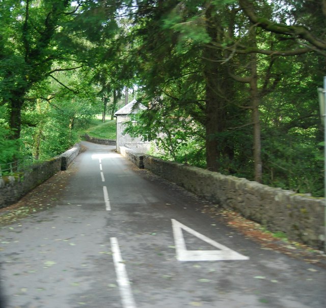
Nant Carreg-y-frân is a picturesque valley located in Denbighshire, Wales. Situated in the northern part of the country, this valley is known for its stunning natural beauty and rich history.

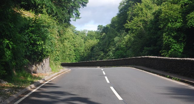
The valley is surrounded by rolling hills and lush greenery, offering visitors breathtaking views of the Welsh countryside. The River Clwyd flows through the valley, adding to its charm and tranquility. The area is home to a diverse range of flora and fauna, making it a popular destination for nature lovers and outdoor enthusiasts.

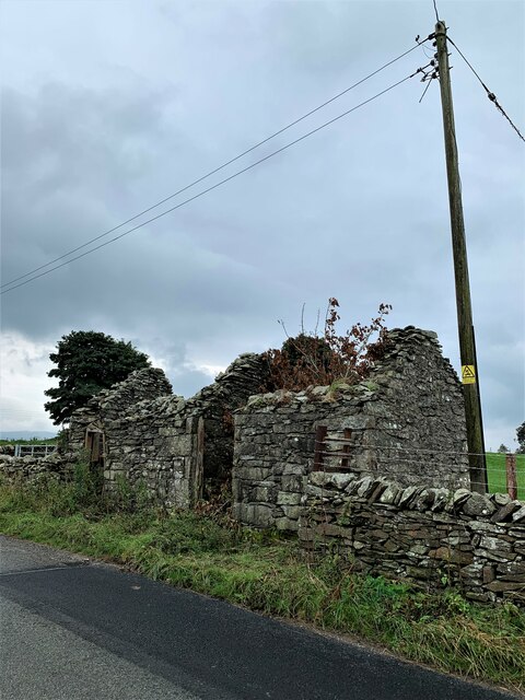
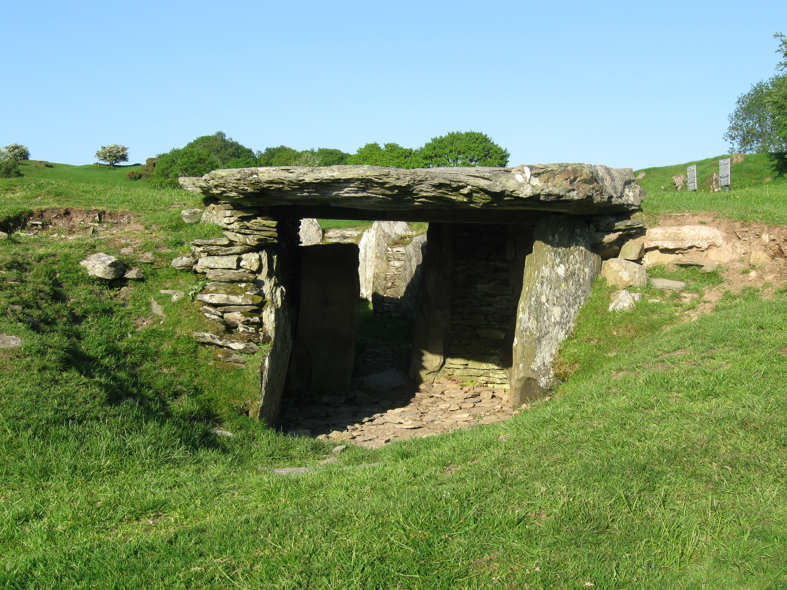
Nant Carreg-y-frân is also steeped in history, with archaeological evidence suggesting human activity in the area as far back as the Bronze Age. The valley is dotted with ancient monuments and ruins, including cairns, burial sites, and standing stones. These remnants of the past provide a glimpse into the lives of the early inhabitants of the region.

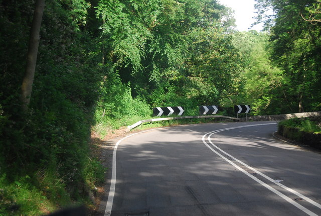
In addition to its natural beauty and historical significance, Nant Carreg-y-frân offers a range of recreational activities. Hiking and walking trails crisscross the valley, allowing visitors to explore its hidden gems. The river provides opportunities for fishing and boating, and the surrounding hills are perfect for cycling and horseback riding.

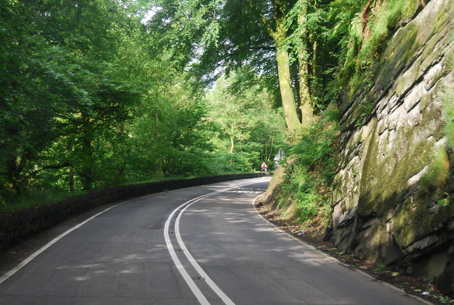
Overall, Nant Carreg-y-frân is a must-visit destination for those seeking a peaceful retreat in the heart of the Welsh countryside. Its combination of natural beauty, historical significance, and outdoor activities make it a truly unique and enchanting place.

If you have any feedback on the listing, please let us know in the comments section below.

Nant Carreg-y-frân Images

Images are sourced within 2km of 53.059784/-3.7353306 or Grid Reference SH8352. Thanks to Geograph Open Source API. All images are credited.

Grassland near Nebo Actually mainly peat bog.
Grassland near Nebo
Actually mainly peat bog.
Derelict building opposite Ty'n y Llidiart For the perfectionist, the telegraph pole does lean.
Derelict building opposite Ty'n y Llidiart
For the perfectionist, the telegraph pole does lean.
Ty'n y Llidiart In a slightly more sombre background than <a href="https://www.geograph.org.uk/photo/5158536">SH8553 : Ty'n y Llidiart</a>
The property has a date over the entrance of 1849.
Ty'n y Llidiart
In a slightly more sombre background than SH8553 : Ty'n y Llidiart The property has a date over the entrance of 1849.
View from B5113
View from B5113
Road B5113 edged by a stone wall The wall formed a very long boundary.
Road B5113 edged by a stone wall
The wall formed a very long boundary.
Bron Ruffydd by the A5 The A5 is a major trunk road that runs 260 miles from London to Holyhead. It follows the course of an old Roman Road (Watling Street).
Wikipedia: <span class="nowrap"><a title="http://en.wikipedia.org/wiki/A5_road_(Great_Britain)" rel="nofollow ugc noopener" href="http://en.wikipedia.org/wiki/A5_road_(Great_Britain)">Link</a><img style="margin-left:2px;" alt="External link" title="External link - shift click to open in new window" src="https://s1.geograph.org.uk/img/external.png" width="10" height="10"/></span>
Bron Ruffydd by the A5
The A5 is a major trunk road that runs 260 miles from London to Holyhead. It follows the course of an old Roman Road (Watling Street). Wikipedia: LinkExternal link
A5, eastbound The A5 is a major trunk road that runs 260 miles from London to Holyhead. It follows the course of an old Roman Road (Watling Street).
Wikipedia: <span class="nowrap"><a title="http://en.wikipedia.org/wiki/A5_road_(Great_Britain)" rel="nofollow ugc noopener" href="http://en.wikipedia.org/wiki/A5_road_(Great_Britain)">Link</a><img style="margin-left:2px;" alt="External link" title="External link - shift click to open in new window" src="https://s1.geograph.org.uk/img/external.png" width="10" height="10"/></span>
A5, eastbound
The A5 is a major trunk road that runs 260 miles from London to Holyhead. It follows the course of an old Roman Road (Watling Street). Wikipedia: LinkExternal link
Tea Bar in a layby, by the A5 The A5 is a major trunk road that runs 260 miles from London to Holyhead. It follows the course of an old Roman Road (Watling Street).
Wikipedia: <span class="nowrap"><a title="http://en.wikipedia.org/wiki/A5_road_(Great_Britain)" rel="nofollow ugc noopener" href="http://en.wikipedia.org/wiki/A5_road_(Great_Britain)">Link</a><img style="margin-left:2px;" alt="External link" title="External link - shift click to open in new window" src="https://s1.geograph.org.uk/img/external.png" width="10" height="10"/></span>
Tea Bar in a layby, by the A5
The A5 is a major trunk road that runs 260 miles from London to Holyhead. It follows the course of an old Roman Road (Watling Street). Wikipedia: LinkExternal link
A5, Nebo turning The A5 is a major trunk road that runs 260 miles from London to Holyhead. It follows the course of an old Roman Road (Watling Street).
Wikipedia: <span class="nowrap"><a title="http://en.wikipedia.org/wiki/A5_road_(Great_Britain)" rel="nofollow ugc noopener" href="http://en.wikipedia.org/wiki/A5_road_(Great_Britain)">Link</a><img style="margin-left:2px;" alt="External link" title="External link - shift click to open in new window" src="https://s1.geograph.org.uk/img/external.png" width="10" height="10"/></span>
A5, Nebo turning
The A5 is a major trunk road that runs 260 miles from London to Holyhead. It follows the course of an old Roman Road (Watling Street). Wikipedia: LinkExternal link
Farmland by the A5
Farmland by the A5
Sheep grazing by the A5
Approaching a sharp bend on the A5 The A5 is a major trunk road that runs 260 miles from London to Holyhead. It follows the course of an old Roman Road (Watling Street).
Wikipedia: <span class="nowrap"><a title="http://en.wikipedia.org/wiki/A5_road_(Great_Britain)" rel="nofollow ugc noopener" href="http://en.wikipedia.org/wiki/A5_road_(Great_Britain)">Link</a><img style="margin-left:2px;" alt="External link" title="External link - shift click to open in new window" src="https://s1.geograph.org.uk/img/external.png" width="10" height="10"/></span>
Approaching a sharp bend on the A5
The A5 is a major trunk road that runs 260 miles from London to Holyhead. It follows the course of an old Roman Road (Watling Street). Wikipedia: LinkExternal link
The A5 The A5 is a major trunk road that runs 260 miles from London to Holyhead. It follows the course of an old Roman Road (Watling Street).
Wikipedia: <span class="nowrap"><a title="http://en.wikipedia.org/wiki/A5_road_(Great_Britain)" rel="nofollow ugc noopener" href="http://en.wikipedia.org/wiki/A5_road_(Great_Britain)">Link</a><img style="margin-left:2px;" alt="External link" title="External link - shift click to open in new window" src="https://s1.geograph.org.uk/img/external.png" width="10" height="10"/></span>
The A5
The A5 is a major trunk road that runs 260 miles from London to Holyhead. It follows the course of an old Roman Road (Watling Street). Wikipedia: LinkExternal link
A5 in the Conwy valley The A5 is a major trunk road that runs 260 miles from London to Holyhead. It follows the course of an old Roman Road (Watling Street).
Wikipedia: <span class="nowrap"><a title="http://en.wikipedia.org/wiki/A5_road_(Great_Britain)" rel="nofollow ugc noopener" href="http://en.wikipedia.org/wiki/A5_road_(Great_Britain)">Link</a><img style="margin-left:2px;" alt="External link" title="External link - shift click to open in new window" src="https://s1.geograph.org.uk/img/external.png" width="10" height="10"/></span>
A5 in the Conwy valley
The A5 is a major trunk road that runs 260 miles from London to Holyhead. It follows the course of an old Roman Road (Watling Street). Wikipedia: LinkExternal link
A5, Padog The A5 is a major trunk road that runs 260 miles from London to Holyhead. It follows the course of an old Roman Road (Watling Street).
Wikipedia: <span class="nowrap"><a title="http://en.wikipedia.org/wiki/A5_road_(Great_Britain)" rel="nofollow ugc noopener" href="http://en.wikipedia.org/wiki/A5_road_(Great_Britain)">Link</a><img style="margin-left:2px;" alt="External link" title="External link - shift click to open in new window" src="https://s1.geograph.org.uk/img/external.png" width="10" height="10"/></span>
A5, Padog
The A5 is a major trunk road that runs 260 miles from London to Holyhead. It follows the course of an old Roman Road (Watling Street). Wikipedia: LinkExternal link
Narrow winding section of the A5 The A5 is a major trunk road that runs 260 miles from London to Holyhead. It follows the course of an old Roman Road (Watling Street).
Wikipedia: <span class="nowrap"><a title="http://en.wikipedia.org/wiki/A5_road_(Great_Britain)" rel="nofollow ugc noopener" href="http://en.wikipedia.org/wiki/A5_road_(Great_Britain)">Link</a><img style="margin-left:2px;" alt="External link" title="External link - shift click to open in new window" src="https://s1.geograph.org.uk/img/external.png" width="10" height="10"/></span>
Narrow winding section of the A5
The A5 is a major trunk road that runs 260 miles from London to Holyhead. It follows the course of an old Roman Road (Watling Street). Wikipedia: LinkExternal link
Road to Voelas Lodge A bridge across the Afon Conwy is visible.
Road to Voelas Lodge
A bridge across the Afon Conwy is visible.
A5, eastbound The A5 is a major trunk road that runs 260 miles from London to Holyhead. It follows the course of an old Roman Road (Watling Street).
Wikipedia: <span class="nowrap"><a title="http://en.wikipedia.org/wiki/A5_road_(Great_Britain)" rel="nofollow ugc noopener" href="http://en.wikipedia.org/wiki/A5_road_(Great_Britain)">Link</a><img style="margin-left:2px;" alt="External link" title="External link - shift click to open in new window" src="https://s1.geograph.org.uk/img/external.png" width="10" height="10"/></span>
A5, eastbound
The A5 is a major trunk road that runs 260 miles from London to Holyhead. It follows the course of an old Roman Road (Watling Street). Wikipedia: LinkExternal link
Show me another place!

Nant Carreg-y-frân is located at Grid Ref: SH8352 (Lat: 53.059784, Lng: -3.7353306)

Unitary Authority: Conwy

Police Authority: North Wales

What 3 Words

///triangles.prep.stoppage. Near Betws-y-Coed, Conwy

Related Wikis

Afon Merddwr

Afon Merddwr is a river in the south of the county of Conwy, Wales. It is a tributary of the River Conwy and joins it near Pentrefoelas. It is about 10...

Conwy Falls

Conwy Falls (Welsh: Rhaeadr y Graig Lwyd) is a waterfall on the River Conwy at Bro Garmon in Conwy County Borough in Wales. The falls and surrounding area...

Rhiw Llwyd

Rhiw Llwyd is the name of an early medieval Wales lordship which was created in the Kingdom of Gwynedd in the 12th century for Tomas ap Rhodri ab Owain...

River Machno

River Machno (Welsh: Afon Machno) is a river in Snowdonia in north-west Wales. It is the first major tributary of the River Conwy, which it joins south...

St Garmon's Church, Capel Garmon

St Garmon's Church, Capel Garmon, is a redundant Anglican parish church in the village of Capel Garmon, Conwy, Wales. The church was restored and reseated...

Bro Garmon

Bro Garmon is a sparsely populated community in Conwy County Borough, in Wales. It is located on the eastern side of the Conwy Valley, stretching from...

Capel Garmon

Capel Garmon is a village near Betws-y-Coed in the county borough of Conwy, Wales. It is situated high above the Conwy valley, in the community of Bro...

Pentrefoelas

Pentrefoelas is a village and community in Conwy County Borough, Wales. The village lies on the A5 road between Betws-y-Coed to the west and Cerrigydrudion...

Nearby Amenities

Located within 500m of 53.059784,-3.7353306
Created By: Merkaartor 0.12
Lat/Long: 53.0606862/-3.7413006
Created By: Merkaartor 0.12
Lat/Long: 53.05986/-3.7403049
Created By: Merkaartor 0.12
Lat/Long: 53.0595449/-3.7400614
Created By: Merkaartor 0.12
Lat/Long: 53.0589324/-3.7396913
Created By: Merkaartor 0.12
Lat/Long: 53.0579556/-3.7391656
The data included in this document is from www.openstreetmap.org. The data is made available under ODbL.

Have you been to Nant Carreg-y-frân?

Leave your review of Nant Carreg-y-frân below (or comments, questions and feedback).