Coed Aberllyn

Wood, Forest in Caernarfonshire

Wales

Coed Aberllyn

Afon Conwy with viaduct A view of the railway viaduct which crosses the river where it makes a sharp turn to the east. In the background is the steep, eastern margin of the Gwydir Forest by Carreg y Gwalch.
Afon Conwy with viaduct Credit: Jonathan Wilkins

Coed Aberllyn is a picturesque woodland located in the county of Caernarfonshire, Wales. Covering an area of approximately 200 acres, it is a haven for nature enthusiasts and outdoor adventurers alike. The word "coed" translates to "wood" in Welsh, accurately describing the lush forest that blankets the landscape.

Situated near the village of Aberllyn, the woodland boasts a diverse range of tree species, including oak, beech, and birch, providing a rich tapestry of colors throughout the seasons. The forest floor is adorned with a plethora of wildflowers, creating a vibrant and enchanting atmosphere.

Coed Aberllyn is home to a variety of wildlife, making it an ideal destination for birdwatchers and animal lovers. Visitors may catch a glimpse of red squirrels, foxes, and a myriad of bird species, including buzzards and woodpeckers. The tranquil setting offers an opportunity to immerse oneself in the sights and sounds of nature, away from the hustle and bustle of everyday life.

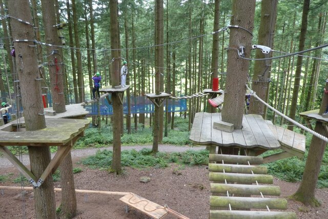
For those seeking outdoor activities, Coed Aberllyn provides a network of well-maintained walking trails, allowing visitors to explore the woodland at their own pace. Whether it's a leisurely stroll or a challenging hike, there is a trail suitable for every level of fitness and experience.

Coed Aberllyn is not only a natural gem but also a place of historical significance. The woodland is believed to have been a vital resource for local communities in the past, providing timber for construction and fuel. Today, it serves as a reminder of the area's rich cultural heritage.

In conclusion, Coed Aberllyn in Caernarfonshire offers a tranquil retreat for nature lovers, boasting a diverse range of flora and fauna. Its well-maintained trails provide an opportunity for exploration and relaxation, making it a must-visit destination for anyone seeking a connection with nature.

If you have any feedback on the listing, please let us know in the comments section below.

Coed Aberllyn Images

Images are sourced within 2km of 53.105087/-3.8059468 or Grid Reference SH7957. Thanks to Geograph Open Source API. All images are credited.

Afon Conwy with viaduct A view of the railway viaduct which crosses the river where it makes a sharp turn to the east. In the background is the steep, eastern margin of the Gwydir Forest by Carreg y Gwalch.
Afon Conwy with viaduct
A view of the railway viaduct which crosses the river where it makes a sharp turn to the east. In the background is the steep, eastern margin of the Gwydir Forest by Carreg y Gwalch.
Conwy Valley sprinter The midday train from Blaenau Ffestiniog to Llandudno crosses the viaduct over the Afon Conwy. Unit number 153333 forms working 2D11 at 1213h.
Conwy Valley sprinter
The midday train from Blaenau Ffestiniog to Llandudno crosses the viaduct over the Afon Conwy. Unit number 153333 forms working 2D11 at 1213h.
Bare ash tree A riverside ash tree has already lost all its leaves.
Bare ash tree
A riverside ash tree has already lost all its leaves.
Shingle bank The shallow, shingle bank on the east side of the Afon Conwy as it heads northward towards Llanrwst. The west bank is steep and forms the edge of the Gwydir forestry.
Shingle bank
The shallow, shingle bank on the east side of the Afon Conwy as it heads northward towards Llanrwst. The west bank is steep and forms the edge of the Gwydir forestry.
Entrance to Hendre-wen Farm
Zip World Fforest The Zip World site near Betws-y-Coed with high ropes course and a forest coaster.
Zip World Fforest
The Zip World site near Betws-y-Coed with high ropes course and a forest coaster.
Forest coaster Part of Zip World near Betws-y-Coed. The Forest Coaster is hauled up two lift sections, before descending by gravity.
Forest coaster
Part of Zip World near Betws-y-Coed. The Forest Coaster is hauled up two lift sections, before descending by gravity.
Disembarkation area of the Forest Coaster The Forest Coaster is one of the attractions at Zip World near Betws-y-Coed.
Disembarkation area of the Forest Coaster
The Forest Coaster is one of the attractions at Zip World near Betws-y-Coed.
Forest Coaster ascent queue Part of Zip World near Betws-y-Coed. The Forest Coaster is hauled up two lift sections, before descending by gravity.
Forest Coaster ascent queue
Part of Zip World near Betws-y-Coed. The Forest Coaster is hauled up two lift sections, before descending by gravity.
Ascending the Forest Coaster Part of Zip World near Betws-y-Coed. The Forest Coaster is hauled up two lift sections, before descending by gravity.
Ascending the Forest Coaster
Part of Zip World near Betws-y-Coed. The Forest Coaster is hauled up two lift sections, before descending by gravity.
Rope hauled ascent of the Alpine Coaster Part of Zip World near Betws-y-Coed. The Forest Coaster is hauled up two lift sections, before descending by gravity.
Rope hauled ascent of the Alpine Coaster
Part of Zip World near Betws-y-Coed. The Forest Coaster is hauled up two lift sections, before descending by gravity.
Alpine coaster ascent section Part of Zip World near Betws-y-Coed. The Forest Coaster is hauled up two lift sections, before descending by gravity.
Alpine coaster ascent section
Part of Zip World near Betws-y-Coed. The Forest Coaster is hauled up two lift sections, before descending by gravity.
Zip World high ropes course One of the attractions at the Zip World site near Betws-y-Coed.
Zip World high ropes course
One of the attractions at the Zip World site near Betws-y-Coed.
Zip wire at Zip World Part of the high ropes course at the Zip World site near Betws-y-Coed.
Zip wire at Zip World
Part of the high ropes course at the Zip World site near Betws-y-Coed.
People on the high ropes course Part of the high ropes course at the Zip World site near Betws-y-Coed.
People on the high ropes course
Part of the high ropes course at the Zip World site near Betws-y-Coed.
Zip wire on the high ropes course Part of the high ropes course at the Zip World site near Betws-y-Coed.
Zip wire on the high ropes course
Part of the high ropes course at the Zip World site near Betws-y-Coed.
Zip world high ropes course Part of the high ropes course at the Zip World site near Betws-y-Coed.
Zip world high ropes course
Part of the high ropes course at the Zip World site near Betws-y-Coed.
High ropes courses Part of the high ropes course at the Zip World site near Betws-y-Coed.
High ropes courses
Part of the high ropes course at the Zip World site near Betws-y-Coed.
Show me another place!

Coed Aberllyn is located at Grid Ref: SH7957 (Lat: 53.105087, Lng: -3.8059468)

Unitary Authority: Conwy

Police Authority: North Wales

What 3 Words

///carpeted.rocker.control. Near Betws-y-Coed, Conwy

Nearby Locations

Coed Aberllyn

Related Wikis

Llyn Parc

Llyn Parc (also known as "Llyn y Parc") is a lake in the Gwydir Forest in North Wales. Lying at a height of 664 feet, it covers an area of 22 acres (89...

Betws-y-Coed

Betws-y-coed (Welsh: [ˈbɛtʊs ə ˈkoːɨ̯d] ; meaning 'prayer-house in the wood') is a village and community in the Conwy valley in Conwy County Borough, Wales...

Betws-y-Coed railway station

Betws-y-coed railway station is on the Conwy Valley Line, which runs between Llandudno and Blaenau Ffestiniog. It is situated 15+1⁄2 miles (24.9 km) south...

St Mary's Church, Betws-y-Coed

St Mary's Church, Betws-y-Coed, is in the village of Betws-y-Coed, Conwy, Wales. It is an active Anglican parish church of the Church in Wales, in the...

Nearby Amenities

Located within 500m of 53.105087,-3.8059468
Source: OS_OpenData_StreetView
Lat/Long: 53.1059544/-3.8088613
Source: OS_OpenData_StreetView
Lat/Long: 53.1068405/-3.8017021
Source: OS_OpenData_StreetView
Lat/Long: 53.1079926/-3.8030228
Source: OS_OpenData_StreetView
Lat/Long: 53.1024306/-3.8043463
Source: OS_OpenData_StreetView
Lat/Long: 53.1025648/-3.8090731
Source: OS_OpenData_StreetView
Lat/Long: 53.1014764/-3.8046151
Source: OS_OpenData_StreetView
Lat/Long: 53.1037284/-3.8035585
Source: OS_OpenData_StreetView
Lat/Long: 53.1025948/-3.8063476
Source: OS_OpenData_StreetView
Lat/Long: 53.1021/-3.805875
Source: OS_OpenData_StreetView
Lat/Long: 53.1009848/-3.8044566
Source: OS_OpenData_StreetView
Lat/Long: 53.1009293/-3.8053415
Source: OS_OpenData_StreetView
Lat/Long: 53.1087307/-3.8037645
Source: OS_OpenData_StreetView
Lat/Long: 53.1034429/-3.8036774
Source: OS_OpenData_StreetView
Lat/Long: 53.107506/-3.8087091
Source: OS_OpenData_StreetView
Lat/Long: 53.1063525/-3.8007646
Source: OS_OpenData_StreetView
Lat/Long: 53.1054331/-3.8095414
Source: OS_OpenData_StreetView
Lat/Long: 53.1074055/-3.8081406
Source: OS_OpenData_StreetView
Lat/Long: 53.1063883/-3.8010606
Source: OS_OpenData_StreetView
Lat/Long: 53.1056551/-3.8093961
Source: OS_OpenData_StreetView
Lat/Long: 53.1011196/-3.8082207
Source: OS_OpenData_StreetView
Lat/Long: 53.1084757/-3.8092963
Source: OS_OpenData_StreetView
Lat/Long: 53.104442/-3.8087886
Source: OS_OpenData_StreetView
Lat/Long: 53.1037526/-3.808427
Source: OS_OpenData_StreetView
Lat/Long: 53.1012001/-3.8058352
Source: OS_OpenData_StreetView
Lat/Long: 53.1011672/-3.8056453
Source: OS_OpenData_StreetView
Lat/Long: 53.1022759/-3.8047711
Source: OS_OpenData_StreetView
Lat/Long: 53.1012782/-3.8044698
Source: OS_OpenData_StreetView
Lat/Long: 53.102087/-3.8100697
Source: OS_OpenData_StreetView
Lat/Long: 53.1065432/-3.8014751
Source: OS_OpenData_StreetView
Lat/Long: 53.1088211/-3.8038258
Source: OS_OpenData_StreetView
Lat/Long: 53.1032051/-3.8035982
Source: OS_OpenData_StreetView
Lat/Long: 53.10085/-3.8050377
Source: OS_OpenData_StreetView
Lat/Long: 53.1071502/-3.8023212
Source: OS_OpenData_StreetView
Lat/Long: 53.1051556/-3.809515
Source: OS_OpenData_StreetView
Lat/Long: 53.102492/-3.8094358
Source: OS_OpenData_StreetView
Lat/Long: 53.1014447/-3.8067019
Source: OS_OpenData_StreetView
Lat/Long: 53.1024333/-3.8058839
Source: OS_OpenData_StreetView
Lat/Long: 53.1014209/-3.8048132
Source: OS_OpenData_StreetView
Lat/Long: 53.1019762/-3.8107119
Source: OS_OpenData_StreetView
Lat/Long: 53.1012227/-3.8049189
Source: OS_OpenData_StreetView
Lat/Long: 53.1074971/-3.8024037
Source: OS_OpenData_StreetView
Lat/Long: 53.1022615/-3.8097131
Source: OS_OpenData_StreetView
Lat/Long: 53.1014022/-3.8078814
Source: OS_OpenData_StreetView
Lat/Long: 53.1009689/-3.8048793
Source: OS_OpenData_StreetView
Lat/Long: 53.102966/-3.8036904
Source: OS_OpenData_StreetView
Lat/Long: 53.1013019/-3.8061604
Source: OS_OpenData_StreetView
Lat/Long: 53.1029805/-3.8070969
Source: OS_OpenData_StreetView
Lat/Long: 53.1033031/-3.8077772
Waterway: waterfall
Lat/Long: 53.1067739/-3.8027553
Man Made: mineshaft
Lat/Long: 53.1073973/-3.8039524
Man Made: mineshaft
Lat/Long: 53.1072706/-3.8038092
Man Made: mineshaft
Lat/Long: 53.1071404/-3.8037101
Man Made: adit
Lat/Long: 53.1066299/-3.8033174
Man Made: mineshaft
Lat/Long: 53.1059879/-3.8032136
Man Made: mineshaft
Lat/Long: 53.1058597/-3.8031081
Man Made: adit
Lat/Long: 53.1063933/-3.8019655
Man Made: adit
Lat/Long: 53.1026529/-3.8022985
Man Made: mineshaft
Lat/Long: 53.1026934/-3.802192
Man Made: mineshaft
Lat/Long: 53.102755/-3.8020051
Man Made: mineshaft
Lat/Long: 53.1026393/-3.8004059
Man Made: mineshaft
Lat/Long: 53.1028264/-3.8018951
Man Made: mineshaft
Lat/Long: 53.102785/-3.8037453
Man Made: adit
Lat/Long: 53.1024977/-3.7998277
Man Made: water_well
Lat/Long: 53.1027397/-3.7997329
Aberllyn Lead Mine
Place: locality
Lat/Long: 53.1034831/-3.8012394
Man Made: adit
Lat/Long: 53.10419/-3.8105168
Man Made: mineshaft
Lat/Long: 53.1041857/-3.8097511
Man Made: mineshaft
Lat/Long: 53.1040387/-3.8098584
Man Made: mineshaft
Lat/Long: 53.1039098/-3.8096209
Man Made: mineshaft
Lat/Long: 53.1035277/-3.8097442
Man Made: mineshaft
Lat/Long: 53.104593/-3.810374
Man Made: adit
Lat/Long: 53.1016776/-3.8088867
Pen-yr-allt Lead Mine
Place: locality
Lat/Long: 53.1018273/-3.8087707
Man Made: adit
Lat/Long: 53.101965/-3.8092384
Man Made: mineshaft
Lat/Long: 53.1020154/-3.8074795
Man Made: mineshaft
Lat/Long: 53.1028262/-3.8041222
Man Made: adit
Lat/Long: 53.1065172/-3.8033794
Man Made: mineshaft
Lat/Long: 53.1061704/-3.8037149
Man Made: mineshaft
Lat/Long: 53.1064286/-3.8033257
Man Made: mineshaft
Lat/Long: 53.1063246/-3.8032625
Man Made: adit
Lat/Long: 53.1034073/-3.8008127
Turning Circle
Lat/Long: 53.102796/-3.8039726
Fixme: there should be a footpath here. There is a gate in the fence to the West but the footpath is then obstructed by a barbed wire fence so you cannot get onto the road. Reported to Conway council.
Lat/Long: 53.1030848/-3.8120051
The data included in this document is from www.openstreetmap.org. The data is made available under ODbL.

Have you been to Coed Aberllyn?

Leave your review of Coed Aberllyn below (or comments, questions and feedback).