Coed Benarth

Wood, Forest in Caernarfonshire

Wales

Coed Benarth

The Carneddau 15 January 2024 In the distance.
Snow had fallen there yesterday but more had come lower overnight. This was timed at 08.29 on a then, dreary, cold, and grey day.
The Carneddau 15 January 2024 Credit: Richard Hoare

Coed Benarth is a historic woodland located in the county of Caernarfonshire, Wales. Nestled in the scenic countryside, it covers an area of approximately 200 hectares and is renowned for its natural beauty and rich biodiversity.

The woodland consists of a mix of deciduous and coniferous trees, including oak, beech, and pine, creating a diverse and picturesque landscape. It is home to a variety of wildlife, including deer, badgers, foxes, and numerous bird species. The tranquil atmosphere and peaceful surroundings make it a popular destination for nature enthusiasts and hikers.

Coed Benarth has a long history, with evidence of human activity dating back to the Neolithic period. It was once part of the expansive estate owned by the local gentry and was managed for timber production. However, today it is primarily a nature reserve, managed by a conservation organization, with a focus on preserving its ecological value and providing a habitat for wildlife.

The woodland offers a network of well-maintained walking trails, allowing visitors to explore its beauty and appreciate the natural wonders it holds. These paths wind through the ancient trees, offering glimpses of hidden ponds, babbling brooks, and breathtaking vistas.

Coed Benarth is not only a sanctuary for nature but also holds cultural significance. It has inspired local artists and writers throughout the years, with its enchanting landscapes and timeless beauty. It remains a cherished destination for those seeking solace in nature and a deeper connection to the natural world.

If you have any feedback on the listing, please let us know in the comments section below.

Coed Benarth Images

Images are sourced within 2km of 53.275634/-3.8180647 or Grid Reference SH7876. Thanks to Geograph Open Source API. All images are credited.

The Carneddau 15 January 2024 In the distance.
Snow had fallen there yesterday but more had come lower overnight. This was timed at 08.29 on a then, dreary, cold, and grey day.
The Carneddau 15 January 2024
In the distance. Snow had fallen there yesterday but more had come lower overnight. This was timed at 08.29 on a then, dreary, cold, and grey day.
Sunset at 20.44 on 24 August 2021
Common thistle In the hedgerow.
Common thistle
In the hedgerow.
The end of an era This 300 year old property described as a former vicarage but of latter times a farmhouse is to be demolished and six town type houses are to be erected.
It seems the cedar tree must come down. A TPO application failed. <a href="https://www.geograph.org.uk/photo/5505933">SH8076 : A cedar tree in Glan Conwy</a>
The end of an era
This 300 year old property described as a former vicarage but of latter times a farmhouse is to be demolished and six town type houses are to be erected. It seems the cedar tree must come down. A TPO application failed. SH8076 : A cedar tree in Glan Conwy
Ty Mawr from above the new graveyard Regrettably the farmhouse site is becoming a 'graveyard' itself.
This 300 year old property described as a former vicarage but of latter times a farmhouse is to be demolished and six town type houses are to be erected.
It seems the cedar tree must come down. A TPO application failed. <a href="https://www.geograph.org.uk/photo/5505933">SH8076 : A cedar tree in Glan Conwy</a>
Ty Mawr from above the new graveyard
Regrettably the farmhouse site is becoming a 'graveyard' itself. This 300 year old property described as a former vicarage but of latter times a farmhouse is to be demolished and six town type houses are to be erected. It seems the cedar tree must come down. A TPO application failed. SH8076 : A cedar tree in Glan Conwy
Church Street, Glan Conwy, October 2021 We are left with one shop - the Caffi Llan which opens as well for newspapers, bread and dairy products Monday - Saturday mornings.
There is a hairdressers at the end of the street on the left. A takeaway on the right. On the A470 ahead and to the right is the Cross Keys pub and a Post Office which opens for just a couple of hours a week.
In the distance is a new development of residential properties on the site of the Conwy Vale pub. Some feel the sight of the river etc has been lost, which is true to an extent. Interestingly the new properties are virtually the same height of the former pub.
See <a href="https://www.geograph.org.uk/photo/3049934">SH8076 : The Retreat Restaurant (now closed) Church Street 2012</a> taken in 2012.
Church Street, Glan Conwy, October 2021
We are left with one shop - the Caffi Llan which opens as well for newspapers, bread and dairy products Monday - Saturday mornings. There is a hairdressers at the end of the street on the left. A takeaway on the right. On the A470 ahead and to the right is the Cross Keys pub and a Post Office which opens for just a couple of hours a week. In the distance is a new development of residential properties on the site of the Conwy Vale pub. Some feel the sight of the river etc has been lost, which is true to an extent. Interestingly the new properties are virtually the same height of the former pub. See SH8076 : The Retreat Restaurant (now closed) Church Street 2012 taken in 2012.
Demolition of Ty Mawr farmhouse Regrettably the farmhouse site is becoming a 'graveyard' itself.
This 300 year old property described as a former vicarage but of latter times a farmhouse is to be demolished and six town type houses are to be erected.
It seems the cedar tree to the left must come down. A TPO application failed. <a href="https://www.geograph.org.uk/photo/5505933">SH8076 : A cedar tree in Glan Conwy</a>
Demolition of Ty Mawr farmhouse
Regrettably the farmhouse site is becoming a 'graveyard' itself. This 300 year old property described as a former vicarage but of latter times a farmhouse is to be demolished and six town type houses are to be erected. It seems the cedar tree to the left must come down. A TPO application failed. SH8076 : A cedar tree in Glan Conwy
Demolition of Ty Mawr farmhouse viewed from above the old graveyard From above the old graveyard and showing Ysgol Glan Conwy.
Regrettably the farmhouse site is becoming a 'graveyard' itself.
This 300 year old property described as a former vicarage but of latter times a farmhouse is to be demolished and six town type houses are to be erected.
It seems the cedar tree must come down. A TPO application failed. <a href="https://www.geograph.org.uk/photo/5505933">SH8076 : A cedar tree in Glan Conwy</a>
Demolition of Ty Mawr farmhouse viewed from above the old graveyard
From above the old graveyard and showing Ysgol Glan Conwy. Regrettably the farmhouse site is becoming a 'graveyard' itself. This 300 year old property described as a former vicarage but of latter times a farmhouse is to be demolished and six town type houses are to be erected. It seems the cedar tree must come down. A TPO application failed. SH8076 : A cedar tree in Glan Conwy
A little more of Ty Mawr farmhouse has gone This 300 year old property described as a former vicarage but in latter times a farmhouse is to be demolished and six town type houses are to be erected.
It seems the cedar tree to the right and off screen must come down. A TPO application failed. <a href="https://www.geograph.org.uk/photo/5505933">SH8076 : A cedar tree in Glan Conwy</a>
A little more of Ty Mawr farmhouse has gone
This 300 year old property described as a former vicarage but in latter times a farmhouse is to be demolished and six town type houses are to be erected. It seems the cedar tree to the right and off screen must come down. A TPO application failed. SH8076 : A cedar tree in Glan Conwy
Late flowering misshapen sunflower These appeared a few days ago. They are misshapen. Prior to, it looked like snails had collected at the top of the stem. Very tight dark buds.
Late flowering misshapen sunflower
These appeared a few days ago. They are misshapen. Prior to, it looked like snails had collected at the top of the stem. Very tight dark buds.
The end is nigh for Ty Mawr farmhouse This 300 year old property described as a former vicarage but in latter times a farmhouse is to be demolished and six town type houses are to be erected.
The end is nigh for Ty Mawr farmhouse
This 300 year old property described as a former vicarage but in latter times a farmhouse is to be demolished and six town type houses are to be erected.
The trunk of the cedar tree at Ty Mawr The age of the tree is not known for certain.
However a TPO failed and work has stopped as there is some suggestion a sculpture might be undertaken.
The trunk of the cedar tree at Ty Mawr
The age of the tree is not known for certain. However a TPO failed and work has stopped as there is some suggestion a sculpture might be undertaken.
The first of the walls have gone This 300 year old property described as a former vicarage but in latter times a farmhouse is to be demolished and six town type houses are to be erected.
The first of the walls have gone
This 300 year old property described as a former vicarage but in latter times a farmhouse is to be demolished and six town type houses are to be erected.
It's looking sorry for itself This 300 year old property described as a former vicarage but in latter times a farmhouse is to be demolished and six town type houses are to be erected.
It's looking sorry for itself
This 300 year old property described as a former vicarage but in latter times a farmhouse is to be demolished and six town type houses are to be erected.
At least the greenhouse is still intact This 300 year old property described as a former vicarage but in latter times a farmhouse is to be demolished and six town type houses are to be erected.
A villager has tended this part of the garden for many years and produced some wonderful vegetable crops. Not for much longer though.
At least the greenhouse is still intact
This 300 year old property described as a former vicarage but in latter times a farmhouse is to be demolished and six town type houses are to be erected. A villager has tended this part of the garden for many years and produced some wonderful vegetable crops. Not for much longer though.
Remembrance wreath Hand knitted poppies by the villagers which the local young school children have used to create a wreath.
Remembrance wreath
Hand knitted poppies by the villagers which the local young school children have used to create a wreath.
Road works scheme to be done shortly On A470.
See <a href="https://www.geograph.org.uk/photo/7017649">SH8076 : Road roller Hammtronic HD+90i</a>
Bet no-one is going to hold them to the parking restrictions that apply to the lay-by.
Interestingly the actual scheme was a strip of about the length and a bit of the orange machine and possibly twice its width, accounting for half the A470.
Road works scheme to be done shortly
On A470. See SH8076 : Road roller Hammtronic HD+90i Bet no-one is going to hold them to the parking restrictions that apply to the lay-by. Interestingly the actual scheme was a strip of about the length and a bit of the orange machine and possibly twice its width, accounting for half the A470.
Road roller Hammtronic HD+90i Road work on A470 due shortly.
Bet no-one is going to hold it to the parking restrictions that apply to the lay-by. Might be interesting to tow away or vehicle lift.
Road roller Hammtronic HD+90i
Road work on A470 due shortly. Bet no-one is going to hold it to the parking restrictions that apply to the lay-by. Might be interesting to tow away or vehicle lift.
Show me another place!

Coed Benarth is located at Grid Ref: SH7876 (Lat: 53.275634, Lng: -3.8180647)

Unitary Authority: Conwy

Police Authority: North Wales

What 3 Words

///insulated.expand.froth. Near Conwy

Related Wikis

Afon Gyffin

The Afon Gyffin ("River Gyffin") is a river in Conwy County Borough. == Geography == The river runs into the River Conwy close to Conwy Castle. An area...

Conwy Railway Bridge

The Conwy Railway Bridge carries the North Wales coast railway line across the River Conwy between Llandudno Junction and the town of Conwy. The wrought...
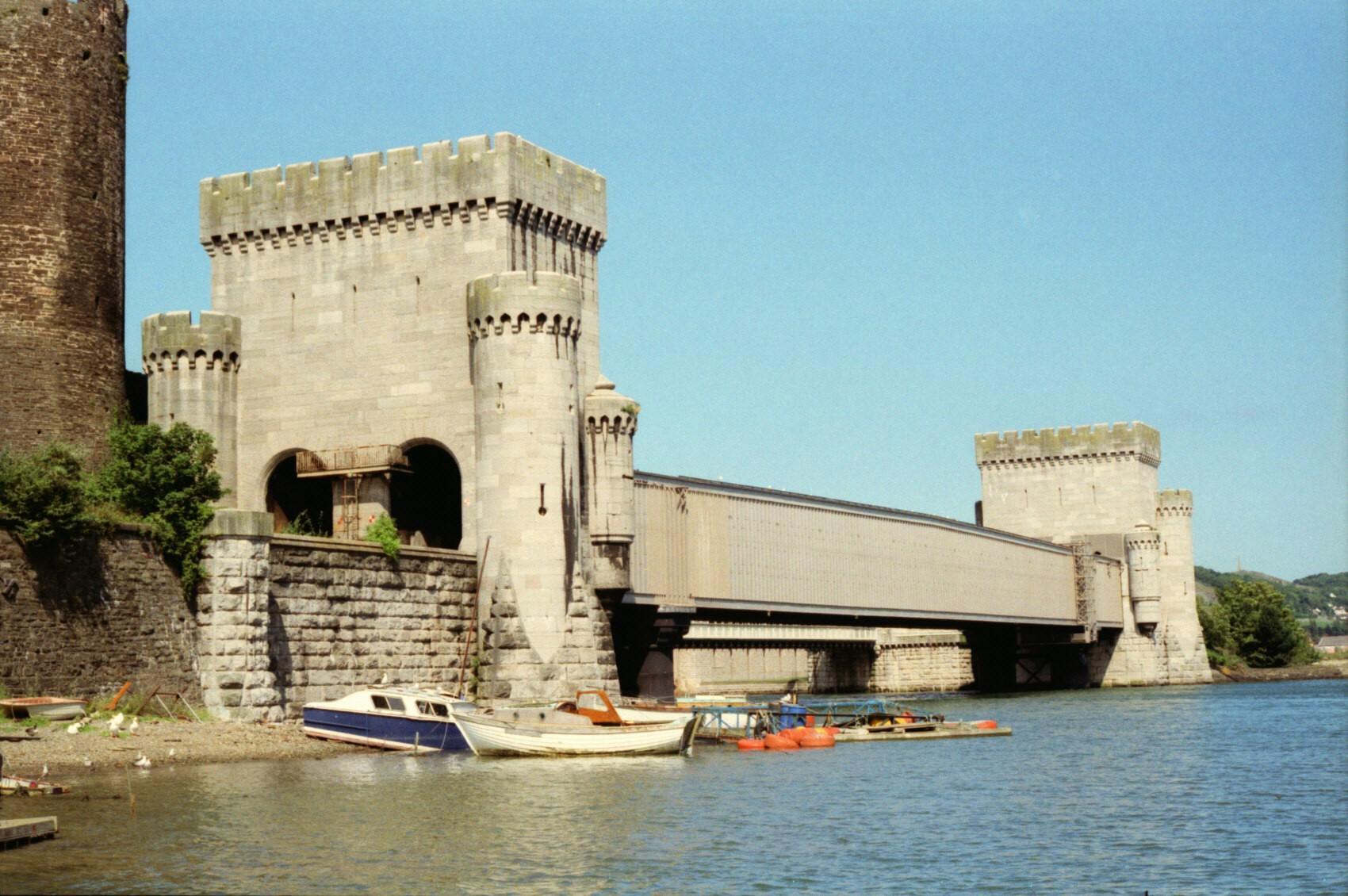
Conwy Castle

Conwy Castle (Welsh: Castell Conwy; Welsh pronunciation: [kastɛɬ 'kɔnwɨ̞]) is a fortification in Conwy, located in North Wales. It was built by Edward...

Conwy Guildhall

Conwy Guildhall (Welsh: Neuadd y Dref Conwy) is a municipal structure in Rose Hill Street, Conwy, Wales. The guildhall, which is the meeting place of...

Nearby Amenities

Located within 500m of 53.275634,-3.8180647
Created By: almien_coastlines
Source: PGS
Lat/Long: 53.271578/-3.814923
Source: PGS
Lat/Long: 53.2723701/-3.8154456
Created By: almien_coastlines
Source: PGS
Lat/Long: 53.273621/-3.815817
Source: PGS
Lat/Long: 53.2739433/-3.8158045
Source: PGS
Lat/Long: 53.274495/-3.8159246
Source: PGS
Lat/Long: 53.2751494/-3.8158855
Source: PGS
Lat/Long: 53.275579/-3.8159043
Source: PGS
Lat/Long: 53.2761538/-3.8158479
Source: PGS
Lat/Long: 53.2768053/-3.8163844
Source: PGS
Lat/Long: 53.2770375/-3.8168228
Source: PGS
Lat/Long: 53.2773929/-3.8179782
Source: PGS
Lat/Long: 53.2774686/-3.8182912
Source: PGS
Lat/Long: 53.2776929/-3.8211369
Source: PGS
Lat/Long: 53.2777328/-3.8212466
Source: PGS
Lat/Long: 53.2784613/-3.8225153
Source: PGS
Lat/Long: 53.2786331/-3.8230971
Direction: S
Generator Method: photovoltaic
Generator Output Electricity: yes
Generator Solar Modules: 16
Generator Source: solar
Generator Type: solar_photovoltaic_panel
Location: roof
Power: generator
Lat/Long: 53.2736978/-3.8189614
The data included in this document is from www.openstreetmap.org. The data is made available under ODbL.

Have you been to Coed Benarth?

Leave your review of Coed Benarth below (or comments, questions and feedback).