Coed Ffrith Siân

Wood, Forest in Caernarfonshire

Wales

Coed Ffrith Siân

Afon Conwy with reeds A shallow part of the river with small islands of reeds showing fabulous colour against dark water.
Afon Conwy with reeds Credit: Jonathan Wilkins

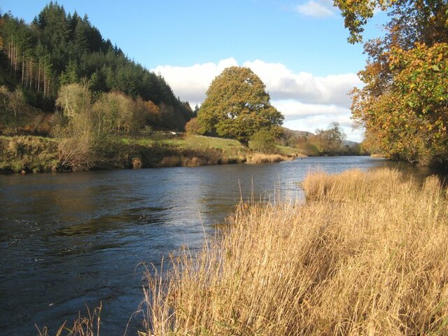
Coed Ffrith Siân, located in Caernarfonshire, Wales, is a picturesque woodland area that covers approximately 200 acres. The forest is nestled within the stunning Snowdonia National Park, offering visitors a tranquil and scenic escape from the hustle and bustle of everyday life.

The woodland is primarily composed of native tree species such as oak, birch, and rowan, creating a diverse and vibrant ecosystem. These trees provide a habitat for various wildlife species, including birds, mammals, and insects, making it a popular spot for nature enthusiasts and birdwatchers.

A network of well-maintained trails weaves through the forest, allowing visitors to explore the area at their own pace. These paths range from gentle strolls to more challenging hikes, catering to a range of fitness levels. Along the way, hikers are treated to breathtaking views of the surrounding mountains and valleys.

Coed Ffrith Siân also boasts a diverse range of flora, with carpets of bluebells and wild garlic creating a stunning display in the springtime. The forest changes with the seasons, with autumn bringing vibrant hues of red, orange, and yellow as the leaves change color.

Visitors to Coed Ffrith Siân can enjoy a range of activities, including picnicking, wildlife spotting, and photography. The forest is also a popular destination for educational visits, with local schools often organizing trips to teach students about the importance of conservation and the natural world.

Overall, Coed Ffrith Siân offers a serene and immersive woodland experience, showcasing the beauty and biodiversity of Caernarfonshire's natural landscape.

If you have any feedback on the listing, please let us know in the comments section below.

Coed Ffrith Siân Images

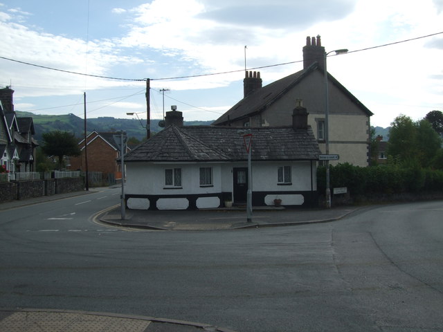
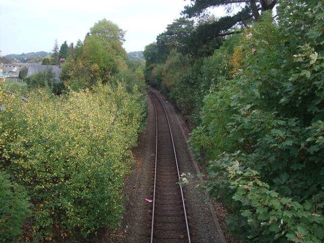
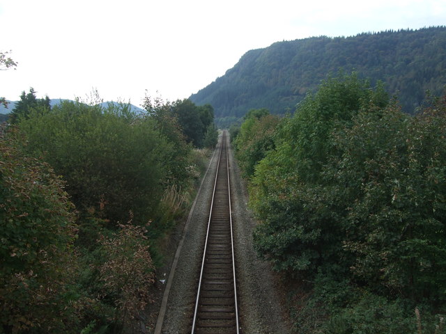
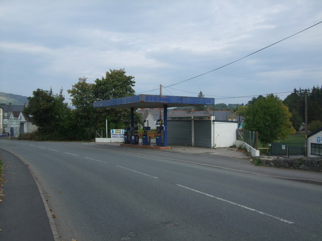
Images are sourced within 2km of 53.134751/-3.8168032 or Grid Reference SH7861. Thanks to Geograph Open Source API. All images are credited.

Afon Conwy with reeds A shallow part of the river with small islands of reeds showing fabulous colour against dark water.
Afon Conwy with reeds
A shallow part of the river with small islands of reeds showing fabulous colour against dark water.
Shoring-up the railway Makeshift repair for a washed-out section of river bank by Afon Nant y Goron.
Shoring-up the railway
Makeshift repair for a washed-out section of river bank by Afon Nant y Goron.
Flood defence In a number of places the Conwy Valley railway line has become a de-facto flood defence, which would be fine if it was designed to be so. In recent years, repeated flooding has overwhelmed the low railway embankment leading to washed-out formation. The solution has been to armour the sides of the bank where it is vulnerable, then if it is over-topped the rocks will prevent the washing-away of the ballast and railway formation. Here there is also an accommodation bridge which doubles as a flood-relief drain.
Flood defence
In a number of places the Conwy Valley railway line has become a de-facto flood defence, which would be fine if it was designed to be so. In recent years, repeated flooding has overwhelmed the low railway embankment leading to washed-out formation. The solution has been to armour the sides of the bank where it is vulnerable, then if it is over-topped the rocks will prevent the washing-away of the ballast and railway formation. Here there is also an accommodation bridge which doubles as a flood-relief drain.
View of Llanrwst
View of Llanrwst
Stile on the pathway of River Conwy at Llanrwst Viewed facing south this time. For a northerly aspect see <a href="https://www.geograph.org.uk/photo/1483380">SH8060 : Stile or no stile Llanrwst</a>
Stile on the pathway of River Conwy at Llanrwst
Viewed facing south this time. For a northerly aspect see SH8060 : Stile or no stile Llanrwst
An old schoolhouse Llanrwst A Grade II listed building - CADW source ID 3625.
Known as the Schoolmasters house.
Built 1896-97 with Grierson and Bellis as architects of Bangor. Illustrated with minor differences of detail in Building News, June 26 1896.
An old schoolhouse Llanrwst
A Grade II listed building - CADW source ID 3625. Known as the Schoolmasters house. Built 1896-97 with Grierson and Bellis as architects of Bangor. Illustrated with minor differences of detail in Building News, June 26 1896.
The Old School in Llanrwst A Grade II listed building. Granted 1993 by CADW. Source ID 3596.
Original plans in County Record Office, Ruthin dated 1844; built 1846. Architect Henry Kennedy.
Jacobethan style school. Central block with crosswings, formerly housing schoolrooms for 120 girls and 120 boys, with classroom between.
The Old School in Llanrwst
A Grade II listed building. Granted 1993 by CADW. Source ID 3596. Original plans in County Record Office, Ruthin dated 1844; built 1846. Architect Henry Kennedy. Jacobethan style school. Central block with crosswings, formerly housing schoolrooms for 120 girls and 120 boys, with classroom between.
Birmingham Garage Llanrwst On the A470.
Birmingham Garage Llanrwst
On the A470.
An old toll house on A470 Early 19th century toll house now a private dwelling.
Grade II listed - CADW source 3585.
An old toll house on A470
Early 19th century toll house now a private dwelling. Grade II listed - CADW source 3585.
Railway line from Llanrwst looking north This picturesque line goes from Llandudno Junction to Blaenau Ffestiniog following the Conwy Valley. Standing room only this morning - must be the good weather. For south south west view see <a href="https://www.geograph.org.uk/photo/2626608">SH8061 : Railway line to Betws-y-Coed from A470 at Llanrwst</a>
Railway line from Llanrwst looking north
This picturesque line goes from Llandudno Junction to Blaenau Ffestiniog following the Conwy Valley. Standing room only this morning - must be the good weather. For south south west view see SH8061 : Railway line to Betws-y-Coed from A470 at Llanrwst
Railway line to Betws-y-Coed from A470 at Llanrwst This picturesque line goes from Llandudno Junction to Blaenau Ffestiniog following the Conwy Valley. Standing room only this morning - must be the good weather. For northwards view see 
<a href="https://www.geograph.org.uk/photo/2626604">SH8061 : Railway line from Llanrwst looking north</a>
Railway line to Betws-y-Coed from A470 at Llanrwst
This picturesque line goes from Llandudno Junction to Blaenau Ffestiniog following the Conwy Valley. Standing room only this morning - must be the good weather. For northwards view see SH8061 : Railway line from Llanrwst looking north
Redundant petrol forecourt A470 Llanrwst This forecourt has been closed for many years although the garage repair shops are still in use behind.
Redundant petrol forecourt A470 Llanrwst
This forecourt has been closed for many years although the garage repair shops are still in use behind.
Tin Chapel A humble and honourable place of worship.
Tin Chapel
A humble and honourable place of worship.
Cutmark on railway bridge Denbigh Street Llanrwst Waypoint: BM2446
Cutmark on railway bridge Denbigh Street Llanrwst
Waypoint: BM2446
Terraced properties on Denbigh Street I recall our daughters visiting one of the properties when it was a sweet shop (possibly the equivalent of a tuck shop) on their way to and from school <a href="https://www.geograph.org.uk/photo/3130716">SH7961 : The former Ysgol Dyffryn Conwy</a> which was just around the corner. Of recent years the property with the grey door was home to a grooming parlour for dogs and frequented by Geographers dog for her 'shampoo, set and pedicure'.
Terraced properties on Denbigh Street
I recall our daughters visiting one of the properties when it was a sweet shop (possibly the equivalent of a tuck shop) on their way to and from school SH7961 : The former Ysgol Dyffryn Conwy which was just around the corner. Of recent years the property with the grey door was home to a grooming parlour for dogs and frequented by Geographers dog for her 'shampoo, set and pedicure'.
'I'll walk the line' ''I keep a close watch on this heart of mine
I keep my eyes wide open all the time
I keep the ends out for the tie that binds
Because you're mine, I walk the line''

“No animals were harmed in the making of this picture''. Nor was the 12.19 delayed.
'I'll walk the line'
''I keep a close watch on this heart of mine I keep my eyes wide open all the time I keep the ends out for the tie that binds Because you're mine, I walk the line'' “No animals were harmed in the making of this picture''. Nor was the 12.19 delayed.
A grey commemorative plaque Anyone old enough to dispute the facts?
A grey commemorative plaque
Anyone old enough to dispute the facts?
A semi redundant pink drainpipe No need to clean the windows either it seems.
A semi redundant pink drainpipe
No need to clean the windows either it seems.
Show me another place!

Coed Ffrith Siân is located at Grid Ref: SH7861 (Lat: 53.134751, Lng: -3.8168032)

Unitary Authority: Conwy

Police Authority: North Wales

What 3 Words

///analogy.pegs.zapped. Near Llanrwst, Conwy

Related Wikis

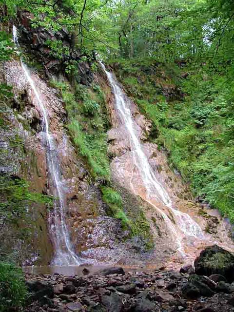
Grey Mare's Tail, Conwy

The Grey Mare's Tail (Welsh: Rhaeadr y Parc Mawr) is a waterfall on the very edge of the Snowdonia National Park near Gwydir Castle in Conwy County Borough...
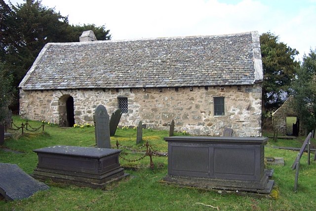
Llanrhychwyn

Llanrhychwyn is a hamlet in Conwy county borough, Wales. It lies in the Conwy valley, less than a mile south of Trefriw, and a mile north-west of Llanrwst...
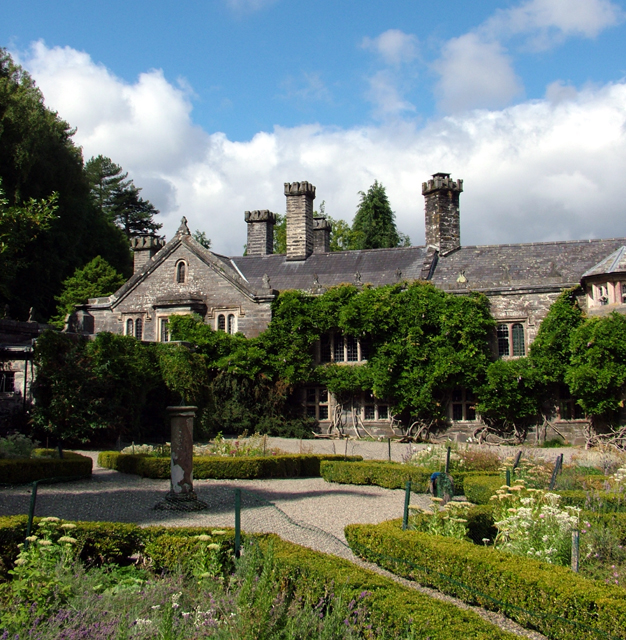
Gwydir Castle

Gwydir Castle is situated in the Conwy valley, Wales, a mile to the west of the ancient market town of Llanrwst and 1.5 miles (2.4 km) to the south of...
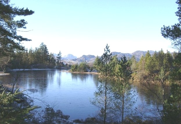
Gwydir Forest

Gwydir Forest, also spelled Gwydyr, is located in Conwy county borough and the Snowdonia National Park in Wales. It takes its name from the ancient Gwydir...

Nearby Amenities

Located within 500m of 53.134751,-3.8168032
Waterway: weir
Lat/Long: 53.133411/-3.8099348
Source: OS_OpenData_StreetView
Lat/Long: 53.1353058/-3.820134
Source: OS_OpenData_StreetView
Lat/Long: 53.1349493/-3.8192623
Source: OS_OpenData_StreetView
Lat/Long: 53.1359793/-3.8217981
Source: OS_OpenData_StreetView
Lat/Long: 53.1323899/-3.8160265
Source: OS_OpenData_StreetView
Lat/Long: 53.1317164/-3.8163567
Source: OS_OpenData_StreetView
Lat/Long: 53.1356544/-3.8212038
Source: OS_OpenData_StreetView
Lat/Long: 53.1312475/-3.8213113
Source: OS_OpenData_StreetView
Lat/Long: 53.1366019/-3.8223219
Source: OS_OpenData_StreetView
Lat/Long: 53.1338954/-3.8177435
Source: OS_OpenData_StreetView
Lat/Long: 53.1305357/-3.8163831
Source: OS_OpenData_StreetView
Lat/Long: 53.1335389/-3.8170567
Source: OS_OpenData_StreetView
Lat/Long: 53.1313202/-3.8162114
Source: OS_OpenData_StreetView
Lat/Long: 53.1330951/-3.8165944
Source: OS_OpenData_StreetView
Lat/Long: 53.1367295/-3.8225783
Power: pole
Lat/Long: 53.1381285/-3.8132457
Barrier: stile
Material: wood
Source: survey;gps
Stile: ladder
Lat/Long: 53.1373786/-3.8154783
Barrier: stile
Material: wood
Source: survey;gps
Stile: ladder
Lat/Long: 53.1373689/-3.8157615
Ford: yes
Lat/Long: 53.1372142/-3.8158873
Barrier: stile
Material: wood
Source: survey;gps
Stile: ladder
Lat/Long: 53.1366561/-3.8126392
Rhaeadr y Parc Mawr
Name Cy: Rhaeadr y Parc Mawr
Name En: The Grey Mare’s Tail
Url: https://www.welshslatewaterfeatures.co.uk/rheadr-y-parc-mawr/
Waterway: waterfall
Lat/Long: 53.1328765/-3.8106308
Power: pole
Lat/Long: 53.1379706/-3.814663
Power: pole
Lat/Long: 53.1374254/-3.8149313
Power: pole
Lat/Long: 53.1371886/-3.8139142
Power: pole
Lat/Long: 53.1377377/-3.8137822
Power: pole
Lat/Long: 53.1372439/-3.8155891
Power: pole
Lat/Long: 53.1360597/-3.8129528
Power: pole
Lat/Long: 53.1365489/-3.8133686
Power: pole
Lat/Long: 53.1359019/-3.8128068
Power: pole
Lat/Long: 53.1356135/-3.8135788
Power: pole
Lat/Long: 53.1356731/-3.8124558
Power: pole
Lat/Long: 53.1353042/-3.8143779
Man Made: mineshaft
Lat/Long: 53.1375835/-3.8164203
Man Made: mineshaft
Lat/Long: 53.1376236/-3.8167549
Man Made: mineshaft
Lat/Long: 53.1377265/-3.8164538
Man Made: mineshaft
Lat/Long: 53.1380075/-3.8160355
Man Made: mineshaft
Lat/Long: 53.1381982/-3.8160355
The data included in this document is from www.openstreetmap.org. The data is made available under ODbL.

Have you been to Coed Ffrith Siân?

Leave your review of Coed Ffrith Siân below (or comments, questions and feedback).