Bodlondeb Wood

Wood, Forest in Caernarfonshire

Wales

Bodlondeb Wood

Agapanthus (African Lily) A South African perennial plant, resplendent at the entrance to the castle car park.
Agapanthus (African Lily) Credit: Richard Hoare

Bodlondeb Wood is a picturesque forest located in Caernarfonshire, Wales. Covering an area of approximately 100 hectares, the wood is renowned for its natural beauty and diverse range of flora and fauna.

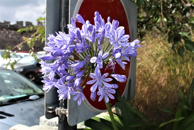
The wood is predominantly composed of native broadleaf trees, such as oak, birch, and beech, which provide a lush and vibrant canopy throughout the year. The forest floor is adorned with a carpet of wildflowers, including bluebells, primroses, and wood anemones, creating a colorful spectacle during the spring months.

Bodlondeb Wood is home to a rich variety of wildlife. Birds such as woodpeckers, thrushes, and owls can be spotted among the treetops, while small mammals like squirrels, badgers, and foxes inhabit the undergrowth. The wood also supports a diverse insect population, including butterflies and beetles, which thrive in the diverse range of habitats within the forest.

The wood offers numerous walking trails and paths, allowing visitors to explore its beauty at their own pace. These trails lead through ancient woodlands, across babbling brooks, and up gentle slopes, offering stunning views of the surrounding countryside. The wood is particularly popular with nature enthusiasts, hikers, and families looking to enjoy a peaceful day out in nature.

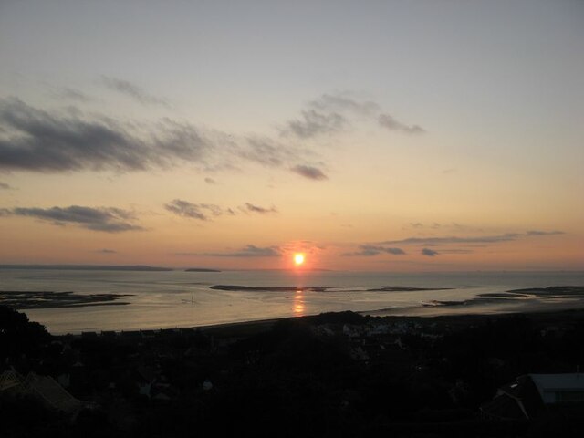
Bodlondeb Wood is easily accessible, located just a short distance from the town of Caernarfon. Its tranquil atmosphere and natural splendor make it a must-visit destination for anyone seeking solace in the beauty of the Welsh countryside.

If you have any feedback on the listing, please let us know in the comments section below.

Bodlondeb Wood Images

Images are sourced within 2km of 53.28567/-3.8336726 or Grid Reference SH7778. Thanks to Geograph Open Source API. All images are credited.

Agapanthus (African Lily) A South African perennial plant, resplendent at the entrance to the castle car park.
Agapanthus (African Lily)
A South African perennial plant, resplendent at the entrance to the castle car park.
Conwy Bay sunset A fine, clear sky for the first time in a couple of weeks made for a spectacular solar descent into terrain - and a reminder just how far the year  has advanced.
Conwy Bay sunset
A fine, clear sky for the first time in a couple of weeks made for a spectacular solar descent into terrain - and a reminder just how far the year has advanced.
Spring tide view A view of the Afon Conwy at a spring low tide. After weeks of drizzle and gloom it was a joy to be out in the evening sun. Low spring tides are always at around 1800h UTC, so a fine start or end to the day is required for such a trip.
Spring tide view
A view of the Afon Conwy at a spring low tide. After weeks of drizzle and gloom it was a joy to be out in the evening sun. Low spring tides are always at around 1800h UTC, so a fine start or end to the day is required for such a trip.
Channel marker buoy There is something alarming about finding a channel marker buoy aground at low tide, but then the map extract does not indicate dry land here anyway! The height of the dune bedding here gives some idea of water depth and the speed of the ebbing tide. I was surprised to find that all of my spaniel assistants and their house-guests are somewhere in this image.
Channel marker buoy
There is something alarming about finding a channel marker buoy aground at low tide, but then the map extract does not indicate dry land here anyway! The height of the dune bedding here gives some idea of water depth and the speed of the ebbing tide. I was surprised to find that all of my spaniel assistants and their house-guests are somewhere in this image.
Spring tide sandbanks A spring tide gives an opportunity to view at close quarters the new sandbank which is growing on the west side of the Conwy estuary. Over the past year it has become obvious that the tidal flow in the river is changing, and the channel now veers eastwards to the north of Bodlondeb Point around this large, new sandbank with its active dune field, while those on the Deganwy side have been bisected by a new channel and largely removed. See <a href="https://www.geograph.org.uk/photo/6450571">SH7878 : Drying moorings</a> for an excursion no longer possible!
Spring tide sandbanks
A spring tide gives an opportunity to view at close quarters the new sandbank which is growing on the west side of the Conwy estuary. Over the past year it has become obvious that the tidal flow in the river is changing, and the channel now veers eastwards to the north of Bodlondeb Point around this large, new sandbank with its active dune field, while those on the Deganwy side have been bisected by a new channel and largely removed. See SH7878 : Drying moorings for an excursion no longer possible!
Sandbanks with dunes The speed and power of the ebb tide can be appreciated from the size of the sand dunes which make up the new ground exposed at low tide on the west side of the estuary. While somewhat sinuous, the dunes all face northward. I have long questioned whether the flood tide creates features which face south, as might be expected? I loved the perfect tracks of a sea birds which have walked along the smooth edge of the dunes.
Sandbanks with dunes
The speed and power of the ebb tide can be appreciated from the size of the sand dunes which make up the new ground exposed at low tide on the west side of the estuary. While somewhat sinuous, the dunes all face northward. I have long questioned whether the flood tide creates features which face south, as might be expected? I loved the perfect tracks of a sea birds which have walked along the smooth edge of the dunes.
Sychnant Pass Road towards Conwy
Horses at Tyrau-Duon
Sychnant Pass Road towards Conwy
Sheep at Mount Pleasant, Conwy
Sychnant Pass Road at Conwy
Conwy town walls The walls were built during the reign of Edward I of England, between 1283 and 1289.
Conwy town walls
The walls were built during the reign of Edward I of England, between 1283 and 1289.
Upper Gate and town walls at Conwy The walls were built during the reign of Edward I of England, between 1283 and 1289.
Upper Gate and town walls at Conwy
The walls were built during the reign of Edward I of England, between 1283 and 1289.
Upper Gate Street in Conwy
Roger Hosking M.A. 1925 - 2013 at Llandudno Junction In the background the preserved class 47 diesel locomotive D1935, Roger Hosking M.A. 1925 - 2013, with the Statesman train due to depart for Carlisle via Chester and the Settle Viaduct.
This was a circular tour starting at Bangor.
Unfortunately this was a chance photograph and it was not known at the time whether it was headed by a steam locomotive. In the event as was seen later it was diesel hauled throughout.
For a closer view see <a href="https://www.geograph.org.uk/photo/6947993">SH7977 : Class 47 diesel locomotive Roger Hosking M.A. 1925 - 2013</a>
Roger Hosking M.A. 1925 - 2013 at Llandudno Junction
In the background the preserved class 47 diesel locomotive D1935, Roger Hosking M.A. 1925 - 2013, with the Statesman train due to depart for Carlisle via Chester and the Settle Viaduct. This was a circular tour starting at Bangor. Unfortunately this was a chance photograph and it was not known at the time whether it was headed by a steam locomotive. In the event as was seen later it was diesel hauled throughout. For a closer view see SH7977 : Class 47 diesel locomotive Roger Hosking M.A. 1925 - 2013
Class 47 diesel locomotive Roger Hosking M.A. 1925 - 2013 A closer view of the preserved class 47 diesel locomotive D1935, Roger Hosking M.A. 1925 - 2013, with the Statesman train due to depart for Carlisle via Chester and the Settle Viaduct. See <a href="https://www.geograph.org.uk/photo/6947965">SH7977 : Roger Hosking M.A. 1925 - 2013 at Llandudno Junction</a>
This was a circular tour starting at Bangor.
Unfortunately this was a chance photograph and it was not known at the time whether it was headed by a steam locomotive. In the event as was seen later it was diesel hauled throughout.
Class 47 diesel locomotive Roger Hosking M.A. 1925 - 2013
A closer view of the preserved class 47 diesel locomotive D1935, Roger Hosking M.A. 1925 - 2013, with the Statesman train due to depart for Carlisle via Chester and the Settle Viaduct. See SH7977 : Roger Hosking M.A. 1925 - 2013 at Llandudno Junction This was a circular tour starting at Bangor. Unfortunately this was a chance photograph and it was not known at the time whether it was headed by a steam locomotive. In the event as was seen later it was diesel hauled throughout.
Roger Hosking M.A.  1925 - 2013 returns from Carlisle A closer view of the preserved class 47 diesel locomotive D1935, Roger Hosking M.A. 1925 - 2013, with the Statesman train on its return from Carlisle via Chester and the Settle Viaduct. It was just a few minutes late on arrival but left promptly to catch up time. See <a href="https://www.geograph.org.uk/photo/6947965">SH7977 : Roger Hosking M.A. 1925 - 2013 at Llandudno Junction</a>
This was a circular tour starting at Bangor and diesel hauled throughout.
Roger Hosking M.A. 1925 - 2013 returns from Carlisle
A closer view of the preserved class 47 diesel locomotive D1935, Roger Hosking M.A. 1925 - 2013, with the Statesman train on its return from Carlisle via Chester and the Settle Viaduct. It was just a few minutes late on arrival but left promptly to catch up time. See SH7977 : Roger Hosking M.A. 1925 - 2013 at Llandudno Junction This was a circular tour starting at Bangor and diesel hauled throughout.
Roger Hosking M.A. 1925 - 2013 sets off for Bangor A closer view of the preserved class 47 diesel locomotive D1935, Roger Hosking M.A. 1925 - 2013, with the Statesman train on its return from Carlisle via Chester and the Settle Viaduct. It was just a few minutes late on arrival but left promptly to catch up time. See <a href="https://www.geograph.org.uk/photo/6947965">SH7977 : Roger Hosking M.A. 1925 - 2013 at Llandudno Junction</a>
This was a circular tour starting at Bangor and diesel hauled throughout.
Roger Hosking M.A. 1925 - 2013 sets off for Bangor
A closer view of the preserved class 47 diesel locomotive D1935, Roger Hosking M.A. 1925 - 2013, with the Statesman train on its return from Carlisle via Chester and the Settle Viaduct. It was just a few minutes late on arrival but left promptly to catch up time. See SH7977 : Roger Hosking M.A. 1925 - 2013 at Llandudno Junction This was a circular tour starting at Bangor and diesel hauled throughout.
Show me another place!

Bodlondeb Wood is located at Grid Ref: SH7778 (Lat: 53.28567, Lng: -3.8336726)

Unitary Authority: Conwy

Police Authority: North Wales

What 3 Words

///outfitter.qualifier.switched. Near Conwy

Nearby Locations

Bodlondeb Wood

Related Wikis

Bodlondeb Woods

Boldondeb Woods is a woodland local nature reserve in Conwy, Wales. Located on the western shore of the Conwy estuary, the woodland is a mix of coniferous...

District of Aberconwy

The Borough of Aberconwy was a local government district with borough status from 1974 to 1996, being one of five districts in the county of Gwynedd, north...

Ysgol Aberconwy

Ysgol Aberconwy is a medium-sized, mixed comprehensive school for ages 11 to 18, on the Conwy estuary on the North Wales coast. The school is two minutes...

Smallest House in Great Britain

The Smallest House in Great Britain (Welsh: Y Tŷ Lleiaf ym Mhrydain Fawr), also known as the Quay House, is a tourist attraction on the quay in Conwy,...

Nearby Amenities

Located within 500m of 53.28567,-3.8336726
Source: PGS
Lat/Long: 53.2830214/-3.8289403
Source: PGS
Lat/Long: 53.2846603/-3.8304297
Source: PGS
Lat/Long: 53.286418/-3.8301921
Source: PGS
Lat/Long: 53.2867485/-3.8306905
Source: PGS
Lat/Long: 53.2869853/-3.8312416
Source: PGS
Lat/Long: 53.2868947/-3.8333359
Source: PGS
Lat/Long: 53.2868392/-3.8340116
Source: PGS
Lat/Long: 53.2869353/-3.8350852
Source: PGS
Lat/Long: 53.2870765/-3.83559
Source: PGS
Lat/Long: 53.2871877/-3.8361466
Source: PGS
Lat/Long: 53.2887121/-3.8347406
Source: PGS
Lat/Long: 53.2887755/-3.8349498
Source: PGS
Lat/Long: 53.2895213/-3.835663
Noexit: yes
Lat/Long: 53.2819327/-3.8307197
Noexit: yes
Lat/Long: 53.2816674/-3.8311518
Barrier: sally_port
Lat/Long: 53.282703/-3.82901
Barrier: kissing_gate
Foot: yes
Lat/Long: 53.2886211/-3.8390632
Life Ring
Emergency: life_ring
Lat/Long: 53.2857884/-3.8304343
Bench
Lat/Long: 53.2841666/-3.8302996
Waste Basket
Lat/Long: 53.2842632/-3.8303176
Bench
Lat/Long: 53.2837799/-3.8301469
Life Ring
Emergency: life_ring
Lat/Long: 53.2834254/-3.8297696
Waste Basket
Lat/Long: 53.2833449/-3.8297426
Barrier: bollard
Bicycle: yes
Foot: yes
Lat/Long: 53.2830065/-3.8295822
Barrier: entrance
Note: entrance to town wall
Lat/Long: 53.2826374/-3.8292454
Turning Circle
Lat/Long: 53.2819422/-3.836181
Parking
Lat/Long: 53.2837384/-3.8326066
Access: yes
Barrier: cattle_grid
Lat/Long: 53.2881807/-3.8388463
Barrier: sally_port
Lat/Long: 53.2826871/-3.8289773
Seamark Buoy Lateral Category: port
Seamark Buoy Lateral Colour: red
Seamark Buoy Lateral Shape: can
Seamark Buoy Lateral System: iala-a
Seamark Light Character: Fl
Seamark Light Colour: red
Seamark Light Exhibition: night
Seamark Light Group: 2+1
Seamark Light Period: 10
Seamark Name: Deganwy Marina Outer
Seamark Type: buoy_lateral
Lat/Long: 53.2886667/-3.8308333
Seamark Buoy Lateral Category: port
Seamark Buoy Lateral Colour: red
Seamark Buoy Lateral Shape: can
Seamark Buoy Lateral System: iala-a
Seamark Light Character: Q
Seamark Light Colour: red
Seamark Light Exhibition: night
Seamark Light Group: 2
Seamark Light Period: 6
Seamark Name: Deganwy Marina Middle
Seamark Type: buoy_lateral
Lat/Long: 53.2895/-3.83
Traffic Calming: cushion
Lat/Long: 53.2869924/-3.8384073
Crossing
Crossing: uncontrolled
Crossing Ref: zebra
Kerb: flush
Tactile Paving: yes
Lat/Long: 53.2815253/-3.8322078
Bus Stop
Bus: yes
Naptan AtcoCode: 5130AWD70286
Naptan NaptanCode: cnwawap
Public Transport: platform
Shelter: yes
Lat/Long: 53.281878/-3.8313782
Give Way
Direction: backward
Lat/Long: 53.2826795/-3.8298746
Bench
Backrest: yes
Lat/Long: 53.2824288/-3.833742
Crossing
Crossing: traffic_signals
Crossing Ref: pelican
Kerb: flush
Tactile Paving: no
Lat/Long: 53.2849864/-3.8385373
Bus Stop
Bay: yes
Bus: yes
Public Transport: platform
Shelter: no
Timetable: yes
Lat/Long: 53.2851705/-3.839733
Coed Bodlondeb Woods
Board Type: wildlife
Information: board
Tourism: information
Lat/Long: 53.2845687/-3.8335904
Coed Bodlondeb Woods
Board Type: notice
Information: board
Tourism: information
Lat/Long: 53.284559/-3.8335245
Note: https://www.youtube.com/watch?v=XUYQxOCQqsA 51:17
Lat/Long: 53.2827359/-3.8348965
Grit Bin
Lat/Long: 53.2819823/-3.8372802
Coed Bodlondeb Woods
Board Type: nature
Information: board
Tourism: information
Lat/Long: 53.2867866/-3.8338678
Grit Bin
Lat/Long: 53.2834012/-3.8382779
Power: substation
Lat/Long: 53.282141/-3.837184
Information: guidepost
Tourism: information
Lat/Long: 53.2813989/-3.8318681
Tourism: viewpoint
Lat/Long: 53.2828267/-3.8283674
Post Box
Collection Times: Mo-Fr 09:00; Sa 07:00
Operator: Royal Mail
Operator Wikidata: Q638098
Post Box Mounting: pier
Post Box Type: lamp
Ref: LL32 2D
Royal Cypher: EIIR
Royal Cypher Wikidata: Q33102113
Lat/Long: 53.2854601/-3.8382881
Crossing
Crossing: uncontrolled
Crossing Ref: zebra
Kerb: flush
Tactile Paving: yes
Lat/Long: 53.2814906/-3.8322649
Bench
Backrest: yes
Material: wood
Lat/Long: 53.2812846/-3.8320378
Give Way
Direction: forward
Lat/Long: 53.2814247/-3.8320339
Stop
Direction: forward
Stop: minor
Lat/Long: 53.2813461/-3.8320644
Flag Name: Wales
Flag Type: national
Flag Wikidata: Q185692
Man Made: flagpole
Subject: Wales
Subject Wikidata: Q25
Lat/Long: 53.2829287/-3.8294502
Noexit: yes
Lat/Long: 53.2825595/-3.8293489
Fire Hydrant
Emergency: fire_hydrant
Fire Hydrant Type: underground
Lat/Long: 53.2827142/-3.8298444
Give Way
Lat/Long: 53.2828533/-3.8298295
Bench
Backrest: yes
Material: wood
Lat/Long: 53.2824432/-3.8285054
Barrier: bollard
Bollard: fixed
Foot: yes
Lat/Long: 53.2825667/-3.8286958
Waste Basket
Lat/Long: 53.2825398/-3.8286643
Bench
Backrest: yes
Material: wood
Lat/Long: 53.2825523/-3.8286804
Bench
Backrest: yes
Material: wood
Lat/Long: 53.2825318/-3.8286455
Bench
Backrest: yes
Material: wood
Lat/Long: 53.2825114/-3.8286133
Bench
Backrest: yes
Material: wood
Lat/Long: 53.2824857/-3.8285784
Bench
Backrest: yes
Material: wood
Lat/Long: 53.2824613/-3.8285355
Bench
Backrest: yes
Material: wood
Lat/Long: 53.2824252/-3.8284765
Post Box
Brand: Royal Mail
Brand Wikidata: Q638098
Collection Times: Mo-Fr 09:00; Sa 07:00
Operator: Royal Mail
Operator Wikidata: Q638098
Post Box Mounting: pier
Post Box Type: lamp
Ref: LL32 22D
Royal Cypher: EIIR
Royal Cypher Wikidata: Q33102113
Lat/Long: 53.2820343/-3.8342481
Traffic Calming: cushion
Lat/Long: 53.2877017/-3.8386281
Give Way
Direction: forward
Lat/Long: 53.2814885/-3.8319164
Information: board
Title En: Llywelyn destroys castle as English eye land grab
Tourism: information
Lat/Long: 53.2828368/-3.8283776
The data included in this document is from www.openstreetmap.org. The data is made available under ODbL.

Have you been to Bodlondeb Wood?

Leave your review of Bodlondeb Wood below (or comments, questions and feedback).