Allt Goch

Wood, Forest in Caernarfonshire

Wales

Allt Goch

Cefnrhos Gwawr Cefnrhos Gwawr forestry
Cefnrhos Gwawr Credit: Colin Prosser

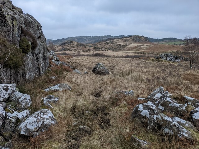
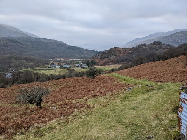
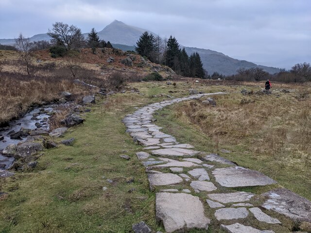
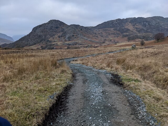
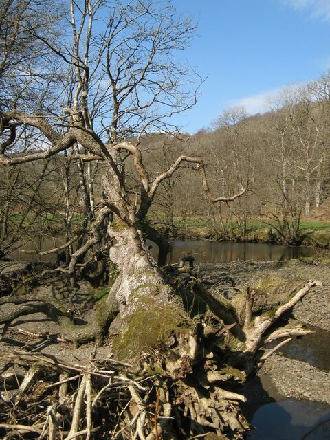
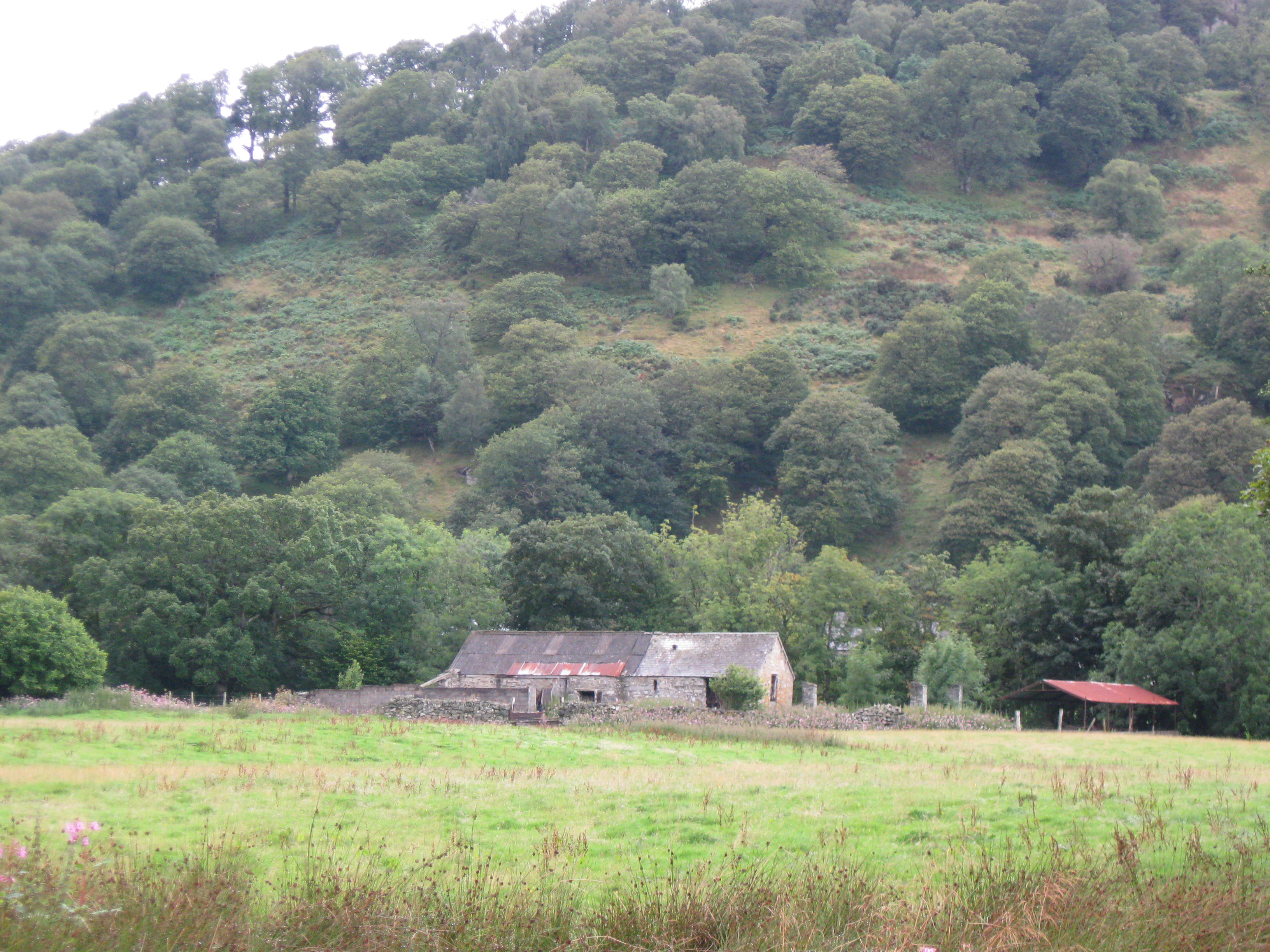
Allt Goch is a wood located in the historic county of Caernarfonshire, Wales. It is situated near the village of Llanrug, approximately 5 miles southeast of the town of Caernarfon. This beautiful forest covers an area of around 100 acres and is nestled within the stunning Snowdonia National Park.

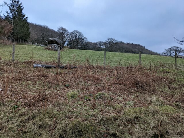
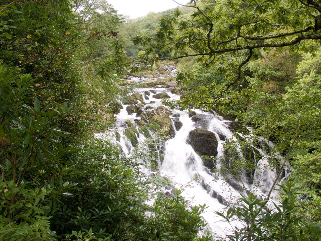
Allt Goch is known for its diverse range of tree species, including oak, beech, ash, and birch. The woodland is rich in flora and fauna, providing a habitat for a wide variety of wildlife. Visitors can expect to see an array of bird species, such as woodpeckers, buzzards, and owls, as well as small mammals like foxes, badgers, and squirrels.

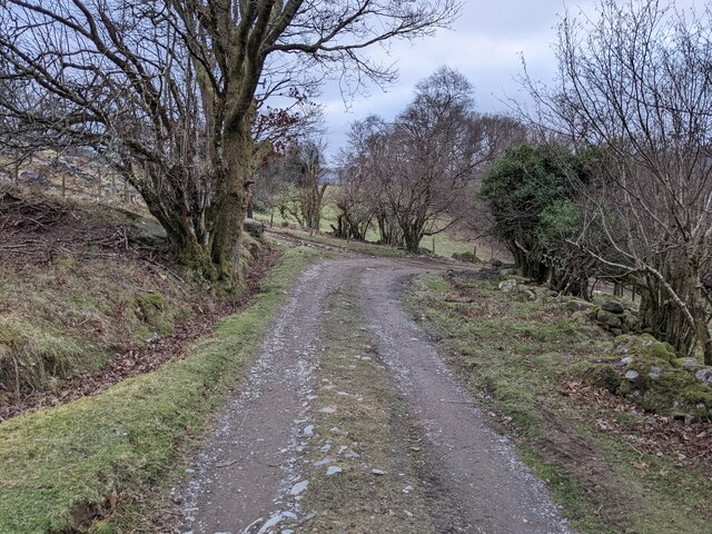
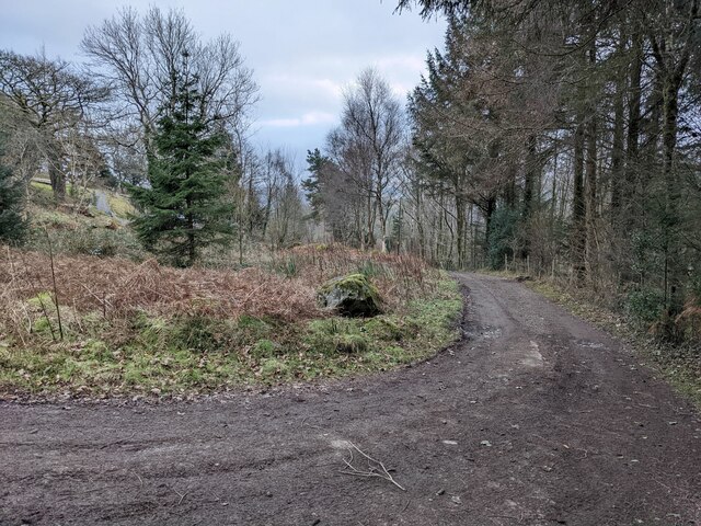
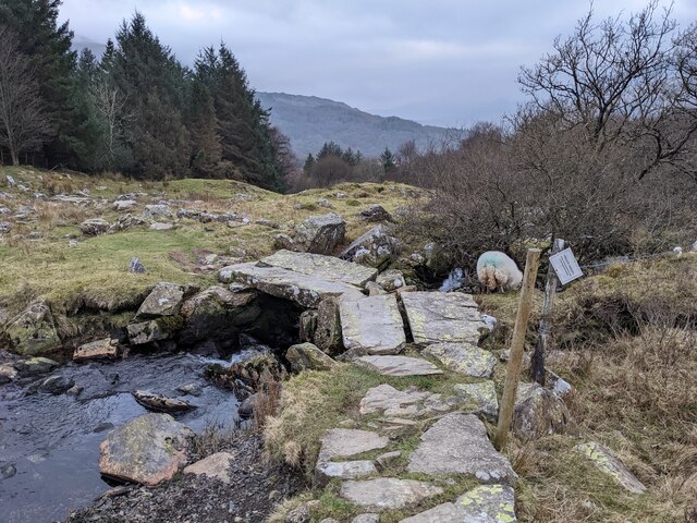
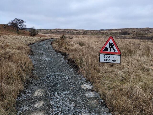
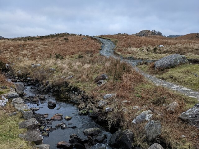
The wood offers several walking trails, making it a popular destination for nature lovers and hikers. The paths are well-maintained and provide stunning views of the surrounding mountains and valleys. There are also picnic areas and benches scattered throughout the forest, allowing visitors to relax and enjoy the peaceful atmosphere.

Allt Goch is an important part of the local community, providing residents and visitors with a tranquil escape from the hustle and bustle of everyday life. The wood also contributes to the conservation efforts of the Snowdonia National Park, helping to preserve the natural beauty of the area.

Overall, Allt Goch is a picturesque woodland that offers a serene environment for outdoor enthusiasts and nature lovers to explore and appreciate the wonders of Caernarfonshire's countryside.

If you have any feedback on the listing, please let us know in the comments section below.
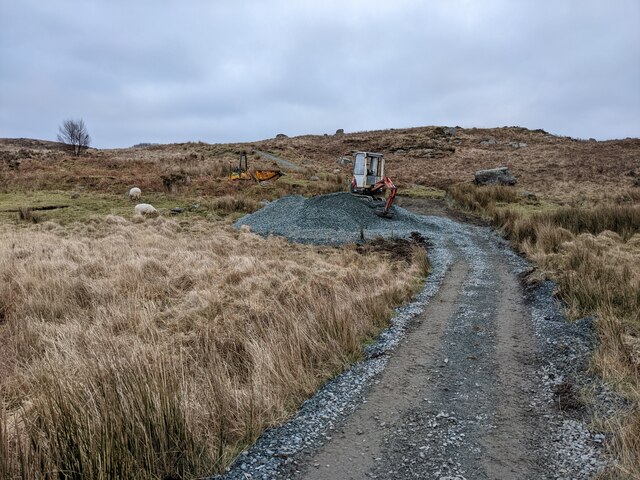
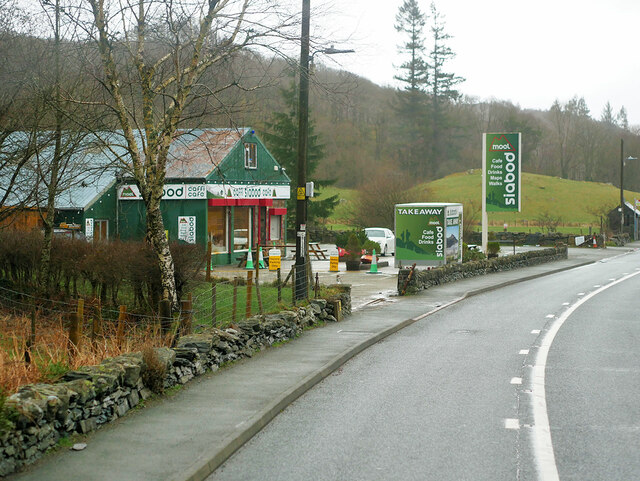
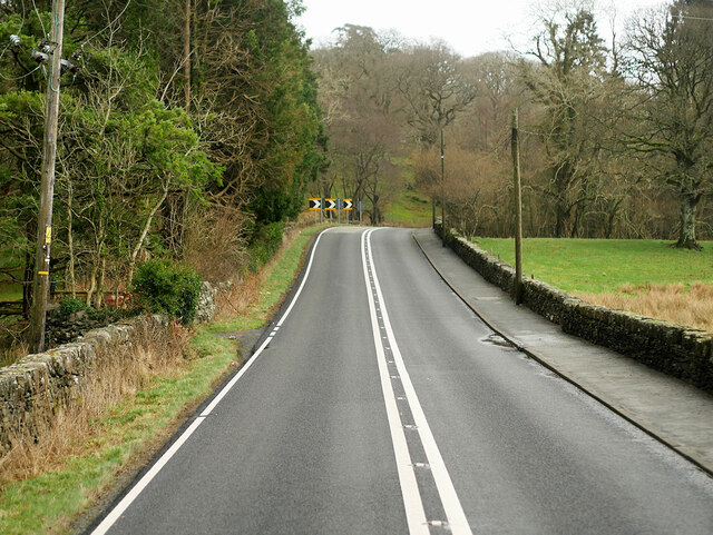
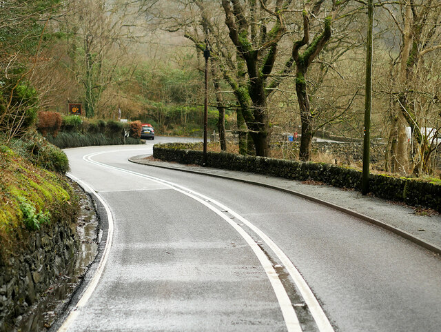
Allt Goch Images

Images are sourced within 2km of 53.10162/-3.8737527 or Grid Reference SH7457. Thanks to Geograph Open Source API. All images are credited.

Cefnrhos Gwawr Cefnrhos Gwawr forestry
Cefnrhos Gwawr
Cefnrhos Gwawr forestry
Swallow Falls The Swallow falls near Betws-y-Coed on the Afon Llugwy.
Swallow Falls
The Swallow falls near Betws-y-Coed on the Afon Llugwy.
Rocks below Clogwyn Mawr
The footpath down to Bryntyrch
The bridleway down to Capel Curig
Perched erratic boulders above Capel Curig
The bridleway down to Capel Curig
An ancient bridge on the bridleway The wonky sign states that the path goes through a garden and please respect this.
An ancient bridge on the bridleway
The wonky sign states that the path goes through a garden and please respect this.
Path protected from erosion - the old way There is controversy (in 2022) about the National Park's heavy-handed treatment of the Crafnant bridleway. This is a good example of previous, landscape sensitive, work using natural stone.  See other photos for the modern process.
Path protected from erosion - the old way
There is controversy (in 2022) about the National Park's heavy-handed treatment of the Crafnant bridleway. This is a good example of previous, landscape sensitive, work using natural stone. See other photos for the modern process.
Path protected from erosion - the 2022 method There is great controversy about the Snowdonia National Park using heavy machinery to dig up this bridleway and then resurfacing with gravel and not natural stone. This is already being washed out by recent storms in places, so the detractors seem to have a case.
Path protected from erosion - the 2022 method
There is great controversy about the Snowdonia National Park using heavy machinery to dig up this bridleway and then resurfacing with gravel and not natural stone. This is already being washed out by recent storms in places, so the detractors seem to have a case.
A section of resurfaced path
Newly resurfaced path Scraped out and filled with gravel, thus becoming a clichéd 'scar on the landscape' which is likely to be washed out by winter storms.
Newly resurfaced path
Scraped out and filled with gravel, thus becoming a clichéd 'scar on the landscape' which is likely to be washed out by winter storms.
Men at work A digger and gravel pile, ready to cover the old stone path. It is not surprising that the National Park is getting adverse comments about this process.
Men at work
A digger and gravel pile, ready to cover the old stone path. It is not surprising that the National Park is getting adverse comments about this process.
A5 passing Moel Siabod Cafe, Capel Curig The A5 is a major trunk road which runs for about 181 miles from London, in England, to Holyhead, in Wales. For part of its route, it follows a section of the Roman route which later took the Anglo-Saxon name Watling Street.  At Oswestry, the A5 joins the A483 and becomes the bypass to the east of the town. It continues to multiplex with the A483 until it reaches Halton, where it diverges towards Llangollen and Holyhead.
A5 passing Moel Siabod Cafe, Capel Curig
The A5 is a major trunk road which runs for about 181 miles from London, in England, to Holyhead, in Wales. For part of its route, it follows a section of the Roman route which later took the Anglo-Saxon name Watling Street. At Oswestry, the A5 joins the A483 and becomes the bypass to the east of the town. It continues to multiplex with the A483 until it reaches Halton, where it diverges towards Llangollen and Holyhead.
A5 towards Betws-y-Coed The A5 is a major trunk road which runs for about 181 miles from London, in England, to Holyhead, in Wales. For part of its route, it follows a section of the Roman route which later took the Anglo-Saxon name Watling Street.  At Oswestry, the A5 joins the A483 and becomes the bypass to the east of the town. It continues to multiplex with the A483 until it reaches Halton, where it diverges towards Llangollen and Holyhead.
A5 towards Betws-y-Coed
The A5 is a major trunk road which runs for about 181 miles from London, in England, to Holyhead, in Wales. For part of its route, it follows a section of the Roman route which later took the Anglo-Saxon name Watling Street. At Oswestry, the A5 joins the A483 and becomes the bypass to the east of the town. It continues to multiplex with the A483 until it reaches Halton, where it diverges towards Llangollen and Holyhead.
A5 near Swallow Falls The A5 is a major trunk road which runs for about 181 miles from London, in England, to Holyhead, in Wales. For part of its route, it follows a section of the Roman route which later took the Anglo-Saxon name Watling Street.  At Oswestry, the A5 joins the A483 and becomes the bypass to the east of the town. It continues to multiplex with the A483 until it reaches Halton, where it diverges towards Llangollen and Holyhead.
A5 near Swallow Falls
The A5 is a major trunk road which runs for about 181 miles from London, in England, to Holyhead, in Wales. For part of its route, it follows a section of the Roman route which later took the Anglo-Saxon name Watling Street. At Oswestry, the A5 joins the A483 and becomes the bypass to the east of the town. It continues to multiplex with the A483 until it reaches Halton, where it diverges towards Llangollen and Holyhead.
Afon Llugwy A view upstream from a dry section of the braided channel by Ty Hyll.
Afon Llugwy
A view upstream from a dry section of the braided channel by Ty Hyll.
Fallen tree A fallen tree, whose root-plate has been washed clean by floodwater.
Fallen tree
A fallen tree, whose root-plate has been washed clean by floodwater.
Show me another place!

Allt Goch is located at Grid Ref: SH7457 (Lat: 53.10162, Lng: -3.8737527)

Unitary Authority: Conwy

Police Authority: North Wales

What 3 Words

///retaliate.resettle.starlight. Near Betws-y-Coed, Conwy

Nearby Locations

Allt Goch

Related Wikis

Caer Llugwy

Caer Llugwy, or Bryn-y-Gefeiliau, is the site of a Roman fort in a loop of the Afon Llugwy near Capel Curig in Conwy, Wales. It is notable in that there...

Llyn Goddionduon

Llyn Goddionduon is a remote lake in the Gwydir Forest in north Wales. It lies at a height of 794 ft (242 m) and covers an area of 10 acres (40,000 m2...

Cobden's Hotel

Cobden's Hotel is a 19th-century hotel in Capel Curig, Conwy, Wales. It became famous after it was bought by the celebrated cricketer Frank Cobden and...
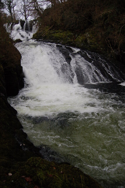
Swallow Falls

Swallow Falls is an English name for the Welsh Rhaeadr y Wennol, also known as Rhaeadr Ewynnol (English: 'the foaming waterfall'), a multiple waterfall...

Nearby Amenities

Located within 500m of 53.10162,-3.8737527
Created By: Merkaartor 0.12
Lat/Long: 53.1035581/-3.8782918
Created By: Merkaartor 0.12
Lat/Long: 53.103362/-3.878043
Created By: Merkaartor 0.12
Lat/Long: 53.103261/-3.877679
Created By: Merkaartor 0.12
Lat/Long: 53.1032789/-3.87729
Created By: Merkaartor 0.12
Lat/Long: 53.1033499/-3.876771
Created By: Merkaartor 0.12
Lat/Long: 53.103347/-3.876195
Created By: Merkaartor 0.12
Lat/Long: 53.103328/-3.87587
Created By: Merkaartor 0.12
Lat/Long: 53.1033789/-3.8753429
Created By: Merkaartor 0.12
Lat/Long: 53.103376/-3.874962
Created By: Merkaartor 0.12
Lat/Long: 53.103463/-3.874427
Created By: Merkaartor 0.12
Lat/Long: 53.103657/-3.873471
Created By: Merkaartor 0.12
Lat/Long: 53.103822/-3.873211
Created By: Merkaartor 0.12
Lat/Long: 53.104046/-3.873077
Created By: Merkaartor 0.12
Lat/Long: 53.104235/-3.87318
Created By: Merkaartor 0.12
Lat/Long: 53.1045569/-3.873277
Created By: Merkaartor 0.12
Lat/Long: 53.1048879/-3.87325
Created By: Merkaartor 0.12
Lat/Long: 53.1053/-3.873169
Created By: Merkaartor 0.12
Lat/Long: 53.105762/-3.87288
Created By: Merkaartor 0.12
Lat/Long: 53.104959/-3.8687879
Created By: Merkaartor 0.12
Lat/Long: 53.1040859/-3.868938
Created By: Merkaartor 0.12
Lat/Long: 53.103764/-3.86846
Created By: Merkaartor 0.12
Lat/Long: 53.102825/-3.8665419
Caer Llugwy Roman Fort
Archaeological Site: fortification
Fortification Type: castrum
Historic: archaeological_site
Historic Civilization: ancient_roman
Historic Period: roman
Name Cy: Bryn-y-Gefeiliau
Lat/Long: 53.0978385/-3.8739315
Post Box
Operator: Royal Mail
Post Box Type: wall
Ref: LL24 134
Royal Cypher: GVIR
Royal Cypher Wikidata: Q33102169
Source: survey
Lat/Long: 53.1003547/-3.86727
Material: wood
Power: pole
Lat/Long: 53.1000035/-3.8731432
Material: wood
Power: pole
Lat/Long: 53.0994784/-3.8726497
Material: wood
Power: pole
Lat/Long: 53.0992723/-3.8714802
Material: wood
Power: pole
Lat/Long: 53.0990984/-3.8704744
Power: pole
Lat/Long: 53.0989502/-3.8696938
Material: wood
Power: pole
Lat/Long: 53.1004737/-3.8735723
Material: wood
Power: pole
Lat/Long: 53.1002446/-3.8739741
Material: wood
Power: pole
Lat/Long: 53.1000292/-3.8743334
Material: wood
Power: pole
Lat/Long: 53.0998076/-3.8746716
Material: wood
Power: pole
Lat/Long: 53.0994479/-3.8753694
Entrance: yes
Lat/Long: 53.0997206/-3.8750156
Power: pole
Lat/Long: 53.0992865/-3.8680357
Power: pole
Lat/Long: 53.0992456/-3.8689686
The data included in this document is from www.openstreetmap.org. The data is made available under ODbL.

Have you been to Allt Goch?

Leave your review of Allt Goch below (or comments, questions and feedback).