Coed y Gelli

Wood, Forest in Carmarthenshire

Wales

Coed y Gelli

Ordnance Survey Cut Mark This OS cut mark can be found on the SE face of Penmaen Farmhouse. It marks a point 246.413m above mean sea level.
Ordnance Survey Cut Mark Credit: Adrian Dust

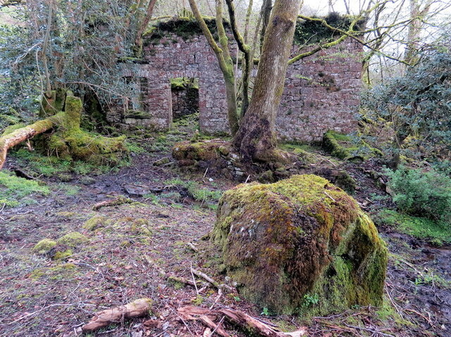
Coed y Gelli is a picturesque woodland located in the county of Carmarthenshire, Wales. Covering an area of approximately 100 acres, it is known for its natural beauty and diverse range of flora and fauna.

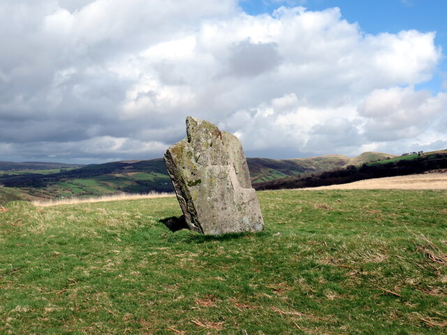
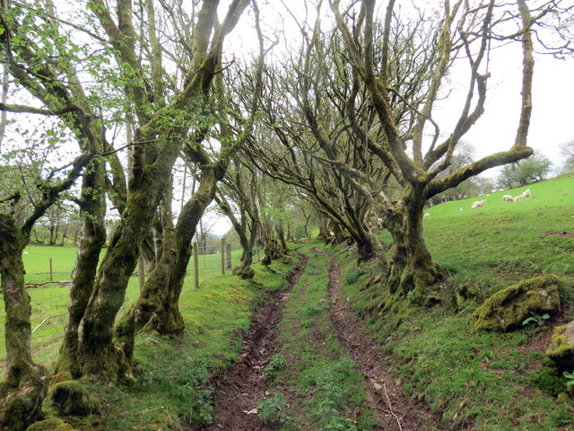
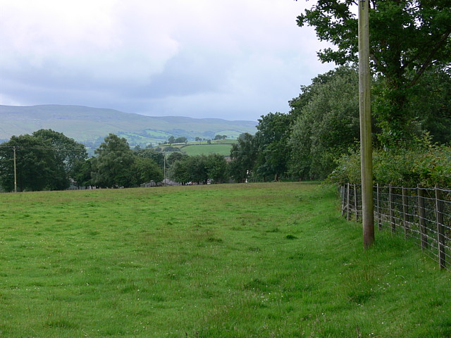
The woodland is predominantly composed of native tree species such as oak, beech, and birch, creating a dense and enchanting forest canopy. The area is crisscrossed by a network of well-maintained footpaths, allowing visitors to explore the woodlands at their own pace. These paths offer stunning views of the surrounding countryside and provide opportunities for peaceful walks and nature appreciation.

Coed y Gelli is home to a wealth of wildlife, making it a popular spot for birdwatching and nature enthusiasts. Visitors may spot a variety of bird species, including woodpeckers, jays, and thrushes, as well as small mammals like squirrels and rabbits. The woodland also supports a diverse range of plant life, with carpets of bluebells and wild garlic in the spring, adding to its natural beauty.

In addition to its natural attractions, Coed y Gelli offers various amenities to enhance visitors' experiences. There are picnic areas scattered throughout the woodland, providing a perfect spot for a leisurely lunch amidst nature. The woodlands are also well-maintained, ensuring a safe and enjoyable environment for all who visit.

Overall, Coed y Gelli in Carmarthenshire is a delightful woodland retreat, offering a tranquil and immersive experience in nature. Whether it's for a leisurely stroll, birdwatching, or simply enjoying the serenity of the forest, Coed y Gelli is a must-visit destination for nature lovers in the area.

If you have any feedback on the listing, please let us know in the comments section below.

Coed y Gelli Images

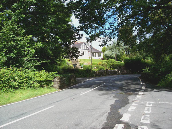
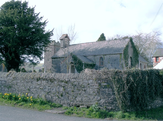
Images are sourced within 2km of 51.884521/-3.8227588 or Grid Reference SN7422. Thanks to Geograph Open Source API. All images are credited.

Ordnance Survey Cut Mark This OS cut mark can be found on the SE face of Penmaen Farmhouse. It marks a point 246.413m above mean sea level.
Ordnance Survey Cut Mark
This OS cut mark can be found on the SE face of Penmaen Farmhouse. It marks a point 246.413m above mean sea level.
Footbridge over stream at Ynys-wen, twynllanan
Maenhir Tyle-pengam / Tyle-pengam Standing Stone Maenhir posibl o'r Oes Efydd wedi ei leoli ar glos ffarm adfeiliedig Tyle-pengam. 

A possible Bronze Age standing stone located in the yard of the abandoned Tyle-pengam Farm.
Maenhir Tyle-pengam / Tyle-pengam Standing Stone
Maenhir posibl o'r Oes Efydd wedi ei leoli ar glos ffarm adfeiliedig Tyle-pengam. A possible Bronze Age standing stone located in the yard of the abandoned Tyle-pengam Farm.
Maenhir ger Tyle-pengam / Standing stone near Tyle-pengam Maenhir o'r Oes Efydd wedi ei leoli ar dir preifat uwchben Ffarm Tyle-pengam. Yn ol Map y Degwm 1841 gelwid y gefnen lle saif y garreg y Lan. 

A Bronze Age standing stone located on private land above Tyle-pengam Farm (trans. hill of the ?crooked standing stone). According to the 1841 Tithe Map the ridge is known as  y Lan (trans. the hill).
Maenhir ger Tyle-pengam / Standing stone near Tyle-pengam
Maenhir o'r Oes Efydd wedi ei leoli ar dir preifat uwchben Ffarm Tyle-pengam. Yn ol Map y Degwm 1841 gelwid y gefnen lle saif y garreg y Lan. A Bronze Age standing stone located on private land above Tyle-pengam Farm (trans. hill of the ?crooked standing stone). According to the 1841 Tithe Map the ridge is known as y Lan (trans. the hill).
Maenhir Ynys-wen / Ynys-wen Standing Stone Maenhir gerllaw hen Ffatri Wlan Ynys-wen.

A standing stone near the former Ynys-wen Woollen Factory.
Maenhir Ynys-wen / Ynys-wen Standing Stone
Maenhir gerllaw hen Ffatri Wlan Ynys-wen. A standing stone near the former Ynys-wen Woollen Factory.
Hen heol las / Old green road Hen heol las ddymunol ger Ty Uchaf.

A pleasant old green road near Ty Uchaf (trans. upper house).
Hen heol las / Old green road
Hen heol las ddymunol ger Ty Uchaf. A pleasant old green road near Ty Uchaf (trans. upper house).
Ffald Truman Hen gorlan fawr na ddefynyddir bellach a elwir Ffald Truman.

An  abandoned large sheepfold known as Ffald Truman (trans. little ridge sheepfold).
Ffald Truman
Hen gorlan fawr na ddefynyddir bellach a elwir Ffald Truman. An abandoned large sheepfold known as Ffald Truman (trans. little ridge sheepfold).
Twmpath llosg / Burnt mound Yn y blaendir uwchben nant fach saif twmpath llosg o'r Oes Efydd. Pan oedd ein hynafiaid yn coginio cig yn ystod y cyfnod hwn byddent yn twymo cerrig mewn tân cyn eu rhoi nhw mewn cafn llawn dŵr i ferwi cig. Pan mewn cysylltiad â dŵr oer byddai llawer o'r cerrig hyn yn chwalu. Mae'r domen yn ganlyniad i groniad dros amser o gerrig wedi'u chwalu a malurion tân fel siarcol. Damcaniaethau eraill yw eu bod nhw'n rhyw fath o sona neu ar gyfer berweddu cwrw. 

In the foreground above a small watercourse is a Bronze Age burnt mound.  When our ancestors cooked meat during this period they would heat stones in a fire before putting them in a trough full of water to boil meat. When in contact with cold water many of the stones would shatter.  The mound is a result of an accumulation over time of discarded shattered stones and fire debris such as charcoal. Other theories are that they were used as a sauna or for brewing beer.
Twmpath llosg / Burnt mound
Yn y blaendir uwchben nant fach saif twmpath llosg o'r Oes Efydd. Pan oedd ein hynafiaid yn coginio cig yn ystod y cyfnod hwn byddent yn twymo cerrig mewn tân cyn eu rhoi nhw mewn cafn llawn dŵr i ferwi cig. Pan mewn cysylltiad â dŵr oer byddai llawer o'r cerrig hyn yn chwalu. Mae'r domen yn ganlyniad i groniad dros amser o gerrig wedi'u chwalu a malurion tân fel siarcol. Damcaniaethau eraill yw eu bod nhw'n rhyw fath o sona neu ar gyfer berweddu cwrw. In the foreground above a small watercourse is a Bronze Age burnt mound. When our ancestors cooked meat during this period they would heat stones in a fire before putting them in a trough full of water to boil meat. When in contact with cold water many of the stones would shatter. The mound is a result of an accumulation over time of discarded shattered stones and fire debris such as charcoal. Other theories are that they were used as a sauna or for brewing beer.
Falls at Pont Aber These falls on the Afon Sawdde Fechan are just visible from the road bridge but you can get a much better view from the public footpath on the south bank.
Falls at Pont Aber
These falls on the Afon Sawdde Fechan are just visible from the road bridge but you can get a much better view from the public footpath on the south bank.
Bridge Over Afon Sawdde Marked on OS 1:25000 as Cwm Du
Bridge Over Afon Sawdde
Marked on OS 1:25000 as Cwm Du
Field in front of farmstead Farm is named on map as Pen crug.
Field in front of farmstead
Farm is named on map as Pen crug.
A4069 With Turning To Capel-Gwynfe Pen-y-cae-du on left after junction.
A4069 With Turning To Capel-Gwynfe
Pen-y-cae-du on left after junction.
Pontbren A4069

Note: 1:25000 & 1:50000  show road to Heol y gelli junction ( behind me in this photo & to left) in different geosquares.... 1:25k in SN7322 and 1:50k in this geosquare
Pontbren
A4069 Note: 1:25000 & 1:50000 show road to Heol y gelli junction ( behind me in this photo & to left) in different geosquares.... 1:25k in SN7322 and 1:50k in this geosquare
Pont Newydd Junction of the A4069 with two unclassified roads making a staggered crossroads over the Afon Sawdde which is in a deep gorge under the bridge.
Pont Newydd
Junction of the A4069 with two unclassified roads making a staggered crossroads over the Afon Sawdde which is in a deep gorge under the bridge.
Afon Sawdde Fechan This is a tiny section of the river that passes through this gridsquare. The view is taken from the west bank of the river.
Afon Sawdde Fechan
This is a tiny section of the river that passes through this gridsquare. The view is taken from the west bank of the river.
Confluence of Sawdde Fechan and Ceulan The Ceulan is the smaller stream joining from the right of shot. The Sawdde Fechan runs in from the left and out at the bottom. Downstream from here the river flows north through a pleasant wooded section, the last members of which are visible in this shot before the land opens out in the distance.
Confluence of Sawdde Fechan and Ceulan
The Ceulan is the smaller stream joining from the right of shot. The Sawdde Fechan runs in from the left and out at the bottom. Downstream from here the river flows north through a pleasant wooded section, the last members of which are visible in this shot before the land opens out in the distance.
Improvised footbridge on Sawdde Fechan An old "I"-beam has been laid as a precarious footbridge over the river at this point. Then someone has thought better of it and blocked it off.
Improvised footbridge on Sawdde Fechan
An old "I"-beam has been laid as a precarious footbridge over the river at this point. Then someone has thought better of it and blocked it off.
Afon Ceulan Taken while crossing the Ceulan from east to west and looking upstream to the south. This whole area is large gentle slope down to the north. Most of the expanse is corrugated gently from runoff but here a deep river gully has formed due to the large, obvious bowl formed in the mountain in the distance.
Afon Ceulan
Taken while crossing the Ceulan from east to west and looking upstream to the south. This whole area is large gentle slope down to the north. Most of the expanse is corrugated gently from runoff but here a deep river gully has formed due to the large, obvious bowl formed in the mountain in the distance.
Show me another place!

Coed y Gelli is located at Grid Ref: SN7422 (Lat: 51.884521, Lng: -3.8227588)

Unitary Authority: Carmarthenshire

Police Authority: Dyfed Powys

What 3 Words

///jugs.provoking.plod. Near Llanddeusant, Carmarthenshire

Related Wikis

Cae Maes-y-ffynnon

Cae Maes-y-ffynnon is a wet unimproved pasture that is a Site of Special Scientific Interest in Carmarthen & Dinefwr, Wales. == See also == List of Sites...

A4069 road

The A4069 is an A road which connects Llandovery with Gwaun-Cae-Gurwen in Wales, UK. == Route == The route begins at the junction with the A474 at the...

Gwynfe

Gwynfe () or Capel Gwynfe is a small village inside the portion of Brecon Beacons National Park that is in Carmarthenshire, a county of southwestern Wales...

Caeau Heol y Llidiart-coch

Caeau Heol y Llidiart-coch is a Site of Special Scientific Interest in Carmarthenshire, Wales. The site is of special interest for its marshy grassland...

Nearby Amenities

Located within 500m of 51.884521,-3.8227588
Place: farm
Lat/Long: 51.8862963/-3.8237924
The data included in this document is from www.openstreetmap.org. The data is made available under ODbL.

Have you been to Coed y Gelli?

Leave your review of Coed y Gelli below (or comments, questions and feedback).