Allt Blaen-nant-melyn

Wood, Forest in Carmarthenshire

Wales

Allt Blaen-nant-melyn

Allt y Berth in the Cothi valley
Allt y Berth in the Cothi valley Credit: Philip Halling

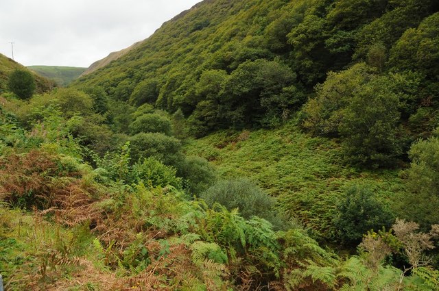
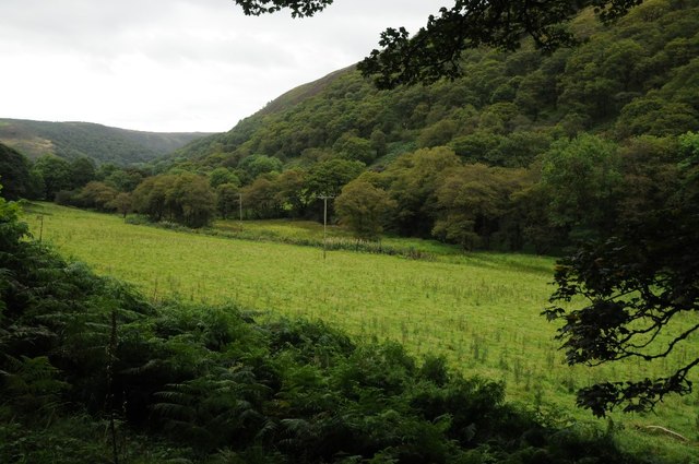
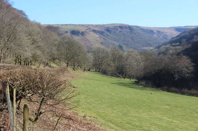
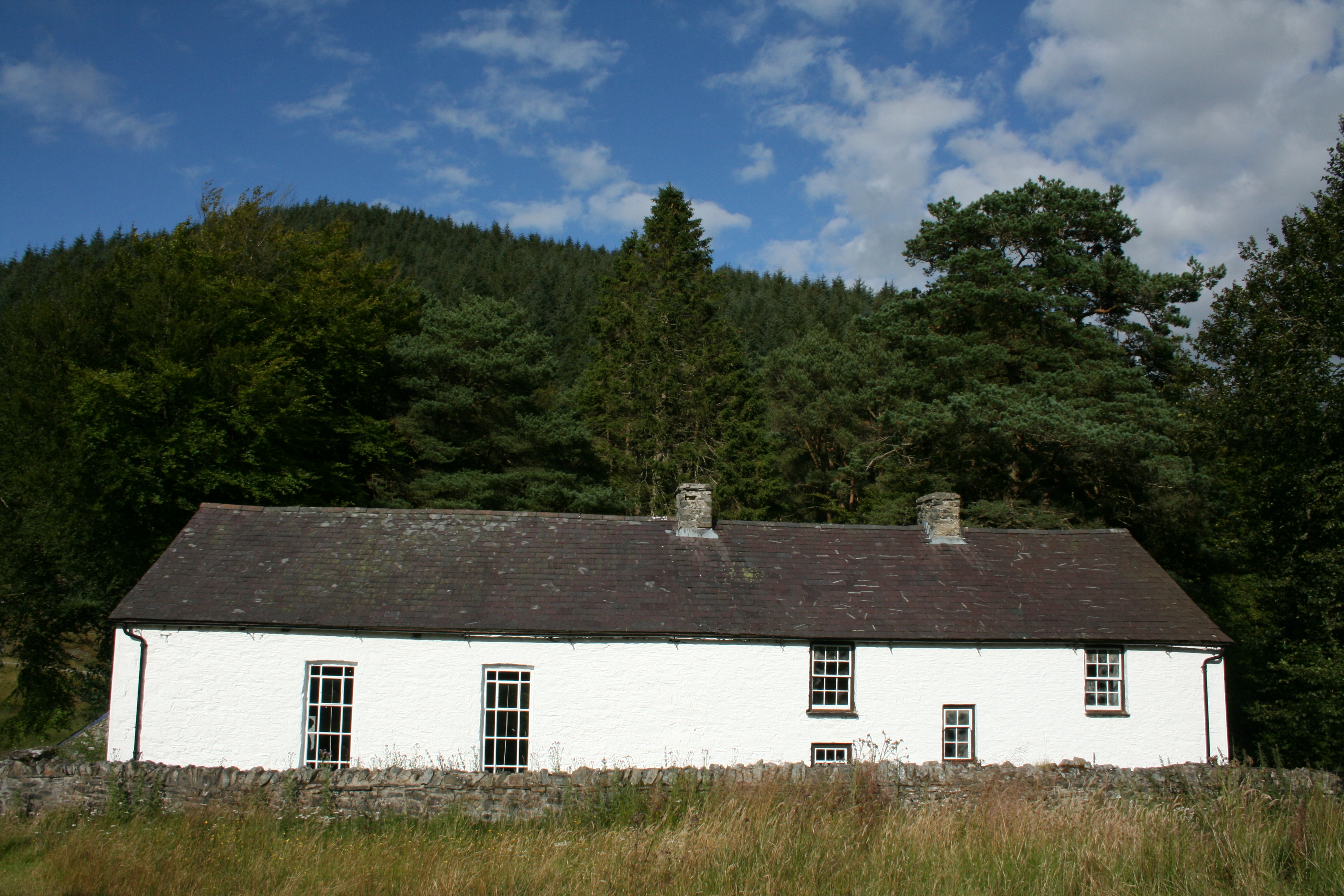
Allt Blaen-nant-melyn is a picturesque wood located in the county of Carmarthenshire, Wales. Situated in the rural landscape, this enchanting forest covers an area of approximately 50 acres. The wood is nestled amidst rolling hills and offers visitors a tranquil and serene environment.

The name Allt Blaen-nant-melyn translates to "hillside of the yellow stream" in English, which is fitting as there is a small stream running through the wood, adding to the beauty and charm of the location. The area is rich in flora and fauna, with a diverse range of trees such as oak, ash, and beech, which provide a canopy of shade and shelter.

Visitors to Allt Blaen-nant-melyn can enjoy a variety of activities. There are well-maintained paths that meander through the wood, providing opportunities for leisurely walks and hikes. The wood is also home to a wide range of wildlife, including birds, squirrels, and deer, making it a popular spot for birdwatching and wildlife enthusiasts.

The wood has a rich history, with evidence of ancient settlements and archeological sites dating back to the Bronze Age. There are also remnants of old stone walls and structures, adding an element of mystery and intrigue to the wood.

Allt Blaen-nant-melyn is a truly idyllic location for nature lovers and those seeking a peaceful escape from the hustle and bustle of everyday life. With its natural beauty, diverse wildlife, and historical significance, it is a place that captivates the imagination and leaves a lasting impression on all who visit.

If you have any feedback on the listing, please let us know in the comments section below.

Allt Blaen-nant-melyn Images

Images are sourced within 2km of 52.104811/-3.851604 or Grid Reference SN7346. Thanks to Geograph Open Source API. All images are credited.

Allt y Berth in the Cothi valley
Bwlch-y-rhiw Pass between the Cothi and Melyn valleys.
Bwlch-y-rhiw
Pass between the Cothi and Melyn valleys.
Road passing through Allt Goch Country road passing through Allt Goch in the Nant Melyn valley.
Road passing through Allt Goch
Country road passing through Allt Goch in the Nant Melyn valley.
Field beside Nant Melyn Field between the road and Nant Melyn which flows through this valley.
Field beside Nant Melyn
Field between the road and Nant Melyn which flows through this valley.
The Nant Melyn valley The Nant Melyn valley near Pont Rhyd-felin.
The Nant Melyn valley
The Nant Melyn valley near Pont Rhyd-felin.
Nant Melyn valley Nant Melyn valley below Craig Llys-fedw.
Nant Melyn valley
Nant Melyn valley below Craig Llys-fedw.
Country road in the Nant Melyn valley
The Gwenffrwd valley Meadow beside Gwenffrwd in valley upstream from Rhandirmwyn.
The Gwenffrwd valley
Meadow beside Gwenffrwd in valley upstream from Rhandirmwyn.
Nant y Gelynen Nant y Gelynen, complete with some rubbish, viewed from the bridge carrying the minor road up the valley.
Nant y Gelynen
Nant y Gelynen, complete with some rubbish, viewed from the bridge carrying the minor road up the valley.
Bridge crossing Nant y Gelynen
Uwchlaw Cwm Gwenffrwd / Above Cwm Gwenffrwd Llwybr ar rostrir uwchlaw Cwm Gwenffrwd.

Path on moorland above Cwm Gwenffrwd (trans. fair/ white stream valley).
Uwchlaw Cwm Gwenffrwd / Above Cwm Gwenffrwd
Llwybr ar rostrir uwchlaw Cwm Gwenffrwd. Path on moorland above Cwm Gwenffrwd (trans. fair/ white stream valley).
Uwchlaw Blaen Nant Melyn / Above Blaen Nant Melyn Cerddwyr yn dilyn llwybr defaid uwchlaw Blaen Nant Melyn.

Walkers following a sheep path above Blaen Nant Melyn (trans. source of the brown/ yellow river).
Uwchlaw Blaen Nant Melyn / Above Blaen Nant Melyn
Cerddwyr yn dilyn llwybr defaid uwchlaw Blaen Nant Melyn. Walkers following a sheep path above Blaen Nant Melyn (trans. source of the brown/ yellow river).
Pont Rhyd Felin from below Looking up at Pont Rhyd Felin from below with the Nant Melyn flowing over waterfall.
Pont Rhyd Felin from below
Looking up at Pont Rhyd Felin from below with the Nant Melyn flowing over waterfall.
Minor road east of Bwlch-y-rhiw Narrow road just above the Nant Cartws (out of picture right) near the head of a valley.
Minor road east of Bwlch-y-rhiw
Narrow road just above the Nant Cartws (out of picture right) near the head of a valley.
Ordnance Survey Cut Mark This OS cut mark can be found on the NW parapet of the bridge over the Nant Melyn. It marks a point 223.214m above mean sea level.
Ordnance Survey Cut Mark
This OS cut mark can be found on the NW parapet of the bridge over the Nant Melyn. It marks a point 223.214m above mean sea level.
Ordnance Survey Cut Mark This OS cut mark can be found on the roadside barn at Bwlch-y-Rhiw Farm. It marks a point 854.1ft above mean sea level.
Ordnance Survey Cut Mark
This OS cut mark can be found on the roadside barn at Bwlch-y-Rhiw Farm. It marks a point 854.1ft above mean sea level.
Track to Blaen-nant-melyn Start of track on the side of Allt Blaen-nant-melyn. The sign says, 'Blaen Nant Melyn', - presumably a remote farm.
Track to Blaen-nant-melyn
Start of track on the side of Allt Blaen-nant-melyn. The sign says, 'Blaen Nant Melyn', - presumably a remote farm.
Roadside pasture above the Nant Melyn The stream is in the trees just out of shot, right. The hill on the skyline is Troed-y-rhiw.
Roadside pasture above the Nant Melyn
The stream is in the trees just out of shot, right. The hill on the skyline is Troed-y-rhiw.
Show me another place!

Allt Blaen-nant-melyn is located at Grid Ref: SN7346 (Lat: 52.104811, Lng: -3.851604)

Unitary Authority: Carmarthenshire

Police Authority: Dyfed Powys

What 3 Words

///kneeled.farmland.argued. Near Llandovery, Carmarthenshire

Related Wikis

Mynydd Mallaen

Mynydd Mallaen (Welsh: [ˈmənɨð ˈmaɬain]) is an expansive plateau to the northwest of Cilycwm in northeast Carmarthenshire, Wales. It forms part of the...

Pwllpriddog Oak

The Pwllpriddog Oak (Welsh: Derwen Pwllpriddog), also known as the Rhandirmwyn Oak, is a 600–700 year old tree located in farmland near Rhandirmwyn in...

Rhandirmwyn

Rhandirmwyn (or Rhandir-mwyn) is a small village in the north east of Carmarthenshire, Wales. Located in the upper Towy valley, 3 km north of Cilycwm village...

Cilycwm

Cilycwm (Welsh: Cil-y-cwm, IPA: [ˈkiːl ə ˈkʊm]) is a village, parish and community located in Carmarthenshire, Wales. The community population taken at...

Church of St Michael, Cilycwm

The Church of St Michael, Cilycwm is the Church in Wales parish church for the parish of Cilycwm, near Llandovery, Wales. The rubble building with pink...

Cilycwm transmitting station

The Cilycwm television relay station is sited on high ground to the east of the village of Cilycwm to the north of Llandovery in Carmarthenshire, South...

Llyn Brianne

Llyn Brianne is a man-made lake or reservoir in the headwaters of the River Towy in Wales. == Construction == The reservoir was constructed by Wimpey Construction...

Soar y mynydd

Soar-y-mynydd or Soar y mynydd is a Calvinist Methodist chapel near the eastern extremity of the large parish of Llanddewi Brefi, Ceredigion. It is claimed...

Have you been to Allt Blaen-nant-melyn?

Leave your review of Allt Blaen-nant-melyn below (or comments, questions and feedback).