Coed Tyglas

Wood, Forest in Merionethshire

Wales

Coed Tyglas

Graig Goch From near Maes-y-Pandy.
Graig Goch Credit: Richard Hoare

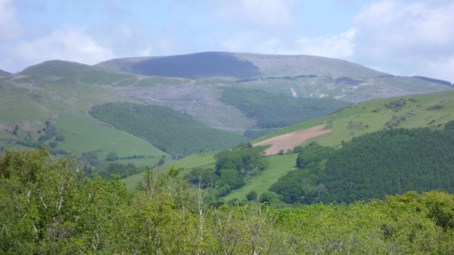
Coed Tyglas, located in Merionethshire, is a picturesque woodland area known for its natural beauty and diverse ecosystem. Covering a vast area, the woods are home to a wide range of plant and animal species, making it an ideal destination for nature enthusiasts and hikers.

The woodland is characterized by its dense tree cover, predominantly made up of native species such as oak, ash, and beech. These trees provide a habitat for numerous bird species, including woodpeckers and owls, as well as small mammals like squirrels and voles.

The forest floor is adorned with a variety of wildflowers, adding a burst of color to the surroundings during spring and summer. Moss-covered rocks and fallen logs are scattered throughout, creating a natural playground for insects and fungi.

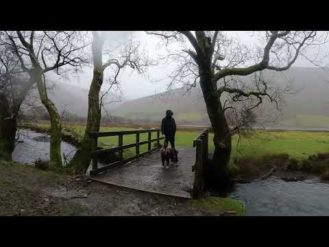
Trails and footpaths wind through Coed Tyglas, allowing visitors to explore the woods at their own pace. These paths offer breathtaking views of the surrounding countryside, showcasing the region's natural beauty.

Coed Tyglas is not only a haven for wildlife but also a site of historical significance. The remains of ancient settlements and burial mounds can be found within its boundaries, providing a glimpse into the area's rich past.

The woodland is managed by local conservation organizations, ensuring its preservation and protection for future generations to enjoy. Educational programs and guided tours are also available, allowing visitors to learn about the importance of biodiversity and sustainable forest management.

In conclusion, Coed Tyglas in Merionethshire is a captivating woodland area that offers a serene escape into nature. With its diverse flora and fauna, scenic trails, and historical significance, it is a must-visit destination for those seeking tranquility and a deeper appreciation for the natural world.

If you have any feedback on the listing, please let us know in the comments section below.

Coed Tyglas Images

Images are sourced within 2km of 52.649695/-3.8957894 or Grid Reference SH7107. Thanks to Geograph Open Source API. All images are credited.

Graig Goch From near Maes-y-Pandy.
Graig Goch
From near Maes-y-Pandy.
High up in Pantperthog Forest
Unused Product Abandoned slates at the Darren Slate Quarry.
Unused Product
Abandoned slates at the Darren Slate Quarry.
Tarren y Gesail First Marilyn of the day reversing the Nuttall's route. Sunny warm morning greying as day went on. Lovely views of River Dovey, main reason for reversing route.
Name: Tarren y Gesail
Hill number: 2148
Height: 667m / 2188ft
Area: 30F: Dolgellau to Machynlleth
Class: Ma,Hew,N
Grid ref: SH 71053 05895
Summit feature: no feature
Drop: 463m
Col: 204m  SH738093
Tarren y Gesail
First Marilyn of the day reversing the Nuttall's route. Sunny warm morning greying as day went on. Lovely views of River Dovey, main reason for reversing route. Name: Tarren y Gesail Hill number: 2148 Height: 667m / 2188ft Area: 30F: Dolgellau to Machynlleth Class: Ma,Hew,N Grid ref: SH 71053 05895 Summit feature: no feature Drop: 463m Col: 204m SH738093
Tarren y Gesail viewed from Tarren Hendre Extensive clear-felling has been taking place on the slopes of the mountain.
Tarren y Gesail viewed from Tarren Hendre
Extensive clear-felling has been taking place on the slopes of the mountain.
Llyn Mwyngil  and clouds over Graig Goch The southwestern tip of Llyn Mwyngil (Tal-y-llin Lake) fringed by trees at Tal-y-llyn with part of the beer garden of the Pen-y-bont Hotel. Behind, the steep slopes of Graig Goch rise up to 586m (1922') with clouds scutting along the top of the ridge.
Llyn Mwyngil and clouds over Graig Goch
The southwestern tip of Llyn Mwyngil (Tal-y-llin Lake) fringed by trees at Tal-y-llyn with part of the beer garden of the Pen-y-bont Hotel. Behind, the steep slopes of Graig Goch rise up to 586m (1922') with clouds scutting along the top of the ridge.
Tarren y Gesail viewed from Cors Dyfi Nature Reserve This mountain is fairly readily identifiable with its path or track line above the forestry.
Tarren y Gesail viewed from Cors Dyfi Nature Reserve
This mountain is fairly readily identifiable with its path or track line above the forestry.
Tarren y Gesail. The trig. It's bang on the grid line, but looks like it belongs here, and fortunately the POV is also in SH7105. View west towards Tarren Hendre.
Tarren y Gesail.
The trig. It's bang on the grid line, but looks like it belongs here, and fortunately the POV is also in SH7105. View west towards Tarren Hendre.
Ty'n Y Cornel Hotel, Tal-y-Llyn
Mynydd Cedris One of the impressive mountains towering over the Dysynni Valley.
The Talyllyn railway runs along the valley and is well worth a visit.
Mynydd Cedris
One of the impressive mountains towering over the Dysynni Valley. The Talyllyn railway runs along the valley and is well worth a visit.
Summit of Mynydd Cedris
Ty'n y Cornel Hotel. Meaning "house in the corner", this hotel has always had a good reputation.
<span class="nowrap"><a title="http://www.tynycornel.co.uk" rel="nofollow ugc noopener" href="http://www.tynycornel.co.uk">Link</a><img style="margin-left:2px;" alt="External link" title="External link - shift click to open in new window" src="https://s1.geograph.org.uk/img/external.png" width="10" height="10"/></span>
Ty'n y Cornel Hotel.
Meaning "house in the corner", this hotel has always had a good reputation. LinkExternal link
Graig Goch Graig Goch ridge looking dramatic in the low sunlight, with Saint Mary's church and Pen-y-Bont hotel in the foreground.
Graig Goch
Graig Goch ridge looking dramatic in the low sunlight, with Saint Mary's church and Pen-y-Bont hotel in the foreground.
Mist over Graig Goch Contrast to <a title="https://www.geograph.org.uk/photo/546685" href="https://www.geograph.org.uk/photo/546685">Link</a> taken two months earlier
Mist over Graig Goch
Contrast to Link taken two months earlier
View north from Tarren y Gesail This is the right square; you can just see the fence on the right which is shown as on the square boundary on the 1:25000 map! Cadair Idris lies on the horizon; the long ridge intervening is Mynydd Cedris. Tarren y Gesail is a good viewpoint, and you can often have it to yourself.
View north from Tarren y Gesail
This is the right square; you can just see the fence on the right which is shown as on the square boundary on the 1:25000 map! Cadair Idris lies on the horizon; the long ridge intervening is Mynydd Cedris. Tarren y Gesail is a good viewpoint, and you can often have it to yourself.
Forest track Unmarked track junction which will hopefully lead us onto the south east ridge of Mynydd Braich-goch
Forest track
Unmarked track junction which will hopefully lead us onto the south east ridge of Mynydd Braich-goch
Tarren y Gesail Looking up to the east face of Tarren y Gesail from the head of Cwm Cadian
Tarren y Gesail
Looking up to the east face of Tarren y Gesail from the head of Cwm Cadian
Dewey bagging A single stone on Foel y Geifr with Mynydd Braich-goch showing above the stile
Dewey bagging
A single stone on Foel y Geifr with Mynydd Braich-goch showing above the stile
Show me another place!

Coed Tyglas is located at Grid Ref: SH7107 (Lat: 52.649695, Lng: -3.8957894)

Unitary Authority: Gwynedd

Police Authority: North Wales

What 3 Words

///mornings.blushed.vies. Near Corris, Gwynedd

Nearby Locations

Coed Tyglas

Related Wikis

Graig Goch

Graig Goch is a 586m high hill in the Gwynedd area in Wales and lying within Snowdonia National Park. The hill falls within the communities of Llanfihangel...

Ceiswyn Formation

The Ceiswyn Formation (also known as the Ceiswyn Beds) is an Ordovician lithostratigraphic group (a sequence of rock strata) in Mid Wales. The rock of...
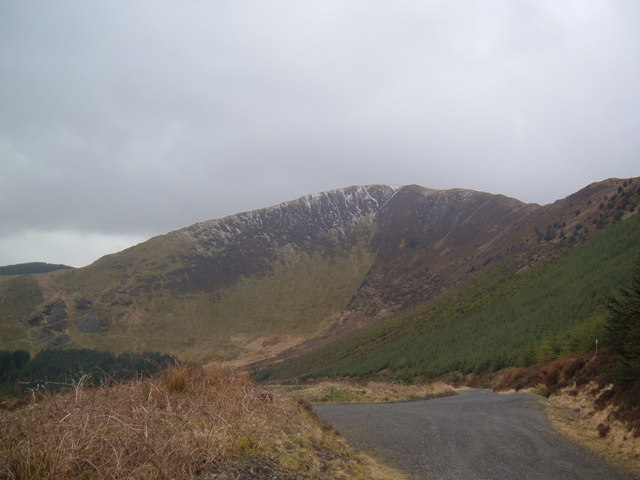
Tarren y Gesail

Tarren y Gesail is a mountain in Snowdonia, north Wales. It is one of the Marilyns of the Cadair Idris group. Lying to the south of Cadair Idris, it and...

Garnedd-Wen Formation

The Garnedd-Wen Formation (also known as the Garnedd-Wen Beds) is an Ordovician lithostratigraphic formation (a sequence of rock strata) in Mid Wales....
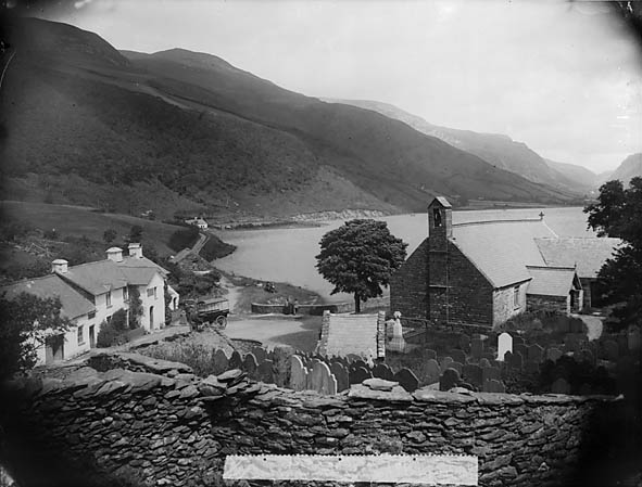
Tal-y-llyn, Gwynedd

Tal-y-llyn, or Talyllyn, is a small hamlet and former parish in the community of Llanfihangel-y-Pennant in Gwynedd, Wales, situated at the end of Tal-y...

Tal-y-llyn Lake

Tal-y-llyn Lake, (Welsh: Llyn Mwyngil), also known as Talyllyn Lake and Llyn Myngul, is a large glacial ribbon lake in Gwynedd, North Wales. It is formed...

Corris Uchaf

Corris Uchaf (English: Upper Corris) is a village in the south of Snowdonia National Park in Gwynedd, Wales. The slate quarries that surround Corris Uchaf...

Bryn Eglwys quarry

Bryn Eglwys quarry was a slate quarry and mine near Abergynolwyn, in Merionethshire (now part of Gwynedd), Wales. More than 300 men worked at the site...

Related Videos

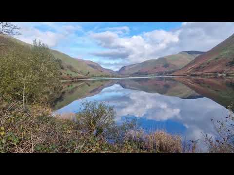
A BEAUTIFUL walk to Llyn Mwyngil, Wales 🏴󠁧󠁢󠁷󠁬󠁳󠁿 UK Family Vanlife

We went for a walk to Llyn Mwyngil near our campsite in Cwmrhwyddfor. What a stunning place to spend a day! Follow us on ...

Talyllyn Lake Walk

Video of a walk around Talyllyn Lake, Eryri (Snowdonia) in Wales, on a wet and windy day, December 2022. The video was filmed ...

Have you been to Coed Tyglas?

Leave your review of Coed Tyglas below (or comments, questions and feedback).