Coed Madog

Wood, Forest in Merionethshire

Wales

Coed Madog

River Dovey near Derwenlas
River Dovey near Derwenlas Credit: Chris Morgan

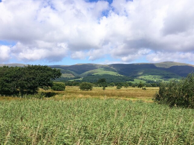
Coed Madog is a stunning woodland area located in Merionethshire, Wales. Situated amidst the scenic countryside, this woodland is known for its natural beauty and rich biodiversity. Covering a vast area, Coed Madog serves as a haven for wildlife and a popular destination for nature enthusiasts.

The woodland is primarily composed of native tree species such as oak, birch, and beech, which create a diverse and vibrant ecosystem. The tall, majestic trees provide a dense canopy that filters sunlight, creating a cool and tranquil atmosphere within the woodland. The forest floor is adorned with a variety of plants and wildflowers, adding to the overall charm of the area.

Coed Madog offers a range of walking trails and paths, allowing visitors to explore the woodlands at their own pace. These well-maintained routes lead through the heart of the forest, offering breathtaking views of the surroundings. The peaceful ambiance and the sound of birdsong make it an ideal destination for those seeking solace in nature.

Moreover, Coed Madog is home to a wide array of wildlife, including deer, squirrels, and various bird species. Nature enthusiasts can enjoy birdwatching and may even spot rare species that inhabit the area. The woodland also provides an important habitat for many species of insects and small mammals.

Coed Madog is not only a natural gem but also a place of historical significance. The area has been inhabited for centuries, and remnants of ancient settlements and structures can still be found within the woodland. Exploring these historical sites adds an additional layer of fascination to the overall experience.

Overall, Coed Madog in Merionethshire offers a captivating blend of natural beauty, biodiversity, and historical significance. It is a place where visitors can immerse themselves in the tranquility of nature while discovering the secrets of the past.

If you have any feedback on the listing, please let us know in the comments section below.

Coed Madog Images

Images are sourced within 2km of 52.588299/-3.9062025 or Grid Reference SH7000. Thanks to Geograph Open Source API. All images are credited.

River Dovey near Derwenlas
A487 roadworks near Morben
A487 near Derwenlas
A487 near Derwenlas
From a Macchynlleth-Aberystwyth train, bend in the River Dovey
From a Machynlleth-Aberystwyth train, alongside the river Dovey
From a Machynlleth-Aberystwyth train, reed beds by the Dovey
Afon Dyfi near Pennal
Entrance to Llugwy Hall A private road but is a right of way.
Entrance to Llugwy Hall
A private road but is a right of way.
Llugwy Hall Dating from the late 17th century, Llugwy Hall is Grade II listed. It became a hotel circa 1980 and then a convention/training centre. Although still marked as an hotel on current maps, it is now again a private residence. Coflein: <span class="nowrap"><a title="http://www.coflein.gov.uk/en/site/96579/details/llugwy-hallllugwy-hotel" rel="nofollow ugc noopener" href="http://www.coflein.gov.uk/en/site/96579/details/llugwy-hallllugwy-hotel">Link</a><img style="margin-left:2px;" alt="External link" title="External link - shift click to open in new window" src="https://s1.geograph.org.uk/img/external.png" width="10" height="10"/></span>
Llugwy Hall
Dating from the late 17th century, Llugwy Hall is Grade II listed. It became a hotel circa 1980 and then a convention/training centre. Although still marked as an hotel on current maps, it is now again a private residence. Coflein: LinkExternal link
Path skirting Llugwy Hall A right of way runs along here.
Path skirting Llugwy Hall
A right of way runs along here.
Footbridge by Afon Dyfi The bridge crosses a small stream which flows into the river. It is on a right of way footpath which runs along the north side of the river from Llugwy Hall to Dolgelynen Farm and beyond. The bridge is in poor condition with rotten footboards and loose handrails. An accident waiting to happen?
Footbridge by Afon Dyfi
The bridge crosses a small stream which flows into the river. It is on a right of way footpath which runs along the north side of the river from Llugwy Hall to Dolgelynen Farm and beyond. The bridge is in poor condition with rotten footboards and loose handrails. An accident waiting to happen?
Canoeing on Afon Dyfi A group of people enjoying themselves on the river.
Canoeing on Afon Dyfi
A group of people enjoying themselves on the river.
Pumwern A farmstead standing above Afon Dyfi.
Pumwern
A farmstead standing above Afon Dyfi.
Beside Afon Dyfi On a public footpath which runs along the north bank of the river.
Beside Afon Dyfi
On a public footpath which runs along the north bank of the river.
Gate and stile beside Afon Dyfi The stile was somewhat 'rickety'. Fortunately the gate wasn't locked.
Gate and stile beside Afon Dyfi
The stile was somewhat 'rickety'. Fortunately the gate wasn't locked.
Afon Dyfi Looking upstream.
Afon Dyfi
Looking upstream.
Temporary fence beside Afon Dyfi
Footpath beside Afon Dyfi
Show me another place!

Coed Madog is located at Grid Ref: SH7000 (Lat: 52.588299, Lng: -3.9062025)

Unitary Authority: Gwynedd

Police Authority: North Wales

What 3 Words

///shoulders.machinery.trusts. Near Machynlleth, Powys

Nearby Locations

Coed Madog Coed y Fron

Related Wikis

Llugwy Hall

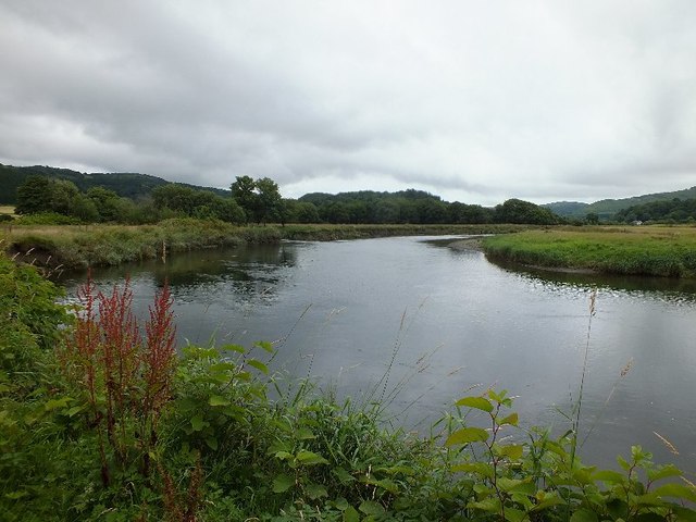
Llugwy is the name of an old property near Pennal, a village on the A493 road in southern Gwynedd, Wales, on the north bank of the Afon Dyfi/River Dovey...

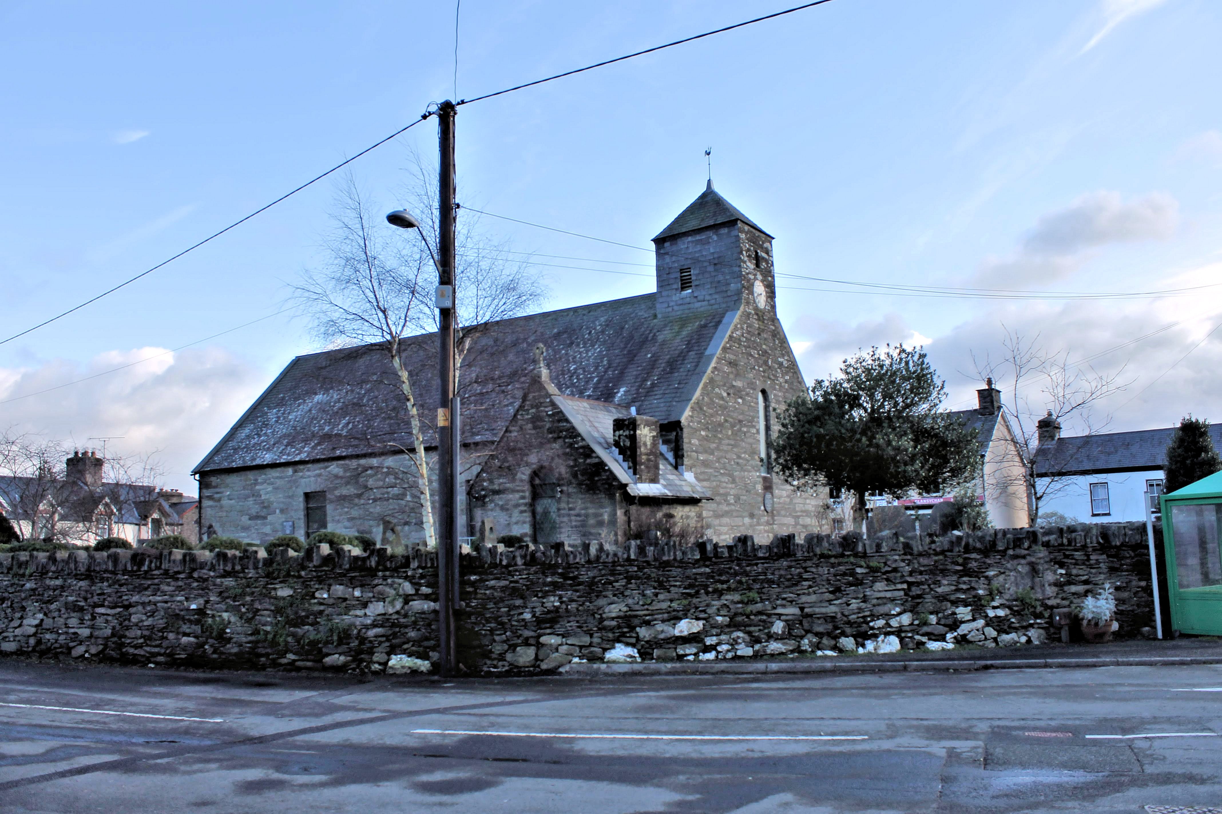
St Peter ad Vincula, Pennal

The parish church of St Peter ad Vincula (meaning Saint Peter in Chains) in the village of Pennal in Gwynedd, north-west Wales, is notable as the site...

Pennal

Pennal is a village and community on the A493 road in southern Gwynedd, Wales, on the north bank of the River Dyfi, near Machynlleth. It lies in the historic...

Morben

Morben is a hamlet in northern Powys, Wales. Part of the historic county of Montgomeryshire (Sir Drefaldwyn) from 1536 to 1974, it lies on the Afon Dyfi...

Nearby Amenities

Located within 500m of 52.588299,-3.9062025
Place: farm
Lat/Long: 52.5848692/-3.9014977
Power: pole
Lat/Long: 52.5868165/-3.9002967
Power: pole
Lat/Long: 52.5865264/-3.90167
Power: pole
Lat/Long: 52.5864629/-3.9030781
Power: pole
Lat/Long: 52.5864107/-3.9041242
Power: pole
Lat/Long: 52.5863227/-3.9059106
Power: pole
Lat/Long: 52.5861532/-3.9071417
Power: pole
Lat/Long: 52.5858713/-3.9089334
Power: pole
Lat/Long: 52.5856529/-3.9102075
Power: pole
Lat/Long: 52.5854346/-3.9117417
The data included in this document is from www.openstreetmap.org. The data is made available under ODbL.

Have you been to Coed Madog?

Leave your review of Coed Madog below (or comments, questions and feedback).