Coed Llwyn-garu

Wood, Forest in Cardiganshire

Wales

Coed Llwyn-garu

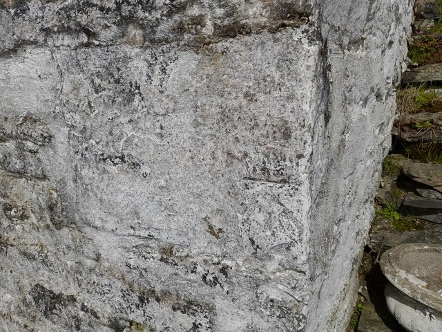
Ordnance Survey Cut Mark This OS cut mark can be found on the wall SW side of the road. It marks a point 249.363m above mean sea level.
Ordnance Survey Cut Mark Credit: Adrian Dust

Coed Llwyn-garu is a picturesque woodland located in Cardiganshire, Wales. With its stunning natural beauty and rich biodiversity, it is a popular destination for nature lovers and outdoor enthusiasts alike.

Covering an area of approximately 500 acres, Coed Llwyn-garu is characterized by its dense and diverse collection of trees. The woodland is predominantly composed of native species such as oak, birch, beech, and ash, which provide a haven for a wide variety of wildlife. Visitors can expect to encounter numerous bird species, including woodpeckers, warblers, and owls, as well as small mammals like squirrels, badgers, and foxes.

The woodland is crisscrossed by a network of well-maintained trails, allowing visitors to explore and appreciate its natural wonders. These trails offer a range of difficulty levels, catering to both casual strollers and more experienced hikers. Along the way, visitors may come across babbling brooks, tranquil ponds, and breathtaking viewpoints, providing ample opportunities for relaxation and reflection.

Coed Llwyn-garu is also home to a number of rare and protected plant species, making it an important site for conservation efforts. Conservationists work tirelessly to maintain the delicate balance of this unique ecosystem, ensuring the continued survival of its diverse flora and fauna.

In addition to its natural beauty, Coed Llwyn-garu is also steeped in history. The woodland is dotted with ancient ruins and archaeological sites, hinting at its significance in the region's past. These historical remnants add an extra layer of intrigue and wonder to an already captivating destination.

Overall, Coed Llwyn-garu is a haven of natural beauty, biodiversity, and historical significance. Whether it's a leisurely stroll, a challenging hike, or an exploration of its rich history, this woodland offers something for everyone.

If you have any feedback on the listing, please let us know in the comments section below.

Coed Llwyn-garu Images

Images are sourced within 2km of 52.215769/-3.8967798 or Grid Reference SN7059. Thanks to Geograph Open Source API. All images are credited.

Ordnance Survey Cut Mark This OS cut mark can be found on the wall SW side of the road. It marks a point 249.363m above mean sea level.
Ordnance Survey Cut Mark
This OS cut mark can be found on the wall SW side of the road. It marks a point 249.363m above mean sea level.
Ordnance Survey Cut Mark This OS cut mark can be found on Lletty-meurig. It marks a point 205.398m above mean sea level.
Ordnance Survey Cut Mark
This OS cut mark can be found on Lletty-meurig. It marks a point 205.398m above mean sea level.
Ffens derfyn ger Trawscoed / Boundary fence near Trawscoed Ffin derfyn ar dir garw uwchben Ffarm Trawscoed.

Boundary fence on rough pasture above Trawscoed Farm.
Ffens derfyn ger Trawscoed / Boundary fence near Trawscoed
Ffin derfyn ar dir garw uwchben Ffarm Trawscoed. Boundary fence on rough pasture above Trawscoed Farm.
Ffens derfyn ger Bryn-coch / Boundary fence near Bryn-coch Ffens derfyn ar dir garw ger Ffarm Bryn-coch.

A boundary fence on rough pasture near Bryn-coch Farm (trans. red/brown hill).
Ffens derfyn ger Bryn-coch / Boundary fence near Bryn-coch
Ffens derfyn ar dir garw ger Ffarm Bryn-coch. A boundary fence on rough pasture near Bryn-coch Farm (trans. red/brown hill).
Gât fynediad i'r mynydd-dir / Access gate to the hills Gât yn rhoi mynediad i'r mynydd-dir. Mae yna lwybr ceffyl dymunol iawn yn mynd lan Cwm Croes Fawr. 

A gate giving access to the hill. There is a pleasant bridleway ascending Cwm Croes Fawr (trans. the larger Croes [river] valley).
Gât fynediad i'r mynydd-dir / Access gate to the hills
Gât yn rhoi mynediad i'r mynydd-dir. Mae yna lwybr ceffyl dymunol iawn yn mynd lan Cwm Croes Fawr. A gate giving access to the hill. There is a pleasant bridleway ascending Cwm Croes Fawr (trans. the larger Croes [river] valley).
Ewe with triplets near Tregaron This ewe looks very contented, as do her offspring. Taken through the hedge and fence.
Ewe with triplets near Tregaron
This ewe looks very contented, as do her offspring. Taken through the hedge and fence.
Ordnance Survey Cut Mark This OS cut mark can be found on the NW parapet of the bridge. It marks a point 256.634m above mean sea level.
Ordnance Survey Cut Mark
This OS cut mark can be found on the NW parapet of the bridge. It marks a point 256.634m above mean sea level.
Ordnance Survey Cut Mark This OS cut mark can be found on the wall NE side of the road. It marks a point 247.363m above mean sea level.
Ordnance Survey Cut Mark
This OS cut mark can be found on the wall NE side of the road. It marks a point 247.363m above mean sea level.
Ordnance Survey Cut Mark This OS cut mark can be found on the wall south side of the road. It marks a point 271.771m above mean sea level.
Ordnance Survey Cut Mark
This OS cut mark can be found on the wall south side of the road. It marks a point 271.771m above mean sea level.
Farmland in the valley of the Afon Groes, Ceredigion The lane to Tregaron (just over a mile away) is behind the hedge on the right. The land is almost exclusively used for grazing, with patches of deciduous woodland.
Farmland in the valley of the Afon Groes, Ceredigion
The lane to Tregaron (just over a mile away) is behind the hedge on the right. The land is almost exclusively used for grazing, with patches of deciduous woodland.
Ceredigion farmland near Tregaron The valley of the Afon Groes supports rich fields for grazing and hay production.
Ceredigion farmland near Tregaron
The valley of the Afon Groes supports rich fields for grazing and hay production.
Farmland near Tregaron, Ceredigion Here the gentle slopes of the Afon Groes Valley support rich fields for grass and grazing.
Farmland near Tregaron, Ceredigion
Here the gentle slopes of the Afon Groes Valley support rich fields for grass and grazing.
Farmland by the Afon Groes, Ceredigion A beautiful rural secluded valley which once had its own chapel and school (which became a youth hostel, unnecessarily closed by the YHA).
Farmland by the Afon Groes, Ceredigion
A beautiful rural secluded valley which once had its own chapel and school (which became a youth hostel, unnecessarily closed by the YHA).
Farmland near the Afon Groes, Tregaron, Ceredigion Predominantly sheep grazing country.
Farmland near the Afon Groes, Tregaron, Ceredigion
Predominantly sheep grazing country.
Across the fields to Y Bryn, near Tregaron, Ceredigion The peak of Y Bryn is at 422m height, and the ridge to the right leads up to Garn Gron at 541m.
Across the fields to Y Bryn, near Tregaron, Ceredigion
The peak of Y Bryn is at 422m height, and the ridge to the right leads up to Garn Gron at 541m.
Afon Groes landscape east of Tregaron, Ceredigion The lane to Tregaron (just over a mile away) is behind the hedge on the right.
Afon Groes landscape east of Tregaron, Ceredigion
The lane to Tregaron (just over a mile away) is behind the hedge on the right.
Farmland east of Tregaron, Ceredigion The public footpaths across the fields lead only to farmhouses, including  Cyrtau and Trawscoed on the other side of the Afon Groes. The peaks on the skyline are Y Bryn (422m) and Garn Gron (541m).
Farmland east of Tregaron, Ceredigion
The public footpaths across the fields lead only to farmhouses, including Cyrtau and Trawscoed on the other side of the Afon Groes. The peaks on the skyline are Y Bryn (422m) and Garn Gron (541m).
Farmland east of Tregaron, Ceredigion Looking across the wide valley of the Afon Groes. The farm at Brynhownant is just visible in trees at the centre of the picture. On the skyline at the right of the picture is the wooded hill at Banc Tan-yr-allt SN695588.
Farmland east of Tregaron, Ceredigion
Looking across the wide valley of the Afon Groes. The farm at Brynhownant is just visible in trees at the centre of the picture. On the skyline at the right of the picture is the wooded hill at Banc Tan-yr-allt SN695588.
Show me another place!

Coed Llwyn-garu is located at Grid Ref: SN7059 (Lat: 52.215769, Lng: -3.8967798)

Unitary Authority: Ceredigion

Police Authority: Dyfed Powys

What 3 Words

///whiplash.paths.food. Near Tregaron, Ceredigion

Related Wikis

Pentre, Ceredigion

Pentre is a small area in the community of Tregaron, Ceredigion, Wales, which is 60.4 miles (97.2 km) from Cardiff and 169.5 miles (272.8 km) from London...

River Brenig

The River Brenig (Afon Brenig) is a tributary river of the River Teifi and runs through the market town of Tregaron in Ceredigion, Wales. It is formed...

Tregaron

Tregaron (Welsh: [treˈɡaːrɔn] "town of St Caron") is an ancient market town in Ceredigion, Wales. It is sited astride the River Brenig, a tributary of...

Tregaron Hospital

Tregaron Hospital (Welsh: Ysbyty Tregaron) is a community hospital in Tregaron, Wales. It is managed by the Hywel Dda University Health Board. == History... ==

Tregaron railway station

Tregaron was a railway station in Wales on the former Carmarthen to Aberystwyth Line serving Tregaron, Ceredigion, Wales. The Manchester and Milford Railway...

Ysgol Henry Richard

Ysgol Henry Richard is a bilingual middle school for pupils aged 3–16 in Ceredigion, Wales. The school is a product of the amalgamation of Ysgol Llanddewi...

Cors Caron

Cors Caron is a raised bog in Ceredigion, Wales. Cors is the Welsh word for "bog". Cors Caron covers an area of approximately 349 hectares (862 acres)...

Alltddu Halt railway station

Alltddu Halt railway station served the hamlet of Allt-ddu, located between Lampeter and Aberystwyth on the Carmarthen Aberystwyth Line in the Welsh county...

Have you been to Coed Llwyn-garu?

Leave your review of Coed Llwyn-garu below (or comments, questions and feedback).