Allt Botwm

Wood, Forest in Carmarthenshire

Wales

Allt Botwm

Track and footpath near Llansadwrn A footpath follows this track eventually to Pont Cwm-llynfe.
Track and footpath near Llansadwrn Credit: Philip Halling

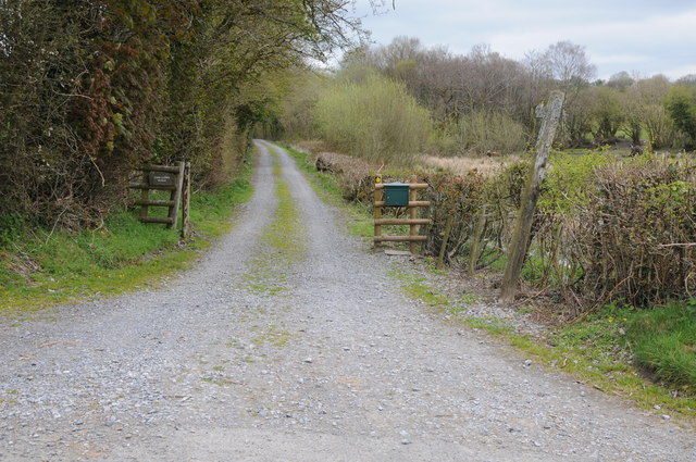
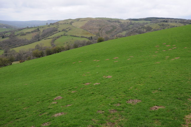
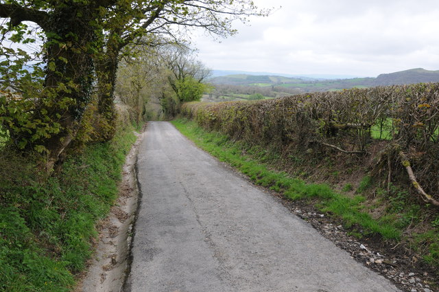
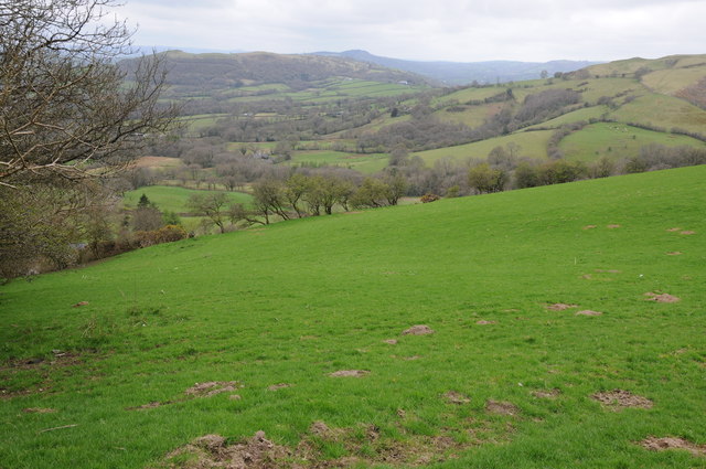
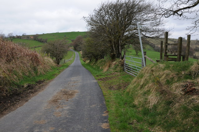
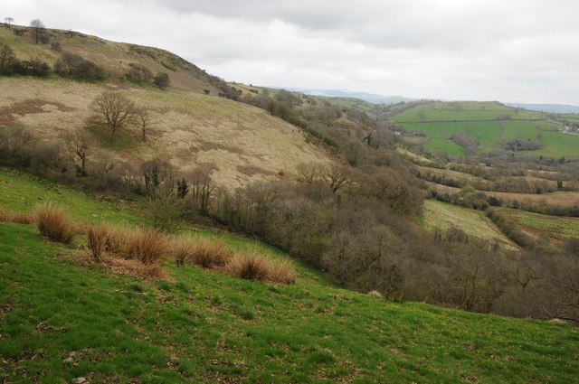
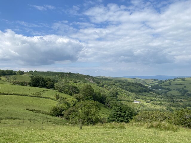
Allt Botwm is a picturesque woodland area located in Carmarthenshire, Wales. Covering an expansive area of lush greenery, it is a haven for nature enthusiasts and those seeking tranquility amidst the stunning Welsh countryside.

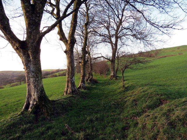
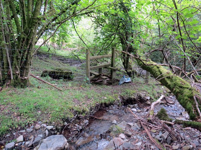
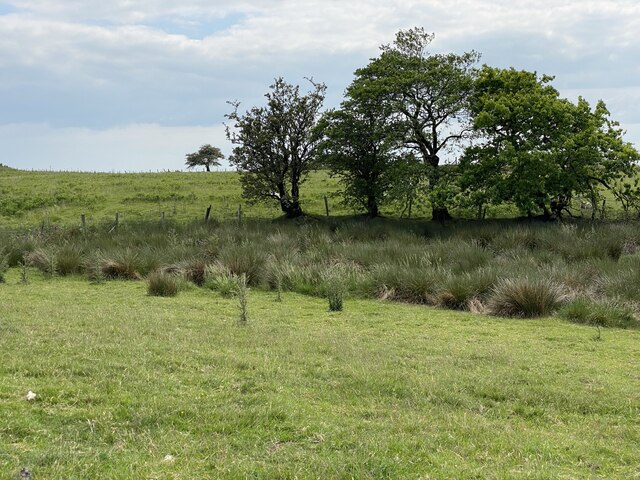
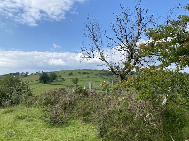
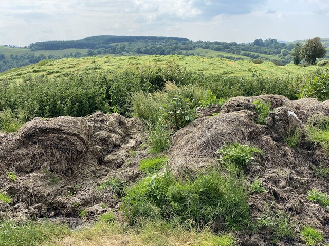
The woodland is characterized by its diverse range of tree species, including oak, beech, and birch, creating a rich and vibrant ecosystem. The forest floor is adorned with an array of wildflowers, adding a splash of color to the landscape. The dense canopy provides a sheltered habitat for various wildlife species, such as red squirrels, badgers, and a variety of bird species.

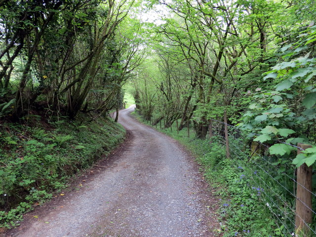
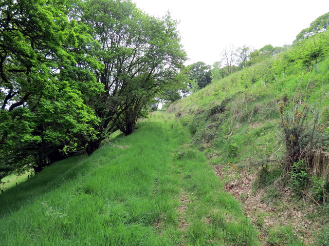
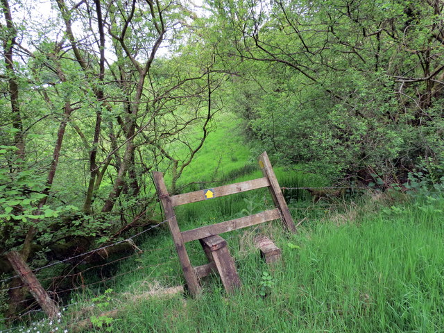
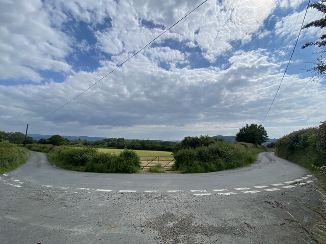
Walking trails crisscross the woodland, allowing visitors to explore its beauty at their own pace. These paths lead to secluded spots where one can enjoy a picnic or simply sit back and appreciate the serene surroundings. The babbling streams and small waterfalls that meander through the woods add to its enchanting charm.

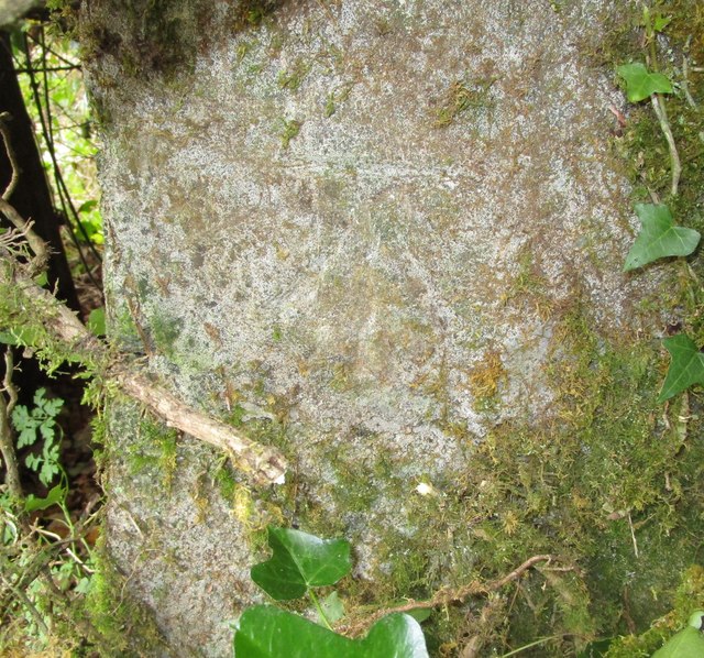
Allt Botwm is not only a place of natural beauty but also holds historical significance. Remnants of ancient settlements and stone structures can be found within the woodland, offering a glimpse into the area's past. The forest has also been utilized by locals for centuries, providing a source of timber and firewood.

With its breathtaking scenery, diverse flora and fauna, and rich history, Allt Botwm is a must-visit destination for anyone looking to immerse themselves in the beauty of Carmarthenshire's woodlands. Whether hiking, birdwatching, or simply enjoying a peaceful walk, this forest offers a truly rejuvenating experience for all who venture within its bounds.

If you have any feedback on the listing, please let us know in the comments section below.

Allt Botwm Images

Images are sourced within 2km of 51.983769/-3.8880809 or Grid Reference SN7033. Thanks to Geograph Open Source API. All images are credited.

Track and footpath near Llansadwrn A footpath follows this track eventually to Pont Cwm-llynfe.
Track and footpath near Llansadwrn
A footpath follows this track eventually to Pont Cwm-llynfe.
Farmland above Afon Marlais View across farmland a valley which Afon Marlais flows through.
Farmland above Afon Marlais
View across farmland a valley which Afon Marlais flows through.
Steep road north of Llansadwrn Steep country road to the north of Llansadwrn.
Steep road north of Llansadwrn
Steep country road to the north of Llansadwrn.
Welsh hill country Welsh hill country near Llansadwrn.
Welsh hill country
Welsh hill country near Llansadwrn.
Footpath off a country road Footpath off a country road to the north of Llansadwrn.
Footpath off a country road
Footpath off a country road to the north of Llansadwrn.
Above Cwm-Marchion Farmland above Cwm-Marchion viewed from a footpath which descends into the valley.
Above Cwm-Marchion
Farmland above Cwm-Marchion viewed from a footpath which descends into the valley.
Llwybr Ceffyl Ty'r Mynydd Bridleway Llwybr ceffyl yn mynd i gyfeiriad Ffarm Ty'r Mynydd.

A bridleway heading in the direction of Ty'r Mynydd Farm (trans. mountain house).
Llwybr Ceffyl Ty'r Mynydd Bridleway
Llwybr ceffyl yn mynd i gyfeiriad Ffarm Ty'r Mynydd. A bridleway heading in the direction of Ty'r Mynydd Farm (trans. mountain house).
Llwybr Cwm Llynfe Uchaf / Cwm Llynfe Uchaf path Heol ffarm a llwybr cyhoeddus yn mynd i gyfeiriad anhedd-dy o'r enw Cwm Llynfe Uchaf.

Access road and public footpath heading in the direction of a property known as Cwm Llynfe Uchaf. (trans. Llynfe stream valley upper farm).
Llwybr Cwm Llynfe Uchaf / Cwm Llynfe Uchaf path
Heol ffarm a llwybr cyhoeddus yn mynd i gyfeiriad anhedd-dy o'r enw Cwm Llynfe Uchaf. Access road and public footpath heading in the direction of a property known as Cwm Llynfe Uchaf. (trans. Llynfe stream valley upper farm).
Sticil Cwm Llynfe Isaf Stile Sticil ar lan nant fach (Llynfe?) ger Ffarm Cwm Llynfe Isaf.

A stile on the banks of a stream ( Llynfe?) near Cwm Llynfe Isaf Farm (trans. lower Llynfe valley farm)
Sticil Cwm Llynfe Isaf Stile
Sticil ar lan nant fach (Llynfe?) ger Ffarm Cwm Llynfe Isaf. A stile on the banks of a stream ( Llynfe?) near Cwm Llynfe Isaf Farm (trans. lower Llynfe valley farm)
Llwybr Tir y Graig / Tir y Graig path Llwybr cyhoeddus yn dringo'r bryn uwchben anhedd-dy o'r enw Tir y Graig. 

A public footpath ascending the hill above a property known as Tir y Graig (trans. land of the hill).
Llwybr Tir y Graig / Tir y Graig path
Llwybr cyhoeddus yn dringo'r bryn uwchben anhedd-dy o'r enw Tir y Graig. A public footpath ascending the hill above a property known as Tir y Graig (trans. land of the hill).
Sticil ger Bryn-pribwll / Stile near Bryn-pribwll Sticil ar gyffordd o lwybrau ger Bryn-pibwll (adfail). 

A stile at a junction of paths near Bryn-pribwll (ruin).
Sticil ger Bryn-pribwll / Stile near Bryn-pribwll
Sticil ar gyffordd o lwybrau ger Bryn-pibwll (adfail). A stile at a junction of paths near Bryn-pribwll (ruin).
Ordnance Survey Cut Mark This OS cut mark can be found on the west face of Capel Seion. It marks a point 137.052m above mean sea level.
Ordnance Survey Cut Mark
This OS cut mark can be found on the west face of Capel Seion. It marks a point 137.052m above mean sea level.
Ordnance Survey Cut Mark This OS cut mark can be found on the milk stand at Bryn-Dyfan Farm. It marks a point 162.035m above mean sea level.
Ordnance Survey Cut Mark
This OS cut mark can be found on the milk stand at Bryn-Dyfan Farm. It marks a point 162.035m above mean sea level.
Grasses in the corner of a field
Undergrowth at field edge
Carmarthenshire landscape View towards Pant y Bedol.
Carmarthenshire landscape
View towards Pant y Bedol.
Cut hay and dung heap
Road junction
Road junction
Show me another place!

Allt Botwm is located at Grid Ref: SN7033 (Lat: 51.983769, Lng: -3.8880809)

Unitary Authority: Carmarthenshire

Police Authority: Dyfed Powys

What 3 Words

///newsreel.conspired.shirtless. Near Llansadwrn, Carmarthenshire

Related Wikis

Llanwrda

Llanwrda ([ɬanʊrˈda] ) is a village and community in Carmarthenshire, Wales, 4 miles (6.4 km) southwest of Llandovery. It lies on the River Towy. The population...

Llanwrda railway station

Llanwrda railway station serves the village of Llanwrda near Llandovery, Carmarthenshire. Opened by the Vale of Towy Railway in 1858, the station is on...

Llansadwrn

Llansadwrn (; Welsh: [ɬanˈsadʊn]; ) is a small village and community in Carmarthenshire, Wales. It is located in the countryside above the valley of the...

Llangadog railway station

Llangadog railway station serves the village of Llangadog near Llandeilo, Carmarthenshire. The station is on the Heart of Wales Line 36+1⁄2 miles (59 km...

Afon Brân

The Afon Brân is a tributary of the River Towy (or Welsh Afon Tywi) in mid Wales. Its headwaters rise in Irfon Forest in the northeastern corner of Carmarthenshire...

Llangadog

Llangadog () is a village and community in Carmarthenshire, Wales, which also includes the villages of Bethlehem and Capel Gwynfe. A notable local landscape...

Crugybar

Crugybar is a village in Carmarthenshire, Wales, located between Talley and Pumsaint. It is roughly of equal distance from Lampeter, Llandovery and Llandeilo...

Aberbowlan

Aberbowlan is a small village in Carmarthenshire. It is located in the north of the county, 8 miles (13 km) to the north-east of the town of Llandovery...

Have you been to Allt Botwm?

Leave your review of Allt Botwm below (or comments, questions and feedback).