Coed Tynybedw

Wood, Forest in Cardiganshire

Wales

Coed Tynybedw

B4340 in Tynygraig
B4340 in Tynygraig Credit: David Smith

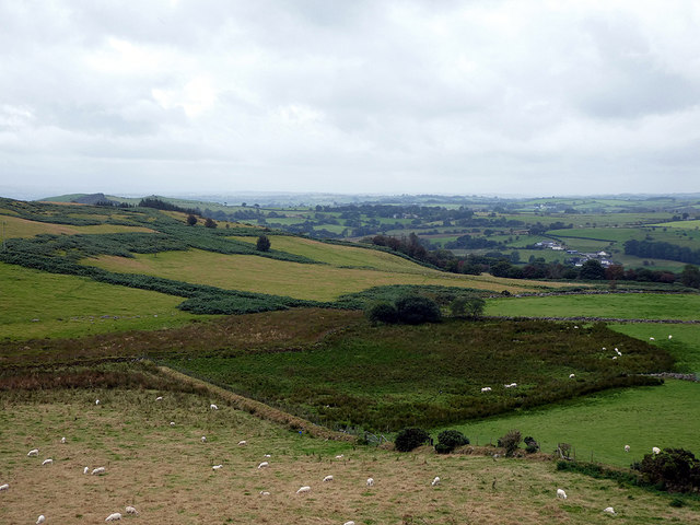
Coed Tynybedw is a picturesque woodland located in the county of Cardiganshire, Wales. It covers an area of approximately 100 acres and is nestled within the breathtaking countryside of the Teifi Valley. The name "Tynybedw" translates to "Birch Farm" in English, alluding to the presence of birch trees that dominate the woodland.

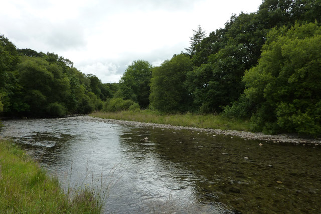
This enchanting forest is a haven for nature lovers and outdoor enthusiasts alike. Its diverse ecosystem encompasses a variety of tree species, including oak, ash, beech, and rowan, creating a vibrant and verdant landscape throughout the year. The woodland floor is adorned with a rich carpet of ferns, bluebells, and wildflowers, adding bursts of color and beauty to the surroundings.

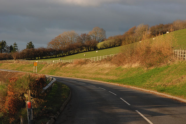
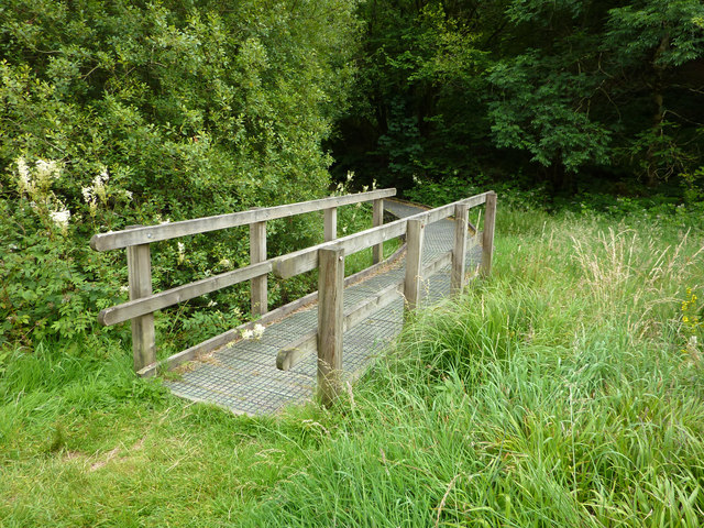
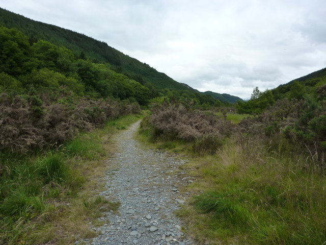
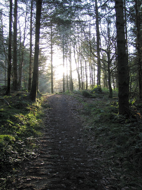
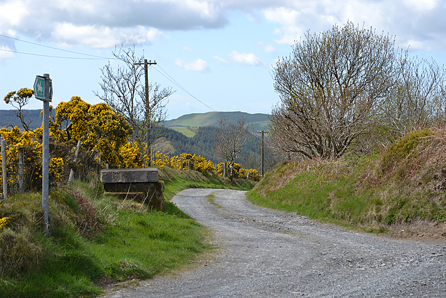
Coed Tynybedw is crisscrossed by a network of well-maintained footpaths and trails, allowing visitors to explore its wonders at their own pace. The tranquil atmosphere and abundant wildlife make it the perfect destination for leisurely walks, birdwatching, and nature photography. Lucky visitors may catch a glimpse of native species such as red kites, buzzards, and woodpeckers, as well as elusive mammals like badgers and foxes.

The woodland also holds historical significance, with remnants of ancient settlements and burial mounds scattered throughout its expanse. These archaeological sites provide a window into the area's rich past, offering glimpses of the lives of those who once called this forest home.

Coed Tynybedw is a hidden gem in the heart of Cardiganshire, offering a serene and captivating escape from the hustle and bustle of everyday life. With its natural beauty, diverse flora and fauna, and intriguing history, it is a must-visit destination for anyone seeking a peaceful retreat in the Welsh countryside.

If you have any feedback on the listing, please let us know in the comments section below.

Coed Tynybedw Images

Images are sourced within 2km of 52.325046/-3.9176966 or Grid Reference SN6971. Thanks to Geograph Open Source API. All images are credited.

B4340 in Tynygraig
B4340 in Tynygraig
B4340 north of Tynygraig
Talfryn Farmhouse On the southern flank of Mynydd Bach.
Talfryn Farmhouse
On the southern flank of Mynydd Bach.
Farmland at Talfryn
Farmland at Talfryn
Pasture and woodland east of Tynygraig, Ceredigion Sheep and horses share the grazing rights this summer.
Pasture and woodland east of Tynygraig, Ceredigion
Sheep and horses share the grazing rights this summer.
Pasture and hillside near Tynygraig, Ceredigion Looking across Cwm Tarw.
Pasture and hillside near Tynygraig, Ceredigion
Looking across Cwm Tarw.
Pentref Tynygraig / Tynygraig Village B4340 yng nghanol Pentref Tynygraig / B4340 in the centre of Tynygraig Village
Pentref Tynygraig / Tynygraig Village
B4340 yng nghanol Pentref Tynygraig / B4340 in the centre of Tynygraig Village
The B4340 leaving Tynygraig One of the few good bits of road. The sign ahead warns of the number of accidents in recent years, on what is the popular route between Aberystwyth and Pontrhydfendigaid, but which has a number of tricky sections.
The B4340 leaving Tynygraig
One of the few good bits of road. The sign ahead warns of the number of accidents in recent years, on what is the popular route between Aberystwyth and Pontrhydfendigaid, but which has a number of tricky sections.
New bungalow near Llanafan
Afon Ystwyth near Grogwynion Nature Reserve
Boardwalk at Grogwynion Nature Reserve
Path through Grogwynion Nature Reserve Alongside the Afon Ystwyth. Heavy metal pollution from mining higher up Cwm Ystwyth means that this area is relatively clear of trees. Heather dominates.
Back in 1979 and 1980 this was the site of a free festival - the Psilocybin Fayre. <span class="nowrap"><a title="http://www.ukrockfestivals.com/Psilocybin-Festival.html" rel="nofollow ugc noopener" href="http://www.ukrockfestivals.com/Psilocybin-Festival.html">Link</a><img style="margin-left:2px;" alt="External link" title="External link - shift click to open in new window" src="https://s1.geograph.org.uk/img/external.png" width="10" height="10"/></span>
Path through Grogwynion Nature Reserve
Alongside the Afon Ystwyth. Heavy metal pollution from mining higher up Cwm Ystwyth means that this area is relatively clear of trees. Heather dominates. Back in 1979 and 1980 this was the site of a free festival - the Psilocybin Fayre. LinkExternal link
Afon Ystwyth from Grogwynion Nature Reserve
Heathland at Grogwynion Nature Reserve Alongside the Afon Ystwyth. Heavy metal pollution from mining higher up Cwm Ystwyth means that this area is relatively clear of trees. Heather dominates.
Back in 1979 and 1980 this was the site of a free festival - the Psilocybin Fayre. <span class="nowrap"><a title="http://www.ukrockfestivals.com/Psilocybin-Festival.html" rel="nofollow ugc noopener" href="http://www.ukrockfestivals.com/Psilocybin-Festival.html">Link</a><img style="margin-left:2px;" alt="External link" title="External link - shift click to open in new window" src="https://s1.geograph.org.uk/img/external.png" width="10" height="10"/></span>
Heathland at Grogwynion Nature Reserve
Alongside the Afon Ystwyth. Heavy metal pollution from mining higher up Cwm Ystwyth means that this area is relatively clear of trees. Heather dominates. Back in 1979 and 1980 this was the site of a free festival - the Psilocybin Fayre. LinkExternal link
Path through trees near Grogwynion Nature Reserve
Forest path in Coed Tynybedw The path is one of several marked trails starting from the small car park at Grogwynion.  It climbs steeply out of the Ystwyth gorge, cutting off several turns in the forestry road.
Forest path in Coed Tynybedw
The path is one of several marked trails starting from the small car park at Grogwynion. It climbs steeply out of the Ystwyth gorge, cutting off several turns in the forestry road.
Forestry road in Coed Tynybedw The forestry road approaches the top of the south side of Ystwyth gorge after several turns.  Several marked paths make for a more pleasant and steeper way out of the deep valley.
Forestry road in Coed Tynybedw
The forestry road approaches the top of the south side of Ystwyth gorge after several turns. Several marked paths make for a more pleasant and steeper way out of the deep valley.
Track to Nant-byr-uchaf farm Also a bridleway which ends up at Tegfriw-fawr farm on the B4340.
Track to Nant-byr-uchaf farm
Also a bridleway which ends up at Tegfriw-fawr farm on the B4340.
Show me another place!

Coed Tynybedw is located at Grid Ref: SN6971 (Lat: 52.325046, Lng: -3.9176966)

Unitary Authority: Ceredigion

Police Authority: Dyfed Powys

What 3 Words

///december.nuance.snowmen. Near Lledrod, Ceredigion

Nearby Locations

Coed Tynybedw

Related Wikis

St Afan's Church, Llanafan

Saint Afan's Church (SN68387192) is located in Llanafan, 8 miles (13 km) east of Aberystwyth, Ceredigion, in Wales. == History == The original church on...

Ernest Vaughan, 7th Earl of Lisburne

Ernest Edmund Henry Malet Vaughan, 7th Earl of Lisburne KStJ (8 February 1892 – 30 June 1965), of Trawsgoed, Cardiganshire, was a Welsh nobleman. ��2...

Llanafan, Ceredigion

Llanafan is a small village between Tregaron and Aberystwyth, Ceredigion, in Wales. Llanafan is around ten miles from Aberystwyth and Tregaron. It is named...

Trawscoed fort

Trawscoed fort is a Roman auxiliary fort in Ceredigion, Wales, located near the modern settlement of Trawsgoed and is cut through by the modern B4340 road...

River Ystwyth

The River Ystwyth Welsh: Afon Ystwyth [ˈəstʊɨ̯θ] "winding river") is a river in Ceredigion, Wales. The length of the main river is 20.5 miles (33.0 km...

Caradog Falls Halt railway station

Caradog Falls Halt railway station was one of five new halts on the Carmarthen to Aberystwyth Line (originally called the Manchester and Milford Railway...

Ty'n-y-graig

Ty'n-y-graig is a hamlet in the community of Ystrad Meurig, Ceredigion, Wales, which is 65.3 miles (105.2 km) from Cardiff and 170.7 miles (274.8 km)...

Wenallt

Wenallt is a hamlet in the community of Trawsgoed, Ceredigion, Wales, 10 miles (16 km) southeast of Aberystwyth. Wenallt is represented in the Senedd...

Related Videos

7 HOURS of Relaxing Campfire Sounds | Burning Logs with Crackling sound | 4K HD

A high quality (4k HD) video of our fire pit during our trip to Dolau Afon in Wales. It was a magical night were we were able to ...

Nearby Amenities

Located within 500m of 52.325046,-3.9176966
Source: npe
Lat/Long: 52.3259417/-3.9239767
The data included in this document is from www.openstreetmap.org. The data is made available under ODbL.

Have you been to Coed Tynybedw?

Leave your review of Coed Tynybedw below (or comments, questions and feedback).