Allt Pantadam

Wood, Forest in Carmarthenshire

Wales

Allt Pantadam

Country road passing through Allt y Graig Country road passing through Allt y Graig in the Cothi valley.
Country road passing through Allt y Graig Credit: Philip Halling

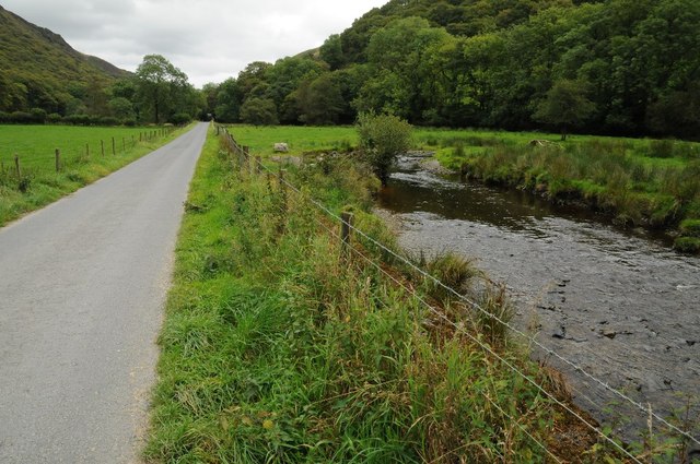
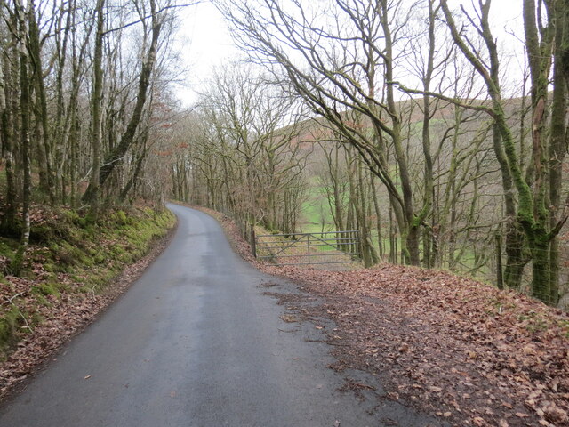
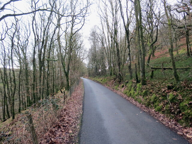
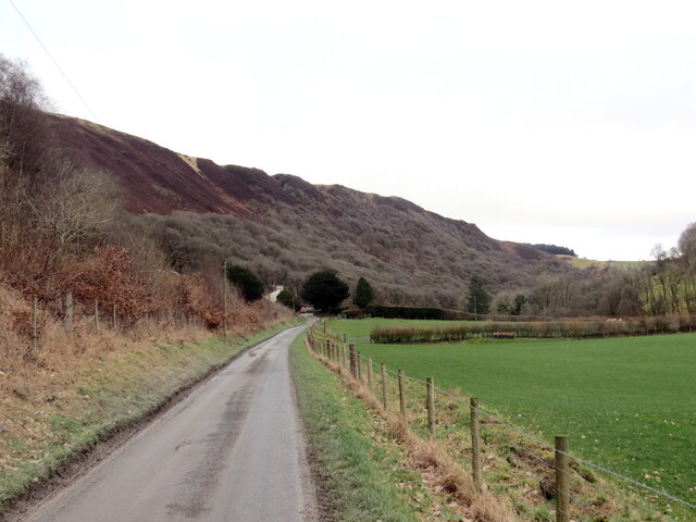
Allt Pantadam is a picturesque woodland located in the county of Carmarthenshire, Wales. Spread across an area of approximately 200 acres, it is known for its rich biodiversity and stunning natural beauty. The woodland is situated near the village of Pantyffynnon, just a few miles north of Ammanford.

Allt Pantadam is predominantly composed of native broadleaf trees, including oak, beech, and ash, which create a dense canopy and provide a habitat for various flora and fauna. The woodland is home to a diverse range of plant species, including bluebells, primroses, and wild garlic, which create a vibrant and colorful display during springtime.

The forest is also a haven for wildlife, with numerous bird species, such as woodpeckers, thrushes, and finches, regularly spotted in the area. Mammals, including badgers, foxes, and squirrels, can also be found within the woodland, adding to its ecological significance.

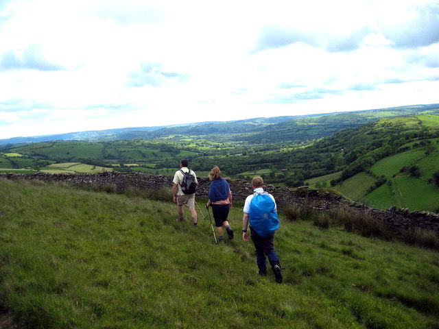
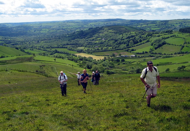
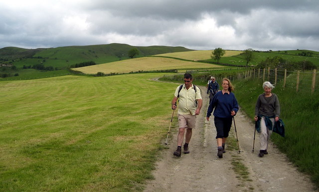
Allt Pantadam offers visitors a serene and tranquil environment, making it an ideal destination for nature lovers and outdoor enthusiasts. The woodland features several walking trails, allowing visitors to explore its beauty and discover hidden gems along the way. These trails are well-maintained and provide access to stunning viewpoints, offering breathtaking vistas of the surrounding countryside.

In addition to its natural attractions, Allt Pantadam is also a site of historical importance. The woodland was once part of a larger estate and boasts remnants of past structures, such as an old lime kiln, which serve as a reminder of the area's industrial past.

Overall, Allt Pantadam is a remarkable woodland that showcases the beauty of Carmarthenshire's natural landscape. Its diverse flora and fauna, combined with its historical significance, make it a truly enchanting destination for visitors of all ages.

If you have any feedback on the listing, please let us know in the comments section below.

Allt Pantadam Images

Images are sourced within 2km of 52.091379/-3.9117597 or Grid Reference SN6945. Thanks to Geograph Open Source API. All images are credited.

Country road passing through Allt y Graig Country road passing through Allt y Graig in the Cothi valley.
Country road passing through Allt y Graig
Country road passing through Allt y Graig in the Cothi valley.
Road beside Afon Cothi Country road beside Afon Cothi to the east of Cwrt-y-Cadno.
Road beside Afon Cothi
Country road beside Afon Cothi to the east of Cwrt-y-Cadno.
Ordnance Survey Cut Mark This OS cut mark can be found on the NW parapet of the bridge over the Afon Cothi. It marks a point 195.493m above mean sea level.
Ordnance Survey Cut Mark
This OS cut mark can be found on the NW parapet of the bridge over the Afon Cothi. It marks a point 195.493m above mean sea level.
Cwrt y Cadno Cyrraedd pentre bach gwledig Cwrt y Cadno. 

Entering the little rural village of Cwrt y Cadno (trans. Court of the fox).
Cwrt y Cadno
Cyrraedd pentre bach gwledig Cwrt y Cadno. Entering the little rural village of Cwrt y Cadno (trans. Court of the fox).
Tuat at Gwrt y Cadno / Towards Cwrt y Cadno Heol fach wledig yn mynd i gyfeiriad pentre bach Cwrt y Cadno.

A minor rural road heading towards the little village of Cwrt y Cadno (trans. court of the fox).
Tuat at Gwrt y Cadno / Towards Cwrt y Cadno
Heol fach wledig yn mynd i gyfeiriad pentre bach Cwrt y Cadno. A minor rural road heading towards the little village of Cwrt y Cadno (trans. court of the fox).
Llwybr ceffyl ger Pentwyn / A bridleway near Pentwyn Llwybr ceffyl ger Ffarm Pentwyn yn dringo i gyfeiriad Mynydd Mallaen.

A bridleway near Pentwyn Farm (trans. top of the hillock) ascends towards Mynydd Mallaen (trans. mountain of Llaen's plain).
Llwybr ceffyl ger Pentwyn / A bridleway near Pentwyn
Llwybr ceffyl ger Ffarm Pentwyn yn dringo i gyfeiriad Mynydd Mallaen. A bridleway near Pentwyn Farm (trans. top of the hillock) ascends towards Mynydd Mallaen (trans. mountain of Llaen's plain).
Llwybr i Gwrt y Cadno / Path to Cwrt y Cadno Llwybr ceffyl yn mynd i lawr y waered i gyfeiriad pentre bach Cwrty Cadno.

A bridleway descends the hill in the direction of the little village of Cwrt y Cadno (trans. court of the fox).
Llwybr i Gwrt y Cadno / Path to Cwrt y Cadno
Llwybr ceffyl yn mynd i lawr y waered i gyfeiriad pentre bach Cwrty Cadno. A bridleway descends the hill in the direction of the little village of Cwrt y Cadno (trans. court of the fox).
 A wide sweep The forestry on the horizon sits above the grazing land in the foreground: all is in the square.
A wide sweep
The forestry on the horizon sits above the grazing land in the foreground: all is in the square.
Llwybr Ceffyl Cwrt y Cadno bridleway Llwybr ceffyl yn arwain i lawr o Fynydd Mallaen at dreflan Cwrt y Cadno. Yn y pellter gellir gweld Capel Cwrtycadno.

A bridleway leading down from Mynydd Mallaen (trans. plains of Llain) Mountain to the hamlet of Cwrtycadno (trans. Court of the fox). Capel Cwrtycadno Chapel can be seen in the distance.
Llwybr Ceffyl Cwrt y Cadno bridleway
Llwybr ceffyl yn arwain i lawr o Fynydd Mallaen at dreflan Cwrt y Cadno. Yn y pellter gellir gweld Capel Cwrtycadno. A bridleway leading down from Mynydd Mallaen (trans. plains of Llain) Mountain to the hamlet of Cwrtycadno (trans. Court of the fox). Capel Cwrtycadno Chapel can be seen in the distance.
Uwchben Tynant / Above Tynant Cerddwyr yn dilyn llwybr ar rostir uwchben Ffarm Tynant.

Walkers following a path on a hill slope above Tynant Farm (stream house).
Uwchben Tynant / Above Tynant
Cerddwyr yn dilyn llwybr ar rostir uwchben Ffarm Tynant. Walkers following a path on a hill slope above Tynant Farm (stream house).
Dringo'r tyle / Ascending the hill Cerddwyr yn dringo'r tyle yn ardal Ffarmers.

Walkers ascending the hill in the Ffarmers area.
Dringo'r tyle / Ascending the hill
Cerddwyr yn dringo'r tyle yn ardal Ffarmers. Walkers ascending the hill in the Ffarmers area.
Llwybr Blaenau / Blaenau path Cerddwyr yn dilyn llwybr cyhoeddus i lawr o'r ucheldir tuag at Ffarm y Blaenau.

Walkers following a public path down from the hills in the direction of Blaenau Farm (trans. uplands)
Llwybr Blaenau / Blaenau path
Cerddwyr yn dilyn llwybr cyhoeddus i lawr o'r ucheldir tuag at Ffarm y Blaenau. Walkers following a public path down from the hills in the direction of Blaenau Farm (trans. uplands)
Hen Ysgol Cwrtycadno Old School Hen Ysgol Cwrtycadno sy wedi bod am flynyddoedd yn eiddo i Ysgol Gyfun Rhydfelen fel canolfan weithgareddau.

Cwrtycadno (tran. fox court) Old School has been for years the property of Rhydfelen (trans. brown ford) Comprehensive School and used as an activity centre.
Hen Ysgol Cwrtycadno Old School
Hen Ysgol Cwrtycadno sy wedi bod am flynyddoedd yn eiddo i Ysgol Gyfun Rhydfelen fel canolfan weithgareddau. Cwrtycadno (tran. fox court) Old School has been for years the property of Rhydfelen (trans. brown ford) Comprehensive School and used as an activity centre.
Allt Troed-Rhiw-Gelli-Fawr The northern edge of the forest
Allt Troed-Rhiw-Gelli-Fawr
The northern edge of the forest
Foel - East Side The track leading up past the east side of Foel. It looks like the ferns have been burnt relatively recently.
Foel - East Side
The track leading up past the east side of Foel. It looks like the ferns have been burnt relatively recently.
Heol i Gilycwm / Road to Cilycwm Heol fach o dan Graig yr Allt yn mynd i gyfeiriad pentre Cilycwm.

A minor road below Craig yr Allt (trans. crag of the wooded hill) heading towards Cilycwm village (trans. valley nook).
Heol i Gilycwm / Road to Cilycwm
Heol fach o dan Graig yr Allt yn mynd i gyfeiriad pentre Cilycwm. A minor road below Craig yr Allt (trans. crag of the wooded hill) heading towards Cilycwm village (trans. valley nook).
Heol i Gwrtycadno / Road to Cwrtycadno Heol fach wledig yn mynd i gyfeiriad Cwrtycadno.

A minor rural road heading towards Cwrtycadno (trans. court of the fox).
Heol i Gwrtycadno / Road to Cwrtycadno
Heol fach wledig yn mynd i gyfeiriad Cwrtycadno. A minor rural road heading towards Cwrtycadno (trans. court of the fox).
Heol i Gilycwm / Road to Cilycwm Heol fach wledig ger Aber Branddu yn mynd i gyfeiriad Cilcwm.

A minor rural road near Aber Branddu (trans. confluence of the black crow stream).
Heol i Gilycwm / Road to Cilycwm
Heol fach wledig ger Aber Branddu yn mynd i gyfeiriad Cilcwm. A minor rural road near Aber Branddu (trans. confluence of the black crow stream).
Show me another place!

Allt Pantadam is located at Grid Ref: SN6945 (Lat: 52.091379, Lng: -3.9117597)

Unitary Authority: Carmarthenshire

Police Authority: Dyfed Powys

What 3 Words

///gallons.helpfully.fully. Near Llangybi, Ceredigion

Related Wikis

Ffarmers

Ffarmers is a village near Lampeter, in the north of Carmarthenshire, Wales. It was named after the old "Farmers' Arms" public house, which is now closed...

Llanycrwys

Llanycrwys is a hamlet and community located in Carmarthenshire, Wales. Situated in the historical Cayo Hundred in the Union of Lampeter, it is situated...

Mynydd Mallaen

Mynydd Mallaen (Welsh: [ˈmənɨð ˈmaɬai̯n]) is an expansive plateau to the northwest of Cilycwm in northeast Carmarthenshire, Wales. It forms part of the...

Cynwyl Gaeo

Cynwyl Gaeo is a parish and community located in rural Carmarthenshire, Wales, near the boundary with Ceredigion, in the upper Cothi valley about halfway...

Have you been to Allt Pantadam?

Leave your review of Allt Pantadam below (or comments, questions and feedback).