Coed Cerrig-mawr

Wood, Forest in Cardiganshire

Wales

Coed Cerrig-mawr

Dyfi Furnace
Dyfi Furnace Credit: John H Darch

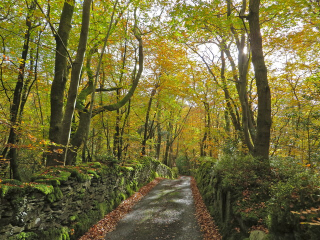
Coed Cerrig-mawr, located in Cardiganshire, is a picturesque woodland area renowned for its natural beauty and biodiversity. Covering a vast expanse, this enchanting forest is a haven for nature enthusiasts and hikers alike.

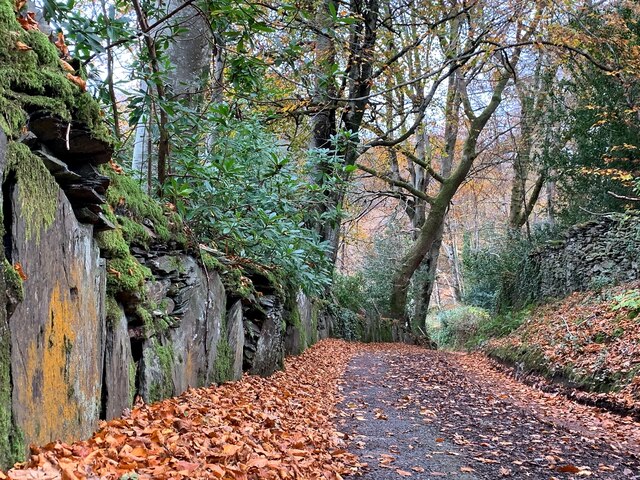
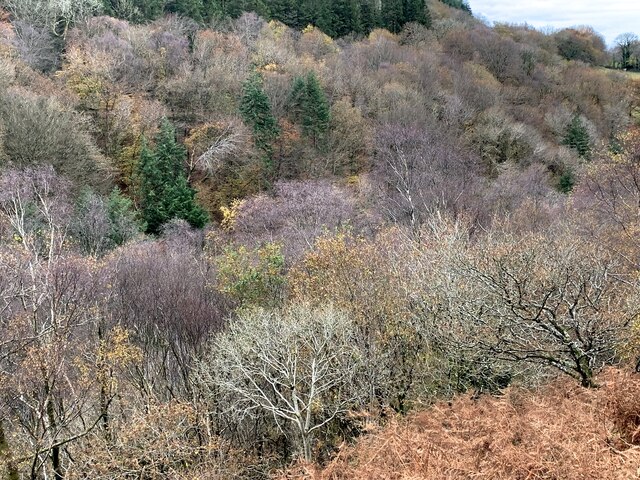
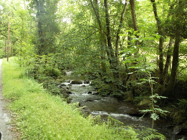
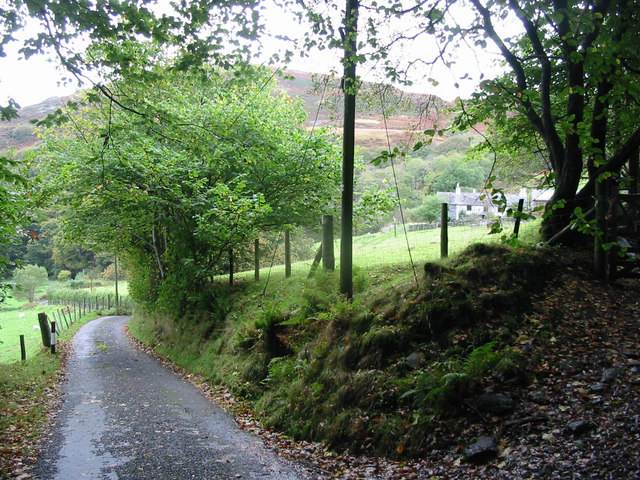
Situated within the Cambrian Mountains, Coed Cerrig-mawr boasts a rich tapestry of diverse flora and fauna. The forest is predominantly composed of native tree species such as oak, beech, and birch, creating a dense, verdant canopy that provides a tranquil and inviting ambiance. The forest floor is adorned with a myriad of wildflowers, enhancing the visual appeal and adding to the vibrant ecosystem.

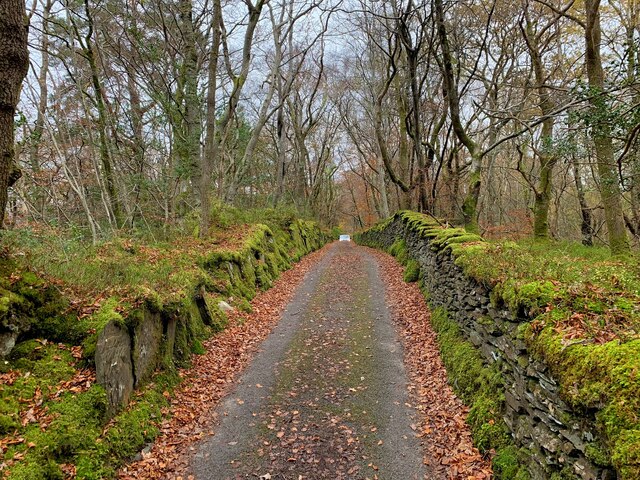
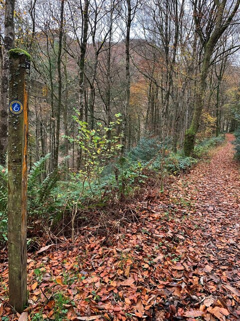
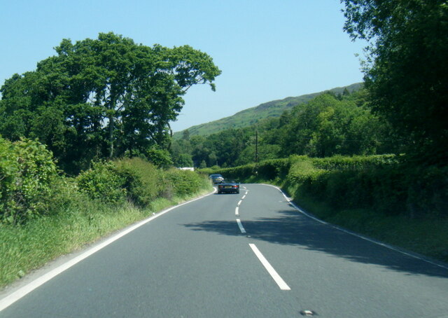
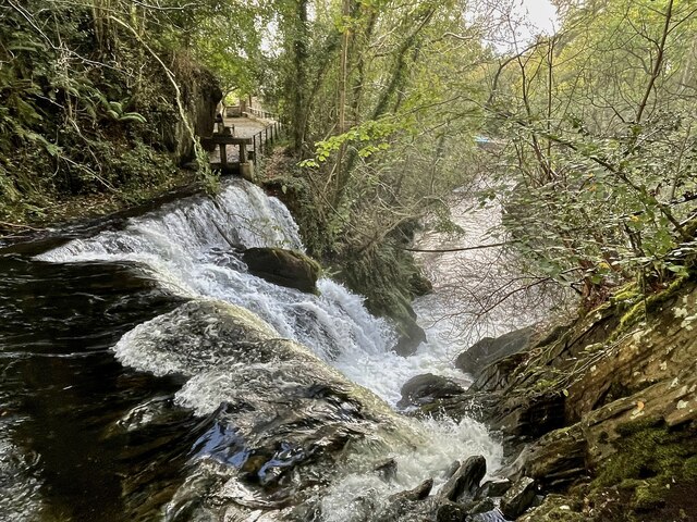
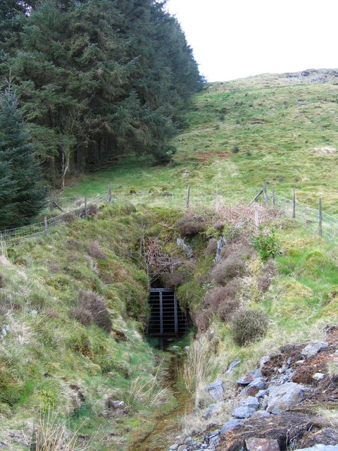
Hikers and outdoor enthusiasts are drawn to Coed Cerrig-mawr for its extensive network of well-maintained trails. These paths wind through the forest, offering breathtaking views of the surrounding landscape and opportunities to spot wildlife, including deer, foxes, and a variety of bird species. The forest also features a serene river that meanders through its heart, adding to its idyllic charm.

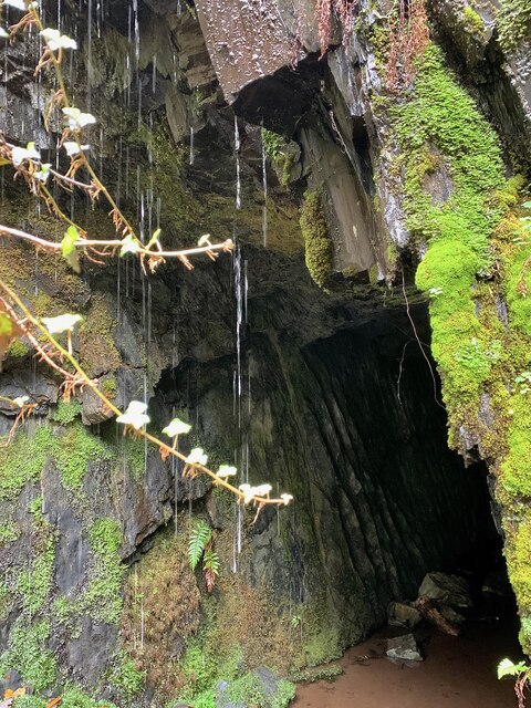
Coed Cerrig-mawr is not only a recreational paradise but also plays a crucial role in environmental conservation. The forest serves as a vital habitat for numerous endangered species, including the red squirrel and the pied flycatcher. Conservation efforts in the area focus on preserving the delicate balance of the ecosystem and protecting the diverse range of species that call this forest home.

Overall, Coed Cerrig-mawr is a natural gem, offering visitors a chance to immerse themselves in the beauty of nature and experience the tranquility of a pristine woodland. Whether it's for leisurely walks, birdwatching, or simply appreciating the wonders of the natural world, this forest is a must-visit destination for anyone seeking solace in the great outdoors.

If you have any feedback on the listing, please let us know in the comments section below.

Coed Cerrig-mawr Images

Images are sourced within 2km of 52.531408/-3.9374552 or Grid Reference SN6894. Thanks to Geograph Open Source API. All images are credited.

Dyfi Furnace
Dyfi Furnace
Lôn uwchben Ffwrnais The lane above Furnace through the woods.
Lôn uwchben Ffwrnais
The lane above Furnace through the woods.
Bwlcheinion Sea View Arwydd ar A487 yn Ffwrnais / Sign on the A487 in Furnace.
Bwlcheinion Sea View
Arwydd ar A487 yn Ffwrnais / Sign on the A487 in Furnace.
Wal y lôn, Ffwrnais / Lane wall, Furnace
Lôn uwchben Ffwrnais / Lane above Furnace In the last of the autumn colours.
Lôn uwchben Ffwrnais / Lane above Furnace
In the last of the autumn colours.
Mine adit, in the woods near Furnace In the woods above the rushing Afon Einion are plenty of remnants of the area's industrial age. In the C19, silver, lead, copper and zinc were all mined in the valley.
Mine adit, in the woods near Furnace
In the woods above the rushing Afon Einion are plenty of remnants of the area's industrial age. In the C19, silver, lead, copper and zinc were all mined in the valley.
Yr olaf o liwiau'r hydref / Last of the autumn colours Along Cwm Einion, above Ffwrnais/Furnace village.
Yr olaf o liwiau'r hydref / Last of the autumn colours
Along Cwm Einion, above Ffwrnais/Furnace village.
Wales Coast(less) Path, Cwm Einion Because there's no bridging point of the Dyfi lower than Machynlleth, the coast path has to veer a long way inland. It's a glorious route, all the same, but don't bring a bucket and spade.
Wales Coast(less) Path, Cwm Einion
Because there's no bridging point of the Dyfi lower than Machynlleth, the coast path has to veer a long way inland. It's a glorious route, all the same, but don't bring a bucket and spade.
A487 near Coed y Fedw
A487 at Furnace village boundary
Rhaeadr yr Afon Einion, Ffwrnais At the top of the Furnace waterfall, looking down it and the Afon Einion towards the A487 bridge. The furnace building itself is behind the rock top left. The old leat running to the waterwheel there can be seen, with a sluice gate in front of it.
Rhaeadr yr Afon Einion, Ffwrnais
At the top of the Furnace waterfall, looking down it and the Afon Einion towards the A487 bridge. The furnace building itself is behind the rock top left. The old leat running to the waterwheel there can be seen, with a sluice gate in front of it.
Afon Einion Afon Einion in Cwm Einion, just East of Pont Tyn y Cwm.
Afon Einion
Afon Einion in Cwm Einion, just East of Pont Tyn y Cwm.
Artist's Valley looking down towards Furnace
Deep adit, Ystrad Einion mine This is the deep adit entrance to Ystrad Einion mine, which was worked for copper, zinc and lead in the 1890s.
Deep adit, Ystrad Einion mine
This is the deep adit entrance to Ystrad Einion mine, which was worked for copper, zinc and lead in the 1890s.
Upper adit, Ystrad Einion mine This is the gated entrance to the upper adit level of this late 19th century copper, zinc and lead mine.
Upper adit, Ystrad Einion mine
This is the gated entrance to the upper adit level of this late 19th century copper, zinc and lead mine.
Underground waterwheel, Ystrad Einion Underground waterwheels were not uncommon in Victorian metal mines like Ystrad Einion, but they don't usually survive.  This very rare pumping and winding wheel is 16' in diameter and was used to pump water and wind ore and waste rock from an underground shaft.
Underground waterwheel, Ystrad Einion
Underground waterwheels were not uncommon in Victorian metal mines like Ystrad Einion, but they don't usually survive. This very rare pumping and winding wheel is 16' in diameter and was used to pump water and wind ore and waste rock from an underground shaft.
Dol Goch Seen from the high level path along the north side of Cwm Einion.
Dol Goch
Seen from the high level path along the north side of Cwm Einion.
Bwlch-y-maen A recently renovated building high above Cwm Einion.
Bwlch-y-maen
A recently renovated building high above Cwm Einion.
Show me another place!

Coed Cerrig-mawr is located at Grid Ref: SN6894 (Lat: 52.531408, Lng: -3.9374552)

Unitary Authority: Ceredigion

Police Authority: Dyfed Powys

What 3 Words

///soaps.argue.jets. Near Machynlleth, Powys

Related Wikis

Coed y Garth, Ceredigion

Coed y Garth is a small village in the community of Ysgubor-y-coed, Ceredigion, Wales, which is 79.7 miles (128.2 km) from Cardiff and 176.9 miles (284...

Coed Cwm Einion

Coed Cwm Einion is a woodland to the east of the village of Furnace, in Ceredigion, west Wales. It is designated a Site of Special Scientific Interest...
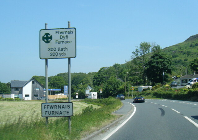
Furnace, Ceredigion

Furnace (Welsh: Ffwrnais) is a hamlet in Ceredigion, Wales on the A487 trunk road from Machynlleth to Aberystwyth, near Eglwysfach. It is the location...
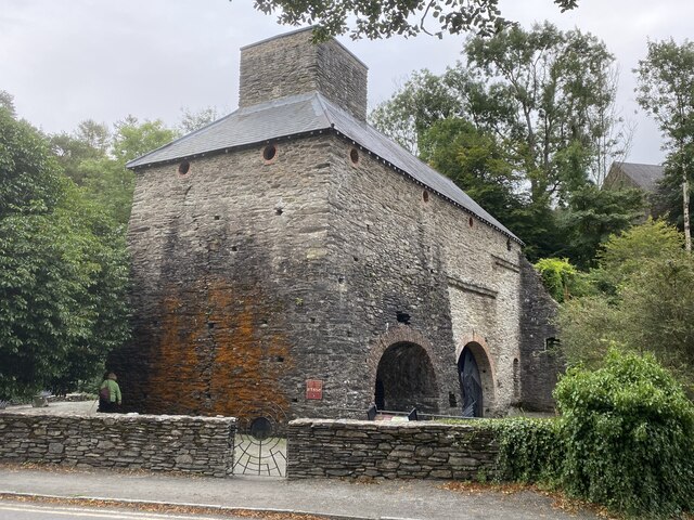
Dyfi Furnace

Dyfi Furnace is a restored mid 18th century charcoal fired blast furnace used for smelting iron ore. It has given its name to the adjoining hamlet of Furnace...

Nearby Amenities

Located within 500m of 52.531408,-3.9374552
Place: farm
Lat/Long: 52.5287703/-3.9428431
Power: pole
Lat/Long: 52.5327652/-3.9418066
Power: pole
Lat/Long: 52.5320343/-3.9421552
Power: pole
Lat/Long: 52.5314762/-3.9425522
Power: pole
Lat/Long: 52.531039/-3.9432764
Power: pole
Lat/Long: 52.5306082/-3.9440167
Leisure: picnic_table
Lat/Long: 52.5304817/-3.9431678
The data included in this document is from www.openstreetmap.org. The data is made available under ODbL.

Have you been to Coed Cerrig-mawr?

Leave your review of Coed Cerrig-mawr below (or comments, questions and feedback).