Coed y Fedw

Wood, Forest in Cardiganshire

Wales

Coed y Fedw

Dyfi Furnace
Dyfi Furnace Credit: John H Darch

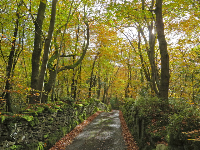
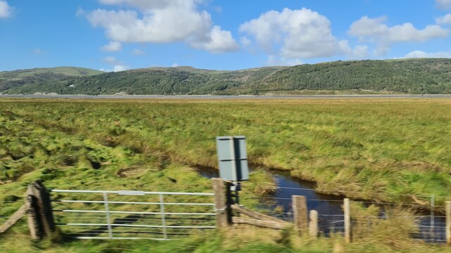
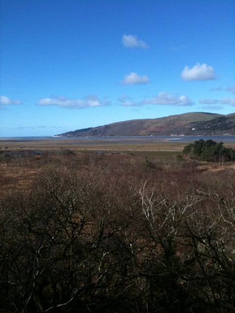
Coed y Fedw is a picturesque woodland located in Cardiganshire, Wales. With its dense canopy of trees and tranquil surroundings, it is a popular destination for nature enthusiasts and those seeking a peaceful retreat.

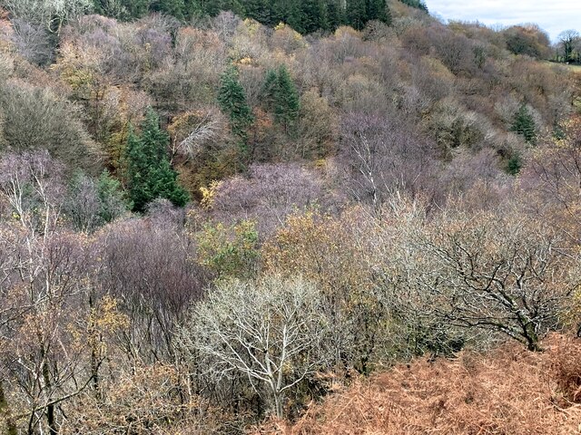
Covering an area of approximately 100 acres, Coed y Fedw is home to a diverse range of flora and fauna, making it a haven for wildlife. The woodland is predominantly made up of native species such as oak, beech, and birch trees, which provide a rich habitat for various bird species, mammals, and insects.

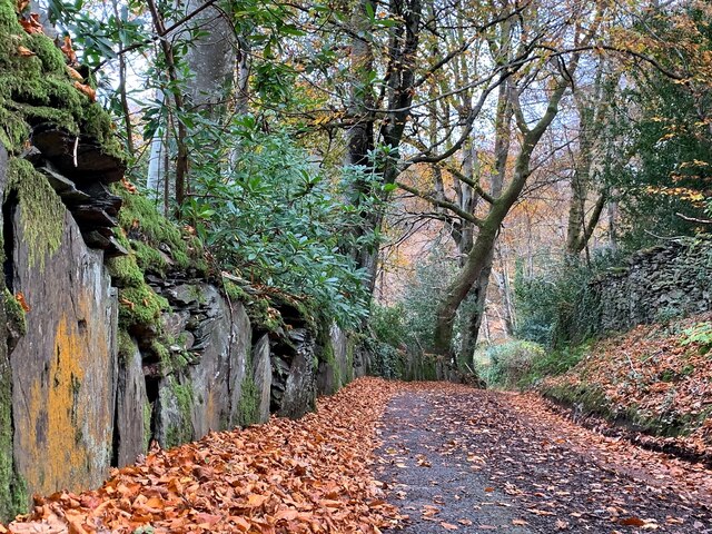
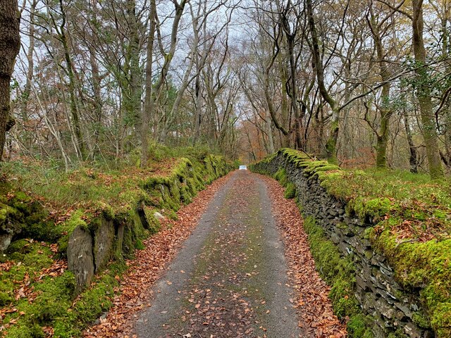
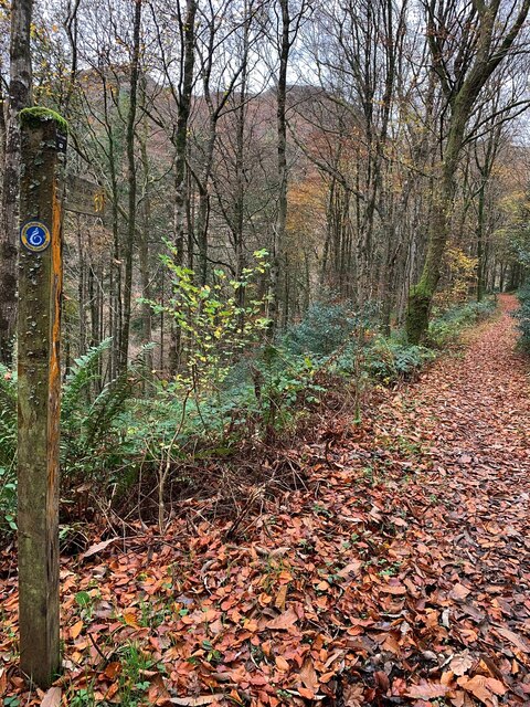
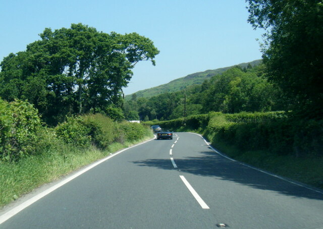
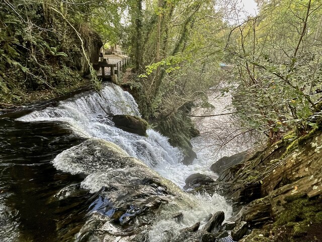
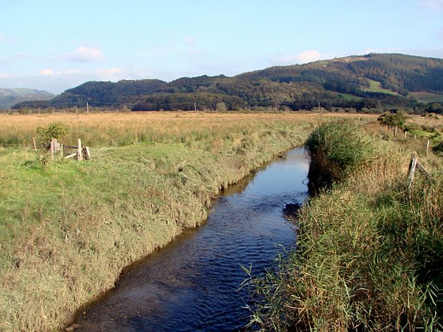
Visitors to Coed y Fedw can explore the woodland through a network of well-maintained footpaths and trails. These paths meander through the forest, offering stunning views of the surrounding landscape and opportunities for wildlife spotting. The woodland also features a small stream that adds to its natural beauty.

Coed y Fedw is open to the public throughout the year, and visitors are encouraged to respect the environment and wildlife while enjoying their visit. The woodland is particularly popular during the spring and summer months when the trees are in full bloom, creating a vibrant and colorful setting.

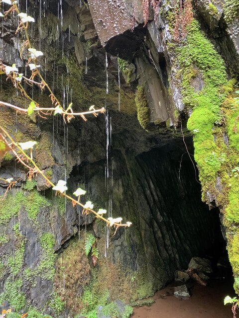
In addition to its natural beauty, Coed y Fedw also has historical significance. It is believed that the woodland has been in existence for centuries and may have been used for various purposes by local communities in the past.

Overall, Coed y Fedw offers a serene and tranquil escape from the hustle and bustle of everyday life, allowing visitors to reconnect with nature and enjoy the peacefulness of this beautiful Welsh woodland.

If you have any feedback on the listing, please let us know in the comments section below.

Coed y Fedw Images

Images are sourced within 2km of 52.534571/-3.952339 or Grid Reference SN6794. Thanks to Geograph Open Source API. All images are credited.

Dyfi Furnace
Dyfi Furnace
Lôn uwchben Ffwrnais The lane above Furnace through the woods.
Lôn uwchben Ffwrnais
The lane above Furnace through the woods.
Bwlcheinion Sea View Arwydd ar A487 yn Ffwrnais / Sign on the A487 in Furnace.
Bwlcheinion Sea View
Arwydd ar A487 yn Ffwrnais / Sign on the A487 in Furnace.
Wal y lôn, Ffwrnais / Lane wall, Furnace
Lôn uwchben Ffwrnais / Lane above Furnace In the last of the autumn colours.
Lôn uwchben Ffwrnais / Lane above Furnace
In the last of the autumn colours.
Mine adit, in the woods near Furnace In the woods above the rushing Afon Einion are plenty of remnants of the area's industrial age. In the C19, silver, lead, copper and zinc were all mined in the valley.
Mine adit, in the woods near Furnace
In the woods above the rushing Afon Einion are plenty of remnants of the area's industrial age. In the C19, silver, lead, copper and zinc were all mined in the valley.
Yr olaf o liwiau'r hydref / Last of the autumn colours Along Cwm Einion, above Ffwrnais/Furnace village.
Yr olaf o liwiau'r hydref / Last of the autumn colours
Along Cwm Einion, above Ffwrnais/Furnace village.
Wales Coast(less) Path, Cwm Einion Because there's no bridging point of the Dyfi lower than Machynlleth, the coast path has to veer a long way inland. It's a glorious route, all the same, but don't bring a bucket and spade.
Wales Coast(less) Path, Cwm Einion
Because there's no bridging point of the Dyfi lower than Machynlleth, the coast path has to veer a long way inland. It's a glorious route, all the same, but don't bring a bucket and spade.
Salt marsh near Ynis Edwin
Ordnance Survey Cut Mark This OS cut mark can be found on the wall west side of the road. It marks a point 41.319m above mean sea level.
Ordnance Survey Cut Mark
This OS cut mark can be found on the wall west side of the road. It marks a point 41.319m above mean sea level.
Milestone - Aberystwyth 10 Badly damaged milestone east side of road.
Milestone - Aberystwyth 10
Badly damaged milestone east side of road.
A487 in The Park woodland
A487 near Coed y Fedw
A487 at Furnace village boundary
From a Machynlleth-Aberystwyth train, saltmarsh by the Dovey estuary
Rhaeadr yr Afon Einion, Ffwrnais At the top of the Furnace waterfall, looking down it and the Afon Einion towards the A487 bridge. The furnace building itself is behind the rock top left. The old leat running to the waterwheel there can be seen, with a sluice gate in front of it.
Rhaeadr yr Afon Einion, Ffwrnais
At the top of the Furnace waterfall, looking down it and the Afon Einion towards the A487 bridge. The furnace building itself is behind the rock top left. The old leat running to the waterwheel there can be seen, with a sluice gate in front of it.
View towards the Dovey estuary, from a bird hide in the Ynys hir RSPB site
Show me another place!

Coed y Fedw is located at Grid Ref: SN6794 (Lat: 52.534571, Lng: -3.952339)

Unitary Authority: Ceredigion

Police Authority: Dyfed Powys

What 3 Words

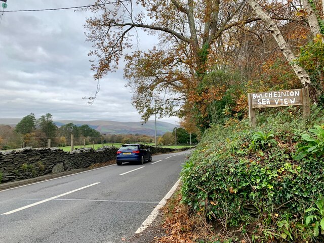
///acid.catchers.huts. Near Borth, Ceredigion

Nearby Locations

Coed y Fedw

Related Wikis

Coed y Garth, Ceredigion

Coed y Garth is a small village in the community of Ysgubor-y-coed, Ceredigion, Wales, which is 79.7 miles (128.2 km) from Cardiff and 176.9 miles (284...
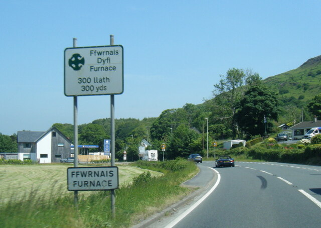
Furnace, Ceredigion

Furnace (Welsh: Ffwrnais) is a hamlet in Ceredigion, Wales on the A487 trunk road from Machynlleth to Aberystwyth, near Eglwysfach. It is the location...
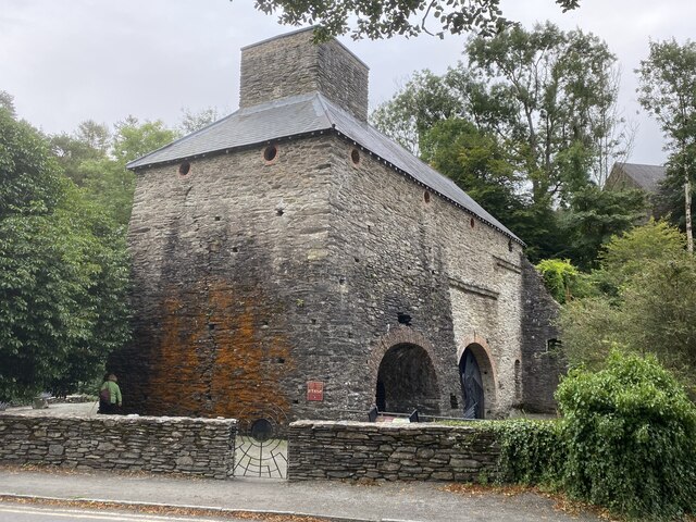
Dyfi Furnace

Dyfi Furnace is a restored mid 18th century charcoal fired blast furnace used for smelting iron ore. It has given its name to the adjoining hamlet of Furnace...

Eglwys Fach

Eglwys Fach, also known as Eglwys-fach or Eglwysfach, is a small village, roughly 12 miles (19 km) outside of Aberystwyth, Ceredigion. It is known for...

Ynys-hir RSPB reserve

Ynys-hir RSPB reserve is a nature reserve of the RSPB situated beside the Dyfi estuary in Ceredigion, mid Wales between Aberystwyth and Machynlleth. The...

Coed Cwm Einion

Coed Cwm Einion is a woodland to the east of the village of Furnace, in Ceredigion, west Wales. It is designated a Site of Special Scientific Interest...

Afon Llyfnant

The River Llyfnant (Welsh: Afon Llyfnant) is a short river in Ceredigion, on the west coast of Wales. The river rises in the mountains south of Machynlleth...

Aberdyfi Castle

Aberdyfi Castle is a castle located near Glandyfi, Ceredigion, in Wales. All that now remains is the motte, which is referred to as Domen Las (traditionally...

Nearby Amenities

Located within 500m of 52.534571,-3.952339
Parking
Parking: layby
Lat/Long: 52.5330331/-3.9487178
Place: farm
Lat/Long: 52.5349515/-3.9565224
Place: farm
Lat/Long: 52.5361001/-3.9487976
Building: yes
Lat/Long: 52.5321866/-3.9481339
Power: pole
Lat/Long: 52.530693/-3.9527366
Power: pole
Lat/Long: 52.5304271/-3.9531979
Direction: SSE
Generator Method: photovoltaic
Generator Output Electricity: yes
Generator Solar Modules: 24
Generator Source: solar
Generator Type: solar_photovoltaic_panel
Location: roof
Power: generator
Lat/Long: 52.5310312/-3.9514605
The data included in this document is from www.openstreetmap.org. The data is made available under ODbL.

Have you been to Coed y Fedw?

Leave your review of Coed y Fedw below (or comments, questions and feedback).