Black Covert

Wood, Forest in Cardiganshire

Wales

Black Covert

Ystwyth Trail near Crosswood The Ystwyth Trail is a 32.1km/20M footpath and cycle route linking Tregaron and Aberystwyth. Part of the trail follows the track of the old Great Western Railway line. Here is where it crosses the B7545
Ystwyth Trail near Crosswood Credit: Eirian Evans

The requested URL returned error: 429 Too Many Requests

If you have any feedback on the listing, please let us know in the comments section below.
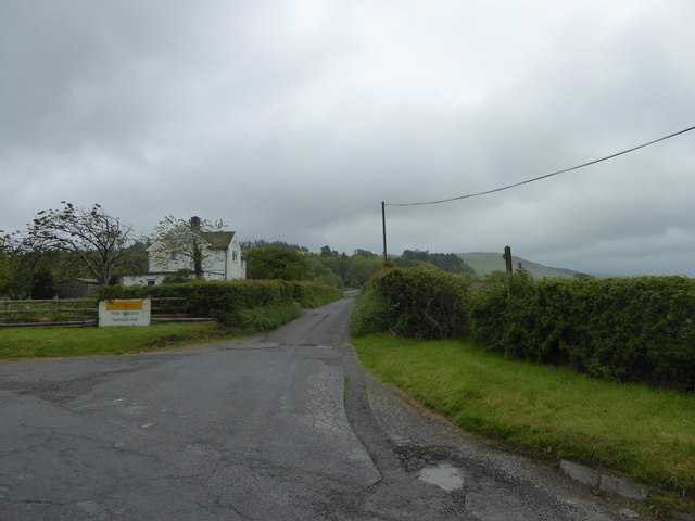
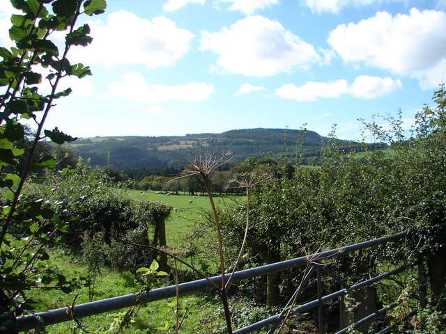
Black Covert Images

Images are sourced within 2km of 52.333962/-3.9530593 or Grid Reference SN6772. Thanks to Geograph Open Source API. All images are credited.

Ystwyth Trail near Crosswood The Ystwyth Trail is a 32.1km/20M footpath and cycle route linking Tregaron and Aberystwyth. Part of the trail follows the track of the old Great Western Railway line. Here is where it crosses the B7545
Ystwyth Trail near Crosswood
The Ystwyth Trail is a 32.1km/20M footpath and cycle route linking Tregaron and Aberystwyth. Part of the trail follows the track of the old Great Western Railway line. Here is where it crosses the B7545
The River Ystwyth at Trawscoed From the bridge connecting the B4575 and the B4340
The River Ystwyth at Trawscoed
From the bridge connecting the B4575 and the B4340
A small stream running into the river Ystwyth at Trawscoed
Black Covert parking area Forestry Commission carpark near the river Ystwyth at Trawscoed
Black Covert parking area
Forestry Commission carpark near the river Ystwyth at Trawscoed
The wide valley of the Ystwyth near Llanafan
Fferm Trawscoed/Trawscoed Farm This is an research farm run by the Institute of Biological, Environmental and Rural Sciences of Aberystwyth University
Fferm Trawscoed/Trawscoed Farm
This is an research farm run by the Institute of Biological, Environmental and Rural Sciences of Aberystwyth University
Llanafan church This tiny village has little more than a church and a church hall. The gravestones paint a picture of country life. The River Ystwyth runs nearby. All around are hills clad in forest.
Llanafan church
This tiny village has little more than a church and a church hall. The gravestones paint a picture of country life. The River Ystwyth runs nearby. All around are hills clad in forest.
Suspension bridge across the River Ystwyth. This forms part of a footpath with stunningly beautiful walks.
Suspension bridge across the River Ystwyth.
This forms part of a footpath with stunningly beautiful walks.
Coed Tynbedw This is the super view from a bench in this forest area. There are many waymarked walks through the trees. A stream winds its way through the forest.
Coed Tynbedw
This is the super view from a bench in this forest area. There are many waymarked walks through the trees. A stream winds its way through the forest.
Trawsgoed Railway Bridge A long-abandoned bridge on the former Carmarthen to Aberystwyth railway line marks the only road into the tiny village of Crosswood.
Trawsgoed Railway Bridge
A long-abandoned bridge on the former Carmarthen to Aberystwyth railway line marks the only road into the tiny village of Crosswood.
Disused Railway Bridge on the B4575 road. This bridge once carried the Carmarthen to Aberystwyth railway line. The abutment on the left is intact but that on the right has been demolished to provide access to the new Ystwyth Trail (Tregaron to Aberystwyth) cycle route.
Disused Railway Bridge on the B4575 road.
This bridge once carried the Carmarthen to Aberystwyth railway line. The abutment on the left is intact but that on the right has been demolished to provide access to the new Ystwyth Trail (Tregaron to Aberystwyth) cycle route.
Beside Cwm-byr Looking towards the forestry area at Banc Cwm-llechwedd.
Beside Cwm-byr
Looking towards the forestry area at Banc Cwm-llechwedd.
Dolfor Farm
Dolfor Farm
Farmland at Trawsgoed Bach Looking south-west from almost the centre of the square.
Farmland at Trawsgoed Bach
Looking south-west from almost the centre of the square.
Solar powered bus stop at Trawsgoed The lighting for this bus stop is powered from a solar panel and battery.
Solar powered bus stop at Trawsgoed
The lighting for this bus stop is powered from a solar panel and battery.
Trawsgoed Station The platform at Trawsgoed station survives despite the railway through here having been closed over forty years ago.
Trawsgoed Station
The platform at Trawsgoed station survives despite the railway through here having been closed over forty years ago.
Afon Ystwyth at Trawsgoed At the very north of the square. No shortage of water here!
Afon Ystwyth at Trawsgoed
At the very north of the square. No shortage of water here!
Cemetery at Llanafan Tynfron farm beyond.
Cemetery at Llanafan
Tynfron farm beyond.
Show me another place!

Black Covert is located at Grid Ref: SN6772 (Lat: 52.333962, Lng: -3.9530593)

Unitary Authority: Ceredigion

Police Authority: Dyfed Powys

What 3 Words

///rave.startles.expiring. Near Lledrod, Ceredigion

Related Wikis

Trawscoed railway station

Trawscoed railway station was located on the Carmarthen to Aberystwyth Line (originally called the Manchester and Milford Railway before being transferred...

Hendre-Rhys

Hendre-Rhys is a small village in the community of Trawsgoed, Ceredigion, Wales, which is 67.8 miles (109.2 km) from Cardiff and 173 miles (278.4 km)...

Trawsgoed

Trawsgoed (Welsh for "Crosswood") is both a community and an estate in Ceredigion, Wales. The estate is 8 miles (13 km) southeast of Aberystwyth, and has...

Wenallt

Wenallt is a hamlet in the community of Trawsgoed, Ceredigion, Wales, 10 miles (16 km) southeast of Aberystwyth. Wenallt is represented in the Senedd...

Nearby Amenities

Located within 500m of 52.333962,-3.9530593
Source: npe
Lat/Long: 52.3378151/-3.9562491
Source: npe
Lat/Long: 52.3367531/-3.9552298
Source: npe
Lat/Long: 52.3357436/-3.9553157
Source: npe
Lat/Long: 52.3344652/-3.9501229
Source: npe
Lat/Long: 52.3341636/-3.9496723
Source: npe
Lat/Long: 52.3312002/-3.9476875
Crosswood
Is In: Ceredigion, Wales, UK
Name Cy: Trawscoed
Place: hamlet
Lat/Long: 52.3358666/-3.9596421
Ford: yes
Lat/Long: 52.331273/-3.9495316
Parking
Black Covert Picnic site
Fee: yes
Parking: surface
Lat/Long: 52.3376445/-3.9572669
Post Box
Ref: SY23 157
Lat/Long: 52.3356912/-3.9593996
Trawscoed
Abandoned Railway: station
Railway: site
Wikidata: Q7836451
Wikipedia: en:Trawscoed railway station
Lat/Long: 52.3353154/-3.9590536
Trawscoed Roman Fort
Historic: archaeological_site
Lat/Long: 52.3367454/-3.9525065
Trawscoed Roman Fort
Place: locality
Lat/Long: 52.3370226/-3.9539901
Direction: 235
Generator Method: photovoltaic
Generator Output Electricity: yes
Generator Solar Modules: 22
Generator Source: solar
Generator Type: solar_photovoltaic_panel
Location: roof
Power: generator
Lat/Long: 52.3315915/-3.9562073
Direction: 75
Generator Method: photovoltaic
Generator Output Electricity: yes
Generator Solar Modules: 9
Generator Source: solar
Generator Type: solar_photovoltaic_panel
Location: roof
Power: generator
Lat/Long: 52.3356931/-3.9594622
The data included in this document is from www.openstreetmap.org. The data is made available under ODbL.

Have you been to Black Covert?

Leave your review of Black Covert below (or comments, questions and feedback).