Allt y Gyrn

Wood, Forest in Carmarthenshire

Wales

Allt y Gyrn

Cyffordd o draciau / A junction of tracks Cyffordd o draciau yn Allt Cwm-dyfiog.

A junction of tracks at Allt Cwm-dyfiog
Cyffordd o draciau / A junction of tracks Credit: Alan Richards

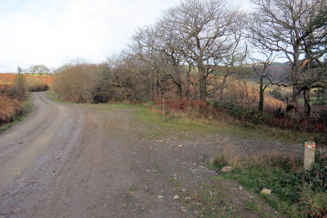
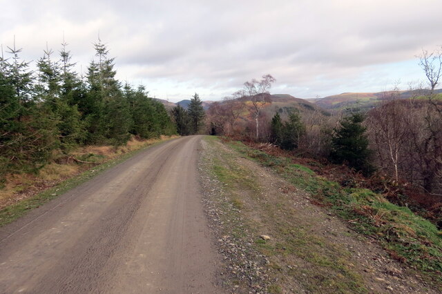
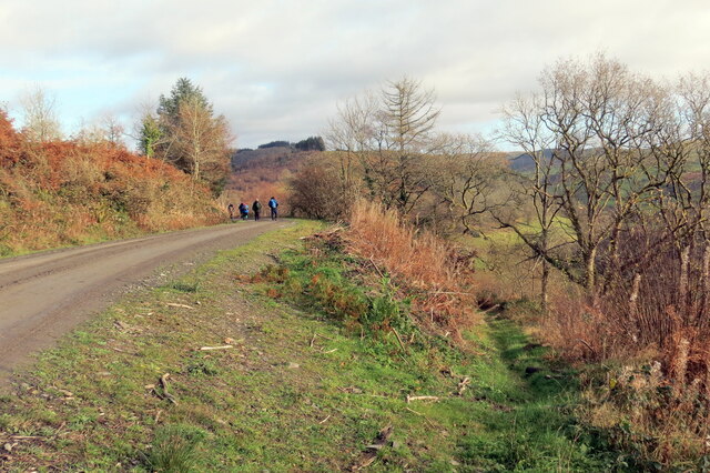
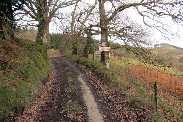
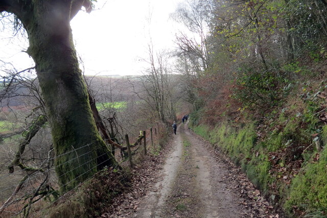
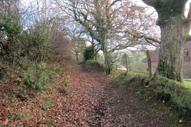
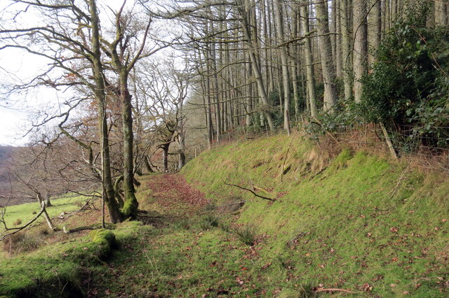
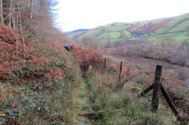
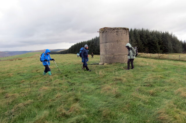
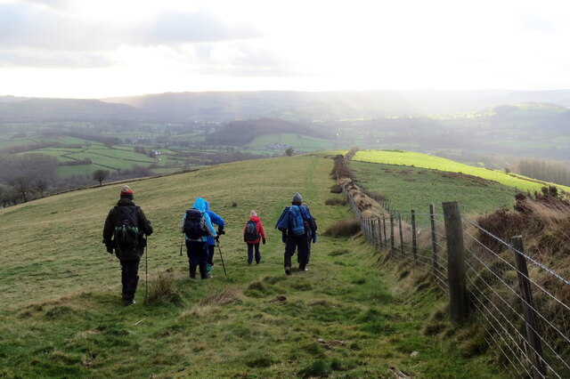
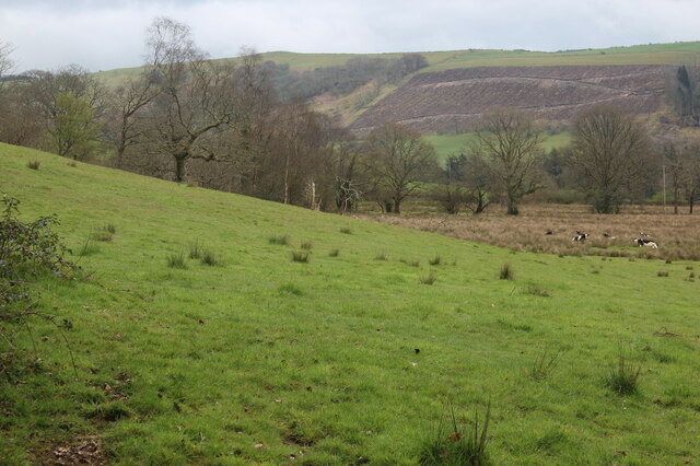
Allt y Gyrn, located in Carmarthenshire, Wales, is a stunning wood and forest area that spans across a vast expanse of land. Its name translates to "Wood of the Cairn" in English. The forest is nestled within the picturesque landscape of the Welsh countryside, offering visitors a serene and peaceful retreat.

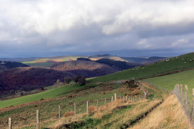
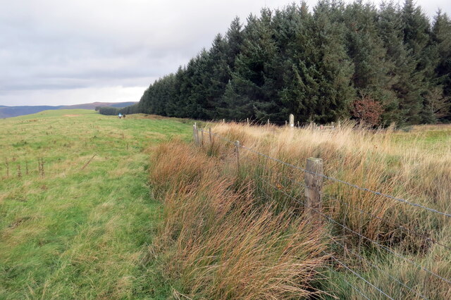
Covering an area of approximately 500 acres, Allt y Gyrn is home to a diverse range of flora and fauna, making it a haven for nature enthusiasts and wildlife lovers. The wood is primarily composed of native tree species, including oak, ash, birch, and beech, creating a rich and vibrant ecosystem. The forest floor is adorned with an array of wildflowers, adding bursts of color to the landscape during the spring and summer months.

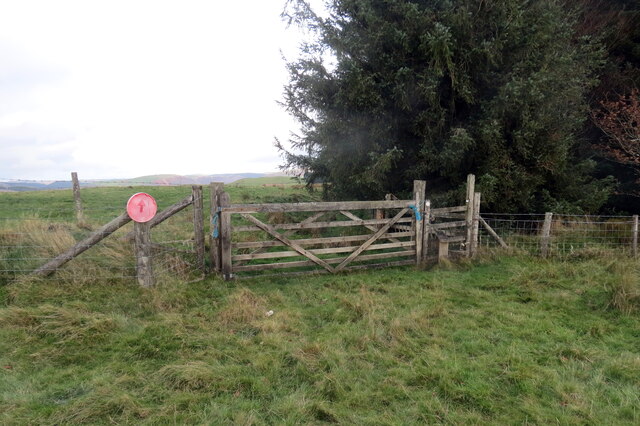
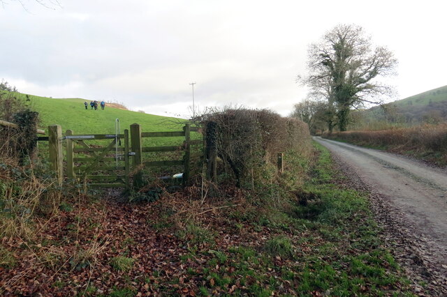
The wood is crisscrossed with a network of walking trails, allowing visitors to explore the beauty of Allt y Gyrn at their own pace. These well-maintained paths lead through ancient woodland, alongside babbling streams, and up to scenic viewpoints, providing breathtaking vistas of the surrounding countryside.

Allt y Gyrn also holds historical significance, as the remains of a Bronze Age cairn can be found within the forest. This ancient burial site is a testament to the area's long and rich history.

With its tranquil atmosphere, diverse wildlife, and stunning scenery, Allt y Gyrn is a truly enchanting destination for those seeking solace in nature.

If you have any feedback on the listing, please let us know in the comments section below.

Allt y Gyrn Images

Images are sourced within 2km of 52.060207/-3.9451175 or Grid Reference SN6641. Thanks to Geograph Open Source API. All images are credited.
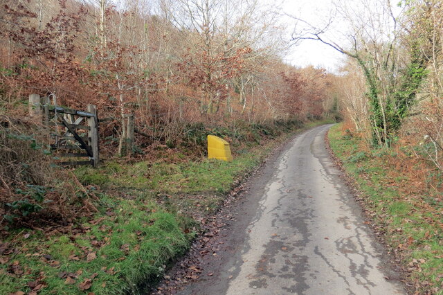
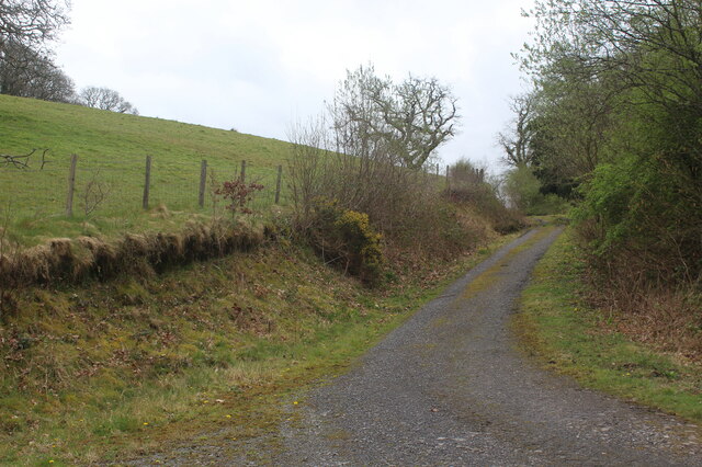
Cyffordd o draciau / A junction of tracks Cyffordd o draciau yn Allt Cwm-dyfiog.

A junction of tracks at Allt Cwm-dyfiog
Cyffordd o draciau / A junction of tracks
Cyffordd o draciau yn Allt Cwm-dyfiog. A junction of tracks at Allt Cwm-dyfiog
Trac y goedwigaeth / Forestry track Trac y goedwigaeth ger Penlan-dolau.

A forestry track near Penlan-dolau (trans. hilltop of meadows)
Trac y goedwigaeth / Forestry track
Trac y goedwigaeth ger Penlan-dolau. A forestry track near Penlan-dolau (trans. hilltop of meadows)
Allt Cwm-dyfiog Llwybr cyhoeddus yn gadael y trac yn Allt Cwm-dyfiog.

A public footpath exits the track at Allt Cwm-dyfiog.
Allt Cwm-dyfiog
Llwybr cyhoeddus yn gadael y trac yn Allt Cwm-dyfiog. A public footpath exits the track at Allt Cwm-dyfiog.
Heol ger Bwlch-y-gilwen / Road near Bwlch-y-gilwen Heol fach ger anhedd-dy o'r enw Bwlch-y-gilwen.

A minor road near a property known as Bwlch-y-gilwen (trans. white nook pass)
Heol ger Bwlch-y-gilwen / Road near Bwlch-y-gilwen
Heol fach ger anhedd-dy o'r enw Bwlch-y-gilwen. A minor road near a property known as Bwlch-y-gilwen (trans. white nook pass)
Heol yn Allt Bwlch-y-gilwen / A road at Allt Bwlch-y-gilwen Heol fach yn mynd i lawr y waered yn Allt Bwlch-y-gilwen.

A minor road descending the hill at Allt Bwlch-y-gilwen (trans. fair nook pass).
Heol yn Allt Bwlch-y-gilwen / A road at Allt Bwlch-y-gilwen
Heol fach yn mynd i lawr y waered yn Allt Bwlch-y-gilwen. A minor road descending the hill at Allt Bwlch-y-gilwen (trans. fair nook pass).
Llwybr Allt Bwlch-y-gelain / Allt Bwlch-y-gelain Llwybr yn gadael yr heol fach o dan Allt Bwlch-y-gilwen.

A path exits the road beneath Allt Bwlch-y-gilwen.
Llwybr Allt Bwlch-y-gelain / Allt Bwlch-y-gelain
Llwybr yn gadael yr heol fach o dan Allt Bwlch-y-gilwen. A path exits the road beneath Allt Bwlch-y-gilwen.
Llwybr Aber-Mangoed / Aber-Mangoed path Llwybr yn mynd i gyfeiriad Ffarm Aber-Mangoed.

A path heading in the direction of Aber-Mangoed Farm.
 (trans. confluence of the Mangoed stream).
Llwybr Aber-Mangoed / Aber-Mangoed path
Llwybr yn mynd i gyfeiriad Ffarm Aber-Mangoed. A path heading in the direction of Aber-Mangoed Farm. (trans. confluence of the Mangoed stream).
Llwybr Aber-Mangoed / Aber-Mangoed path Llwybr yn mynd i gyfeiriad Ffarm Aber-Mangoed.

A path heading towards Aber-Mangoed Farm (trans. confluence of the Mangoed stream).
Llwybr Aber-Mangoed / Aber-Mangoed path
Llwybr yn mynd i gyfeiriad Ffarm Aber-Mangoed. A path heading towards Aber-Mangoed Farm (trans. confluence of the Mangoed stream).
Llwybr Aber-Mangoed / Aber-Mangoed path Cerddwyr yn dilyn llwybr o dan Allt Aber-Mangoed.

Walkers following a path below Allt Aber-Mangoed (trans. wooded slope near the confluence of the Mangoed stream).
Llwybr Aber-Mangoed / Aber-Mangoed path
Cerddwyr yn dilyn llwybr o dan Allt Aber-Mangoed. Walkers following a path below Allt Aber-Mangoed (trans. wooded slope near the confluence of the Mangoed stream).
Hen heol i Gwmcothi  / Old road to Cwmcothi Hen heol sy wedi ei hisraddio i lwybr troed yn mynd i lawr y waered i gyfeiriad Cwmcothi.

An old road now downgraded to a footpath descends the hill towards Cwmcothi (trans. Cothi valley).
Hen heol i Gwmcothi / Old road to Cwmcothi
Hen heol sy wedi ei hisraddio i lwybr troed yn mynd i lawr y waered i gyfeiriad Cwmcothi. An old road now downgraded to a footpath descends the hill towards Cwmcothi (trans. Cothi valley).
Llwybr ger Drysallt / A path near Drysallt Llwybr caniataol ar gefen yn Nrysallt.

A permissive path on a ridge at Drysallt (trans. A wooded slope abounding with brambles).
Llwybr ger Drysallt / A path near Drysallt
Llwybr caniataol ar gefen yn Nrysallt. A permissive path on a ridge at Drysallt (trans. A wooded slope abounding with brambles).
Drysallt Ucheldir yn gymysg o dir porfa a phlanhigfa gonifferaidd.  

Upland consisting of pasture and a conifer plantation.
Drysallt
Ucheldir yn gymysg o dir porfa a phlanhigfa gonifferaidd. Upland consisting of pasture and a conifer plantation.
Twr dwr ar ucheldir / Upland water tower Cerddwyr o amgylch twr dwr ar gefnen.

Walkers at a water tower located on a ridge.
Twr dwr ar ucheldir / Upland water tower
Cerddwyr o amgylch twr dwr ar gefnen. Walkers at a water tower located on a ridge.
I lawr y gefnen / Descending the ridge Cerddwyr yn dilyn llwybr caniataol wrth iddo fynd i lawr y waered.

Walkers following a permissive path as it descends the hill.
I lawr y gefnen / Descending the ridge
Cerddwyr yn dilyn llwybr caniataol wrth iddo fynd i lawr y waered. Walkers following a permissive path as it descends the hill.
Llwybr yn gadael yr heol / Path exiting the road Llwybr yn gadael heol fach ger Mwyngloddiau Aur Dolaucothi.

Path exiting a minor road near the Dolaucothi Goldmines (trans. Cothi [river] meadows).
Llwybr yn gadael yr heol / Path exiting the road
Llwybr yn gadael heol fach ger Mwyngloddiau Aur Dolaucothi. Path exiting a minor road near the Dolaucothi Goldmines (trans. Cothi [river] meadows).
Llwybr yn gadael heol fynedfa / Path exits an access road Llwybr cyhoeddus yn gadael trac ger Ffarm Dolaucothi.

A public footpath exits a track near Dolaucothi Farm (trans. meadows of the river Cothi).
Llwybr yn gadael heol fynedfa / Path exits an access road
Llwybr cyhoeddus yn gadael trac ger Ffarm Dolaucothi. A public footpath exits a track near Dolaucothi Farm (trans. meadows of the river Cothi).
Track up to Allt Dolaucothi from A482 The track turns left <a href="https://www.geograph.org.uk/photo/7149225">SN6540 : Hillside track to Allt Dolaucothi</a> at the end of the straight section; it is the route of a permissive footpath (National Trust).
Track up to Allt Dolaucothi from A482
The track turns left SN6540 : Hillside track to Allt Dolaucothi at the end of the straight section; it is the route of a permissive footpath (National Trust).
Hillside pasture and rushes with cattle Pasture next to track on side of Cothi valley.
Hillside pasture and rushes with cattle
Pasture next to track on side of Cothi valley.
Show me another place!

Allt y Gyrn is located at Grid Ref: SN6641 (Lat: 52.060207, Lng: -3.9451175)

Unitary Authority: Carmarthenshire

Police Authority: Dyfed Powys

What 3 Words

///vibrates.blur.magically. Near Llansawel, Carmarthenshire

Related Wikis

Cynwyl Gaeo

Cynwyl Gaeo is a parish and community located in rural Carmarthenshire, Wales, near the boundary with Ceredigion, in the upper Cothi valley about halfway...

Dolaucothi Estate

The Dolaucothi Estate (also Dolaucothy) is situated about 1 mile (1.6 km) north-west of the village of Caio up the Cothi Valley in the community of Cynwyl...

Dolaucothi Gold Mines

The Dolaucothi Gold Mines (pronounced [ˌdɔlaiˈkɔθɪ]; Welsh: Mwynfeydd Aur Dolaucothi) (grid reference SN662403), also known as the Ogofau Gold Mine, are...

Pumsaint

Pumsaint is a village in Carmarthenshire, Wales, halfway between Llanwrda and Lampeter on the A482 in the valley of the Afon Cothi. It forms part of the...

Afon Twrch, Carmarthenshire

The Afon Twrch is a short river in Carmarthenshire, West Wales. It joins the River Cothi (itself a left-bank tributary of the River Towy) at the village...

Luentinum

Luentinum or Loventium refers to the Roman fort at Pumsaint, Carmarthenshire. The 1.9 hectares (4.7 acres) site lies either side of the A482 in Pumsaint...

Caio, Carmarthenshire

Caio (or Caeo) is a village in the county of Carmarthenshire, south-west Wales, sited near to the Dolaucothi Gold Mines. == Location == It is located between...

Ffarmers

Ffarmers is a village near Lampeter, in the north of Carmarthenshire, Wales. It was named after the old "Farmers' Arms" public house, which is now closed...

Nearby Amenities

Located within 500m of 52.060207,-3.9451175
Post Box
Collection Times: Mo-Fr 10:15; Sa 10:15
Operator: Royal Mail
Operator Wikidata: Q638098
Post Box Design: hovis
Post Box Mounting: stone_wall
Post Box Type: wall
Ref: 262a
Royal Cypher: VR
Royal Cypher Wikidata: Q33102356
Lat/Long: 52.0606622/-3.9401651
Ford: yes
Lat/Long: 52.0604159/-3.9423478
The data included in this document is from www.openstreetmap.org. The data is made available under ODbL.

Have you been to Allt y Gyrn?

Leave your review of Allt y Gyrn below (or comments, questions and feedback).