Coed Alltfedw

Wood, Forest in Cardiganshire

Wales

Coed Alltfedw

Tynyberllan, near Crosswood A farm just off the B4575
Tynyberllan, near Crosswood Credit: Eirian Evans

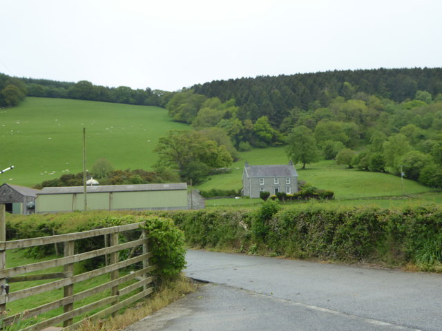
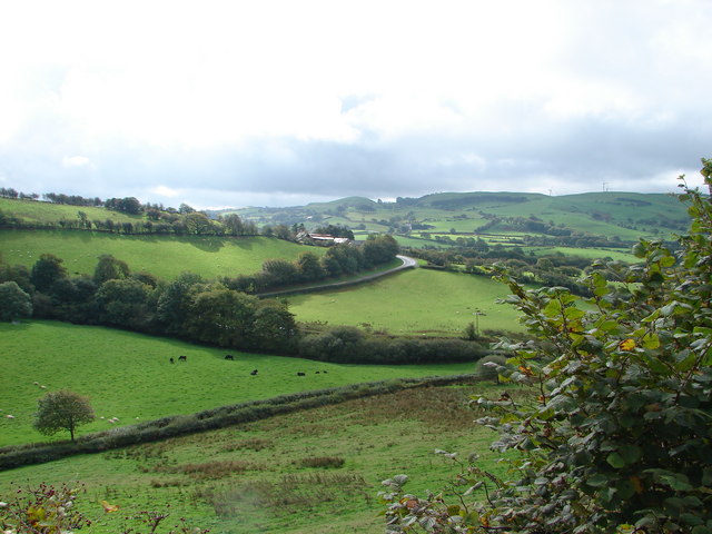
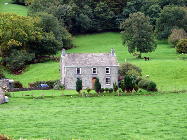
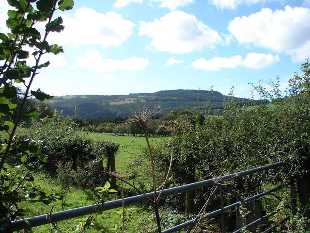
Coed Alltfedw is a picturesque woodland located in Cardiganshire, Wales. Spread across an area of approximately 200 acres, it serves as a haven of natural beauty and tranquility for both locals and tourists alike. The woodland is characterized by its dense, lush vegetation comprising a variety of tree species, including oak, ash, beech, and conifers.

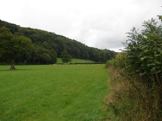
The forest boasts an abundance of wildlife, making it an ideal spot for nature enthusiasts. Visitors may have the opportunity to spot a diverse range of creatures, such as red kites, buzzards, badgers, and even the elusive otter along the nearby riverbanks. The presence of a small pond within the woodland further adds to its ecological diversity, attracting various species of amphibians and insects.

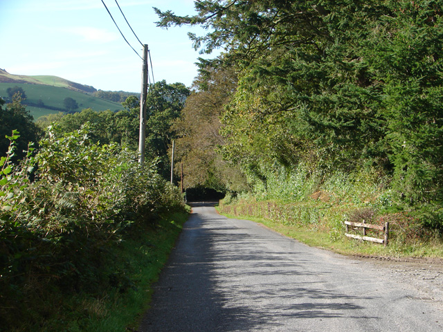
Coed Alltfedw offers a network of well-maintained footpaths that wind through its scenic trails, providing ample opportunities for hiking and exploring. The paths take visitors through enchanting groves, sun-dappled clearings, and babbling streams, creating a truly immersive experience in nature.

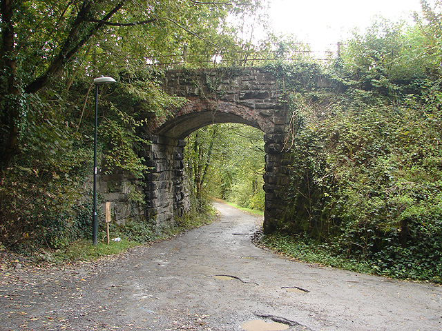
The woodland also holds historical significance as it was once the site of charcoal production during the industrial revolution. Remnants of this past can still be seen in the form of old kilns and a disused railway track that runs through the forest.

Coed Alltfedw is a cherished natural gem, with its combination of stunning landscapes, diverse wildlife, and historical remnants. It offers a peaceful retreat for those seeking solace in nature or wishing to embark on an adventure through its enchanting trails.

If you have any feedback on the listing, please let us know in the comments section below.

Coed Alltfedw Images

Images are sourced within 2km of 52.337427/-3.9707092 or Grid Reference SN6572. Thanks to Geograph Open Source API. All images are credited.

Tynyberllan, near Crosswood A farm just off the B4575
Tynyberllan, near Crosswood
A farm just off the B4575
Ystwyth Trail near Crosswood The Ystwyth Trail is a 32.1km/20M footpath and cycle route linking Tregaron and Aberystwyth. Part of the trail follows the track of the old Great Western Railway line. Here is where it crosses the B7545
Ystwyth Trail near Crosswood
The Ystwyth Trail is a 32.1km/20M footpath and cycle route linking Tregaron and Aberystwyth. Part of the trail follows the track of the old Great Western Railway line. Here is where it crosses the B7545
The River Ystwyth at Trawscoed From the bridge connecting the B4575 and the B4340
The River Ystwyth at Trawscoed
From the bridge connecting the B4575 and the B4340
A small stream running into the river Ystwyth at Trawscoed
Black Covert parking area Forestry Commission carpark near the river Ystwyth at Trawscoed
Black Covert parking area
Forestry Commission carpark near the river Ystwyth at Trawscoed
Trawsgoed Railway Bridge A long-abandoned bridge on the former Carmarthen to Aberystwyth railway line marks the only road into the tiny village of Crosswood.
Trawsgoed Railway Bridge
A long-abandoned bridge on the former Carmarthen to Aberystwyth railway line marks the only road into the tiny village of Crosswood.
Disused Railway Bridge on the B4575 road. This bridge once carried the Carmarthen to Aberystwyth railway line. The abutment on the left is intact but that on the right has been demolished to provide access to the new Ystwyth Trail (Tregaron to Aberystwyth) cycle route.
Disused Railway Bridge on the B4575 road.
This bridge once carried the Carmarthen to Aberystwyth railway line. The abutment on the left is intact but that on the right has been demolished to provide access to the new Ystwyth Trail (Tregaron to Aberystwyth) cycle route.
Farmland in Cwm-byr Looking towards the A485 road at Moelwyn.
Farmland in Cwm-byr
Looking towards the A485 road at Moelwyn.
Beside Cwm-byr Looking towards the forestry area at Banc Cwm-llechwedd.
Beside Cwm-byr
Looking towards the forestry area at Banc Cwm-llechwedd.
Dolfor Farm
Dolfor Farm
Tynberllan Farm In the north-west corner of the square, viewed from the B4575 road.
Tynberllan Farm
In the north-west corner of the square, viewed from the B4575 road.
Pasture at Tyn Coed Beside the B4575 road.
Pasture at Tyn Coed
Beside the B4575 road.
Farmland at Trawsgoed Bach Looking south-west from almost the centre of the square.
Farmland at Trawsgoed Bach
Looking south-west from almost the centre of the square.
Solar powered bus stop at Trawsgoed The lighting for this bus stop is powered from a solar panel and battery.
Solar powered bus stop at Trawsgoed
The lighting for this bus stop is powered from a solar panel and battery.
Trawsgoed Station The platform at Trawsgoed station survives despite the railway through here having been closed over forty years ago.
Trawsgoed Station
The platform at Trawsgoed station survives despite the railway through here having been closed over forty years ago.
Afon Ystwyth at Trawsgoed At the very north of the square. No shortage of water here!
Afon Ystwyth at Trawsgoed
At the very north of the square. No shortage of water here!
Trawsgoed Railway Bridge No longer in railway use but the bridge forms part of the Ystwyth Trail Cycle Route.
Trawsgoed Railway Bridge
No longer in railway use but the bridge forms part of the Ystwyth Trail Cycle Route.
Lane near Llanafan Looking towards the B4340.
Lane near Llanafan
Looking towards the B4340.
Show me another place!

Coed Alltfedw is located at Grid Ref: SN6572 (Lat: 52.337427, Lng: -3.9707092)

Unitary Authority: Ceredigion

Police Authority: Dyfed Powys

What 3 Words

///hamsters.woodstove.jobs. Near Llanilar, Ceredigion

Nearby Locations

Coed Alltfedw

Related Wikis

Hendre-Rhys

Hendre-Rhys is a small village in the community of Trawsgoed, Ceredigion, Wales, which is 67.8 miles (109.2 km) from Cardiff and 173 miles (278.4 km)...

Trawscoed railway station

Trawscoed railway station was located on the Carmarthen to Aberystwyth Line (originally called the Manchester and Milford Railway before being transferred...

Gaer Fawr, Llanilar

Gaer Fawr is an Iron Age hill fort located near Llanilar, Ceredigion, Wales; the Ordnance Survey grid reference is SN648718. The fort is registered with...

Abermagwr

Abermagwr is a small settlement in the county of Ceredigion, Wales. It is on the B4340 road and is 11 kilometres (7 mi) southeast of the town of Aberystwyth...

Have you been to Coed Alltfedw?

Leave your review of Coed Alltfedw below (or comments, questions and feedback).