Tir-mawr Wood

Wood, Forest in Carmarthenshire

Wales

Tir-mawr Wood

River Towy Railway Bridge
River Towy Railway Bridge Credit: Sandy Gerrard

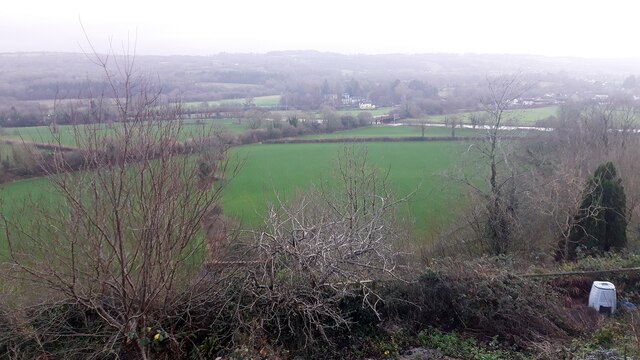
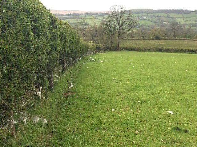
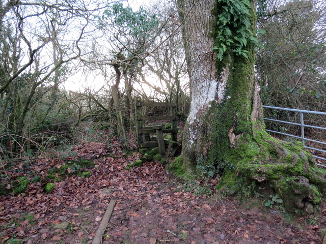
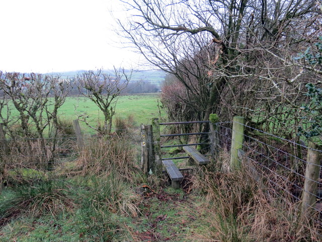
Tir-mawr Wood is a picturesque forest located in Carmarthenshire, Wales. Covering an area of approximately 200 acres, it is a popular destination for nature enthusiasts and those seeking tranquility amidst the stunning Welsh countryside.

The wood is primarily composed of native broadleaf trees, including oak, beech, and birch, which create a diverse and vibrant ecosystem. Walking through the forest, visitors are greeted by a lush carpet of ferns, bluebells, and wildflowers, adding to the enchanting atmosphere. The canopy of the trees provides shade and shelter, making it an ideal habitat for a variety of birds, insects, and small mammals.

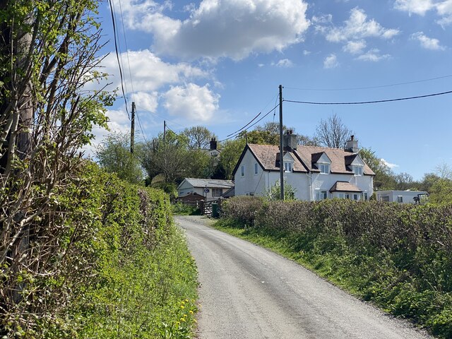
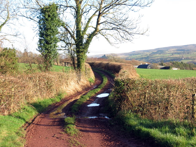
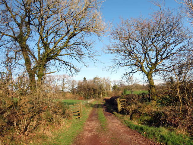
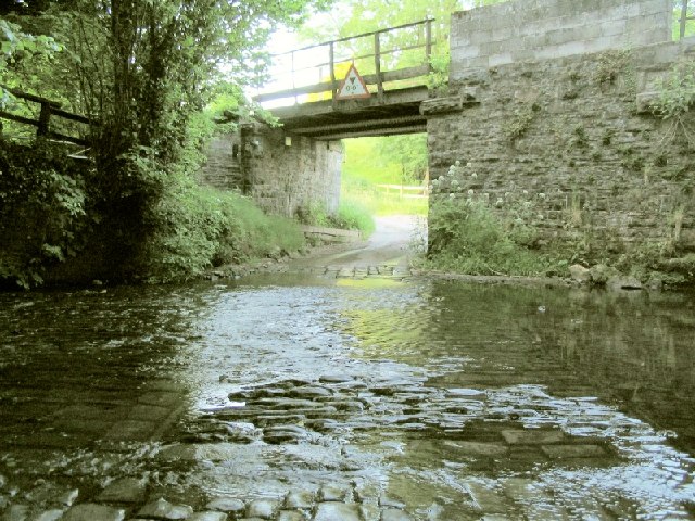
Tir-mawr Wood offers several well-maintained walking trails, allowing visitors to explore its beauty at their own pace. These paths wind through the forest, providing glimpses of hidden glades, babbling brooks, and ancient stone walls that are remnants of its rich history. The wood is also intersected by a small river, which adds to the charm and provides opportunities for peaceful picnics or paddling in the shallow waters.

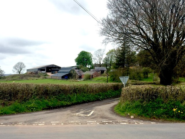
The forest is easily accessible, with ample parking and well-marked entrances. It is a popular spot for families, dog walkers, and nature photographers, as it offers a serene and photogenic backdrop for capturing the beauty of the Welsh countryside. Whether it's for a leisurely stroll, birdwatching, or simply escaping the hustle and bustle of daily life, Tir-mawr Wood is a must-visit destination for anyone seeking a peaceful and enchanting woodland experience.

If you have any feedback on the listing, please let us know in the comments section below.

Tir-mawr Wood Images

Images are sourced within 2km of 51.869267/-3.9647988 or Grid Reference SN6420. Thanks to Geograph Open Source API. All images are credited.

River Towy Railway Bridge
Lane to Tygwyn Farm
Lane to Tygwyn Farm
Ordnance Survey Cut Mark This OS cut mark can be found on the wall of No54 Heol Ffair Fach. It marks a point 45.098m above mean sea level.
Ordnance Survey Cut Mark
This OS cut mark can be found on the wall of No54 Heol Ffair Fach. It marks a point 45.098m above mean sea level.
Ordnance Survey Cut Mark This OS cut mark can be found on the barn conversion at Maeroy Farm. It marks a point 52.345m above mean sea level.
Ordnance Survey Cut Mark
This OS cut mark can be found on the barn conversion at Maeroy Farm. It marks a point 52.345m above mean sea level.
Onen Fawr Road leading to Onen Fawr.
Onen Fawr
Road leading to Onen Fawr.
Hedge and field Grazing pasture land.  Note the wool attached to the fence.
Hedge and field
Grazing pasture land. Note the wool attached to the fence.
Commemorative bench Bench in the village of Trapp to commemorate the award of Best Kept Village in Dyfed, 1986
Commemorative bench
Bench in the village of Trapp to commemorate the award of Best Kept Village in Dyfed, 1986
Pentref Taclusaf Dyfed Best kept village award sign. Note also the Brecon Beacons plaque set in the wall and the old style phone box in the background.
Pentref Taclusaf Dyfed
Best kept village award sign. Note also the Brecon Beacons plaque set in the wall and the old style phone box in the background.
Afon Cennen The River Cennen from the bridge in the village of Trapp.  Note the old mill in the background.
Afon Cennen
The River Cennen from the bridge in the village of Trapp. Note the old mill in the background.
Cennen Arms The Cennen Arms, Trapp.
Cennen Arms
The Cennen Arms, Trapp.
Llwybr Cefncethin / Cefn Cethin Path Sticil ar lwybr cyhoeddus sy'n mynd i gyfeiriad Cefncethin. Yn anffodus, mae'r llwybr, pan dynnwyd y llun, wedi'i rwsystro gan ffens.

A stile on a public footpath heading in the direction of Cefncethin. Unfortunately, at the time of writing, the path has a fence obstruction.
Llwybr Cefncethin / Cefn Cethin Path
Sticil ar lwybr cyhoeddus sy'n mynd i gyfeiriad Cefncethin. Yn anffodus, mae'r llwybr, pan dynnwyd y llun, wedi'i rwsystro gan ffens. A stile on a public footpath heading in the direction of Cefncethin. Unfortunately, at the time of writing, the path has a fence obstruction.
Llwybr i Drap / Footpath to Trap Llwybr cyhoeddus yn arwain at bentre Trap. 

A public footpath heading towards the village of Trap.
Llwybr i Drap / Footpath to Trap
Llwybr cyhoeddus yn arwain at bentre Trap. A public footpath heading towards the village of Trap.
Llwybr i Drap / Path to Trap Llwybr cyhoeddus yn arwain i lawr y waered tuag at bentre Trap.

A public footpath descending the hill towards the village of Trap.
Llwybr i Drap / Path to Trap
Llwybr cyhoeddus yn arwain i lawr y waered tuag at bentre Trap. A public footpath descending the hill towards the village of Trap.
Llwybr Garreg Lwyd / Garreg Lwyd Path Llwybr cyhoeddus yn mynd tuag at Ffarm Garreg Lwyd. Yn weladwy yn y pellter mae Castell Carreg Cennen.

A public footpath heading towards Carreg Lwyd Farm (trans. grey stone). Visible in the distance is Carreg Cennen Castle.
Llwybr Garreg Lwyd / Garreg Lwyd Path
Llwybr cyhoeddus yn mynd tuag at Ffarm Garreg Lwyd. Yn weladwy yn y pellter mae Castell Carreg Cennen. A public footpath heading towards Carreg Lwyd Farm (trans. grey stone). Visible in the distance is Carreg Cennen Castle.
Llwybr Garreg Lwyd / Garreg Lwyd Path Llwybr cyhoeddus yn mynd i gyfeiriad Ffarm Garreg Lwyd.

A public footpath heading towards Garreg Lwyd Farm (trans. grey stone)
Llwybr Garreg Lwyd / Garreg Lwyd Path
Llwybr cyhoeddus yn mynd i gyfeiriad Ffarm Garreg Lwyd. A public footpath heading towards Garreg Lwyd Farm (trans. grey stone)
Trig point overlooking Carreg Cennen Castle This trig point lies in a fenced field right by the roadside. To see the castle to the southeast you need to stand up on the verge.
Trig point overlooking Carreg Cennen Castle
This trig point lies in a fenced field right by the roadside. To see the castle to the southeast you need to stand up on the verge.
Rural scene near Llandeilo The stream flows down into the River Tywi, which is crossed by a lattice-girder railway bridge.  The cows seem quite content with their weedy (or wild flower rich?) pasture.  Llandeilo is in the background.
Rural scene near Llandeilo
The stream flows down into the River Tywi, which is crossed by a lattice-girder railway bridge. The cows seem quite content with their weedy (or wild flower rich?) pasture. Llandeilo is in the background.
Ungated level crossing Crossing of the single line from Llanelli to Craven Arms by the A483.
Ungated level crossing
Crossing of the single line from Llanelli to Craven Arms by the A483.
Show me another place!

Tir-mawr Wood is located at Grid Ref: SN6420 (Lat: 51.869267, Lng: -3.9647988)

Unitary Authority: Carmarthenshire

Police Authority: Dyfed Powys

What 3 Words

///woods.snaps.backhand. Near Llandeilo, Carmarthenshire

Related Wikis

Caeau Tir-mawr

Caeau Tir-mawr is a Site of Special Scientific Interest in Carmarthen & Dinefwr, Wales. == External links == Description at Brecon Beacons National Park...

Llandeilo (electoral ward)

Llandeilo is the name of an electoral ward for Carmarthenshire County Council, which includes the communities of Llandeilo and Dyffryn Cennen, in Carmarthenshire...

Tregyb Woodlands

Tregyb Woodlands (Welsh: Coedydd Tregyb) is a Site of Special Scientific Interest (SSSI) in Carmarthen & Dinefwr, Wales. Designated as a SSSI since 1980...

Ysgol Tre-Gib

Ysgol Tre-Gib was a bilingual, English language / Welsh language comprehensive school for pupils aged 11 yrs to 18 years based in Ffairfach, Llandeilo...

Dyffryn Cennen

Dyffryn Cennen is a community located in Carmarthenshire, Wales. The population of the community taken at the 2011 census was 1,176.The community is bordered...

Afon Cennen

The Afon Cennen is a river in the county of Carmarthenshire, south Wales. It rises on the northern slopes of the Black Mountain to the east of the summit...

Trap, Carmarthenshire

Trap (or Trapp) is a hamlet in the county of Carmarthenshire in southwest Wales, located on the western border of the Brecon Beacons National Park, around...

Ffairfach railway station

Ffairfach railway station serves the village of Ffairfach, near Llandeilo, Carmarthenshire, Wales. The station is on the Heart of Wales Line 30 miles...

Have you been to Tir-mawr Wood?

Leave your review of Tir-mawr Wood below (or comments, questions and feedback).