Coed Pen-y-banc

Wood, Forest in Cardiganshire

Wales

Coed Pen-y-banc

Minor road north from Penrhyn Coch Quite a steep ascent from the village, and a short stretch now through Coed Pen-y-Cwm
Minor road north from Penrhyn Coch Credit: Eirian Evans

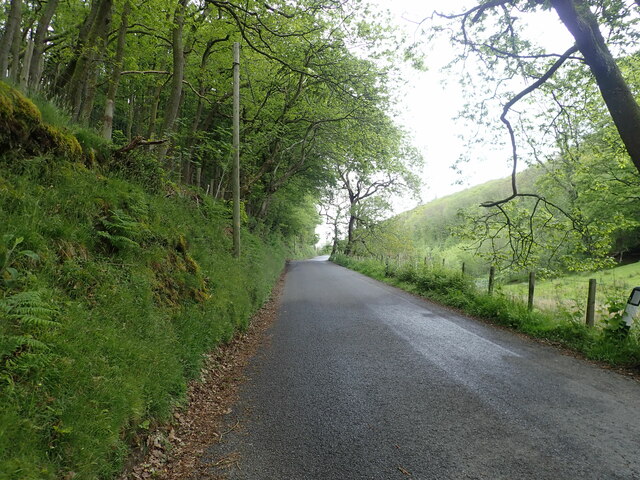
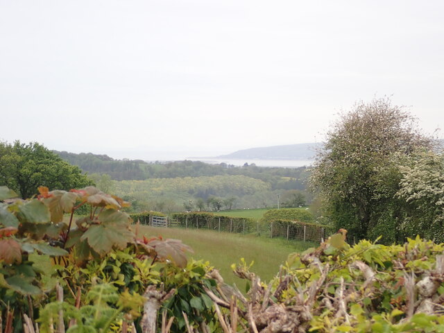
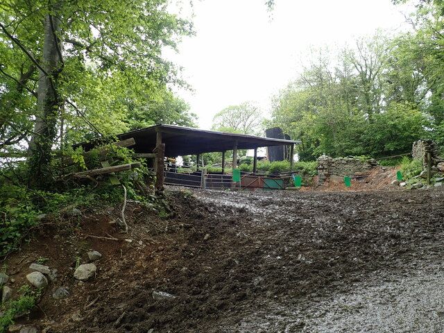
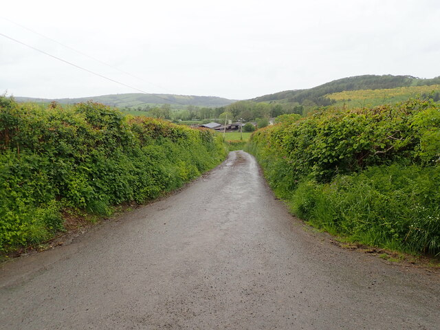
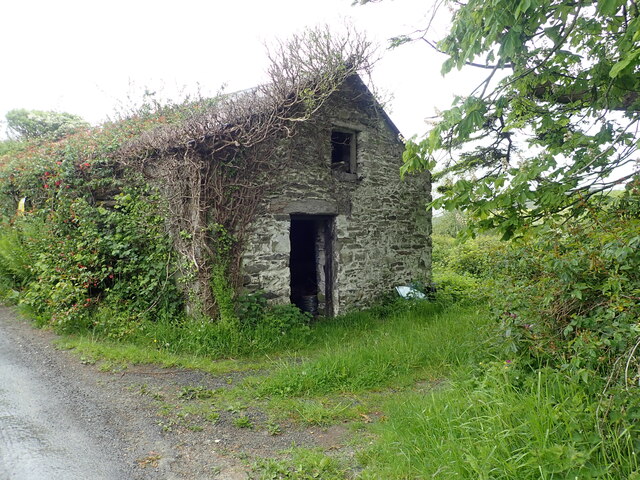
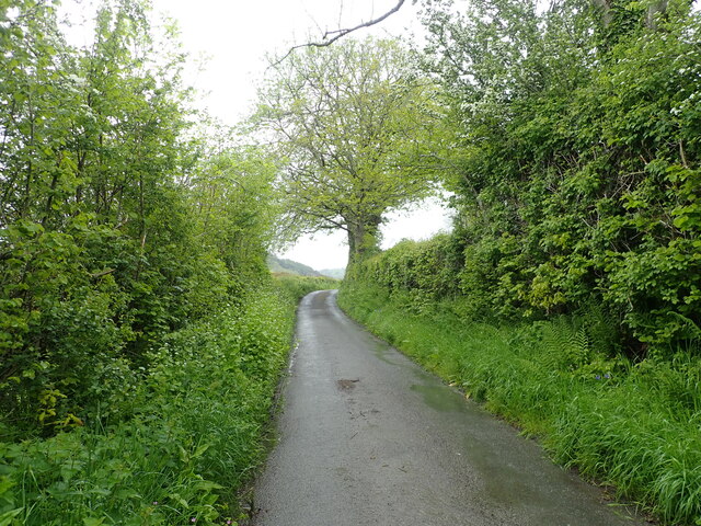
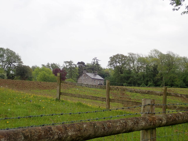
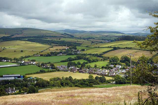
Coed Pen-y-banc, located in Cardiganshire, is a picturesque woodland area that spans across a vast expanse. With its lush greenery, dense trees, and serene atmosphere, it offers a tranquil retreat for nature enthusiasts and outdoor adventurers alike.

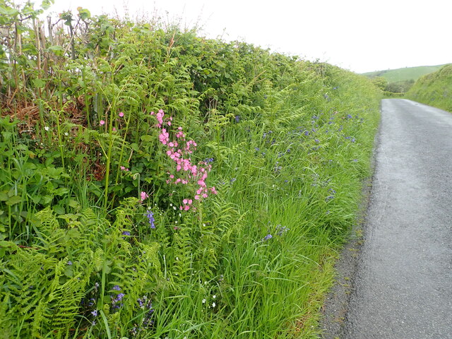
The woodland is a diverse ecosystem, housing a wide array of flora and fauna. Tall, mature trees dominate the landscape, including oak, birch, and beech, providing a dense canopy that filters sunlight and creates a cool, shaded environment. These trees also serve as habitats for various bird species, such as woodpeckers and owls, contributing to the rich biodiversity of the area.

Coed Pen-y-banc offers visitors numerous walking trails and paths, allowing them to explore its natural beauty at their own pace. Along these trails, one can admire the vibrant wildflowers that bloom during the spring and summer months, adding bursts of color to the already enchanting scenery. The forest floor is covered with a thick carpet of moss and ferns, creating a soft and inviting landscape.

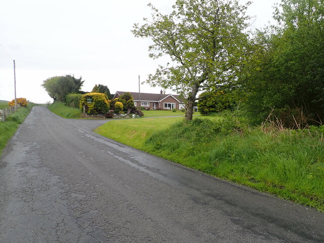
This woodland has become a popular destination for outdoor activities, including hiking, nature photography, and birdwatching. The peaceful ambiance and stunning vistas make it an ideal spot for those seeking solace in nature or simply wanting to immerse themselves in the beauty of the Welsh countryside.

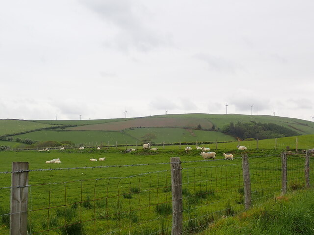
Coed Pen-y-banc is not only a haven for nature lovers but also plays a crucial role in preserving the local ecosystem. It serves as a habitat for many endangered species and contributes to the overall ecological balance of the region. The forest is also actively managed and protected to ensure its long-term sustainability and conservation.

If you have any feedback on the listing, please let us know in the comments section below.

Coed Pen-y-banc Images

Images are sourced within 2km of 52.464712/-3.9984144 or Grid Reference SN6487. Thanks to Geograph Open Source API. All images are credited.

Minor road north from Penrhyn Coch Quite a steep ascent from the village, and a short stretch now through Coed Pen-y-Cwm
Minor road north from Penrhyn Coch
Quite a steep ascent from the village, and a short stretch now through Coed Pen-y-Cwm
Pen-y-Cwm North-east of Bow Street
Pen-y-Cwm
North-east of Bow Street
Grazing sheep at Pen-y-Cwm The windfarm on the horizon is on Banc Mynydd Gorddu, a hill in the Pumlumon range, where there are remains of old lead mines.
Grazing sheep at Pen-y-Cwm
The windfarm on the horizon is on Banc Mynydd Gorddu, a hill in the Pumlumon range, where there are remains of old lead mines.
Elgar Farm At the foot of Mynydd Gorddu.
Elgar Farm
At the foot of Mynydd Gorddu.
Gentle rolling hills East of Rhydypennau
Gentle rolling hills
East of Rhydypennau
Colourful verges on a minor road Pink, white and blue - campion, stitchwort and bluebell - in the lush green of the wayside. The minor road is between Pen-y-Cwm and Ty'n-y-Ffynnon
Colourful verges on a minor road
Pink, white and blue - campion, stitchwort and bluebell - in the lush green of the wayside. The minor road is between Pen-y-Cwm and Ty'n-y-Ffynnon
View west over Coed Bryngwyn Mawr towards the coast
Ty'n y Ffynnon Farm in the hills east of Llandre
Ty'n y Ffynnon
Farm in the hills east of Llandre
Small stream from Waun Wyddul
Barn at Maes-y-Dogn
Barn at Maes-y-Dogn
Maesnewydd Farm
Maesnewydd Farm
Outbuilding at Efail Fach, Llandre Planning permission sought to change this into a dwelling.
Outbuilding at Efail Fach, Llandre
Planning permission sought to change this into a dwelling.
Minor road from Penrhyn Coch to Tal-y-Bont
Llety Llwyd In the woodland behind this house there is the site of a hillfort
Llety Llwyd
In the woodland behind this house there is the site of a hillfort
Houses in Llandre
Houses in Llandre
A view over Llandre The old school building is visible in the centre of the view. It closed in the 1990s and later became a soft play centre. That subsequently closed in 2016 after a couple of years of operation. The building was being offered for sale in 2017 for £230,000. It is featured on the Waymarking website: <span class="nowrap"><a title="https://www.waymarking.com/waymarks/WMAZRK_Old_Llandre_School_Llandre_Bow_Street_Ceredigion_Wales_UK" rel="nofollow ugc noopener" href="https://www.waymarking.com/waymarks/WMAZRK_Old_Llandre_School_Llandre_Bow_Street_Ceredigion_Wales_UK">Link</a><img style="margin-left:2px;" alt="External link" title="External link - shift click to open in new window" src="https://s1.geograph.org.uk/img/external.png" width="10" height="10"/></span>
A view over Llandre
The old school building is visible in the centre of the view. It closed in the 1990s and later became a soft play centre. That subsequently closed in 2016 after a couple of years of operation. The building was being offered for sale in 2017 for £230,000. It is featured on the Waymarking website: LinkExternal link
The harvest is in Fields at Llandre.
The harvest is in
Fields at Llandre.
A view over Ty'n-y-parc North of Llandre.
A view over Ty'n-y-parc
North of Llandre.
Show me another place!

Coed Pen-y-banc is located at Grid Ref: SN6487 (Lat: 52.464712, Lng: -3.9984144)

Unitary Authority: Ceredigion

Police Authority: Dyfed Powys

What 3 Words

///skidding.marine.hunk. Near Bow Street, Ceredigion

Related Wikis

Dol-gau

Dol-gau (or Dôl-gau) is a small village in the community of Tirymynach, Ceredigion, Wales, which is 76.4 miles (123 km) from Cardiff and 177.5 miles...

Taigwynion

Taigwynion is a hamlet 1 km ENE of Llandre in Ceredigion, Wales. It has 11 houses and a postcode of its own, SY24 5AG. == Toponymy == Taigwynion has no...

Cynnull-mawr

Cynnull-mawr is a small village in the community of Ceulanamaesmawr, Ceredigion, Wales, which is 76.3 miles (122.8 km) from Cardiff and 176.9 miles (284...

Dole, Ceredigion

Dole, Ceredigion is a small village in the community of Tirymynach, Ceredigion, Wales. Dole is represented in the Senedd by Elin Jones (Plaid Cymru) and...

Llandre

Llandre, or Llanfihangel Genau'r Glyn, is a village in Ceredigion, Wales. It lies 5 miles north of Aberystwyth in the north-west of the county, on the...

Henllys, Ceredigion

Henllys, Ceredigion is a small village in the community of Genau'r-glyn, Ceredigion, Wales, which is 77.5 miles (124.8 km) from Cardiff and 178.5 miles...

Rhydypennau, Ceredigion

Rhydypennau is a hamlet in the Genau'r-glyn district of Ceredigion, Wales, approximately 4+1⁄2 miles (7.2 km) north-east of Aberystwyth. Along with the...

Bow Street F.C.

Bow Street F.C. are based at Rhydypennau near Bow Street in Ceredigion, Wales, about 4+1⁄2 miles (7.2 km) north-east of Aberystwyth, and are currently...

Nearby Amenities

Located within 500m of 52.464712,-3.9984144
Parking
Parking: layby
Lat/Long: 52.465711/-3.9987696
Place: farm
Lat/Long: 52.4678525/-3.9949422
Building: yes
Lat/Long: 52.4655819/-3.9957608
Power: pole
Lat/Long: 52.4606739/-3.9972773
Power: pole
Lat/Long: 52.4613962/-3.996816
Power: pole
Lat/Long: 52.4624683/-3.993879
Power: pole
Lat/Long: 52.461898/-3.9953381
Power: pole
Lat/Long: 52.4613358/-3.9967731
Power: pole
Lat/Long: 52.4608193/-3.9981812
Power: pole
Lat/Long: 52.4603029/-3.9995223
Power: pole
Lat/Long: 52.4652366/-3.9911699
Power: pole
Lat/Long: 52.4650323/-3.9925861
Power: pole
Lat/Long: 52.4648591/-3.9937314
Power: pole
Lat/Long: 52.4672171/-3.9954561
Power: pole
Lat/Long: 52.4662465/-3.9952201
Power: pole
Lat/Long: 52.4653477/-3.9949465
Power: pole
Lat/Long: 52.4646891/-3.9947668
Power: pole
Lat/Long: 52.4640649/-3.9951181
Power: pole
Lat/Long: 52.4634014/-3.9955527
Power: pole
Lat/Long: 52.4621235/-3.9963573
Power: pole
Lat/Long: 52.4649604/-3.9920577
Man Made: utility_pole
Lat/Long: 52.4679886/-3.9956427
Power: pole
Lat/Long: 52.4675483/-3.9955234
Man Made: utility_pole
Lat/Long: 52.468416/-3.9957531
Man Made: utility_pole
Lat/Long: 52.4686607/-3.9960987
Man Made: utility_pole
Lat/Long: 52.4689438/-3.9965049
The data included in this document is from www.openstreetmap.org. The data is made available under ODbL.

Have you been to Coed Pen-y-banc?

Leave your review of Coed Pen-y-banc below (or comments, questions and feedback).