Allt Maes-rhyg-fach

Wood, Forest in Cardiganshire

Wales

Allt Maes-rhyg-fach

A tree-lined road Beech trees line both sides of the A485 here to the north of Pont Rhydygelli.
A tree-lined road Credit: Philip Halling

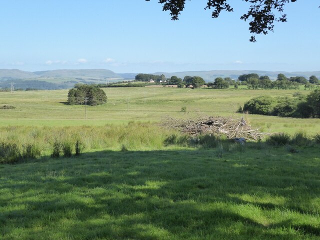
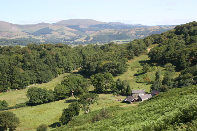
Allt Maes-rhyg-fach is a picturesque wood located in the county of Cardiganshire, Wales. Covering an area of approximately 50 acres, this forested area is renowned for its natural beauty and diverse ecosystem.

The wood is situated on a gentle slope, providing breathtaking views of the surrounding countryside. It is primarily composed of deciduous trees such as oak, beech, and ash, creating a vibrant and colorful landscape throughout the year. These trees provide a habitat for a wide array of flora and fauna, making it a popular spot for nature enthusiasts and birdwatchers.

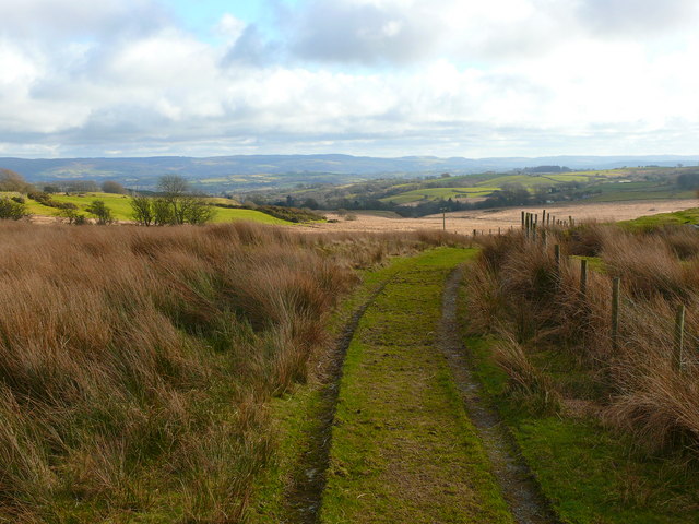
Tranquil walking trails wind their way through the wood, allowing visitors to explore its enchanting corners. The paths are well-maintained and provide easy access for all levels of hikers. Along the way, one may encounter small streams, wildflowers, and moss-covered rocks, enhancing the magical atmosphere of the forest.

Allt Maes-rhyg-fach is also home to various wildlife species, including deer, foxes, and numerous bird species. It offers a peaceful retreat for those seeking solace in nature or a place to reconnect with the natural world.

The wood is open to the public throughout the year, with no admission fees. Visitors are encouraged to respect the environment and follow any guidelines regarding litter and wildlife conservation. Allt Maes-rhyg-fach is a hidden gem in Cardiganshire, providing a serene escape for nature lovers and a chance to immerse oneself in the beauty of the Welsh countryside.

If you have any feedback on the listing, please let us know in the comments section below.

Allt Maes-rhyg-fach Images

Images are sourced within 2km of 52.245829/-4.003312 or Grid Reference SN6362. Thanks to Geograph Open Source API. All images are credited.

A tree-lined road Beech trees line both sides of the A485 here to the north of Pont Rhydygelli.
A tree-lined road
Beech trees line both sides of the A485 here to the north of Pont Rhydygelli.
Farmland above the Tefi valley Farmland above the Tefi valley to the east of the A485.
Farmland above the Tefi valley
Farmland above the Tefi valley to the east of the A485.
Eglwys Blaenpennal Church Ailadeiladwyd Eglwys Dewi Sant, Blaenpennal, yn 1903 ar safle uwch o fewn y fynwent. Dymchwelwyd yr hen eglwys ac yn 1810 fe'i disgrifiwyd hi mwy fel ysgubor nag eglwys. Un ffenest ac un drws oedd ganddi a bu adeilad arall llwm ynghlwm wrthi. Bu Blaenpennal am ganrifoedd yn gapel anwes i Landdewi Brefi.

St David's Church, Blaenpennal, formerly a chapel of ease belonging to Llanddewi Brefi, was totally rebuilt in 1903 on a much elevated spot within the graveyard. The old church was demolished and it was described in 1810 as being '...a disgrace to the mother church. It is a small tiled building with one window and one door and as there is a thatch hovel adjoining it... it resembles a barn than a place of worship!'
Eglwys Blaenpennal Church
Ailadeiladwyd Eglwys Dewi Sant, Blaenpennal, yn 1903 ar safle uwch o fewn y fynwent. Dymchwelwyd yr hen eglwys ac yn 1810 fe'i disgrifiwyd hi mwy fel ysgubor nag eglwys. Un ffenest ac un drws oedd ganddi a bu adeilad arall llwm ynghlwm wrthi. Bu Blaenpennal am ganrifoedd yn gapel anwes i Landdewi Brefi. St David's Church, Blaenpennal, formerly a chapel of ease belonging to Llanddewi Brefi, was totally rebuilt in 1903 on a much elevated spot within the graveyard. The old church was demolished and it was described in 1810 as being '...a disgrace to the mother church. It is a small tiled building with one window and one door and as there is a thatch hovel adjoining it... it resembles a barn than a place of worship!'
Llwybr wedi'i rwystro - Blaenpennal obstructed path Llwybr cyhoeddus yn arwain o Bentrebach at Ffarm Cwmcoy. Yn anffodus, fel llawer o lwybrau eraill yn yr ardal, mae'r ffordd hon wedi'i rhwystro gan ddwy ffens.

A public right of way leading from Pentrebach to Cwmcoy Ffarm. Unfortunately, like many other footpaths in the area, the way is obstructed by two fences.
Llwybr wedi'i rwystro - Blaenpennal obstructed path
Llwybr cyhoeddus yn arwain o Bentrebach at Ffarm Cwmcoy. Yn anffodus, fel llawer o lwybrau eraill yn yr ardal, mae'r ffordd hon wedi'i rhwystro gan ddwy ffens. A public right of way leading from Pentrebach to Cwmcoy Ffarm. Unfortunately, like many other footpaths in the area, the way is obstructed by two fences.
Sarn Helen passing Pomprengarreg The B4343 is heavily enclosed in trees at this point.
Sarn Helen passing Pomprengarreg
The B4343 is heavily enclosed in trees at this point.
A485 east of Tyncelyn
Approaching Tyncelin crossroads
Crossroads at Tyncelin
East from Bryn-cethin turning
The B4577 approaching Tyncelyn from the west With the signpost for the crossroads almost invisible behind the hedge.
The B4577 approaching Tyncelyn from the west
With the signpost for the crossroads almost invisible behind the hedge.
Field gate and For Sale sign A fair-sized meadow up for sale.
Field gate and For Sale sign
A fair-sized meadow up for sale.
Meadow by the B4577 Currently up for sale.
Meadow by the B4577
Currently up for sale.
Pont Rhydygelli A485 ger Tyncelyn / A485 near Tyncelyn
Pont Rhydygelli
A485 ger Tyncelyn / A485 near Tyncelyn
Lon Wledig ger Blaenpennal / Country Lane near Blaenpennal Lon Wledig ger Blaenpennal gyda beicwyr yn y pellter / Country Lane near Blaenpennal with cyclists in the distance
Lon Wledig ger Blaenpennal / Country Lane near Blaenpennal
Lon Wledig ger Blaenpennal gyda beicwyr yn y pellter / Country Lane near Blaenpennal with cyclists in the distance
Esgairhendy Lon Fferm Esgairhendy / Esgairhendy Farm track
Esgairhendy
Lon Fferm Esgairhendy / Esgairhendy Farm track
Capel, Blaenpennal / Blaenpennal Chapel Capel, Blaenpennal / Blaenpennal Chapel
Capel, Blaenpennal / Blaenpennal Chapel
Pont Felin Fach Pont Felin Fach lle mae'r Afon Aeron yn llifo trwy Blaenpennal / Pont Felin Fach (bridge) where the Afon Aeron flows through Blaenpennal.
Pont Felin Fach
Pont Felin Fach lle mae'r Afon Aeron yn llifo trwy Blaenpennal / Pont Felin Fach (bridge) where the Afon Aeron flows through Blaenpennal.
Hen Gapel, Blaenpennal / Old Chapel at Blaenpennal Hen Gapel sydd bellach mewn cyflwr wael / Old Chapel which is now in a poor state of repair.
Hen Gapel, Blaenpennal / Old Chapel at Blaenpennal
Hen Gapel sydd bellach mewn cyflwr wael / Old Chapel which is now in a poor state of repair.
Show me another place!

Allt Maes-rhyg-fach is located at Grid Ref: SN6362 (Lat: 52.245829, Lng: -4.003312)

Unitary Authority: Ceredigion

Police Authority: Dyfed Powys

What 3 Words

///sniff.caged.laying. Near Tregaron, Ceredigion

Nearby Locations

Allt Maes-rhyg-fach

Related Wikis

Ceredigion

Ceredigion (UK: KERR-ə-DIG-ee-ən, US: -⁠ee-on, Welsh: [kɛrɛˈdɪɡjɔn] ), historically Cardiganshire, is a county in the west of Wales. It borders Gwynedd...

Tyncelyn

Tyncelyn is a hamlet in the community of Lledrod, Ceredigion, Wales, which is 63.7 miles (102.5 km) from Cardiff and 172.6 miles (277.7 km) from London...

Ty'n-yr-eithin

Ty'n-yr-eithin is a hamlet in the community of Tregaron, Ceredigion, Wales, which is 62.4 miles (100.4 km) from Cardiff and 171.2 miles (275.4 km) from...

Llangeitho

Llangeitho is a village and community on the upper River Aeron in Ceredigion, Wales, about four miles (6 km) west of Tregaron and 11 kilometres (7 mi)...

Llyn Fanod

Llyn Fanod is an upland lake situated between Penuwch and Bontnewydd in Ceredigion, Wales. It is a Site of Special Scientific Interest partly owned by...

Bontnewydd, Ceredigion

Bontnewydd is a small village in Ceredigion between Tregaron and Aberystwyth near the village of Bronant. It is situated on the edge of the beautiful wild...

Penuwch

Penuwch is a rural village in Ceredigion, Wales. Penuwch is about 1,000 feet above sea level and 8 miles west of Tregaron while the coast is a similar...

Llettum-ddu

Llettum-ddu is a hamlet in the community of Tregaron, Ceredigion, Wales, which is 61.3 miles (98.6 km) from Cardiff and 171.7 miles (276.3 km) from London...

Nearby Amenities

Located within 500m of 52.245829,-4.003312
Created By: POI Editor
Source: npe
Lat/Long: 52.24343/-3.9996522
Created By: POI Editor
Source: npe
Lat/Long: 52.2447071/-4.0028151
Created By: POI Editor
Source: npe
Lat/Long: 52.2454578/-4.0030832
Created By: POI Editor
Source: npe
Lat/Long: 52.2462235/-4.0024732
Created By: POI Editor
Source: npe
Lat/Long: 52.2463551/-4.0010728
Created By: POI Editor
Source: npe
Lat/Long: 52.2478287/-4.0011392
Place: farm
Lat/Long: 52.246406/-3.9985158
Place: farm
Lat/Long: 52.2416236/-4.0040948
The data included in this document is from www.openstreetmap.org. The data is made available under ODbL.

Have you been to Allt Maes-rhyg-fach?

Leave your review of Allt Maes-rhyg-fach below (or comments, questions and feedback).