Coed Bronydd Isaf

Wood, Forest in Caernarfonshire

Wales

Coed Bronydd Isaf

Benchmark near Plâs-uchaf, Llanllechid This benchmark is located at the W side of a narrow country lane near Plâs-uchaf farm in Llanllechid. The mark is not shown in the current Ordnance Survey database but is shown on an 1900 map of the area at a height of 590.8ft above the Liverpool datum.
Benchmark near Plâs-uchaf, Llanllechid Credit: Meirion

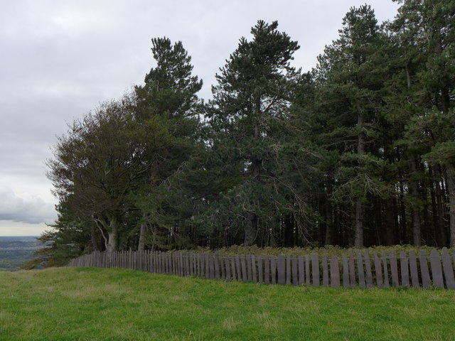
Coed Bronydd Isaf, located in Caernarfonshire, is a picturesque woodland area renowned for its natural beauty and diverse flora and fauna. Spanning approximately 200 acres, this forest boasts a rich history and offers visitors a serene and tranquil environment to explore.

With its origins dating back centuries, Coed Bronydd Isaf has been an integral part of the local landscape. The forest is characterized by a variety of tree species, including oak, birch, and beech, which create a lush canopy overhead. The forest floor is carpeted with an array of wildflowers, providing a burst of color during the spring and summer months.

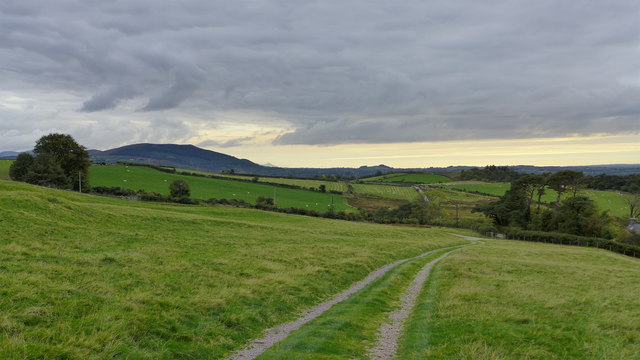
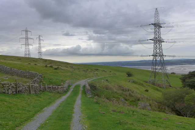
Visitors to Coed Bronydd Isaf can enjoy a range of activities. The forest is crisscrossed by a network of well-maintained walking trails, allowing visitors to immerse themselves in the peaceful surroundings while enjoying a leisurely stroll or a challenging hike. The trails also provide excellent opportunities for birdwatching, as the forest is home to numerous avian species, including woodpeckers and owls.

For those interested in history, Coed Bronydd Isaf offers glimpses into the past. The forest contains remnants of ancient settlements, including burial mounds and stone circles, which serve as a reminder of the area's rich cultural heritage.

Overall, Coed Bronydd Isaf is a haven for nature enthusiasts and history buffs alike. Its breathtaking landscapes, diverse wildlife, and historical significance make it a must-visit destination for anyone seeking a peaceful retreat in the heart of Caernarfonshire.

If you have any feedback on the listing, please let us know in the comments section below.

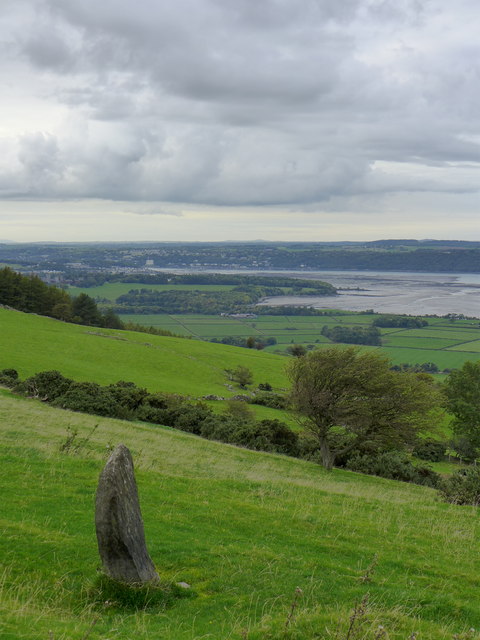
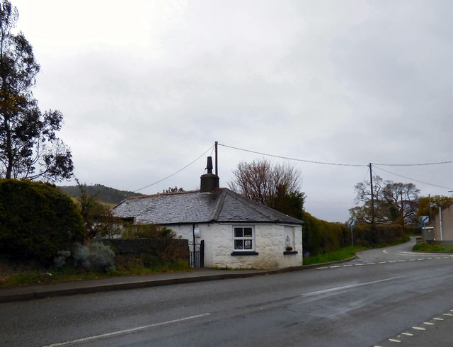
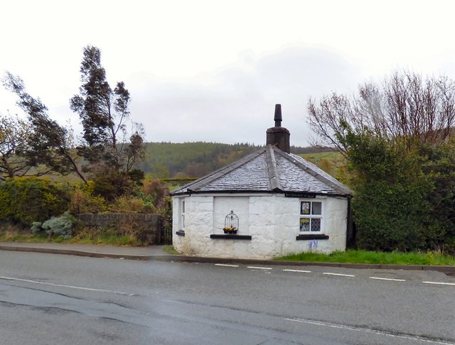
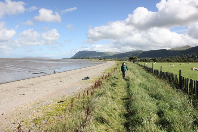
Coed Bronydd Isaf Images

Images are sourced within 2km of 53.216264/-4.0521371 or Grid Reference SH6370. Thanks to Geograph Open Source API. All images are credited.

Benchmark near Plâs-uchaf, Llanllechid This benchmark is located at the W side of a narrow country lane near Plâs-uchaf farm in Llanllechid. The mark is not shown in the current Ordnance Survey database but is shown on an 1900 map of the area at a height of 590.8ft above the Liverpool datum.
Benchmark near Plâs-uchaf, Llanllechid
This benchmark is located at the W side of a narrow country lane near Plâs-uchaf farm in Llanllechid. The mark is not shown in the current Ordnance Survey database but is shown on an 1900 map of the area at a height of 590.8ft above the Liverpool datum.
Bryn Hall Quarry
Bryn Hall Quarry
Woodland and slate fence near Bronydd Isaf
North Wales Path near Bronydd Isaf
North Wales Path near Bronydd Isaf Afon Menai and Anglesey can be seen in the background.
North Wales Path near Bronydd Isaf
Afon Menai and Anglesey can be seen in the background.
Fields near Bronydd Isaf
Turnpike House, Llanllechid 
Located right on the road in Tan-y-lon at the junction between the old Bangor to Conwy road and the road which runs roughly parallel with it between Tan-y-lon and Eglwys St Cross. It was constructed as a toll house on the road which was turnpiked as part of the route between Chester and Holyhead in the 1820s.

It is Grade II listed <span class="nowrap"><a title="http://www.britishlistedbuildings.co.uk/wa-22937-turnpike-house-llanllechid" rel="nofollow ugc noopener" href="http://www.britishlistedbuildings.co.uk/wa-22937-turnpike-house-llanllechid">Link</a><img style="margin-left:2px;" alt="External link" title="External link - shift click to open in new window" src="https://s1.geograph.org.uk/img/external.png" width="10" height="10"/></span>
Turnpike House, Llanllechid
Located right on the road in Tan-y-lon at the junction between the old Bangor to Conwy road and the road which runs roughly parallel with it between Tan-y-lon and Eglwys St Cross. It was constructed as a toll house on the road which was turnpiked as part of the route between Chester and Holyhead in the 1820s. It is Grade II listed LinkExternal link
Turnpike House, Llanllechid 
Located right on road in Tan-y-lon at the junction between the old Bangor to Conwy road and the road which runs roughly parallel with it between Tan-y-lon and Eglwys St Cross. It was constructed as a toll house on the road which was turnpiked as part of the route between Chester and Holyhead in the 1820s.

It is Grade II listed <span class="nowrap"><a title="http://www.britishlistedbuildings.co.uk/wa-22937-turnpike-house-llanllechid" rel="nofollow ugc noopener" href="http://www.britishlistedbuildings.co.uk/wa-22937-turnpike-house-llanllechid">Link</a><img style="margin-left:2px;" alt="External link" title="External link - shift click to open in new window" src="https://s1.geograph.org.uk/img/external.png" width="10" height="10"/></span>
Turnpike House, Llanllechid
Located right on road in Tan-y-lon at the junction between the old Bangor to Conwy road and the road which runs roughly parallel with it between Tan-y-lon and Eglwys St Cross. It was constructed as a toll house on the road which was turnpiked as part of the route between Chester and Holyhead in the 1820s. It is Grade II listed LinkExternal link
Tan Y Marian
Tan Y Marian
Track Below Marianywinllan
The Wales Coast Path approaching Abergwyngregyn The Wales Coast Path heading east at Wig between Abergwyngregyn and Aber-Ogwen. In the distance is Penmaenmawr Mountain.

Wikipedia <span class="nowrap"><a title="https://en.wikipedia.org/wiki/Wales_Coast_Path" rel="nofollow ugc noopener" href="https://en.wikipedia.org/wiki/Wales_Coast_Path">Link</a><img style="margin-left:2px;" alt="External link" title="External link - shift click to open in new window" src="https://s1.geograph.org.uk/img/external.png" width="10" height="10"/></span>
The Wales Coast Path approaching Abergwyngregyn
The Wales Coast Path heading east at Wig between Abergwyngregyn and Aber-Ogwen. In the distance is Penmaenmawr Mountain. Wikipedia LinkExternal link
Stream entering the sea at Wig An unnamed stream enters the sea at Wig.
Stream entering the sea at Wig
An unnamed stream enters the sea at Wig.
Stream entering the sea at Wig An unnamed stream enters the sea at Wig.
Stream entering the sea at Wig
An unnamed stream enters the sea at Wig.
The Wales Coast Path The Wales Coast Path heading east near Coed Gyfynys.

Wikipedia <span class="nowrap"><a title="https://en.wikipedia.org/wiki/Wales_Coast_Path" rel="nofollow ugc noopener" href="https://en.wikipedia.org/wiki/Wales_Coast_Path">Link</a><img style="margin-left:2px;" alt="External link" title="External link - shift click to open in new window" src="https://s1.geograph.org.uk/img/external.png" width="10" height="10"/></span>
The Wales Coast Path
The Wales Coast Path heading east near Coed Gyfynys. Wikipedia LinkExternal link
The Wales Coast Path at Coed Gyfynys The Wales Coast Path heading east at Coed Gyfynys, a small wood next to the coast at Glan-y-mor-isaf.

Wikipedia <span class="nowrap"><a title="https://en.wikipedia.org/wiki/Wales_Coast_Path" rel="nofollow ugc noopener" href="https://en.wikipedia.org/wiki/Wales_Coast_Path">Link</a><img style="margin-left:2px;" alt="External link" title="External link - shift click to open in new window" src="https://s1.geograph.org.uk/img/external.png" width="10" height="10"/></span>
The Wales Coast Path at Coed Gyfynys
The Wales Coast Path heading east at Coed Gyfynys, a small wood next to the coast at Glan-y-mor-isaf. Wikipedia LinkExternal link
Oak trees below Glyn Fine oak trees wearing their Autumn garb in pasture blow Glyn. The low sun is throwing shadows of the field gate and also the slate pale fence which is characteristic of this district.
Oak trees below Glyn
Fine oak trees wearing their Autumn garb in pasture blow Glyn. The low sun is throwing shadows of the field gate and also the slate pale fence which is characteristic of this district.
Fields Below Tan-yr-allt
Old Milestone Milestone distance marker on former toll house near to Tal-y-Bont, Gwynedd. For overall view see <a title="https://www.geograph.org.uk/photo/5379238" href="https://www.geograph.org.uk/photo/5379238">Link</a>
Old Milestone
Milestone distance marker on former toll house near to Tal-y-Bont, Gwynedd. For overall view see Link
Show me another place!

Coed Bronydd Isaf is located at Grid Ref: SH6370 (Lat: 53.216264, Lng: -4.0521371)

Unitary Authority: Gwynedd

Police Authority: North Wales

What 3 Words

///evenly.ushering.jeeps. Near Aber, Gwynedd

Nearby Locations

Coed Bronydd Isaf

Related Wikis

Battle of Y Dalar Hir

The Battle of Y Dalar Hir took place on 5 June 1648 in Caernarfonshire, North Wales, during the Second English Civil War. While little more than a skirmish...

Llanllechid

Llanllechid (Welsh: [ɬanˈɬɛχɪd]) is a village near Bethesda and a community in Gwynedd, Wales with a population of 889 as of the 2011 UK census and an...

Spinnies, Aberogwen

Spinnies Aberogwen is a Nature reserve located 2 miles East of Bangor, in Gwynedd unitary authority, north west Wales. The reserve is owned and managed...

Coedydd Aber National Nature Reserve

Coedydd Aber National Nature Reserve lies tucked away in a steep valley on the northern flanks of the Carneddau mountains, roughly midway between Bangor...

Nearby Amenities

Located within 500m of 53.216264,-4.0521371
Power: tower
Source: Bing
Lat/Long: 53.2120537/-4.0498848
Power: pole
Lat/Long: 53.2203926/-4.0503142
Power: pole
Lat/Long: 53.2200609/-4.0499834
Power: pole
Lat/Long: 53.2197178/-4.0495565
Power: pole
Lat/Long: 53.2194253/-4.0491796
The data included in this document is from www.openstreetmap.org. The data is made available under ODbL.

Have you been to Coed Bronydd Isaf?

Leave your review of Coed Bronydd Isaf below (or comments, questions and feedback).