Allt Ddu
Wood, Forest in Carmarthenshire
Wales
Allt Ddu

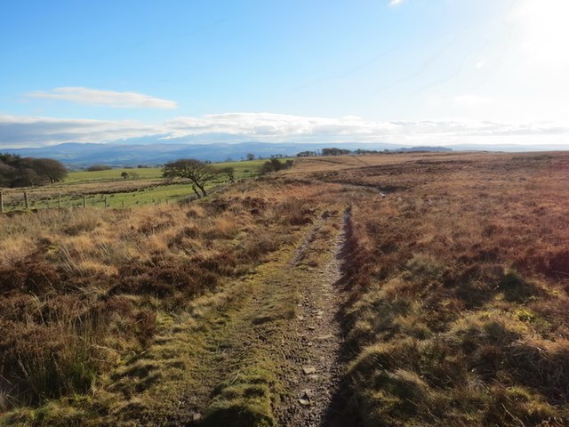
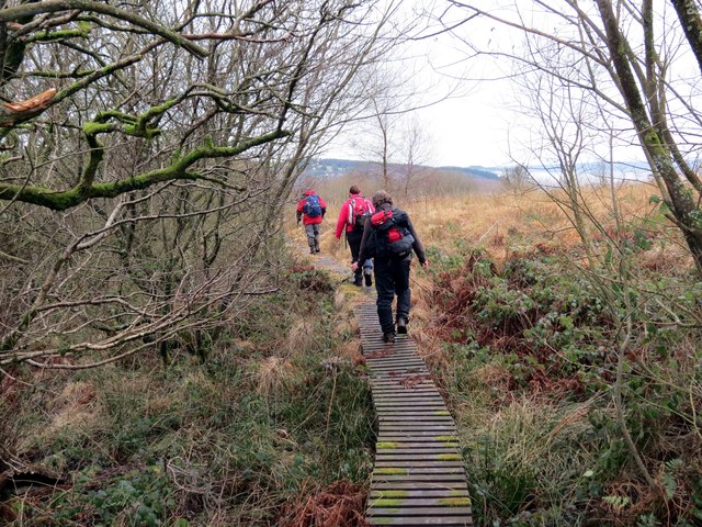
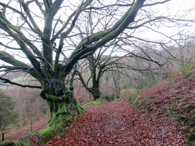
Allt Ddu is a picturesque wood located in the county of Carmarthenshire, Wales. Situated near the village of Cynwyl Elfed, it is a popular destination for nature lovers and outdoor enthusiasts.
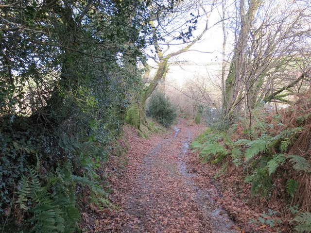
Covering an area of approximately 50 acres, Allt Ddu is characterized by its dense forest and stunning natural beauty. The wood is predominantly made up of deciduous trees, such as oak, beech, and ash, which create a vibrant and colorful landscape throughout the year. The forest floor is adorned with a diverse range of flora, including bluebells, wild garlic, and ferns, adding to the enchanting atmosphere.
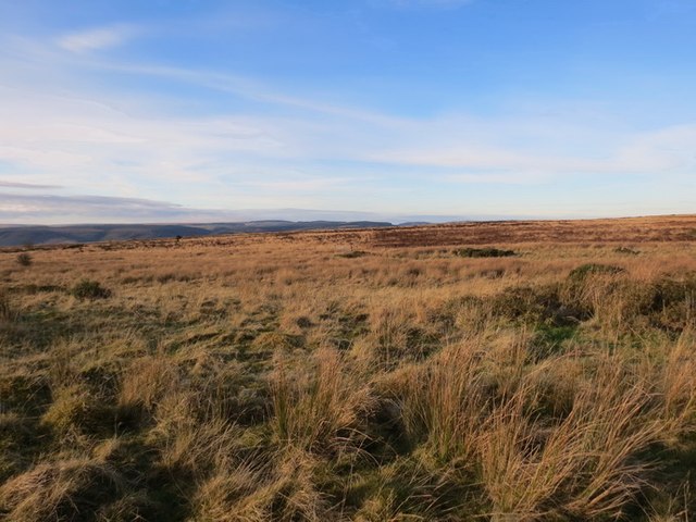
Allt Ddu offers various walking trails that allow visitors to explore the wood's hidden gems. These trails cater to different fitness levels and interests, providing options for leisurely strolls or more challenging hikes. Along the way, visitors can appreciate the tranquil surroundings, listen to the soothing sounds of birdsong, and spot wildlife such as squirrels, deer, and a variety of bird species.
The wood also boasts a small stream that meanders through its heart, adding to the charm and providing a peaceful spot for visitors to relax and enjoy the soothing sounds of flowing water.
Allt Ddu is a protected site, managed by local authorities to preserve its natural beauty and biodiversity. It serves as an important habitat for many species of plants and animals, contributing to the overall ecological balance of the region.
Overall, Allt Ddu in Carmarthenshire offers a delightful retreat for nature lovers, providing a haven of tranquility and natural beauty for all who visit.
If you have any feedback on the listing, please let us know in the comments section below.
Allt Ddu Images
Images are sourced within 2km of 51.956541/-4.0129016 or Grid Reference SN6130. Thanks to Geograph Open Source API. All images are credited.


Allt Ddu is located at Grid Ref: SN6130 (Lat: 51.956541, Lng: -4.0129016)
Unitary Authority: Carmarthenshire
Police Authority: Dyfed Powys
What 3 Words
///pints.poetry.period. Near Llansawel, Carmarthenshire
Nearby Locations
Related Wikis

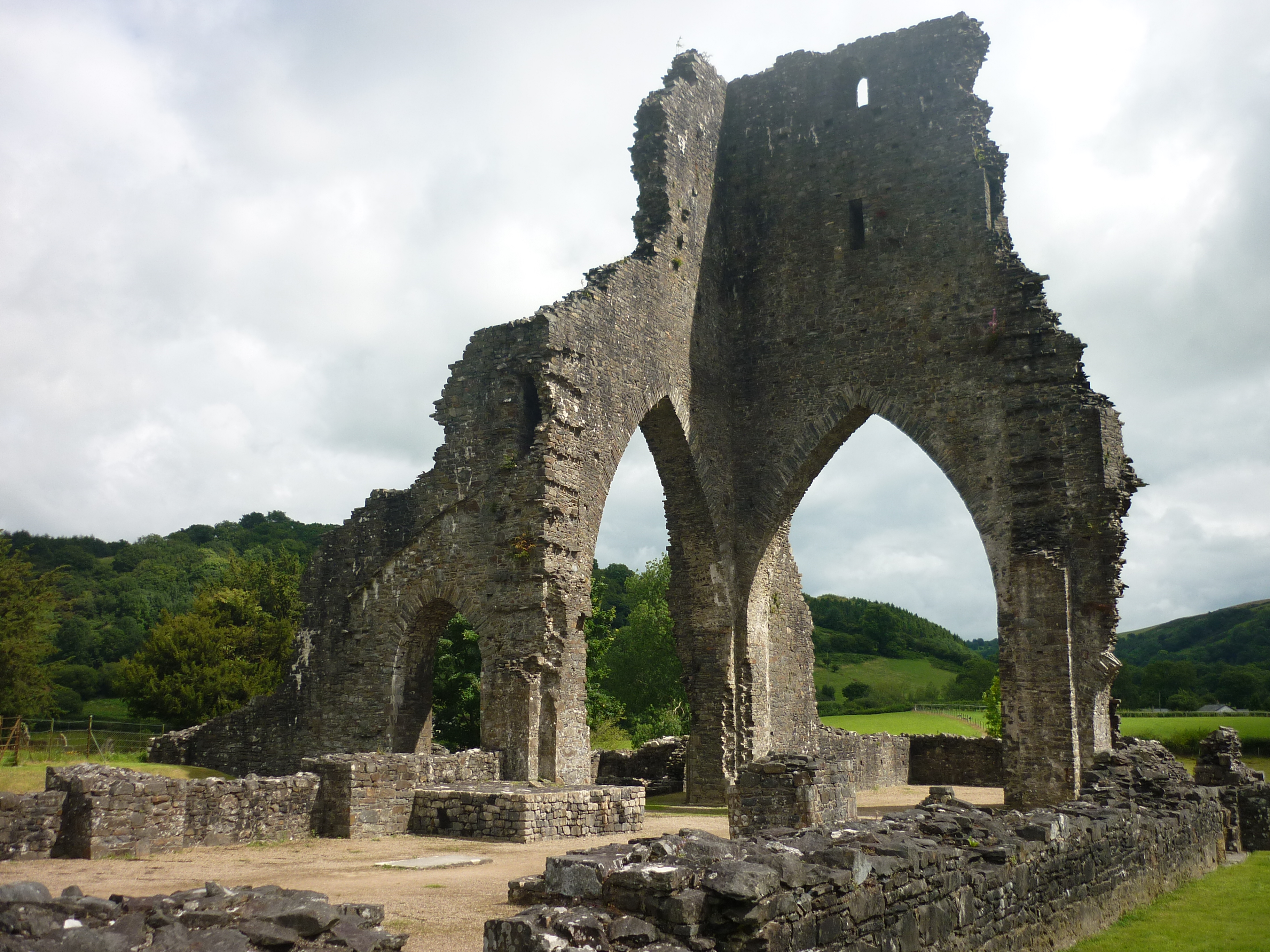
Talley Abbey
Talley Abbey (Welsh: Abaty Talyllychau) is a ruined former monastery of the Premonstratensians ("White Canons") in the village of Talley in Carmarthenshire...
Talley
Talley (Welsh: Talyllychau, historically Tal y Llychau) is a village and community in Carmarthenshire, Wales.The population taken at the 2011 census was...

Talley Lakes
Upper Talley Lake (Welsh: Llyn Talyllychau Uchaf) and Lower Talley Lake (Welsh: Llyn Talyllychau Isaf) are two small lakes immediately north of the village...

Talley transmitting station
The Talley television relay station is sited on high ground to the north of the village of Talley in Carmarthenshire. It was originally built in 1986 as...
Edwinsford
Edwinsford is a small hamlet situated about the historic Edwinsford Estate and fishery on the river Cothi, a tributary of the River Tywi, in Carmarthenshire...

Abergorlech
Abergorlech is a village 8 miles (13 km) to the north-west of Llandeilo in Carmarthenshire, Wales. It lies on the River Cothi on the B4310 road, between...
Llansawel
Llansawel is a village and community in Carmarthenshire, Wales, about ten miles north of Llandeilo. It covers an area of 4,079 hectares (15.75 sq mi)....

Afon Annell
Afon Annell (River Annell) is a small river in Carmarthenshire, Wales. It is a tributary of the Afon Cothi.Some of the waters of the Annell were previously...
Have you been to Allt Ddu?
Leave your review of Allt Ddu below (or comments, questions and feedback).