Allt Cae-ffynnon-wen

Wood, Forest in Carmarthenshire

Wales

Allt Cae-ffynnon-wen

Llwyncelyn, Abergorlech Adfail o dy o'r enw Llwyncelyn yn Abergorlech / A ruined house known as Llwyncelyn (trans. 'hollybush') near Abergorlech
Llwyncelyn, Abergorlech Credit: Alan Richards

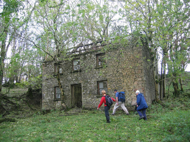
Allt Cae-ffynnon-wen is a picturesque wood located in Carmarthenshire, Wales. With its stunning scenic beauty and tranquil atmosphere, it is a popular destination for nature lovers and hikers seeking a peaceful retreat.

Covering an area of approximately 100 acres, Allt Cae-ffynnon-wen is characterized by its diverse range of tree species, including oak, birch, beech, and pine. These trees create a dense canopy that provides shade and shelter for a variety of wildlife, making it an ideal habitat for birds, squirrels, and small mammals.

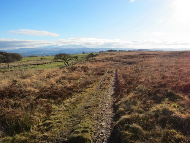
The wood features a network of well-maintained footpaths and trails, making it accessible to visitors of all ages and abilities. These paths wind their way through the forest, offering breathtaking views of the surrounding countryside and allowing visitors to immerse themselves in the natural beauty of the area.

One of the highlights of Allt Cae-ffynnon-wen is the enchanting waterfall that cascades down a rocky ledge, providing a mesmerizing sight and a calming soundtrack of trickling water. This waterfall is a popular spot for photographers and nature enthusiasts, who can capture the beauty of the rushing water against the backdrop of lush greenery.

In addition to its natural attractions, Allt Cae-ffynnon-wen also offers picnic areas and benches where visitors can relax and enjoy a packed lunch while taking in the serenity of the surroundings.

Overall, Allt Cae-ffynnon-wen is a haven of tranquility and natural beauty, making it a must-visit destination for those seeking a peaceful escape in the heart of Carmarthenshire.

If you have any feedback on the listing, please let us know in the comments section below.

Allt Cae-ffynnon-wen Images

Images are sourced within 2km of 51.979209/-4.0145441 or Grid Reference SN6133. Thanks to Geograph Open Source API. All images are credited.

Llwyncelyn, Abergorlech Adfail o dy o'r enw Llwyncelyn yn Abergorlech / A ruined house known as Llwyncelyn (trans. 'hollybush') near Abergorlech
Llwyncelyn, Abergorlech
Adfail o dy o'r enw Llwyncelyn yn Abergorlech / A ruined house known as Llwyncelyn (trans. 'hollybush') near Abergorlech
Bedd Dafydd ap Gwilym / Dafydd ap Gwilym's grave Yn ôl traddodiad gorwedd Dafydd ap Gwilym (1320-1380), bardd enwocaf Cymru, o dan ywen yn Ystrad Fflur yng Ngheredigion. Ond ceir traddodiad arall sy'n honni iddo gael ei gladdu ym mynwent Talyllychau. Ar 15 Medi 1984 dadorchuddiwyd y garreg fedd uchod er cof amdano. 

According to tradition Dafydd ap Gwilym (fl 1320-1380), Wales' greatest poet, was buried under a yew tree at Strata Florida in Ceredigion. However, there is another tradition which claims that he was actually buried at Talley. On 15 September 1984 the above gravestone was unveiled in memory of him.
Bedd Dafydd ap Gwilym / Dafydd ap Gwilym's grave
Yn ôl traddodiad gorwedd Dafydd ap Gwilym (1320-1380), bardd enwocaf Cymru, o dan ywen yn Ystrad Fflur yng Ngheredigion. Ond ceir traddodiad arall sy'n honni iddo gael ei gladdu ym mynwent Talyllychau. Ar 15 Medi 1984 dadorchuddiwyd y garreg fedd uchod er cof amdano. According to tradition Dafydd ap Gwilym (fl 1320-1380), Wales' greatest poet, was buried under a yew tree at Strata Florida in Ceredigion. However, there is another tradition which claims that he was actually buried at Talley. On 15 September 1984 the above gravestone was unveiled in memory of him.
Talley Abbey ruins The abbey ruins are sparse comprising this lofty section of tower and a floorplan of what was buried foundations. However the spot is well worth a visit; as with many ruined abbey sites it is very atmospheric, peaceful and enigmatic.
Talley Abbey ruins
The abbey ruins are sparse comprising this lofty section of tower and a floorplan of what was buried foundations. However the spot is well worth a visit; as with many ruined abbey sites it is very atmospheric, peaceful and enigmatic.
Talley Abbey ruins Talley Abbey was established by the Premonstratensians (also known as the White Canons) in this part of what is now Carmarthenshire in conjunction with Rhys ap Gruffydd in or about 1185. 

The abbey was dissolved by Henry VIII and the structure mined and quarried by the villagers for stone to build much of the present village and the chapel next to the abbey, from where this shot was taken.
Talley Abbey ruins
Talley Abbey was established by the Premonstratensians (also known as the White Canons) in this part of what is now Carmarthenshire in conjunction with Rhys ap Gruffydd in or about 1185. The abbey was dissolved by Henry VIII and the structure mined and quarried by the villagers for stone to build much of the present village and the chapel next to the abbey, from where this shot was taken.
View of the lake from near Talley Abbey ruins The lake was stocked and fished by the monks.
View of the lake from near Talley Abbey ruins
The lake was stocked and fished by the monks.
Gravestones against the church wall near Talley Abbey ruins Some of the older gravestones in St. Michael's churchyard adjacent to the abbey ruins now lean against the boundary wall. What a magnificent spot to have been laid to rest.
Gravestones against the church wall near Talley Abbey ruins
Some of the older gravestones in St. Michael's churchyard adjacent to the abbey ruins now lean against the boundary wall. What a magnificent spot to have been laid to rest.
Talley Abbey silhouette in winter sunlight The ruins may not be as complete as similar abbeys but the remains are very photogenic and atmospheric.
Talley Abbey silhouette in winter sunlight
The ruins may not be as complete as similar abbeys but the remains are very photogenic and atmospheric.
Talley Abbey ruins Not much remains of a grand structure - the Dissolution was the undoing of this abbey and it soon became an easy source of dressed stone for cottages, farms and houses.
Talley Abbey ruins
Not much remains of a grand structure - the Dissolution was the undoing of this abbey and it soon became an easy source of dressed stone for cottages, farms and houses.
Talley Abbey ruins and Talley village When the land was selected for the abbey they chose a spot very amenable for the monastic lifestyle with a blend of beauty and asceticism.
Talley Abbey ruins and Talley village
When the land was selected for the abbey they chose a spot very amenable for the monastic lifestyle with a blend of beauty and asceticism.
Talley / Talyllychau: the Upper Lake
Talley / Talyllychau: the Abbey ruins
Mynydd Cynros Trac ar Fynydd Cynros yn mynd i gyfeiriad y de. Mae'n debygol taw ffurf wreiddiol 'cynros' oedd Cefn Rhos.  

Track on Mynydd Cynros going in a southernly direction. Probably, the original name of 'cynros' was Cefn Rhos (trans. Moor Ridge).
Mynydd Cynros
Trac ar Fynydd Cynros yn mynd i gyfeiriad y de. Mae'n debygol taw ffurf wreiddiol 'cynros' oedd Cefn Rhos. Track on Mynydd Cynros going in a southernly direction. Probably, the original name of 'cynros' was Cefn Rhos (trans. Moor Ridge).
Mynydd Cynros Rhostir uwchben pentre Talyllychau /

Moorland above the village of Talley
Mynydd Cynros
Rhostir uwchben pentre Talyllychau / Moorland above the village of Talley
Banc Beili-Tew Started from track opposite Chapel Cemetery. Then grass - last 300-400m bracken but ways through and sheep grazing.

Name:Banc Beili-Tew
Hill number:5243
Height:278m / 912ft
Area:31C: South-West Wales
Class:Hu
Grid ref:SN 61606 34625
Summit feature:trig point: OS measurement
Drop:120m
Col:158m SN601350
Banc Beili-Tew
Started from track opposite Chapel Cemetery. Then grass - last 300-400m bracken but ways through and sheep grazing. Name:Banc Beili-Tew Hill number:5243 Height:278m / 912ft Area:31C: South-West Wales Class:Hu Grid ref:SN 61606 34625 Summit feature:trig point: OS measurement Drop:120m Col:158m SN601350
Mynydd Cynros Parked at Cilyllynfawr Farm and used right of way to reach the plantationon the east of the hill. Still dry and sunny for Mother's Day.
Name: Mynydd Cynros
Hill number: 2219
Height: 329m / 1079ft
Area: 31C: South-West Wales
Class: Ma
Grid ref: SN 62059 32690
Summit feature: ground within 3m of trig point
Drop: 221m
Col: 108m  SN633328
Mynydd Cynros
Parked at Cilyllynfawr Farm and used right of way to reach the plantationon the east of the hill. Still dry and sunny for Mother's Day. Name: Mynydd Cynros Hill number: 2219 Height: 329m / 1079ft Area: 31C: South-West Wales Class: Ma Grid ref: SN 62059 32690 Summit feature: ground within 3m of trig point Drop: 221m Col: 108m SN633328
War Memorial and Talley church The cross of the war memorial and the bellcote of St Michael's Church, Talley.
War Memorial and Talley church
The cross of the war memorial and the bellcote of St Michael's Church, Talley.
St Michael's church and Talley Abbey St Michael's church with the war memorial in front with the remains of Talley Abbey to the right.
St Michael's church and Talley Abbey
St Michael's church with the war memorial in front with the remains of Talley Abbey to the right.
War Memorial, Talley War Memorial in front of St Michael's church, Talley.
War Memorial, Talley
War Memorial in front of St Michael's church, Talley.
Show me another place!

Allt Cae-ffynnon-wen is located at Grid Ref: SN6133 (Lat: 51.979209, Lng: -4.0145441)

Unitary Authority: Carmarthenshire

Police Authority: Dyfed Powys

What 3 Words

///hacksaw.usages.dislikes. Near Llansawel, Carmarthenshire

Related Wikis

Talley Lakes

Upper Talley Lake (Welsh: Llyn Talyllychau Uchaf) and Lower Talley Lake (Welsh: Llyn Talyllychau Isaf) are two small lakes immediately north of the village...
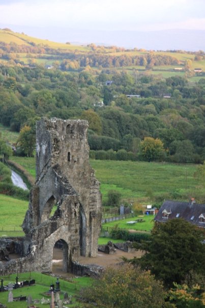
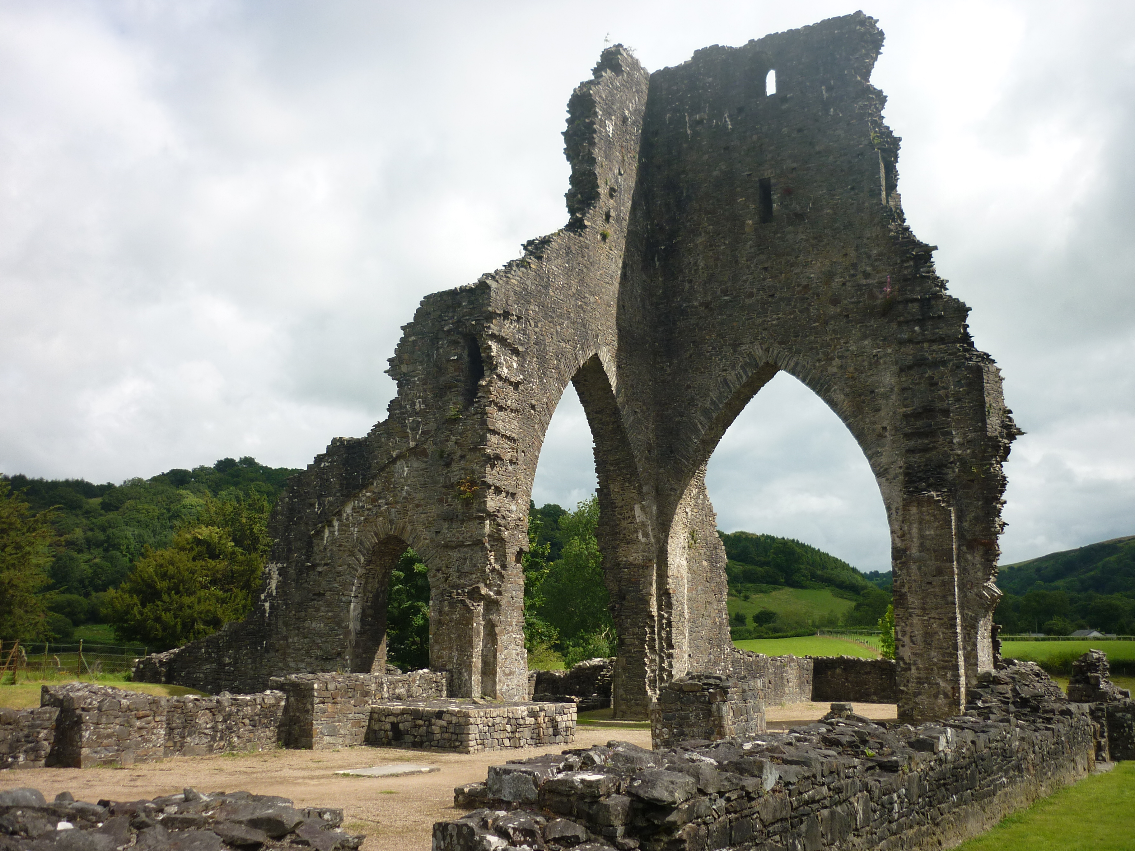
Talley Abbey

Talley Abbey (Welsh: Abaty Talyllychau) is a ruined former monastery of the Premonstratensians ("White Canons") in the village of Talley in Carmarthenshire...
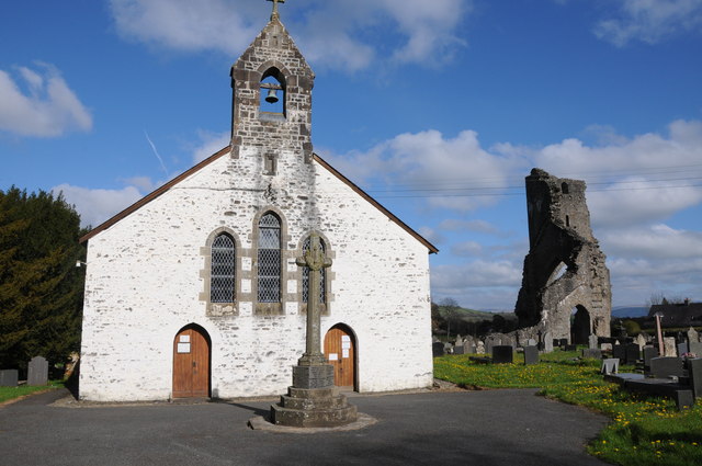
Talley

Talley (Welsh: Talyllychau, historically Tal y Llychau) is a village and community in Carmarthenshire, Wales.The population taken at the 2011 census was...

Edwinsford

Edwinsford is a small hamlet situated about the historic Edwinsford Estate and fishery on the river Cothi, a tributary of the River Tywi, in Carmarthenshire...

Nearby Amenities

Located within 500m of 51.979209,-4.0145441
Addr City: Talley
Addr Country: GB
Addr Housename: Cwm-gwlaw-far
Addr Postcode: SA19 7AZ
Lat/Long: 51.9812078/-4.016153
The data included in this document is from www.openstreetmap.org. The data is made available under ODbL.

Have you been to Allt Cae-ffynnon-wen?

Leave your review of Allt Cae-ffynnon-wen below (or comments, questions and feedback).