Mill Wood

Wood, Forest in Glamorgan

Wales

Mill Wood

Bridge carrying A4118 over Swansea Cycle path
Bridge carrying A4118 over Swansea Cycle path Credit: Jennifer Luther Thomas

Mill Wood is a picturesque forest located in the county of Glamorgan, Wales. Spanning an area of approximately 100 acres, this enchanting woodland is renowned for its natural beauty and rich biodiversity. Situated near the village of Llantwit Major, Mill Wood offers visitors a tranquil retreat from the hustle and bustle of everyday life.

The forest is predominantly composed of native broadleaf trees such as oak, ash, and birch, creating a diverse and vibrant ecosystem. These towering trees provide a lush canopy that filters the sunlight and casts dappled shadows on the forest floor. The woodland is also home to a variety of smaller plant species, including bluebells, wood anemones, and wild garlic, which create a stunning display of colors in the springtime.

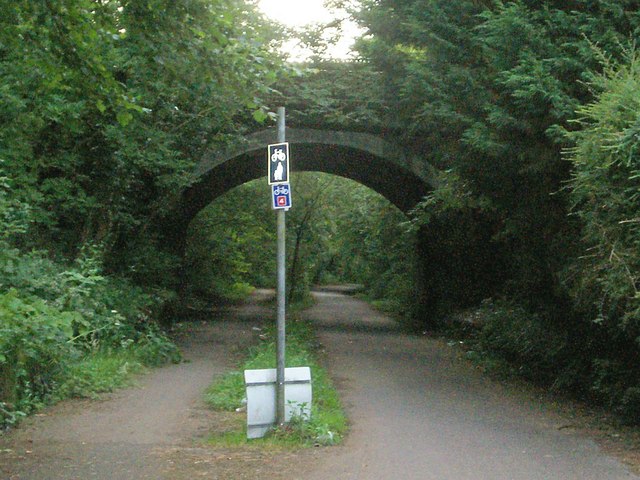
Mill Wood boasts a network of well-maintained footpaths, allowing visitors to explore the forest and discover its hidden gems. The paths wind through the trees, leading to a small stream that meanders through the woodland. This babbling brook adds to the serene ambiance of the forest and provides a refreshing spot for wildlife to drink and thrive.

The forest is teeming with wildlife, making it a haven for nature enthusiasts and birdwatchers. Visitors may catch a glimpse of red kites soaring in the skies above, or spot elusive woodland creatures such as badgers, foxes, and deer. The tranquil atmosphere and abundant wildlife make Mill Wood a perfect place for relaxation, birdwatching, and photography.

Overall, Mill Wood in Glamorgan is a breathtaking woodland that offers visitors a chance to immerse themselves in nature's beauty. Its verdant trees, meandering paths, and diverse wildlife make it a must-visit destination for anyone seeking a peaceful and awe-inspiring experience in the heart of Wales.

If you have any feedback on the listing, please let us know in the comments section below.

Mill Wood Images

Images are sourced within 2km of 51.611525/-4.0054688 or Grid Reference SS6192. Thanks to Geograph Open Source API. All images are credited.

Bridge carrying A4118 over Swansea Cycle path
The Railway Inn, Killay Public House next to the former Heart of Wales Line. The line was closed under the 'Beeching Axe' in the 1960's and this section of it is now a public path and cycle route.
The Railway Inn, Killay
Public House next to the former Heart of Wales Line. The line was closed under the 'Beeching Axe' in the 1960's and this section of it is now a public path and cycle route.
Public bridleway / footpath junction This junction is several yards to the east of where it is marked on the OS map.
Public bridleway / footpath junction
This junction is several yards to the east of where it is marked on the OS map.
Clyne Golf Course Trig Point The highest hill in the area at 131 metres.  Adjacent to the 3rd tee at Clyne Golf Course.

Cf the first Geograph for SS5990: <a href="https://www.geograph.org.uk/photo/248249">SS5990 : Clyne Golf Course trig</a> taken in 2006.
Clyne Golf Course Trig Point
The highest hill in the area at 131 metres. Adjacent to the 3rd tee at Clyne Golf Course. Cf the first Geograph for SS5990: SS5990 : Clyne Golf Course trig taken in 2006.
3rd tee at Clyne Golf Course The highest point on the course at 131 m.
3rd tee at Clyne Golf Course
The highest point on the course at 131 m.
Stile and path  leading towards Hen Parc Wood This is a permissive path rather than a public right of way.  It is not marked on OS maps.
Stile and path leading towards Hen Parc Wood
This is a permissive path rather than a public right of way. It is not marked on OS maps.
Cycle track NCN4 The cyclist is heading up the old railway line and passing under the road bridge at Killay.
Cycle track NCN4
The cyclist is heading up the old railway line and passing under the road bridge at Killay.
Railway Inn, Killay Interior of this old pub which dates back to 1864.
Railway Inn, Killay
Interior of this old pub which dates back to 1864.
Dyffryn Clun signpost Signpost on the Clyne Valley cycle track.
Dyffryn Clun signpost
Signpost on the Clyne Valley cycle track.
Ordnance Survey Cut Mark This OS cut mark can be found on the concrete gatepost SW side of the cycle path. It marks a point 47.064m above mean sea level.
Ordnance Survey Cut Mark
This OS cut mark can be found on the concrete gatepost SW side of the cycle path. It marks a point 47.064m above mean sea level.
Rara Avis The metal bird sculpture overlooking Swansea Bay is a reminder that this area between Blackpill and Mumbles is a SSSI, important for its migratory birds.
Rara Avis
The metal bird sculpture overlooking Swansea Bay is a reminder that this area between Blackpill and Mumbles is a SSSI, important for its migratory birds.
Stream outlet on Swansea Beach Near the bottom of Sketty Lane
Stream outlet on Swansea Beach
Near the bottom of Sketty Lane
Ordnance Survey Cut Mark This OS cut mark can be found on the wall NE side of Brynmill Lane. It marks a point  34.555m above mean sea level.
Ordnance Survey Cut Mark
This OS cut mark can be found on the wall NE side of Brynmill Lane. It marks a point 34.555m above mean sea level.
Bridges over Clyne River
Old track from Clyne Castle to Clyne Farm
Old track to Clyne Castle
Clyne Farm
Clyne Farm
Clyne Golf Clubhouse The clubhouse flag is at half mast following the death of HM Queen Elizabeth and a solitary golfer is walking along the first fairway. In the distance is Mumbles Head.
Clyne Golf Clubhouse
The clubhouse flag is at half mast following the death of HM Queen Elizabeth and a solitary golfer is walking along the first fairway. In the distance is Mumbles Head.
Show me another place!

Mill Wood is located at Grid Ref: SS6192 (Lat: 51.611525, Lng: -4.0054688)

Unitary Authority: Swansea

Police Authority: South Wales

What 3 Words

///policy.deny.goal. Near Three Crosses, Swansea

Nearby Locations

Mill Wood Olchfa Wood

Related Wikis

Mayals

Mayals is an electoral ward and suburb of Swansea, Wales. It is located about 6 kilometers west of Swansea City Centre. Mayals is considered a part of...

Clyne Valley Country Park

The Clyne Valley Country Park is an area of parkland in Britain, at Swansea in south Wales. It lies on either side of the valley of the Clyne River and...

Sketty (electoral ward)

Sketty (Welsh: Sgeti) is the name of an electoral ward (coterminous with the Sketty community and suburb) in the City and County of Swansea, Wales, UK...

Killay, Swansea

Killay (Welsh: Cilâ) is the name of a suburb and local government community in Swansea, Wales. Killay has its own community council. The village is set...
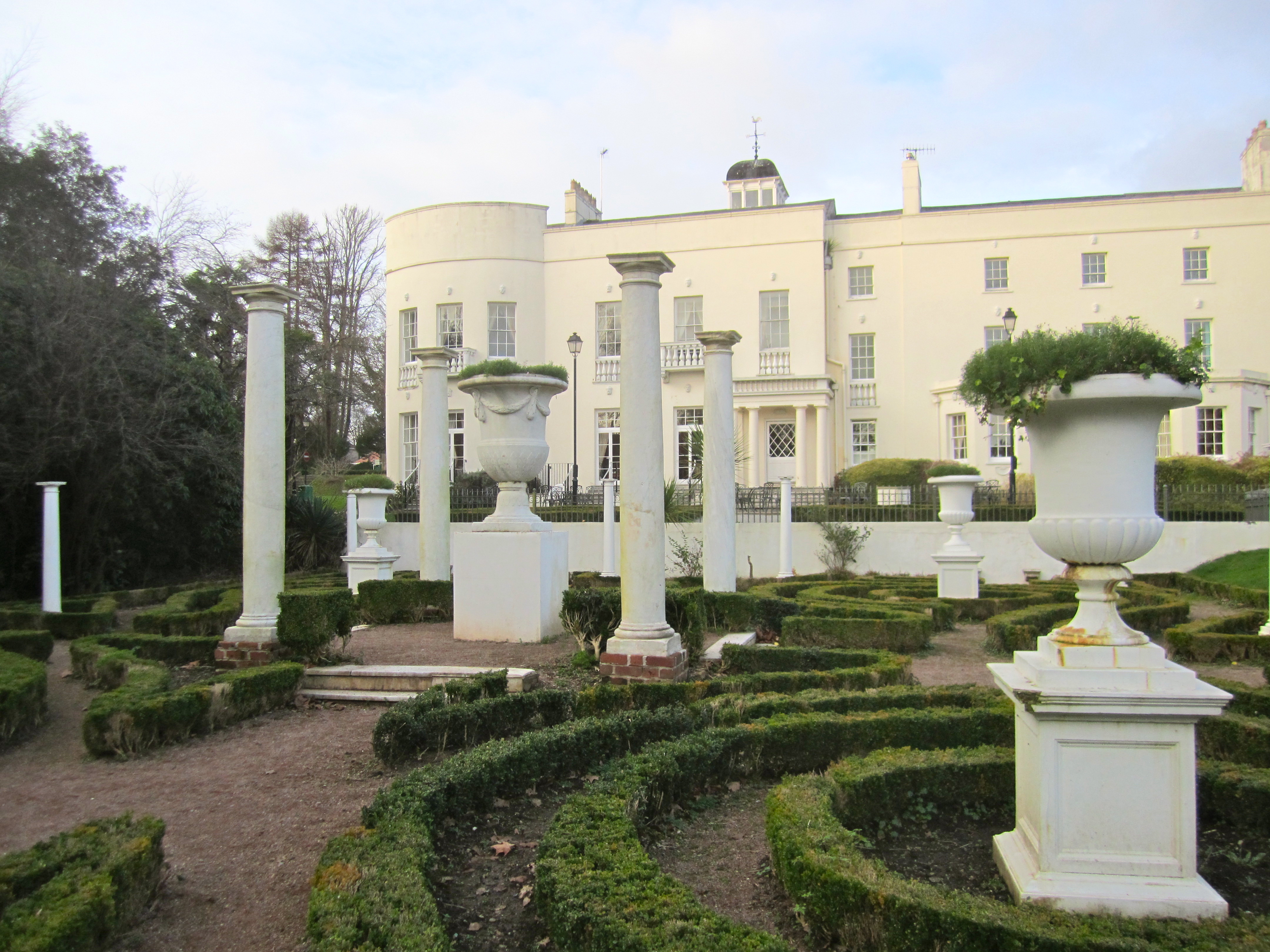
Sketty Hall

Sketty Hall is a venue used for hosting social functions, business functions and conferences in Singleton Park, Swansea, south Wales. The original building...

Hendrefoilan

Hendrefoilan is an area in Swansea, South Wales. The area overlaps northwest Sketty and east Killay communities. The western part is often known as Student...

Wales National Pool

The Wales National Pool (Welsh: Pwll Cenedlaethol Cymru) is a 50-metre swimming pool in the Sketty area of Swansea, Wales. The main pool is 50 m long and...
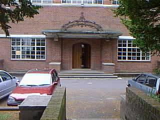
Bishop Gore School

The Bishop Gore School (Welsh: Ysgol Esgob Gore) is a secondary school in Swansea in Wales, founded on 14 September 1682 by Hugh Gore (1613–1691), Bishop...

Nearby Amenities

Located within 500m of 51.611525,-4.0054688
Mini Roundabout
Direction: clockwise
Lat/Long: 51.6145663/-4.006986
Traffic Calming: cushion
Lat/Long: 51.6152286/-4.0070629
Traffic Calming: cushion
Lat/Long: 51.6143023/-4.0041041
Post Box
Collection Times: Mo-Fr 09:00, Sa 07:00
Royal Cypher: EIIR
Royal Cypher Wikidata: Q33102113
Lat/Long: 51.612766/-4.0034952
Bus Stop
Oak Ridge South
Bus: yes
Naptan AtcoCode: 5810AWC50195
Naptan Bearing: NW
Naptan CommonName: Oak Ridge South
Naptan Crossing: Oak Ridge
Naptan NaptanCode: swamtjm
Naptan PlusbusZoneRef: SWANSEA
Naptan Street: New Mill Road
Naptan Verified: no
Public Transport: platform
Source: naptan_import
Lat/Long: 51.6142124/-4.0036956
Bus Stop
Sketty Park Club (W)
Bench: no
Bus: yes
Naptan AtcoCode: 5810AWC50196
Naptan Bearing: W
Naptan CommonName: Sketty Park Club (W)
Naptan Crossing: Aneurin Way
Naptan Landmark: Sketty Park Club
Naptan NaptanCode: swamwpa
Naptan PlusbusZoneRef: SWANSEA
Naptan ShortCommonName: Sketty Park Sports & Social Club W
Naptan Street: New Mill Road
Naptan Verified: no
Public Transport: platform
Shelter: no
Source: naptan_import
Tactile Paving: no
Lat/Long: 51.6145158/-4.0067161
Bus Stop
Dulais Grove (NW)
Bench: no
Bus: yes
Naptan AtcoCode: 5810AWC50197
Naptan Bearing: NW
Naptan CommonName: Dulais Grove (NW)
Naptan Crossing: Dulais Grove
Naptan NaptanCode: swamwjm
Naptan PlusbusZoneRef: SWANSEA
Naptan Street: Saunders Way
Naptan Verified: no
Public Transport: platform
Shelter: no
Source: naptan_import
Tactile Paving: no
Lat/Long: 51.6119991/-4.0037912
Bus Stop
Valley View (NW)
Bench: no
Bus: yes
Naptan AtcoCode: 5810AWC50199
Naptan Bearing: NW
Naptan CommonName: Valley View (NW)
Naptan Crossing: Valley View
Naptan NaptanCode: swamwjt
Naptan PlusbusZoneRef: SWANSEA
Naptan Street: Saunders Way
Naptan Verified: no
Public Transport: platform
Shelter: no
Source: naptan_import
Tactile Paving: no
Lat/Long: 51.6105931/-4.0012476
Bus Stop
Sketty Park Club (N)
Bench: yes
Bus: yes
Naptan AtcoCode: 5810AWC50219
Naptan Bearing: N
Naptan CommonName: Sketty Park Club (N)
Naptan Crossing: New Mill Road
Naptan Landmark: Sketty Park Club
Naptan NaptanCode: swamwpd
Naptan PlusbusZoneRef: SWANSEA
Naptan ShortCommonName: Sketty Park Sports & Social Club N
Naptan Street: Aneurin Way
Public Transport: platform
Shelter: yes
Source: naptan_import
Tactile Paving: no
Lat/Long: 51.614902/-4.0071128
Traffic Calming: cushion
Lat/Long: 51.615877/-4.0064463
Direction: 145
Generator Method: photovoltaic
Generator Output Electricity: yes
Generator Solar Modules: 16
Generator Source: solar
Generator Type: solar_photovoltaic_panel
Location: roof
Power: generator
Lat/Long: 51.6105756/-3.999871
Direction: 280
Generator Method: photovoltaic
Generator Output Electricity: yes
Generator Solar Modules: 10
Generator Source: solar
Generator Type: solar_photovoltaic_panel
Location: roof
Power: generator
Lat/Long: 51.6110822/-4.0000407
Direction: 100
Generator Method: photovoltaic
Generator Output Electricity: yes
Generator Solar Modules: 10
Generator Source: solar
Generator Type: solar_photovoltaic_panel
Location: roof
Power: generator
Lat/Long: 51.6110759/-3.9999927
Direction: 195
Generator Method: photovoltaic
Generator Output Electricity: yes
Generator Solar Modules: 16
Generator Source: solar
Generator Type: solar_photovoltaic_panel
Location: roof
Power: generator
Lat/Long: 51.6107066/-3.9990556
Direction: 195
Generator Method: photovoltaic
Generator Output Electricity: yes
Generator Solar Modules: 21
Generator Source: solar
Generator Type: solar_photovoltaic_panel
Location: roof
Power: generator
Lat/Long: 51.6105658/-3.9985969
Traffic Calming: cushion
Lat/Long: 51.6143492/-4.0021093
Traffic Calming: cushion
Lat/Long: 51.6142293/-4.0033177
Traffic Calming: cushion
Lat/Long: 51.6144516/-4.0053481
Traffic Calming: cushion
Lat/Long: 51.6145474/-4.006425
Traffic Calming: choker
Lat/Long: 51.6132849/-4.0059476
Traffic Calming: cushion
Lat/Long: 51.6142618/-4.007109
Traffic Calming: cushion
Lat/Long: 51.614756/-4.0070057
Direction: 145
Generator Method: photovoltaic
Generator Output Electricity: yes
Generator Solar Modules: 15
Generator Source: solar
Generator Type: solar_photovoltaic_panel
Location: roof
Power: generator
Lat/Long: 51.6092935/-4.0003143
Direction: 190
Generator Method: photovoltaic
Generator Output Electricity: yes
Generator Solar Modules: 8
Generator Source: solar
Generator Type: solar_photovoltaic_panel
Location: roof
Power: generator
Lat/Long: 51.6143159/-4.0054554
Direction: WSW
Generator Method: photovoltaic
Generator Output Electricity: yes
Generator Solar Modules: 16
Generator Source: solar
Generator Type: solar_photovoltaic_panel
Location: roof
Power: generator
Lat/Long: 51.6119758/-4.0040311
Direction: 195
Generator Method: photovoltaic
Generator Output Electricity: yes
Generator Solar Modules: 20
Generator Source: solar
Generator Type: solar_photovoltaic_panel
Location: roof
Power: generator
Lat/Long: 51.6127859/-4.0046866
Direction: 105
Generator Method: photovoltaic
Generator Output Electricity: yes
Generator Solar Modules: 8
Generator Source: solar
Generator Type: solar_photovoltaic_panel
Location: roof
Power: generator
Lat/Long: 51.6129814/-4.0054731
Direction: 285
Generator Method: photovoltaic
Generator Output Electricity: yes
Generator Solar Modules: 8
Generator Source: solar
Generator Type: solar_photovoltaic_panel
Location: roof
Power: generator
Lat/Long: 51.6129568/-4.0055627
Direction: 195
Generator Method: photovoltaic
Generator Output Electricity: yes
Generator Solar Modules: 8
Generator Source: solar
Generator Type: solar_photovoltaic_panel
Location: roof
Power: generator
Lat/Long: 51.6129801/-4.005672
Direction: 195
Generator Method: photovoltaic
Generator Output Electricity: yes
Generator Solar Modules: 16
Generator Source: solar
Generator Type: solar_photovoltaic_panel
Location: roof
Power: generator
Lat/Long: 51.6131985/-4.0068853
Direction: SW
Generator Method: photovoltaic
Generator Output Electricity: yes
Generator Solar Modules: 16
Generator Source: solar
Generator Type: solar_photovoltaic_panel
Location: roof
Power: generator
Lat/Long: 51.6133399/-4.0073758
Direction: 190
Generator Method: photovoltaic
Generator Output Electricity: yes
Generator Solar Modules: 16
Generator Source: solar
Generator Type: solar_photovoltaic_panel
Location: roof
Power: generator
Lat/Long: 51.6142285/-4.007572
Direction: S
Generator Method: photovoltaic
Generator Output Electricity: yes
Generator Solar Modules: 20
Generator Source: solar
Generator Type: solar_photovoltaic_panel
Location: roof
Power: generator
Lat/Long: 51.6131146/-4.001875
Direction: 100
Generator Method: photovoltaic
Generator Output Electricity: yes
Generator Solar Modules: 8
Generator Source: solar
Generator Type: solar_photovoltaic_panel
Location: roof
Power: generator
Lat/Long: 51.6119475/-4.00176
Direction: 280
Generator Method: photovoltaic
Generator Output Electricity: yes
Generator Solar Modules: 7
Generator Source: solar
Generator Type: solar_photovoltaic_panel
Location: roof
Power: generator
Lat/Long: 51.6119496/-4.0017895
Direction: 105
Generator Method: photovoltaic
Generator Output Electricity: yes
Generator Solar Modules: 4
Generator Source: solar
Generator Type: solar_photovoltaic_panel
Location: roof
Power: generator
Lat/Long: 51.6120091/-4.0023145
Direction: 285
Generator Method: photovoltaic
Generator Output Electricity: yes
Generator Solar Modules: 6
Generator Source: solar
Generator Type: solar_photovoltaic_panel
Location: roof
Power: generator
Lat/Long: 51.6120358/-4.002344
Direction: 105
Generator Method: photovoltaic
Generator Output Electricity: yes
Generator Solar Modules: 6
Generator Source: solar
Generator Type: solar_photovoltaic_panel
Location: roof
Power: generator
Lat/Long: 51.6120707/-4.002521
Direction: 285
Generator Method: photovoltaic
Generator Output Electricity: yes
Generator Solar Modules: 4
Generator Source: solar
Generator Type: solar_photovoltaic_panel
Location: roof
Power: generator
Lat/Long: 51.6120424/-4.00258
Mill Wood
Leaf Type: broadleaved
Natural: wood
Lat/Long: 51.6124788/-4.008219
The data included in this document is from www.openstreetmap.org. The data is made available under ODbL.

Have you been to Mill Wood?

Leave your review of Mill Wood below (or comments, questions and feedback).