Burn's Green

Settlement in Hertfordshire East Hertfordshire

England

Burn's Green

Benington: Road Used as a Public Path A Road Used as a Public Path (RUPP) leading from High Elms Lane to Burn's Green.
Benington: Road Used as a Public Path Credit: Nigel Cox

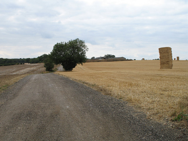
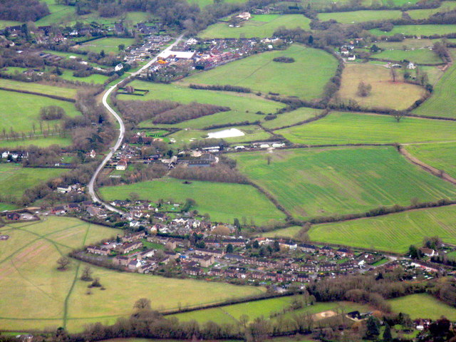
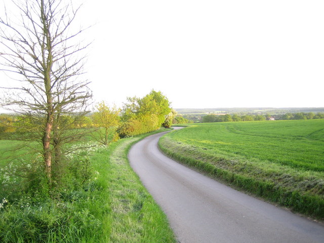
Burn's Green is a small village located in the county of Hertfordshire, in the East of England. Situated approximately 4 miles east of the town of Hitchin, it lies within the North Hertfordshire district. The village is surrounded by picturesque countryside, offering residents and visitors a peaceful and scenic environment.

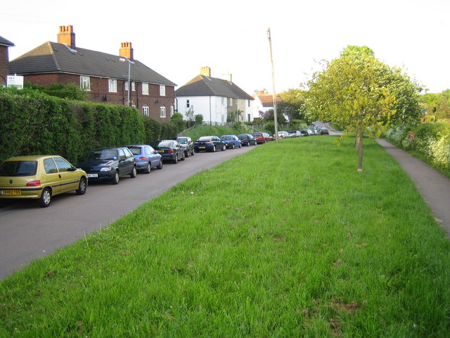
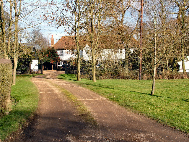
The village of Burn's Green is characterized by its rural charm and traditional English architecture. It is home to a close-knit community, with a population of around 500 people. The village is centered around a small green, which serves as a focal point for local activities and events.

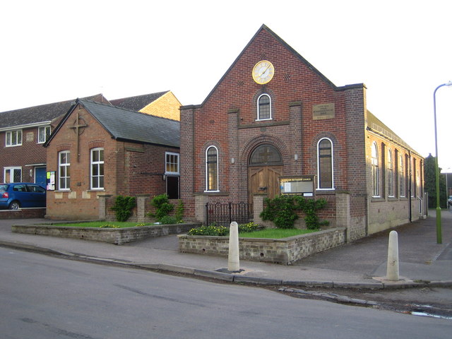
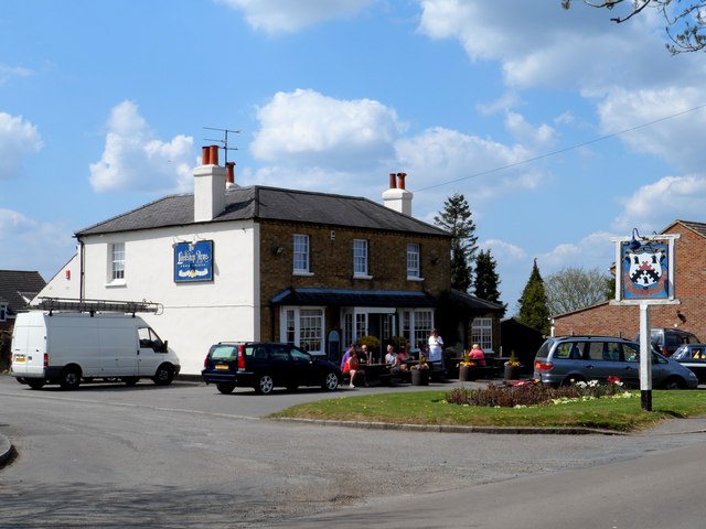
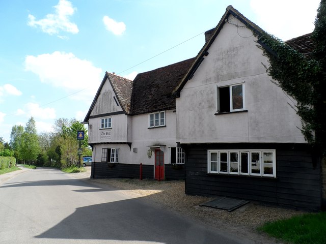
Despite its small size, Burn's Green offers a range of amenities to its residents. These include a village hall, a primary school, and a local pub. The village hall is a popular venue for community gatherings and events, providing a space for various activities such as clubs, meetings, and celebrations.

The primary school in Burn's Green provides education for children aged 4 to 11 and is highly regarded for its supportive and nurturing environment. The school plays an integral role in the local community, fostering a sense of belonging and promoting educational excellence.

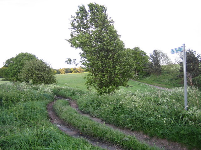
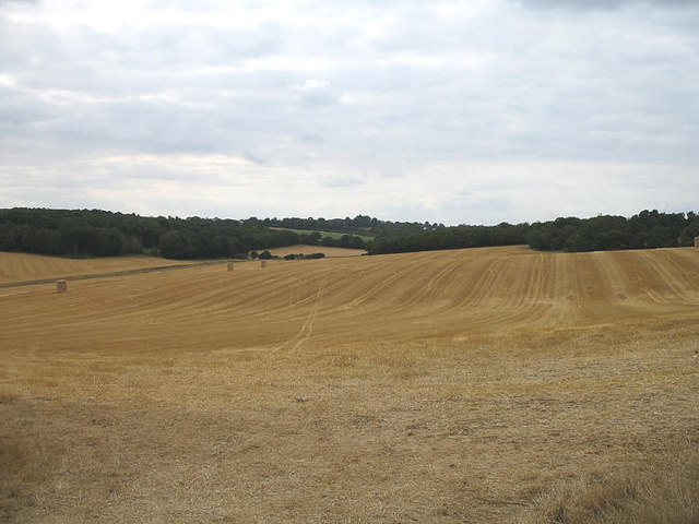
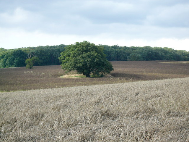
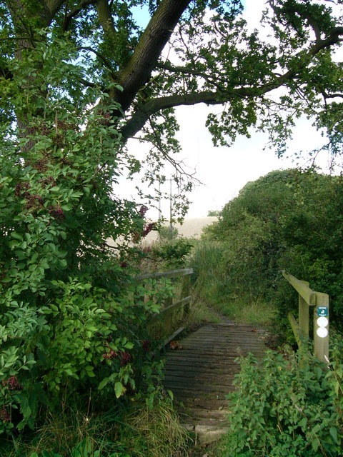
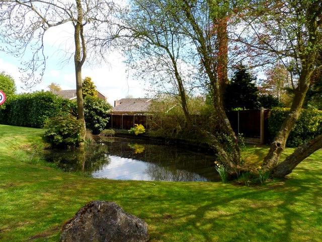
Surrounded by countryside, Burn's Green offers numerous opportunities for outdoor activities and exploration. The village is located near several nature reserves, providing residents with opportunities for walking, cycling, and enjoying the natural beauty of the area.

Overall, Burn's Green is a quaint and peaceful village in Hertfordshire, offering a close-knit community, picturesque surroundings, and a range of amenities for its residents.

If you have any feedback on the listing, please let us know in the comments section below.

Burn's Green Images

Images are sourced within 2km of 51.886599/-0.102305 or Grid Reference TL3022. Thanks to Geograph Open Source API. All images are credited.

Benington: Road Used as a Public Path A Road Used as a Public Path (RUPP) leading from High Elms Lane to Burn's Green.
Benington: Road Used as a Public Path
A Road Used as a Public Path (RUPP) leading from High Elms Lane to Burn's Green.
Benington Methodist Church Built in 1862 and rebuilt in 1933, the church is on Whempstead Road in Burn's Green.
Benington Methodist Church
Built in 1862 and rebuilt in 1933, the church is on Whempstead Road in Burn's Green.
Benington: Town Lane Looking towards Burn's Green.
Benington: Town Lane
Looking towards Burn's Green.
Track to Chapel Farm Track forming route of bridleway as well as access to Chapel farm, which is visible in the centre.  The crop has been harvested, baled and stacked.
Track to Chapel Farm
Track forming route of bridleway as well as access to Chapel farm, which is visible in the centre. The crop has been harvested, baled and stacked.
Valley of The Old Bourne View across the valley towards the gap between Combs wood (on the left) and Banfield Wood (on the right).
Valley of The Old Bourne
View across the valley towards the gap between Combs wood (on the left) and Banfield Wood (on the right).
Cutting Hill Farm
Cutting Hill Farm
Oak Tree Oak tree standing in the fields behind Benington Park. Photographed from the Chain Walk/bridleway starting at Hebing End
Oak Tree
Oak tree standing in the fields behind Benington Park. Photographed from the Chain Walk/bridleway starting at Hebing End
Footbridge over small stream A footbridge over a small stream on the Chain Walk/Bridleway which starts at Hebing End
Footbridge over small stream
A footbridge over a small stream on the Chain Walk/Bridleway which starts at Hebing End
Roadside placard, Benington, Hertfordshire (1) While the country struggles to supplement its energy needs by tentatively developing alternative sources, voices of protest in rural areas raised by those affected by these proposed  installations. The village of Benington in Hertfordshire currently has a numerous placards along the roadside like the one in the image. A justified campaign <span class="nowrap"><a title="http://www.stopbeningtonwindfarm.co.uk/" rel="nofollow ugc noopener" href="http://www.stopbeningtonwindfarm.co.uk/">Link</a><img style="margin-left:2px;" alt="External link" title="External link - shift click to open in new window" src="https://s1.geograph.org.uk/img/external.png" width="10" height="10"/></span> ? or mere nimbyism <span class="nowrap"><a title="http://en.wikipedia.org/wiki/NIMBY" rel="nofollow ugc noopener" href="http://en.wikipedia.org/wiki/NIMBY">Link</a><img style="margin-left:2px;" alt="External link" title="External link - shift click to open in new window" src="https://s1.geograph.org.uk/img/external.png" width="10" height="10"/></span> ?
Roadside placard, Benington, Hertfordshire (1)
While the country struggles to supplement its energy needs by tentatively developing alternative sources, voices of protest in rural areas raised by those affected by these proposed installations. The village of Benington in Hertfordshire currently has a numerous placards along the roadside like the one in the image. A justified campaign LinkExternal link ? or mere nimbyism LinkExternal link ?
Roadside placard, Benington, Hertfordshire (2) <a href="https://www.geograph.org.uk/photo/2533338">TL3023 : Roadside placard, Benington, Hertfordshire (1)</a> ... and here an apparently lone voice of support for the project!
Roadside placard, Benington, Hertfordshire (2)
TL3023 : Roadside placard, Benington, Hertfordshire (1) ... and here an apparently lone voice of support for the project!
Combs Wood May day bank holiday and there seems a lot of cars parked at this spot.
Combs Wood
May day bank holiday and there seems a lot of cars parked at this spot.
Footpath to Green End disappears into Comb's Wood
Start of public restricted byway to Little Munden
Pond near to Burn's Green One of several small ponds marked on the O.S. map.
Pond near to Burn's Green
One of several small ponds marked on the O.S. map.
The Lordship Arms, Bennington
The Bell pub, Bennington
Benington and Burn's Green Two villages surrounded by farmland east of Stevenage. Burn's Green is the more distant.
Benington and Burn's Green
Two villages surrounded by farmland east of Stevenage. Burn's Green is the more distant.
Benington: High Elms Lane Looking over Lamsden Common towards Watton at Stone.
Benington: High Elms Lane
Looking over Lamsden Common towards Watton at Stone.
Show me another place!

Burn's Green is located at Grid Ref: TL3022 (Lat: 51.886599, Lng: -0.102305)

Administrative County: Hertfordshire

District: East Hertfordshire

Police Authority: Hertfordshire

What 3 Words

///quarrel.violinist.unwind. Near Watton at Stone, Hertfordshire

Related Wikis

Benington, Hertfordshire

Benington is a village and civil parish in the East Hertfordshire district of Hertfordshire, England, about four miles east of Stevenage and 35 miles north...

Benington Castle

Benington Castle is a ruined castle in the village of Benington, near Stevenage in Hertfordshire, England at grid reference TL296236. It has been protected...

Benington High Wood

Benington High Wood is a 20.7-hectare (51-acre) biological Site of Special Scientific Interest in Benington, Hertfordshire. The planning authority is East...

Whempstead

Whempstead is a hamlet in the parish of Watton-at-Stone, situated north of Hertford and to the south-east of Stevenage in Hertfordshire, it is close to...

Nearby Amenities

Located within 500m of 51.886599,-0.102305
Barrier: kissing_gate
Lat/Long: 51.8855897/-0.1035132
Barrier: horse_stile
Lat/Long: 51.8874733/-0.1059026
Barrier: kissing_gate
Lat/Long: 51.8848885/-0.102406
Pub
Lordship Arms
Lat/Long: 51.8875443/-0.1005103
Public Bookcase
Bus Stop
Lordship Arms PH
Bus: yes
Departures Board: no
Naptan AtcoCode: 210021305920
Naptan Bearing: N
Naptan CommonName: Lordship Arms PH
Naptan Crossing: Goodey Meade
Naptan Indicator: o/s
Naptan Landmark: Goodey Meade
Naptan NaptanCode: hrtdtapd
Naptan ShortCommonName: NA
Naptan Street: Hebing End
Naptan Verified: no
Public Transport: platform
Shelter: yes
Source: naptan_import
Lat/Long: 51.8873315/-0.1000167
Bus Stop
Lordship Arms PH
Bus: yes
Naptan AtcoCode: 210021310780
Naptan Bearing: S
Naptan CommonName: Lordship Arms PH
Naptan Crossing: Gosmore Farm
Naptan Indicator: opp
Naptan Landmark: Gosmore Farm
Naptan NaptanCode: hrtdpdaw
Naptan ShortCommonName: NA
Naptan Street: Hebing End
Naptan Verified: no
Public Transport: platform
Source: naptan_import
Lat/Long: 51.8875322/-0.100002
Hebing End
Place: hamlet
Lat/Long: 51.887879/-0.0997459
Post Box
Collection Times: Mo-Fr 16:30; Sa 10:00
Post Box Type: lamp
Ref: SG2 98
Lat/Long: 51.887684/-0.100264
Power: pole
Lat/Long: 51.8901433/-0.1023825
Power: pole
Lat/Long: 51.8897121/-0.1038685
Power: pole
Lat/Long: 51.8893438/-0.1061685
Power: pole
Lat/Long: 51.8892792/-0.1053276
Power: pole
Lat/Long: 51.8893843/-0.1071877
Power: pole
Lat/Long: 51.8904603/-0.1012614
Power: pole
Lat/Long: 51.8907703/-0.1001775
Power: pole
Lat/Long: 51.883657/-0.1040374
Power: pole
Lat/Long: 51.8869267/-0.1050888
Power: pole
Lat/Long: 51.8867248/-0.1016824
Power: pole
Lat/Long: 51.8872181/-0.1003225
Power: pole
Lat/Long: 51.8862381/-0.1048501
Power: pole
Lat/Long: 51.8862049/-0.1032649
Power: pole
Lat/Long: 51.8883438/-0.1058211
Power: pole
Lat/Long: 51.8827613/-0.1033534
Power: pole
Lat/Long: 51.889251/-0.1063146
Power: pole
Lat/Long: 51.8857083/-0.1046865
Power: pole
Lat/Long: 51.8846686/-0.1043539
Bench
Source: gps
Lat/Long: 51.8873686/-0.100041
Bench
Source: gps
Lat/Long: 51.8886075/-0.1070787
Crossing
Lat/Long: 51.890153/-0.1009559
The data included in this document is from www.openstreetmap.org. The data is made available under ODbL.

Have you been to Burn's Green?

Leave your review of Burn's Green below (or comments, questions and feedback).