Coed Cors-y-gedol

Wood, Forest in Merionethshire

Wales

Coed Cors-y-gedol

Fog on the path to Afon Ysgethin / Tal-y-Bont
Fog on the path to Afon Ysgethin / Tal-y-Bont Credit: Hansjoerg Lipp

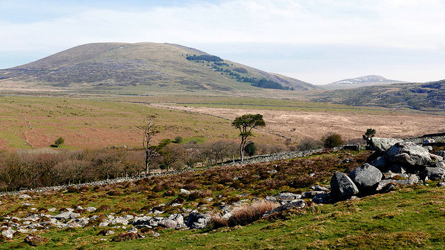
Coed Cors-y-gedol, located in Merionethshire, is a picturesque wood and forest area known for its natural beauty and rich biodiversity. It is situated in northwestern Wales, close to the stunning Cardigan Bay coastline.

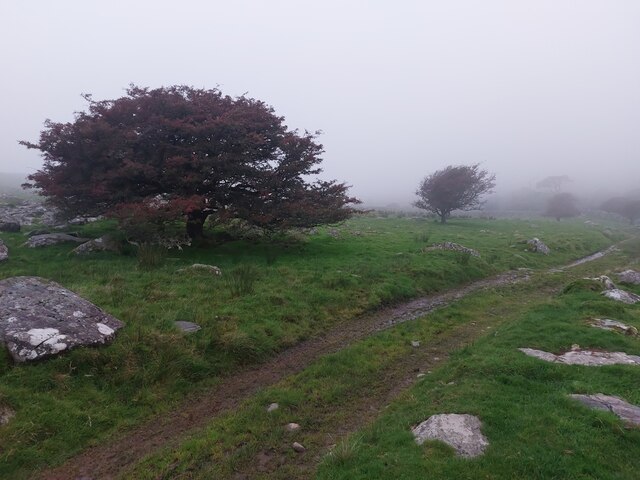
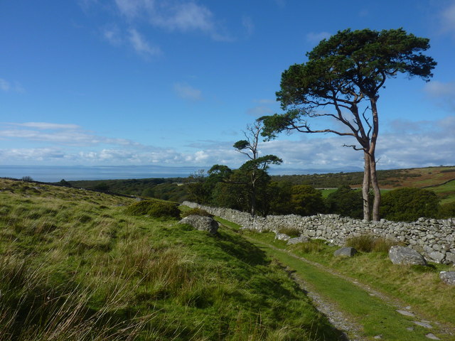
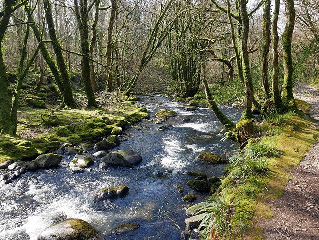
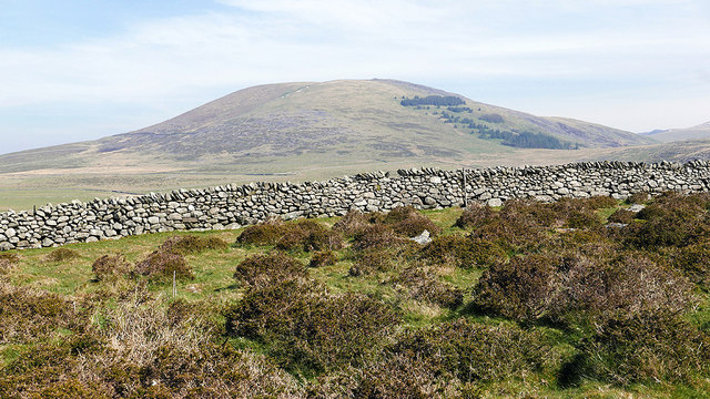
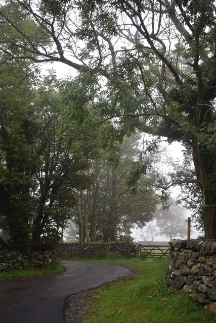
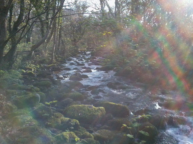
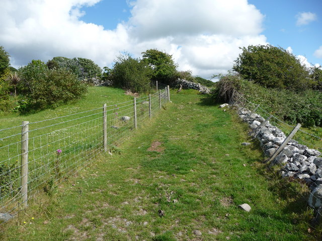
Covering an expansive area, Coed Cors-y-gedol is characterized by its diverse range of habitats, including ancient woodland, wetlands, and meadows. The forest is primarily composed of native tree species such as oak, ash, birch, and hazel, which provide a home to a wide array of plant and animal species.

The wood is particularly renowned for its birdlife, attracting birdwatchers from far and wide. Species such as redstarts, pied flycatchers, and wood warblers can be spotted here during the breeding season. Additionally, Coed Cors-y-gedol is home to various mammals, including badgers, foxes, and bats.

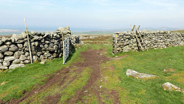
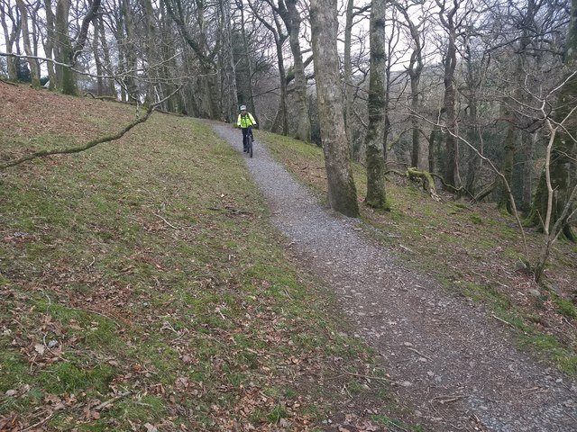
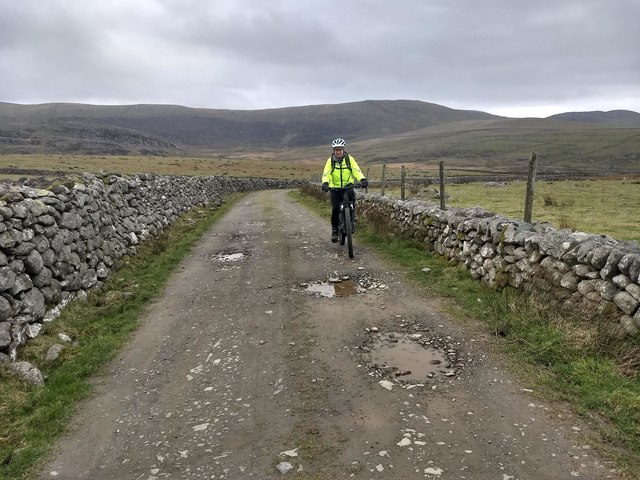
For nature enthusiasts and hikers, this woodland offers a tranquil escape with its network of walking trails and paths. Visitors can explore the diverse flora and fauna while immersing themselves in the serenity of nature. The wood is also a popular destination for photographers, capturing the beauty of its flora, fauna, and landscapes.

Coed Cors-y-gedol is managed and preserved by conservation organizations in order to protect its unique ecosystem and maintain its natural charm. Educational programs and guided tours are available to visitors, providing an opportunity to learn about the importance of conservation and the delicate balance of nature within the woodland.

Overall, Coed Cors-y-gedol is a haven for nature lovers, offering a stunning natural environment, abundant wildlife, and a peaceful retreat away from the hustle and bustle of modern life.

If you have any feedback on the listing, please let us know in the comments section below.

Coed Cors-y-gedol Images

Images are sourced within 2km of 52.780718/-4.0778275 or Grid Reference SH5922. Thanks to Geograph Open Source API. All images are credited.

Fog on the path to Afon Ysgethin / Tal-y-Bont
Track from Llyn Irddyn to Afon Ysgethin
Footpath and Afon Ysgethin Above Tal-y-bont.
Footpath and Afon Ysgethin
Above Tal-y-bont.
Open grassland above Pont Fadog The prominent hill is Moelfre.
Open grassland above Pont Fadog
The prominent hill is Moelfre.
Looking towards Moelfre Viewing one of the fine dry-stone walls which criss-cross the area, from the path and access land above Pont Fadog.
Looking towards Moelfre
Viewing one of the fine dry-stone walls which criss-cross the area, from the path and access land above Pont Fadog.
Open gate and ladder stile This uplands path passes through several dry-stone walls. The ladder stile is probably redundant as the gate is not locked.
Open gate and ladder stile
This uplands path passes through several dry-stone walls. The ladder stile is probably redundant as the gate is not locked.
Abandoned building beside the track to Llyn Bodlyn Shown as a roofed building on the 1889 25" map but without annotation. Moelfre is partly visible on the right.
Abandoned building beside the track to Llyn Bodlyn
Shown as a roofed building on the 1889 25" map but without annotation. Moelfre is partly visible on the right.
Cors-uchaf farmstead (ruin) Beside the track to Llyn Bodlyn. Shown extant on 1764 estate map for Cors y Gedol Hall. Coflein:<span class="nowrap"><a title="https://www.coflein.gov.uk/en/site/89267/details/cors-uchaf" rel="nofollow ugc noopener" href="https://www.coflein.gov.uk/en/site/89267/details/cors-uchaf">Link</a><img style="margin-left:2px;" alt="External link" title="External link - shift click to open in new window" src="https://s1.geograph.org.uk/img/external.png" width="10" height="10"/></span>
Cors-uchaf farmstead (ruin)
Beside the track to Llyn Bodlyn. Shown extant on 1764 estate map for Cors y Gedol Hall. Coflein:LinkExternal link
Corner near Cors-y-Gedol Hall On a misty morning.
Corner near Cors-y-Gedol Hall
On a misty morning.
Old Boundary Marker Bridge Marker set in south bridge parapet of Pont Madog, Afon Ysgethin. Dyffryn Ardudwy parish. Inscribed W V (William Vaughan / 1762 / H Ed (H Edward) / SAER (mason). Roadbridge on the original medieval drovers' route from Bwlch y Rhiwgr to Bontddu and Dolgellau. Some improvements were made to the route in 1760 and recorded on an inscribed tablet. See <span class="nowrap"><a title="http://cadwpublic-api.azurewebsites.net/reports/listedbuilding/FullReport?lang=en&id=84360&fbclid=IwAR0QEV3a6IB9Ncv8R3Tr_ziCFuNUpDj_EIVo0efxBVopZtfBapAJL_KdHP8" rel="nofollow ugc noopener" href="http://cadwpublic-api.azurewebsites.net/reports/listedbuilding/FullReport?lang=en&id=84360&fbclid=IwAR0QEV3a6IB9Ncv8R3Tr_ziCFuNUpDj_EIVo0efxBVopZtfBapAJL_KdHP8">Link</a><img style="margin-left:2px;" alt="External link" title="External link - shift click to open in new window" src="https://s1.geograph.org.uk/img/external.png" width="10" height="10"/></span>. See also <a title="https://www.geograph.org.uk/photo/2355342" href="https://www.geograph.org.uk/photo/2355342">Link</a>.

Milestone Society National ID: MER_DYFARD01br
Old Boundary Marker
Bridge Marker set in south bridge parapet of Pont Madog, Afon Ysgethin. Dyffryn Ardudwy parish. Inscribed W V (William Vaughan / 1762 / H Ed (H Edward) / SAER (mason). Roadbridge on the original medieval drovers' route from Bwlch y Rhiwgr to Bontddu and Dolgellau. Some improvements were made to the route in 1760 and recorded on an inscribed tablet. See LinkExternal link. See also Link. Milestone Society National ID: MER_DYFARD01br
Cors-y-Gedol burial chamber
The bridleway through the woods
The excellent bridleway next to the Afon Ysgethin
The bridleway near Cors-uchaf
Afon Ysgethin The Afon Ysgethin running through the wood on its way to the sea, about 1200mtrs to go.
Afon Ysgethin
The Afon Ysgethin running through the wood on its way to the sea, about 1200mtrs to go.
Large chapel building in Dyffryn Ardudwy This substantial place of worship was once no doubt a very important building in the village and a centre of life there.
Large chapel building in Dyffryn Ardudwy
This substantial place of worship was once no doubt a very important building in the village and a centre of life there.
Footpath out of Dyffryn Ardudwy The path here passes a nearby farm and cottages before heading across fields.
Footpath out of Dyffryn Ardudwy
The path here passes a nearby farm and cottages before heading across fields.
Footpath out of Dyffryn Ardudwy The path ahead turns into fields where the quality of the dry stone walling improves.
Footpath out of Dyffryn Ardudwy
The path ahead turns into fields where the quality of the dry stone walling improves.
Show me another place!

Coed Cors-y-gedol is located at Grid Ref: SH5922 (Lat: 52.780718, Lng: -4.0778275)

Unitary Authority: Gwynedd

Police Authority: North Wales

What 3 Words

///golf.blackbird.forms. Near Tal-y-bont, Gwynedd

Nearby Locations

Coed Cors-y-gedol

Related Wikis

St Dwywe's Church

St Dwywe’s Church is a Grade II* listed church in Llanddwywe, Gwynedd, North Wales.It has a curvilinear churchyard and farm buildings on its west. Its...

Dyffryn Ardudwy

Dyffryn Ardudwy (Welsh pronunciation: [ˌdəfrɨ̞n arˈdɨ̞duːɨ̯]; ) is a village, community and electoral ward in the Ardudwy area of Gwynedd, Wales. It comprises...

Talybont railway station

Talybont railway station serves the villages of Tal-y-bont and Llanddwywe in Gwynedd, Wales. The station is an unstaffed halt on the Cambrian Coast Railway...

Tal-y-bont, Dyffryn Ardudwy

Tal-y-bont (otherwise Talybont) is a village north of the town of Barmouth in north Wales. Tal-y-bont has a railway station on the Cambrian Line and has...

Nearby Amenities

Located within 500m of 52.780718,-4.0778275
Bench
Lat/Long: 52.7801479/-4.0800148
Power: pole
Lat/Long: 52.7828506/-4.084366
Power: pole
Lat/Long: 52.7829918/-4.0837169
Power: pole
Lat/Long: 52.7833089/-4.0822363
Power: pole
Lat/Long: 52.7835855/-4.0809271
Power: pole
Lat/Long: 52.783663/-4.0795562
Power: pole
Lat/Long: 52.783735/-4.0788603
Power: pole
Lat/Long: 52.784013/-4.0778241
Power: pole
Lat/Long: 52.7843728/-4.0764016
Power: pole
Lat/Long: 52.7834388/-4.0836588
Power: pole
Lat/Long: 52.7791092/-4.0710361
Power: pole
Lat/Long: 52.778801/-4.0714512
Power: pole
Lat/Long: 52.7790782/-4.0709477
Power: pole
Lat/Long: 52.7784971/-4.0720252
Power: pole
Lat/Long: 52.7781947/-4.072597
Power: pole
Lat/Long: 52.7777635/-4.073098
Power: pole
Lat/Long: 52.7774651/-4.0737347
Power: pole
Lat/Long: 52.7802966/-4.0712288
Power: pole
Lat/Long: 52.7809929/-4.0723786
Power: pole
Lat/Long: 52.7814111/-4.0729495
Power: pole
Lat/Long: 52.7819738/-4.0732232
Power: pole
Lat/Long: 52.7823282/-4.0737299
Power: pole
Lat/Long: 52.7826207/-4.0741282
Power: pole
Lat/Long: 52.7838009/-4.0756937
Power: pole
Lat/Long: 52.7832879/-4.0750452
Barrier: stile
Lat/Long: 52.7806068/-4.0723841
The data included in this document is from www.openstreetmap.org. The data is made available under ODbL.

Have you been to Coed Cors-y-gedol?

Leave your review of Coed Cors-y-gedol below (or comments, questions and feedback).