Burnley Wood

Settlement in Lancashire Burnley

England

Burnley Wood

WWII Lancashire: Ghost Signs of the Home Front  (22) -
Emergency Water Supply, Hand Bridge, Todmorden Road, Burnley

"EWS Hatch"

A rare EWS sign of metal on the bridge over the River Calder. "EWS Hatch" may refer to a facility to obtain an emergency supply of water from the river (below the bridge).

<a href="https://www.geograph.org.uk/photo/6945367">SD8432 : WWII Lancashire: Ghost Signs of the Home Front  (23)</a>
WWII Lancashire: Ghost Signs of the Home Front (22) Credit: Mike Searle

Burnley Wood is a small residential area located in the town of Burnley, in the county of Lancashire, England. It is situated approximately two miles to the west of Burnley town center. The neighborhood is predominantly composed of residential houses, with a mix of privately-owned and rented properties.

Historically, Burnley Wood was originally developed to accommodate workers in the nearby textile mills during the Industrial Revolution. Over time, the area has experienced significant changes, with many of the mills being demolished or converted into other uses. Today, Burnley Wood is a quiet and close-knit community, offering a mix of housing options for its residents.

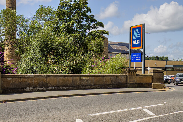
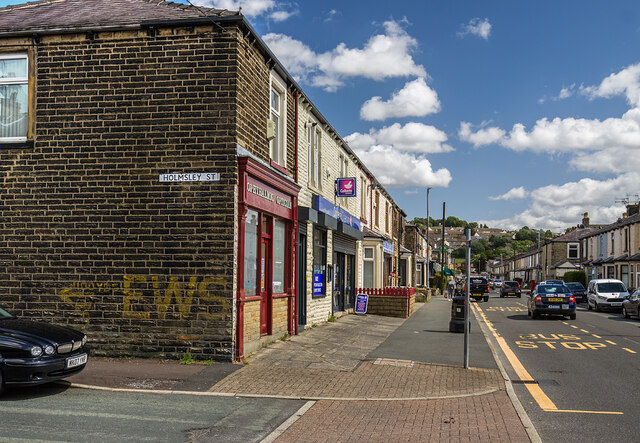
The neighborhood benefits from its proximity to various amenities and facilities. There are several primary and secondary schools in the area, providing education for the local children. Additionally, there are a number of local shops, supermarkets, and small businesses, ensuring that residents have easy access to everyday essentials.

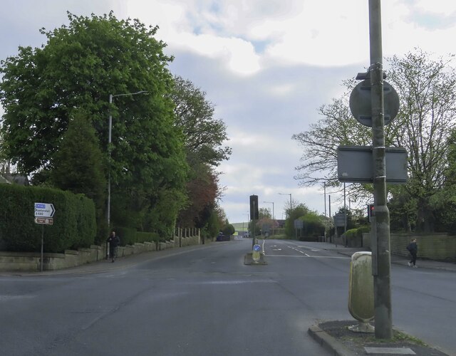
Burnley Wood is also well-connected in terms of transportation. The area is served by regular bus services, providing links to Burnley town center and other nearby areas. For those commuting by car, the neighborhood has good road access to the rest of Burnley and the wider Lancashire region.

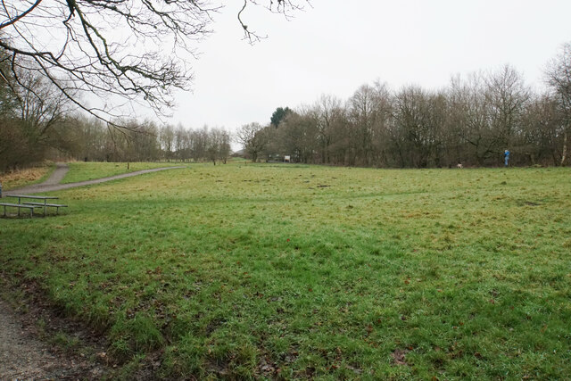
In terms of recreation, Burnley Wood is located near several green spaces, including Thompson Park and Scott Park, which offer opportunities for leisure activities and outdoor pursuits. Overall, Burnley Wood provides a peaceful and convenient place to live for its residents, with a range of amenities and good transport links.

If you have any feedback on the listing, please let us know in the comments section below.
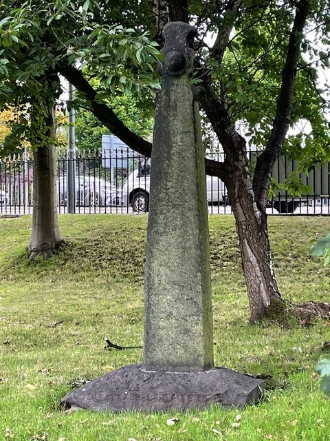
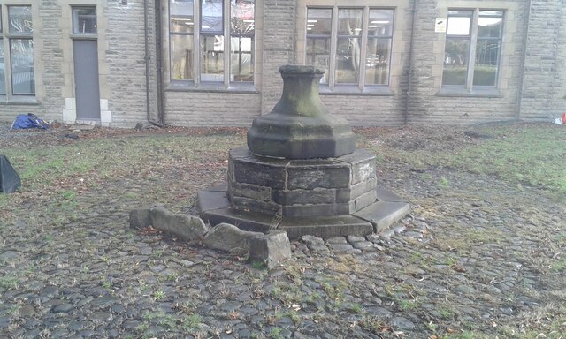
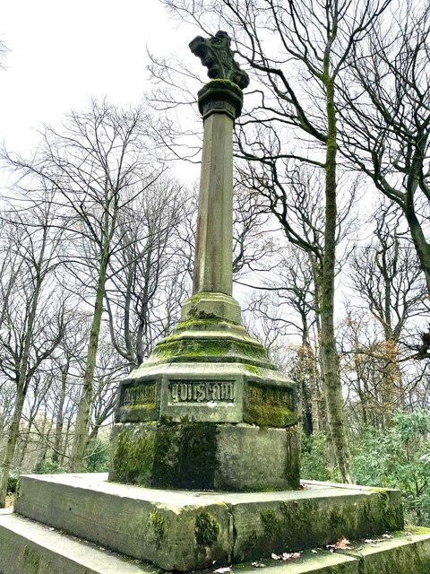
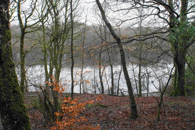
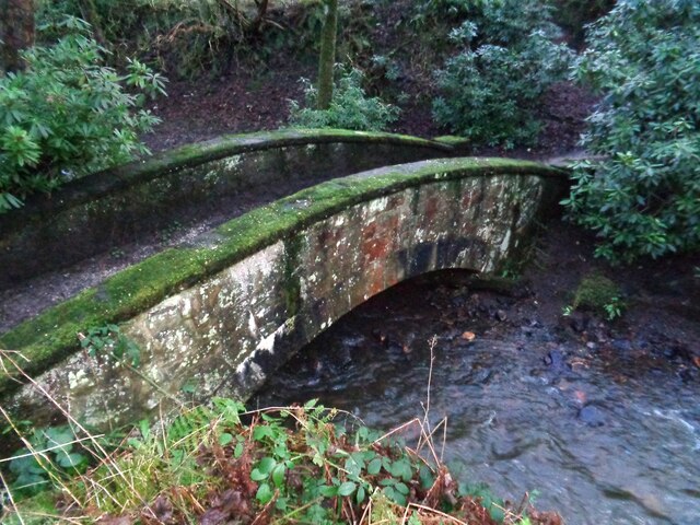
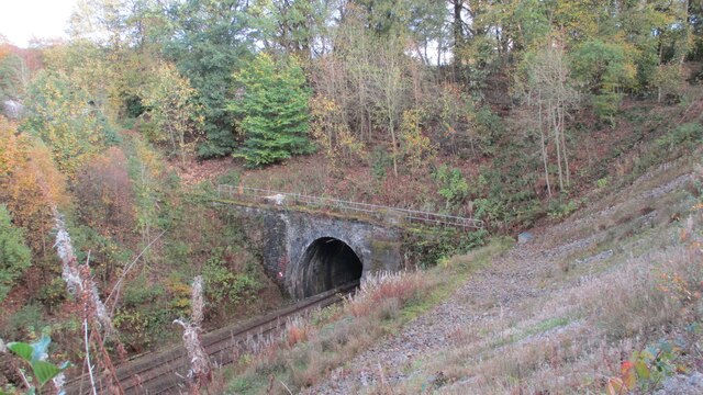
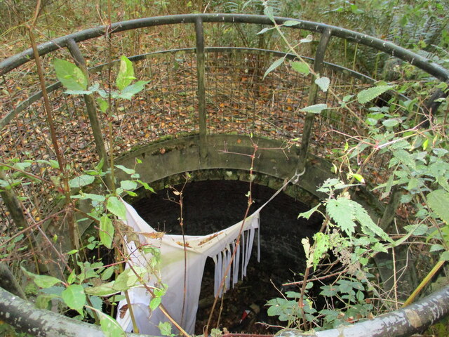
Burnley Wood Images

Images are sourced within 2km of 53.780237/-2.234462 or Grid Reference SD8431. Thanks to Geograph Open Source API. All images are credited.

WWII Lancashire: Ghost Signs of the Home Front  (22) -
Emergency Water Supply, Hand Bridge, Todmorden Road, Burnley

"EWS Hatch"

A rare EWS sign of metal on the bridge over the River Calder. "EWS Hatch" may refer to a facility to obtain an emergency supply of water from the river (below the bridge).

<a href="https://www.geograph.org.uk/photo/6945367">SD8432 : WWII Lancashire: Ghost Signs of the Home Front  (23)</a>
WWII Lancashire: Ghost Signs of the Home Front (22)
- Emergency Water Supply, Hand Bridge, Todmorden Road, Burnley "EWS Hatch" A rare EWS sign of metal on the bridge over the River Calder. "EWS Hatch" may refer to a facility to obtain an emergency supply of water from the river (below the bridge). SD8432 : WWII Lancashire: Ghost Signs of the Home Front (23)
WWII Lancashire: Ghost Signs of the Home Front  (24) -
Emergency Water Supply, Holmsley Street, at junction with Lyndhurst Road, Burnley

"EWS 100 yds"

<a href="https://www.geograph.org.uk/photo/6945363">SD8432 : WWII Lancashire: Ghost Signs of the Home Front  (25)</a>
WWII Lancashire: Ghost Signs of the Home Front (24)
- Emergency Water Supply, Holmsley Street, at junction with Lyndhurst Road, Burnley "EWS 100 yds" SD8432 : WWII Lancashire: Ghost Signs of the Home Front (25)
WWII Lancashire: Ghost Signs of the Home Front  (25) -
Emergency Water Supply, Holmsley Street, at junction with Lyndhurst Road, Burnley

"EWS 100 yds"

                              *********
START: <a href="https://www.geograph.org.uk/photo/6944970">SJ8498 : WWII Lancashire: Ghost Signs of the Home Front  (1)</a>
WWII Lancashire: Ghost Signs of the Home Front (25)
- Emergency Water Supply, Holmsley Street, at junction with Lyndhurst Road, Burnley "EWS 100 yds" ********* START: SJ8498 : WWII Lancashire: Ghost Signs of the Home Front (1)
WWII Lancashire: Ghost Signs of the Home Front  (23) -
Emergency Water Supply,  Hand Bridge, Todmorden Road, Burnley

"EWS Hatch"

<a href="https://www.geograph.org.uk/photo/6945359">SD8432 : WWII Lancashire: Ghost Signs of the Home Front  (24)</a>
WWII Lancashire: Ghost Signs of the Home Front (23)
- Emergency Water Supply, Hand Bridge, Todmorden Road, Burnley "EWS Hatch" SD8432 : WWII Lancashire: Ghost Signs of the Home Front (24)
Old Central Cross in the garden of Burnley College Adult Education Centre on Bank Parade Cross of St Paulinus, a central cross with an old shaft and base. Moved to the garden of Burnley College Adult Education Centre on Bank Parade in Burnley. Probably erected in the former market place east of St Peter's church; moved to Godley Lane c1617, and moved to this site in 1881. Grade II Listed <span class="nowrap"><a title="https://historicengland.org.uk/listing/the-list/list-entry/1022617" rel="nofollow ugc noopener" href="https://historicengland.org.uk/listing/the-list/list-entry/1022617">Link</a><img style="margin-left:2px;" alt="External link" title="External link - shift click to open in new window" src="https://s1.geograph.org.uk/img/external.png" width="10" height="10"/></span>. See also <span class="nowrap"><a title="https://commons.wikimedia.org/wiki/File:Cross_of_St_Paulinus_(Market_Cross),_Burnley.jpg" rel="nofollow ugc noopener" href="https://commons.wikimedia.org/wiki/File:Cross_of_St_Paulinus_(Market_Cross),_Burnley.jpg">Link</a><img style="margin-left:2px;" alt="External link" title="External link - shift click to open in new window" src="https://s1.geograph.org.uk/img/external.png" width="10" height="10"/></span>.

Milestone Society National ID: LABU_BUR01
Old Central Cross in the garden of Burnley College Adult Education Centre on Bank Parade
Cross of St Paulinus, a central cross with an old shaft and base. Moved to the garden of Burnley College Adult Education Centre on Bank Parade in Burnley. Probably erected in the former market place east of St Peter's church; moved to Godley Lane c1617, and moved to this site in 1881. Grade II Listed LinkExternal link. See also LinkExternal link. Milestone Society National ID: LABU_BUR01
Old Central Cross in the garden of Burnley College Adult Education Centre on Bank Parade The Market Cross, a central cross with an old base. Moved to in the garden of Burnley College Adult Education Centre on Bank Parade in Burnley. Erected in the former market place east of St Peter's church in 1617 and moved to this site in 1881. Grade II Listed <span class="nowrap"><a title="https://historicengland.org.uk/listing/the-list/list-entry/1022618" rel="nofollow ugc noopener" href="https://historicengland.org.uk/listing/the-list/list-entry/1022618">Link</a><img style="margin-left:2px;" alt="External link" title="External link - shift click to open in new window" src="https://s1.geograph.org.uk/img/external.png" width="10" height="10"/></span>.

Milestone Society National ID: LABU_BUR02
Old Central Cross in the garden of Burnley College Adult Education Centre on Bank Parade
The Market Cross, a central cross with an old base. Moved to in the garden of Burnley College Adult Education Centre on Bank Parade in Burnley. Erected in the former market place east of St Peter's church in 1617 and moved to this site in 1881. Grade II Listed LinkExternal link. Milestone Society National ID: LABU_BUR02
Old Wayside Cross in Tiwneley Park, Burnley Foldys' Cross, an old market cross base in a new cross. Moved to the intersection of footpaths leading towards Todmorden road in Towneley Park, 300 metres southwest of Towneley Hall in Burnley. Grade II Listed <span class="nowrap"><a title="https://historicengland.org.uk/listing/the-list/list-entry/1247301" rel="nofollow ugc noopener" href="https://historicengland.org.uk/listing/the-list/list-entry/1247301">Link</a><img style="margin-left:2px;" alt="External link" title="External link - shift click to open in new window" src="https://s1.geograph.org.uk/img/external.png" width="10" height="10"/></span>. See also <a title="https://www.geograph.org.uk/photo/3569776" href="https://www.geograph.org.uk/photo/3569776">Link</a> and <a title="https://www.geograph.org.uk/photo/1133733" href="https://www.geograph.org.uk/photo/1133733">Link</a>.

Milestone Society National ID: LABU_BUR03
Old Wayside Cross in Tiwneley Park, Burnley
Foldys' Cross, an old market cross base in a new cross. Moved to the intersection of footpaths leading towards Todmorden road in Towneley Park, 300 metres southwest of Towneley Hall in Burnley. Grade II Listed LinkExternal link. See also Link and Link. Milestone Society National ID: LABU_BUR03
Rowley Lake Viewed through woodland on the south western side, from the path which circumvents the whole lake.
Rowley Lake
Viewed through woodland on the south western side, from the path which circumvents the whole lake.
Footpaths at Pike Hill Open space attached to Rowley Lake which has been developed by Burnley Borough Council as an attractive woodland leisure area.
Footpaths at Pike Hill
Open space attached to Rowley Lake which has been developed by Burnley Borough Council as an attractive woodland leisure area.
The junction of Manchester Road and Rossendale Road
Towneley Hall The north east frontage
Towneley Hall
The north east frontage
Park Shelters At Boggart Bridge in Towneley Park Wilderness
Park Shelters
At Boggart Bridge in Towneley Park Wilderness
Ornamental Footbridge In the Wilderness of Towneley Park over Copy Clough
Ornamental Footbridge
In the Wilderness of Towneley Park over Copy Clough
Towneley Railway Tunnel The north portal
Towneley Railway Tunnel
The north portal
Beehive Coke Oven The charging hole decorated for Halloween
Beehive Coke Oven
The charging hole decorated for Halloween
Entrance to Burnley Bus Station
Bootleggers' sign Sign for the Bootleggers <a href="https://www.geograph.org.uk/photo/7258620">SD8432 : Bootleggers and Roy's Jewellers</a>.
Bootleggers' sign
Sign for the Bootleggers SD8432 : Bootleggers and Roy's Jewellers.
Boot Inn The Grade II listed <span class="nowrap"><a title="https://historicengland.org.uk/listing/the-list/list-entry/1244972?section=official-list-entry" rel="nofollow ugc noopener" href="https://historicengland.org.uk/listing/the-list/list-entry/1244972?section=official-list-entry">Link</a><img style="margin-left:2px;" alt="External link" title="External link - shift click to open in new window" src="https://s1.geograph.org.uk/img/external.png" width="10" height="10"/></span> Boot Inn dates from 1911. For a time it was a Yates Wine Lodge but is now a Wetherspoon's <a href="https://www.geograph.org.uk/photo/7256758">SD8432 : Sign of The Boot Inn</a>.
Boot Inn
The Grade II listed LinkExternal link Boot Inn dates from 1911. For a time it was a Yates Wine Lodge but is now a Wetherspoon's SD8432 : Sign of The Boot Inn.
Show me another place!

Burnley Wood is located at Grid Ref: SD8431 (Lat: 53.780237, Lng: -2.234462)

Administrative County: Lancashire

District: Burnley

Police Authority: Lancashire

What 3 Words

///feed.usage.zest. Near Burnley, Lancashire

Nearby Locations

Burnley Wood

Related Wikis

Towneley railway station

Towneley railway station was a station in Lancashire which served Burnley Wood and the nearby Towneley Hall on the eastern edge of Burnley. Opened on 12...

Burnley Wood

Burnley Wood is a district and former electoral ward of Burnley, Lancashire. In broad terms the area lies between Parliament Street in the north and Hufling...

Towneley Colliery

Towneley Colliery or Towneley Desmesne was a coal mine on the Burnley Coalfield in Burnley, Lancashire, England. Sunk in the late 1860s, it was linked...

Burnley power station

Burnley power station supplied electricity to the town of Burnley, Lancashire from 1893 to 1958. The electricity station was owned and operated by Burnley...

Unity College, Burnley

Unity College is a mixed 11-16 comprehensive school in Burnley, Lancashire, England. == History == === Former school === Towneley High School originally...
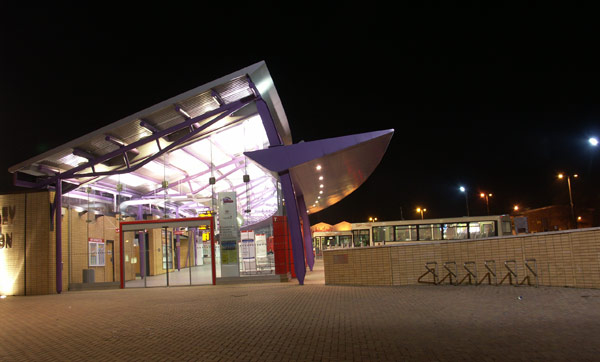
Burnley bus station

Burnley bus station serves the town of Burnley, Lancashire, England. The bus station was funded by both the Lancashire County Council and Burnley Borough...

Burnley Embankment

The Burnley Embankment is an embankment carrying the Leeds and Liverpool Canal across the Calder and Brun valleys in Burnley, Lancashire. Also known as...

Church of St Mary of the Assumption, Burnley

The Church of St Mary of the Assumption is in Yorkshire Street, Burnley, Lancashire, England. It is an active Roman Catholic parish church in the diocese...

Nearby Amenities

Located within 500m of 53.780237,-2.234462
Created By: YahooApplet 1.0
Lat/Long: 53.7835983/-2.2392916
Created By: YahooApplet 1.0
Lat/Long: 53.7830183/-2.2390234
Created By: YahooApplet 1.0
Lat/Long: 53.7809263/-2.2381114
Created By: YahooApplet 1.0
Lat/Long: 53.7807171/-2.2379183
Created By: YahooApplet 1.0
Lat/Long: 53.7802353/-2.2373336
Crossing
Crossing: traffic_signals
Crossing Ref: toucan
Kerb: lowered
Tactile Paving: yes
Lat/Long: 53.782297/-2.2309076
The Alexander
Tourism: hotel
Lat/Long: 53.7835296/-2.2304307
Railway: level_crossing
Lat/Long: 53.7789319/-2.2363135
Pub
Royal Butterfly
Lat/Long: 53.7796973/-2.2357559
Burnley Wood
Place: suburb
Lat/Long: 53.7827714/-2.2356195
Turning Circle
Lat/Long: 53.7767784/-2.2352098
Railway: level_crossing
Lat/Long: 53.7789737/-2.2362845
Bus Stop
Rock Lane
Bus: yes
Naptan AtcoCode: 2500495
Naptan NaptanCode: lanawjwg
Public Transport: platform
Lat/Long: 53.7768128/-2.2329893
Bus Stop
Rock Lane
Bus: yes
Public Transport: platform
Lat/Long: 53.7762339/-2.2324438
Bus Stop
Fairholme Road
Naptan AtcoCode: 2500IMG2775
Naptan NaptanCode: langdwpa
Public Transport: platform
Lat/Long: 53.7791863/-2.2327459
Bus Stop
Fairholme Road
Naptan AtcoCode: 2500IMG2776
Naptan NaptanCode: langdwpd
Public Transport: platform
Lat/Long: 53.7790959/-2.2326346
Bus Stop
The Woodman
Public Transport: platform
Lat/Long: 53.7813924/-2.2316059
Bus Stop
The Woodman
Naptan AtcoCode: 2500LAA00062
Naptan NaptanCode: langtdwt
Public Transport: platform
Lat/Long: 53.7806067/-2.2320385
Bus Stop
Hufling Lane
Naptan AtcoCode: 2500LAA07233
Naptan NaptanCode: langwtwj
Public Transport: platform
Lat/Long: 53.780915/-2.232241
Bus Stop
Strange Street
Public Transport: platform
Lat/Long: 53.7802101/-2.2349098
Bus Stop
Kirkgate
Naptan AtcoCode: 2500IMG2743
Naptan NaptanCode: langdwam
Public Transport: platform
Lat/Long: 53.7818758/-2.2357526
Bus Stop
Parliament Street
Naptan AtcoCode: 2500IMG2672
Naptan NaptanCode: langdpmg
Public Transport: platform
Lat/Long: 53.784083/-2.2368088
Barrier: bollard
Lat/Long: 53.7808229/-2.2329529
The data included in this document is from www.openstreetmap.org. The data is made available under ODbL.

Have you been to Burnley Wood?

Leave your review of Burnley Wood below (or comments, questions and feedback).